Vasudhara Falls Trek
Chamoli, Uttarakhand
Opens without signal on this phone, with the map file and checklist. Saved for offline →
- Max altitude
- 3,650 m
- Days
- 1 day
- Distance
- 12 km
- Difficulty
- Moderate
Sources grade it moderate. It is only about 6 km each way on a clear trail, but you start at about 3,200 m in Mana and climb some 450 m to the falls at about 3,650 m over rocky ground with gradual climbs and exposed sections, so the thin air is the real test for anyone arriving straight from the plains.
Photos
On the trail
The route
Day by day
Day 1 · highest point
Mana village → Mana village (via Vasudhara Falls)
3,200 m → 3,650 m → 3,200 m
Ups and downs
Altitude profile
Where it is
Map
Trailhead and high point only — not a recorded track. Use it with a proper map.
Weather
Next 5 days on the trail
Live forecast for the trailhead and the high point. Mountain weather changes fast — check again on the morning you start.
Trailhead · Mana village
at 3,200 mLoading forecast…
High point · Vasudhara Falls
at 3,650 mLoading forecast…
Each day: high / low °C · rain mm and chance · snow cm · wind km/h
Weather data: Open-Meteo.comModel forecast, not an official warning. For alerts follow IMD and the local administration.
Plan the trip
How to reach
- Trailhead
- Mana village (nearest town: Badrinath)
- Nearest railway
- Yog Nagari Rishikesh (also Haridwar or Dehradun)
- Nearest airport
- Jolly Grant Airport, Dehradun
- By road
- Badrinath (about 3 km by road to Mana; local taxis and shared jeeps in the yatra season); Rishikesh (about 300 km to Badrinath via Devprayag, Rudraprayag, Karnaprayag and Joshimath)
- Drive
- About 11 h from Rishikesh
Plan the trip
Permits and fees
We could not confirm the current permit rules and fees from an official source. Check with the local forest department or tourism office before you go.
Plan the trip
Cost
Self-guided
₹0–1,000
With an operator
₹1,000–2,000
Per person, ex-Badrinath, for the day walk only (travel to Badrinath and stay not included). We found no operator selling this walk as a priced package; it is usually done on your own or as the first day of the Satopanth Tal trek. Self-guided is an estimate: there is no entry fee (discoverwithdheeraj), so the cost is a taxi or shared jeep Badrinath-Mana and back plus water and snacks. Guided is an estimate for hiring a local guide from Mana or Badrinath for a day (Indiahikes quotes about ₹1,000-1,500 a day for guides on the Satopanth route), shared within a small group.
Gear
Top picks for this trek
The gear that matters most on this route, chosen from its altitude, season and risks.
 Ad · affiliate link
 Ad · affiliate link
 Ad · affiliate link
 Ad · affiliate link
 Ad · affiliate link
 Ad · affiliate link
 Ad · affiliate link
- Ad · affiliate link
Store buttons open a search on that store, not a product we picked. As an Amazon Associate we earn from qualifying purchases. Photos show the kind of item, not a specific product. Affiliate disclosure
Packing checklist
Matched to this trek: altitude, season, days and the risks on the route.
Packed 0 of 29
Nights near 3,650 m can drop close to freezing even in summer. Pack one more warm layer than you think.
Tick each item as it goes in the bag.
Know before you go
Good to know
- Mobile network
- Mobile signal works in Badrinath and Mana; discoverwithdheeraj says there is zero connectivity beyond Mana on the Vasudhara trail.
- Last ATM
- Badrinath has limited ATMs and Joshimath is the reliable place to draw cash; there is nothing to buy on the trail, so carry cash for Mana.
- Nearest hospital
- Basic care only in Badrinath; Joshimath for the nearest hospital; AIIMS Rishikesh for serious cases
- Water
- A Tripoto trip report found no water source on the route, and Chalbanjare says there are no permanent shops, shelters, food stalls or toilets on the trail. Fill up in Mana and carry at least 2 litres; the last tea shop is in Mana village.
Highlights
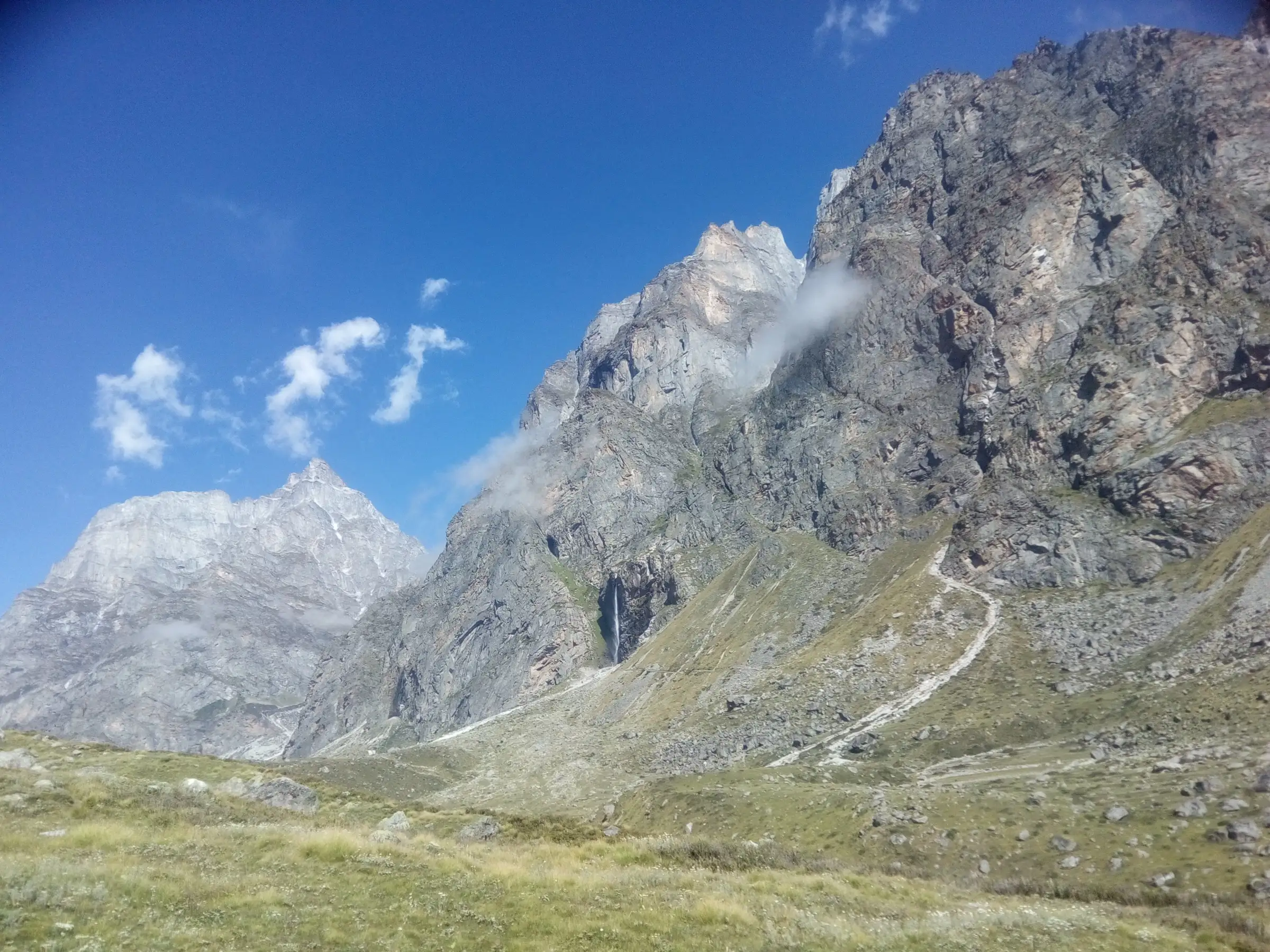
- Vasudhara Falls dropping about 400 ft (120 m) down a sheer rock wall, the water scattering into spray before it reaches the ground
- A tirtha of Bhagwan Vishnu's Badrinath Dham: Vasu-dhara is named for Vasudev, and the sacred account says one of the Ashtavasu did tapasya here and was blessed to become Nand Baba, the father of Bhagwan Shri Krishna, in the Dwapar Yuga
- Walking the route of the Pandavas' Swargarohan, the Mahabharata katha of their last journey from Mana towards Swargarohini; the katha says Sahadev left his body near Vasudhara
- Starting through Mana, India's last village before the Tibet border, past Bhim Pul, Vyas Gufa, Ganesh Gufa and the Saraswati Mandir
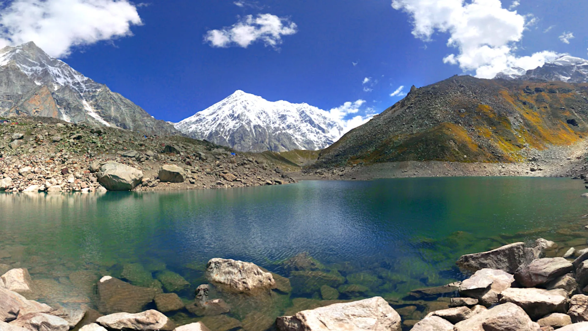
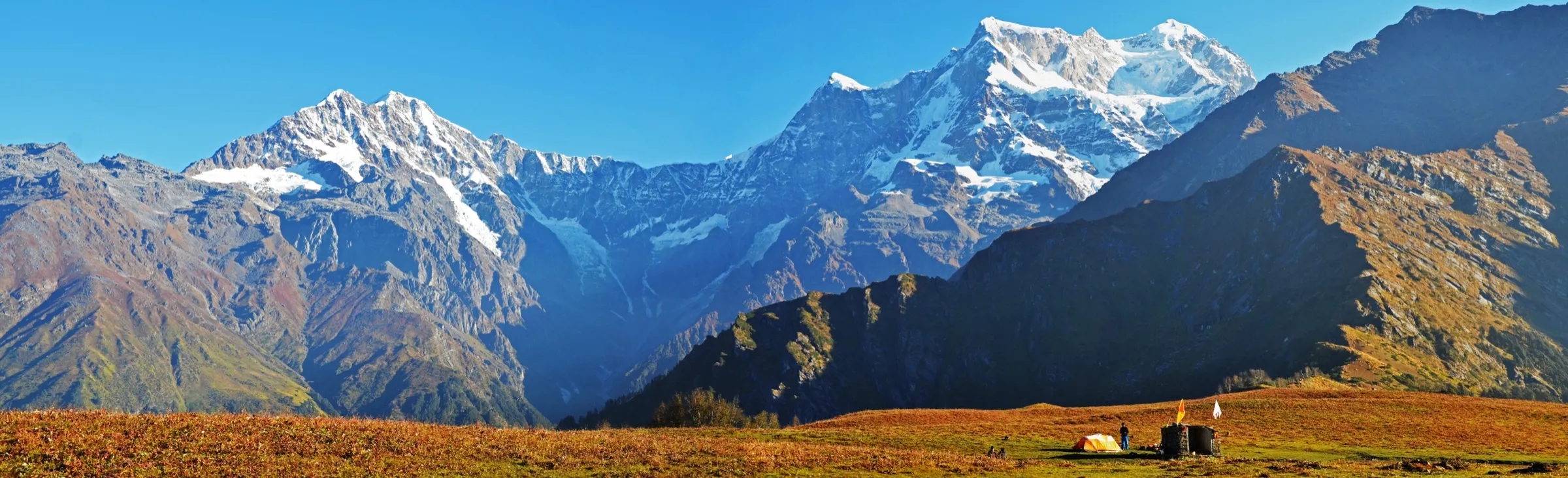
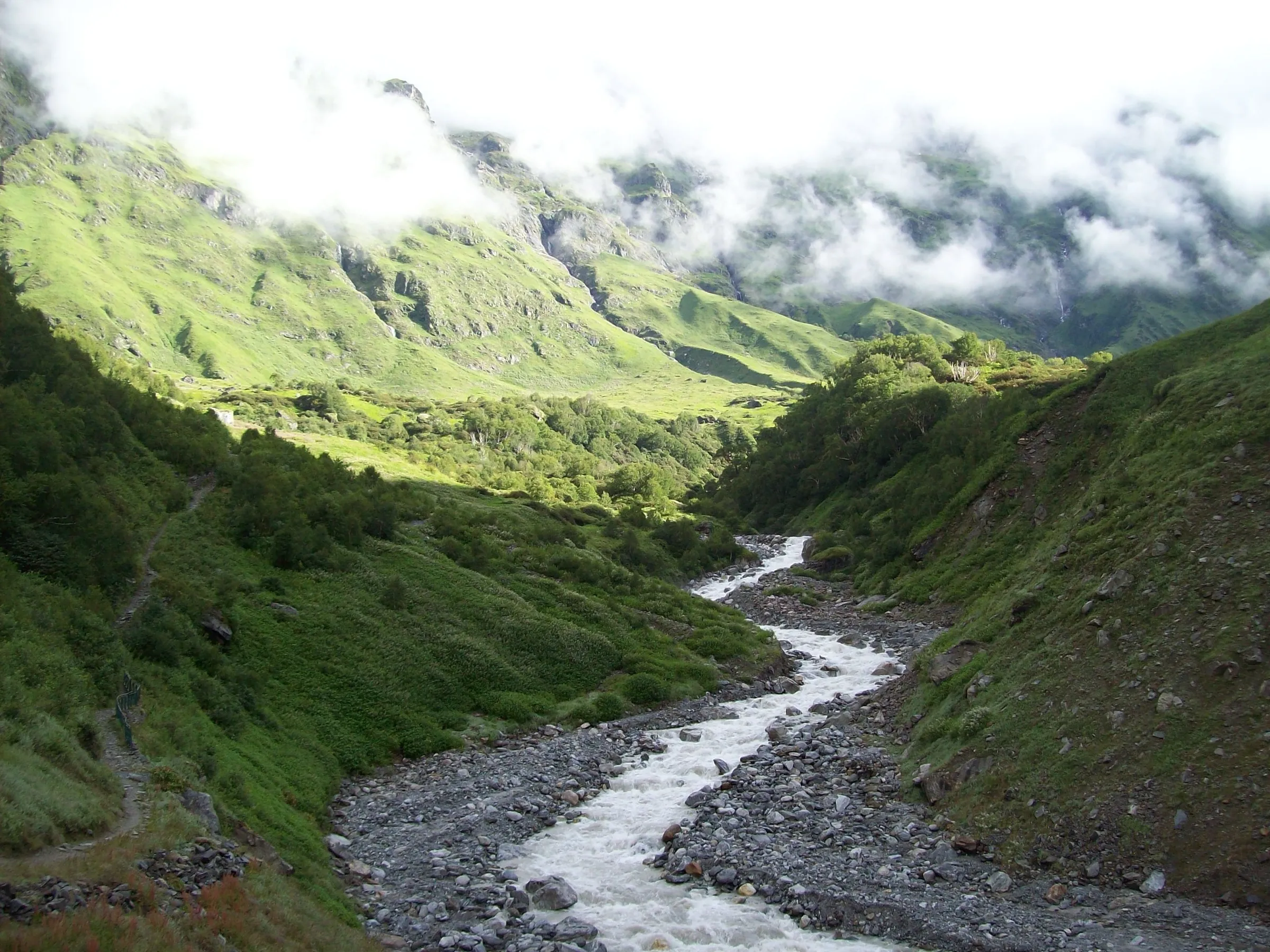
- Wildflowers along the Alaknanda valley in June, with Chaukhamba, Neelkanth and Balakun towering over the upper valley
Risks
- Altitude: Mana is about 3,200 m and the falls about 3,650 m. Coming straight up from the plains, spend a night in Badrinath first, walk slowly and turn back if you get a headache or breathlessness.
- Monsoon (July-August): Tata Neu says to avoid the monsoon because heavy rain makes the trail slippery and dangerous, and Chalbanjare warns of landslide risk; the Badrinath highway is also often blocked by landslides.
- Weather turns fast: a November Tripoto trip report met snow and strong winds after the village with the falls mostly frozen. November is the closing month of the Badrinath season, so check before going.
- No shelter, shops, toilets or water on the trail and no mobile signal beyond Mana. Start early (by 7-8 am, per discoverwithdheeraj) to be back before afternoon cloud.
- This is an Indo-Tibet border area with army and ITBP presence. Sources say no permit is needed for the walk to the falls, but rules here can change; confirm in Badrinath or Mana before setting out.
Know before you go
Questions
How long is the trek to Vasudhara Falls?
About 6 km each way from Mana village (Tata Neu, discoverwithdheeraj; Chalbanjare says 5-6 km), so about 12 km for the round trip. It takes 3-4 hours one way at an easy pace, so plan 5-6 hours for the round trip. Mana is about 3 km by road from Badrinath.
Is the Vasudhara Falls trek difficult?
It is graded moderate. The trail is well defined and marked, but it is rocky with gradual climbs, and you gain about 450 m to around 3,650 m, so the altitude makes it harder than the distance suggests. Himalaya Shelter calls it suitable for beginners.
What is the best time to visit Vasudhara Falls?
May-June and September-October. The walk is possible only while the Badrinath kapat are open (about May to October or November); from December to April the area is under snow. July and August bring slippery trails and landslides.
Do I need a permit or a guide for Vasudhara Falls?
Discoverwithdheeraj says no additional permit and no entry fee are needed for the Vasudhara walk, and that you do not need a guide because the trail is clear. Treks going beyond to Satopanth Tal need a forest permit from Joshimath. Rules in this border area can change, so confirm locally.
Why is Vasudhara Falls sacred?
It is a tirtha of Badrinath Dham. The name joins Vasu (Bhagwan Vishnu as Vasudev) and dhara, the flow of water. The sacred account says one of the Ashtavasu did tapasya here and became Nand Baba in the Dwapar Yuga, and that the Pandavas passed here on their Swargarohan, where Sahadev left his body. Pilgrims stand under the spray and carry the water home for puja; devotees say the water turns away from those who are not pure at heart.
In an emergency
Save these numbers before you lose signal. Tap to call.
- 112All emergenciesIndia’s single emergency number — works in every state
- 108Ambulance
- 1077District disaster control room
You are in
District: ChamoliUttarakhand
- Nearest hospital
- Basic care only in Badrinath; Joshimath for the nearest hospital; AIIMS Rishikesh for serious cases
- Last ATM
- Badrinath has limited ATMs and Joshimath is the reliable place to draw cash; there is nothing to buy on the trail, so carry cash for Mana.
- Phone network
- Mobile signal works in Badrinath and Mana; discoverwithdheeraj says there is zero connectivity beyond Mana on the Vasudhara trail.
Before you set off
- Tell someone your route and when you will be back.
- Carry a charged phone and a power bank.
- Download an offline map of the route.
- Turn back if the weather turns bad — the mountain will wait.
Questions about Vasudhara Falls
No questions yet. Ask something and trekkers who have done it can answer.
Share your trek photo with #TreksAndTrails
I trekked this
Did Vasudhara Falls look different from this page? Tell us what changed and we will check it.
Where this comes from
Sources
Last reviewed:
- Vasundhara Fall trek — Himalaya Shelter
- Vasudhara Falls Badrinath – Scenic High Altitude Waterfall Trek Near Mana Village Uttarakhand — Chalbanjare
- FAQs About Vasudhara Falls Trek: All You Need to Know — Tata Neu
- Mana Village: A Journey to the Last Indian Village and Beyond — Discover with Dheeraj
- Mana & Vasudhara Falls Trek, Uttarakhand — Tripoto (trip report)
- Vasundhara waterfall: door to heaven, Uttarakhand, Badrinath — Onmanorama
- Vasudhara Falls — Wikipedia
Photos: Dvellakat, CC BY-SA 4.0; Bodhisattwa, CC BY-SA 4.0