Panpatia Col Trek
Chamoli and Rudraprayag, Uttarakhand
Opens without signal on this phone, with the map file and checklist. Saved for offline →
- Max altitude
- 5,260 m
- Days
- 13 days
- Distance
- 70 km
- Difficulty
- Challenging
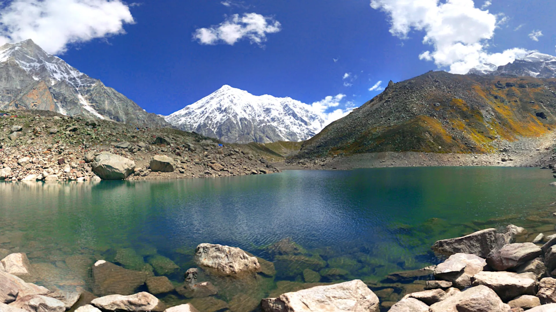
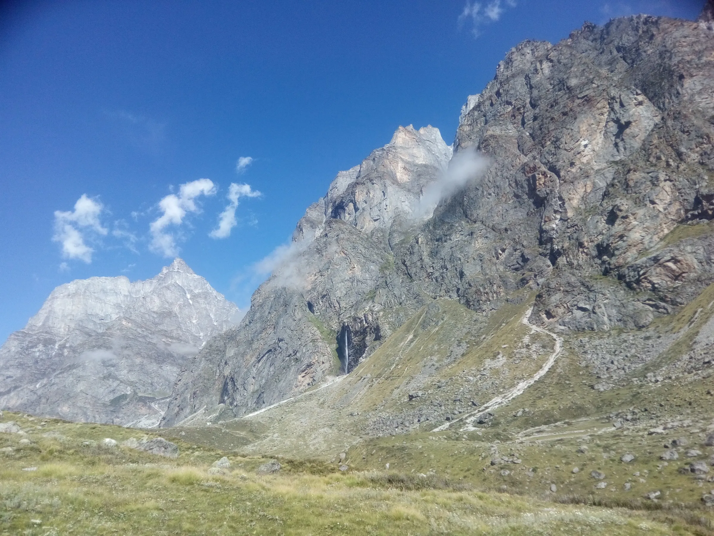
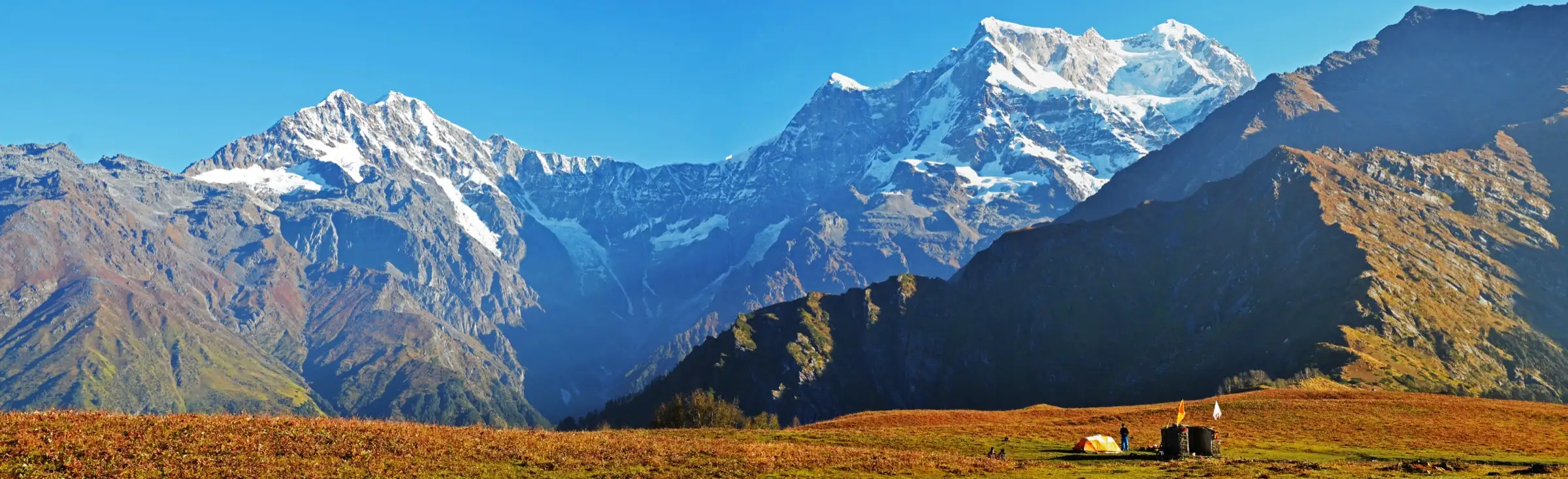
A glacier-pass expedition rather than a hiking trail: the route climbs the crevassed Panpatia Glacier, crosses Parvati Col by a steep snow-and-rock gully that needs fixed ropes, then crosses the 5,260 m Panpatia Col on a high snowfield. Operators ask for ice-axe, crampon and roping skills and prior high-altitude experience, and there is no road or network for about nine days.
Photos
On the trail
The route
Day by day
Day 1
Dehradun → Joshimath
640 m → 1,875 m
Day 2
Joshimath (drive to Hanuman Chatti) → Alaknanda Camp near Khirao
1,875 m → 2,600 m
Day 3
Khirao → Shepherd Camp
2,600 m → 3,580 m
Day 4
Shepherd Camp → Snout Camp (Panpatia Glacier)
3,580 m → 3,920 m
Day 5
Snout Camp → Moraine Camp
3,920 m → 4,300 m
Day 6
Moraine Camp → Moraine Camp (acclimatisation day)
4,300 m → 4,300 m
Day 7
Moraine Camp → Parvati Col Base Camp
4,300 m → 4,600 m
Day 8
Parvati Col Base Camp → Panpatia Snowfield Camp (via Parvati Col)
4,600 m → 5,200 m
Day 9 · highest point
Panpatia Snowfield Camp → Sujal Sarovar (via Panpatia Col)
5,200 m → 5,260 m → 4,750 m
Day 10
Sujal Sarovar → Kachni
4,750 m → 4,160 m
Day 11
Kachni → Nanu Chatti (via Madhyamaheshwar temple)
4,160 m → 3,260 m
Day 12
Nanu Chatti → Rudraprayag (trek to Ransi, then drive)
3,260 m → 895 m
Day 13
Rudraprayag → Dehradun
895 m → 640 m
Ups and downs
Altitude profile
Where it is
Map
Trailhead and high point only — not a recorded track. Use it with a proper map.
Weather
Next 5 days on the trail
Live forecast for the trailhead and the high point. Mountain weather changes fast — check again on the morning you start.
Trailhead · Khirao road head, Hanuman Chatti
at 1,875 mLoading forecast…
High point · Panpatia Col
at 5,260 mLoading forecast…
Each day: high / low °C · rain mm and chance · snow cm · wind km/h
Weather data: Open-Meteo.comModel forecast, not an official warning. For alerts follow IMD and the local administration.
Plan the trip
How to reach
- Trailhead
- Khirao road head, Hanuman Chatti (nearest town: Joshimath (Jyotirmath))
- Nearest railway
- Yog Nagari Rishikesh (Haridwar and Dehradun also work)
- Nearest airport
- Jolly Grant Airport, Dehradun
- By road
- Dehradun or Rishikesh to Joshimath (about 300 km via Rudraprayag), then on towards Badrinath to the Khirao road head at Hanuman Chatti (start); Ransi to Rudraprayag via Ukhimath, then Rudraprayag to Dehradun or Rishikesh (finish)
- Drive
- About 10 h from Dehradun
Plan the trip
Permits and fees
We could not confirm the current permit rules and fees from an official source. Check with the local forest department or tourism office before you go.
Plan the trip
Cost
Self-guided
₹60,000–1,00,000
With an operator
₹92,000–1,56,000
Per person, ex-Dehradun. Guided prices published October 2026: Bikat Adventures ₹87,500 + 5% GST (about ₹91,900) for 12 days Dehradun-Joshimath to Ransi-Rudraprayag, permits included; Himalaya Shelter ₹1,05,000 + 5% GST for 13 days ex-Dehradun; White Magic ₹1,56,000 Delhi to Delhi, twin sharing. Himalayan High sells private expeditions from ₹1,15,000 upwards depending on group size. Self-guided is a rough estimate for a small group hiring a qualified local guide with rope and glacier gear, a cook and porters for about 10 trekking days, plus tents, food, forest and sanctuary fees and the two long drives; crossing without an experienced guide is not advisable.
Gear
Top picks for this trek
The gear that matters most on this route, chosen from its altitude, season and risks.
 Ad · affiliate link
 Ad · affiliate link
 Ad · affiliate link
 Ad · affiliate link
 Ad · affiliate link
 Ad · affiliate link
 Ad · affiliate link
 Ad · affiliate link
Store buttons open a search on that store, not a product we picked. As an Amazon Associate we earn from qualifying purchases. Photos show the kind of item, not a specific product. Affiliate disclosure
Packing checklist
Matched to this trek: altitude, season, days and the risks on the route.
Packed 0 of 36
Nights near 5,260 m can drop close to freezing even in summer. Pack one more warm layer than you think.
Tick each item as it goes in the bag.
Know before you go
Good to know
- Mobile network
- No mobile signal or road access from the Khirao valley until the Madhyamaheshwar side; operators carry satellite phones. Signal returns around Ransi and Ukhimath.
- Last ATM
- Joshimath (carry cash from Dehradun or Rishikesh)
- Nearest hospital
- Community health centre in Joshimath on the start side and Ukhimath on the finish side; district hospitals at Gopeshwar and Rudraprayag, AIIMS Rishikesh for serious cases. From the glacier, evacuation is a carry-down by porters or a helicopter.
- Water
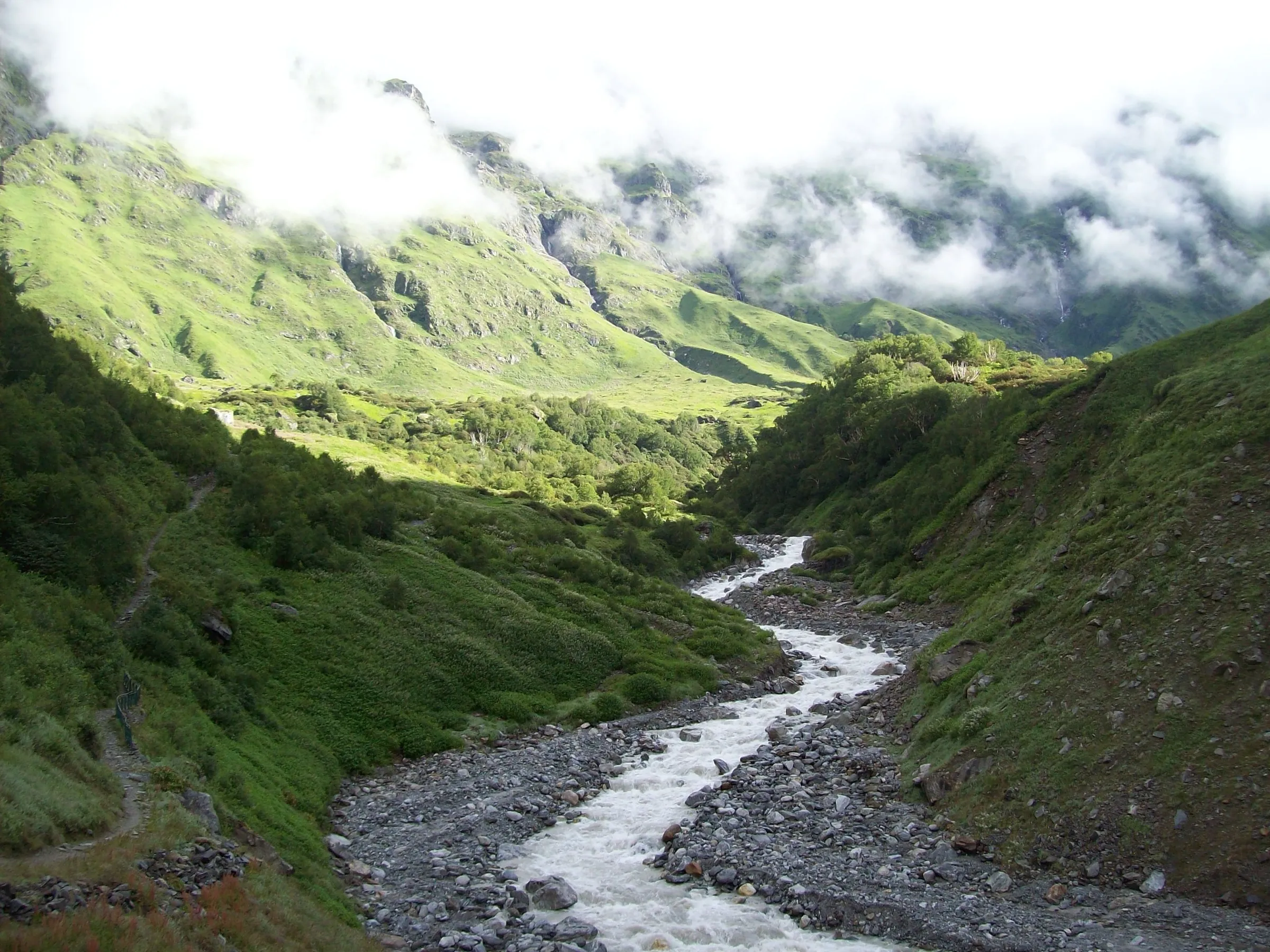
- The Khirao Ganga and glacial streams on the way up, snowmelt at the high camps, Sujal Sarovar lake after the col, and streams down the Madhyamaheshwar valley; filter or treat all water.
Highlights
- Crossing Panpatia Col (5,260 m), the high pass on the ridge between the Alaknanda and Mandakini valleys, the shortest walking line between the Badrinath and Kedarnath sides
- Walking up the remote Khirao Ganga valley and the Panpatia Glacier, then crossing Parvati Col onto the wide Panpatia snowfield below the Chaukhamba massif
- Camping at the high lake of Sujal Sarovar after the pass, then descending through meadows above Kachni
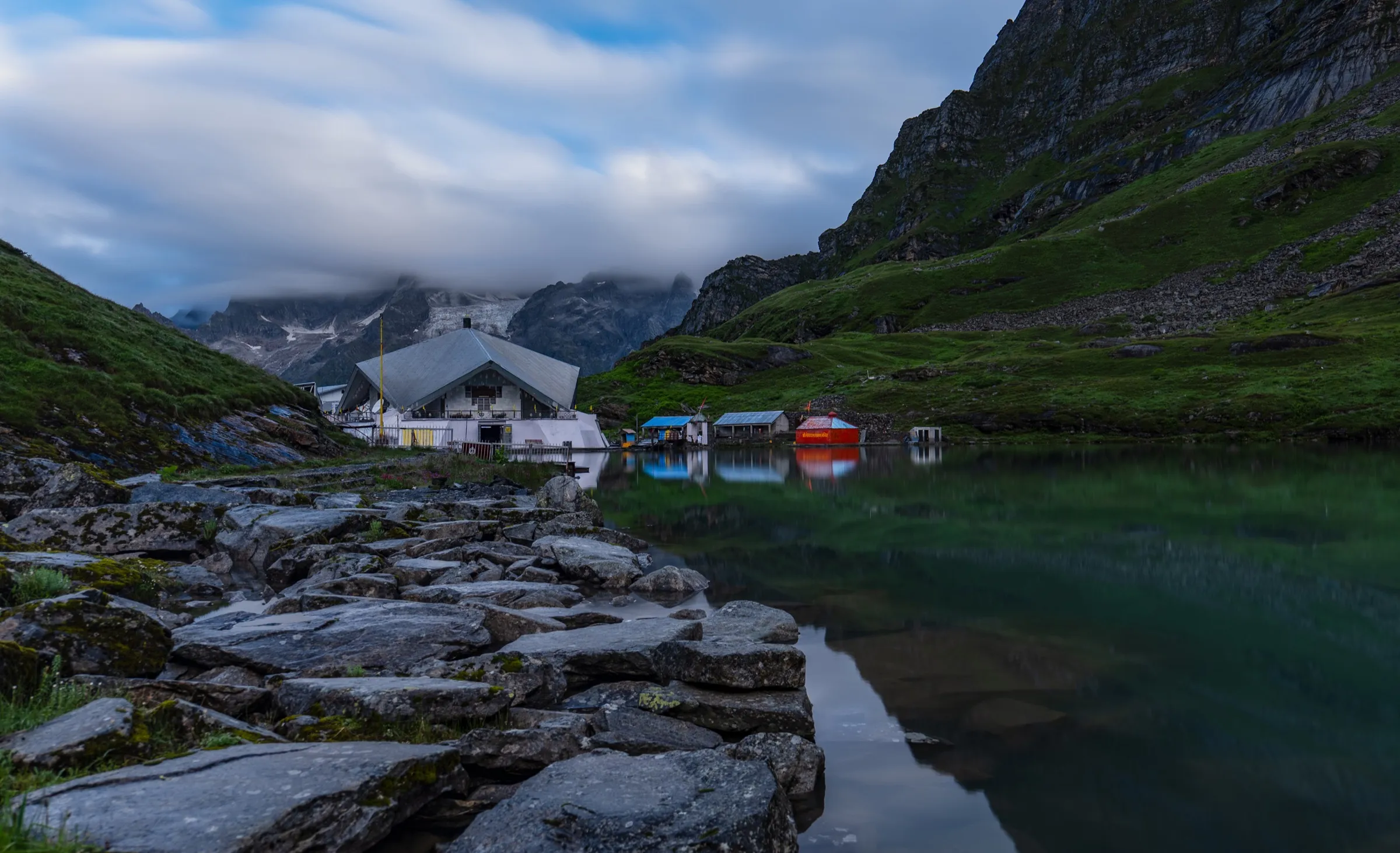
- Darshan at the Madhyamaheshwar temple, the second of the Panch Kedar, where Bhagwan Shiva is worshipped, before walking down the Madhyamaheshwar Ganga valley to Ransi
Risks
- Hidden crevasses on the Panpatia Glacier and snowfield: rope up behind an experienced guide and wear crampons.
- Parvati Col is climbed by a steep snow and rock gully that needs fixed ropes; rockfall and icy snow make it slow.
- The pass day is about 9 km and 7 hours above 5,000 m; weather can bring strong winds, snow and whiteouts, so keep a reserve day.
- Rapid gain from about 1,900 m to over 5,000 m in a week; follow the acclimatisation day at Moraine Camp.
- Monsoon (July-August) brings heavy rain, slippery trails and landslides, and November to April brings heavy snow and extreme cold; operators do not recommend these months.
- No network or road between the Khirao valley and the Madhyamaheshwar side; evacuation from the glacier is slow.
Know before you go
Questions
How difficult is the Panpatia Col trek?
It is one of the hardest trekking routes in Garhwal. Bikat Adventures grades it difficult (BRS 6) and asks for ice-axe, crampon and roping skills; Himalaya Shelter says it suits only experienced high-altitude trekkers and not beginners, children or families. Days are 6 to 9 hours on glacier and high snowfields.
What is the altitude of Panpatia Col?
Operators give the col as 5,260 m (about 17,257 ft). Himalayan High lists 5,222 m. The snowfield camp before the col is at about 5,200 m and Sujal Sarovar, the camp after it, at about 4,750 m.
When is the best time for Panpatia Col?
Late May to June and mid-September to mid-October. Operators avoid July and August because of heavy rain and landslides, and do not run it from November to April because of heavy snow and cold; finish by mid-October as snow can arrive later in the month.
Where does the Panpatia Col trek start and end?
Groups drive from Dehradun to Joshimath, then towards Badrinath to Hanuman Chatti, where the walk starts at the Khirao road head and goes up the Khirao Ganga valley. It ends at Ransi after the Madhyamaheshwar temple, with a drive to Rudraprayag.
How many days and how many kilometres is the trek?
Operators run 12 to 15 days from Dehradun, with 10 to 11 walking days. Published distances range from about 60 km (Bikat Adventures) to 80 km (Himalaya Shelter and Himalayan High).
Do I need technical equipment for Panpatia Col?
Yes. Crampons, ropes, harness and ice axe are needed for Parvati Col and the glacier, and operators say an expert guide or a supported team is essential. Porters, guides, food and camping gear must be arranged in advance, since there is no transport or shelter beyond Joshimath or Badrinath.
In an emergency
Save these numbers before you lose signal. Tap to call.
- 112All emergenciesIndia’s single emergency number — works in every state
- 108Ambulance
- 1077District disaster control room
You are in
District: Chamoli and RudraprayagUttarakhand
- Nearest hospital
- Community health centre in Joshimath on the start side and Ukhimath on the finish side; district hospitals at Gopeshwar and Rudraprayag, AIIMS Rishikesh for serious cases. From the glacier, evacuation is a carry-down by porters or a helicopter.
- Last ATM
- Joshimath (carry cash from Dehradun or Rishikesh)
- Phone network
- No mobile signal or road access from the Khirao valley until the Madhyamaheshwar side; operators carry satellite phones. Signal returns around Ransi and Ukhimath.
Before you set off
- Tell someone your route and when you will be back.
- Carry a charged phone and a power bank.
- Download an offline map of the route.
- Turn back if the weather turns bad — the mountain will wait.
Questions about Panpatia Col
No questions yet. Ask something and trekkers who have done it can answer.
Share your trek photo with #TreksAndTrails
I trekked this
Did Panpatia Col look different from this page? Tell us what changed and we will check it.
Where this comes from
Sources
Last reviewed:
- Panpatia Col Trek — Bikat Adventures
- Panpatia Col Trek — Himalaya Shelter
- Panpatia Col — White Magic Adventure
- Panpatia Col Trek 2026 | Premium Private Expedition — Himalayan High
- Panpatia Col Trek — Trekup India
- Panpatia Col Trek (Navbharat Live travel, 19 April 2026) — Navbharat Live
- Uttarakhand: Across Panpatia Glacier — Outlook Traveller
Photos: Abhishek.ghosh1984, CC BY-SA 4.0; Bodhisattwa, CC BY-SA 4.0; Varun Shiv Kapur from Berkeley, United States, CC BY 2.0