Bhyundar Khal Trek
Chamoli, Uttarakhand
Opens without signal on this phone, with the map file and checklist. Saved for offline →
- Max altitude
- 5,100 m
- Days
- 9 days
- Distance
- 60 km
- Difficulty
- Challenging
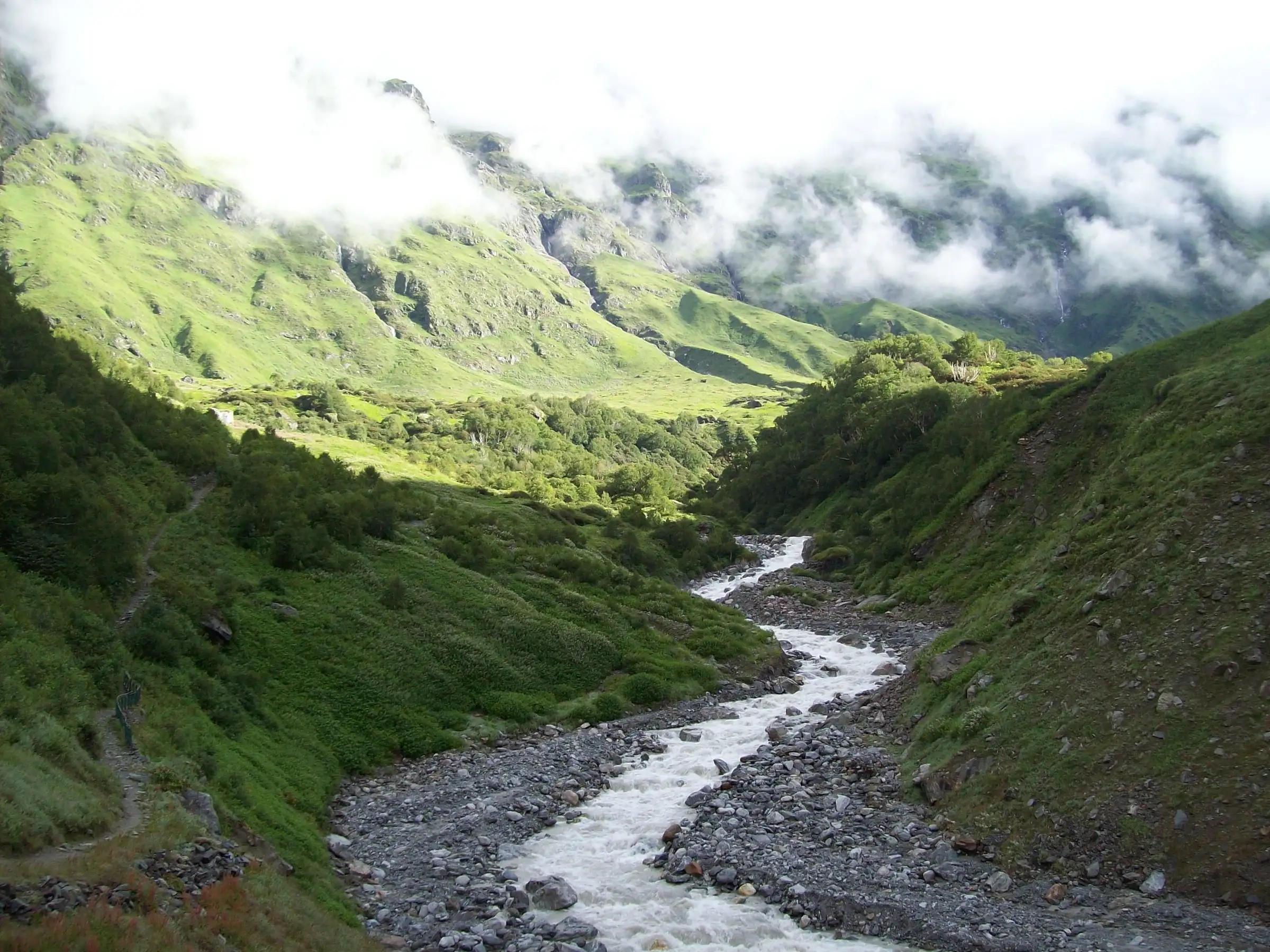
A glacier pass at about 5,100 m: the approach crosses the Bhyundar icefall and crevassed glacier, ropes are fixed on steep sections, pass day starts before sunrise and runs 8-10 km, and operators say basic mountaineering skills are a must.
Photos
On the trail
The route
Day by day
Day 1
Dehradun → Govindghat / Joshimath (drive)
640 m → 1,830 m
Day 2
Govindghat → Ghangaria
1,830 m → 3,050 m
Day 3
Ghangaria → Tipra Kharak (through the Valley of Flowers)
3,050 m → 3,700 m
Day 4
Tipra Kharak → Bhyundar Icefall Camp
3,700 m → 4,300 m
Day 5
Bhyundar Icefall Camp → Bhyundar Khal Base
4,300 m → 4,600 m
Day 6 · highest point
Bhyundar Khal Base → Rataban (East) Glacier camp via Bhyundar Khal
4,600 m → 5,100 m → 4,500 m
Day 7
Rataban Glacier camp → Edi Udiyar
4,500 m → 3,900 m
Day 8
Edi Udiyar → Ghamsali, then drive to Joshimath
3,900 m → 1,890 m
Day 9
Joshimath → Dehradun (drive)
1,890 m → 640 m
Ups and downs
Altitude profile
Where it is
Map
Trailhead and high point only — not a recorded track. Use it with a proper map.
Weather
Next 5 days on the trail
Live forecast for the trailhead and the high point. Mountain weather changes fast — check again on the morning you start.
Trailhead · Govindghat (Govind Ghat)
at 1,830 mLoading forecast…
High point · Bhyundar Khal pass
at 5,100 mLoading forecast…
Each day: high / low °C · rain mm and chance · snow cm · wind km/h
Weather data: Open-Meteo.comModel forecast, not an official warning. For alerts follow IMD and the local administration.
Plan the trip
How to reach
- Trailhead
- Govindghat (Govind Ghat) (nearest town: Joshimath (Jyotirmath))
- Nearest railway
- Rishikesh (about 273 km before Govindghat)
- Nearest airport
- Jolly Grant, Dehradun
- By road
- Dehradun or Rishikesh to Govindghat on the Badrinath highway (NH-7); Joshimath (about 20 km to Govindghat); Exit: Ghamsali in the Niti (Dhauliganga) valley, about 90 km by road back to Joshimath
- Drive
- About 10 h from Dehradun
Plan the trip
Permits and fees
We could not confirm the current permit rules and fees from an official source. Check with the local forest department or tourism office before you go.
Plan the trip
Cost
Self-guided
₹35,000–60,000
With an operator
₹70,000–73,500
Per person, ex-Dehradun. Guided: Himalaya Shelter lists Rs 70,000 per person plus 5% GST (October 2026) for its 9-day trip; Himalayan High quotes private groups on request only. Great Indian Outdoors charged Rs 39,500 in 2014 (Outlook Traveller), now out of date. Self-guided is an estimate for a small team hiring a local guide, porters, tents and glacier rope from Joshimath, plus park entry fees, jeeps and the road transfer from Ghamsali; not advised without mountaineering experience.
Gear
Top picks for this trek
The gear that matters most on this route, chosen from its altitude, season and risks.
 Ad · affiliate link
 Ad · affiliate link
 Ad · affiliate link
 Ad · affiliate link
 Ad · affiliate link
 Ad · affiliate link
 Ad · affiliate link
 Ad · affiliate link
Store buttons open a search on that store, not a product we picked. As an Amazon Associate we earn from qualifying purchases. Photos show the kind of item, not a specific product. Affiliate disclosure
Packing checklist
Matched to this trek: altitude, season, days and the risks on the route.
Packed 0 of 35
Nights near 5,100 m can drop close to freezing even in summer. Pack one more warm layer than you think.
Tick each item as it goes in the bag.
Know before you go
Good to know
- Mobile network
- Usable at Govindghat and patchy at Ghangaria; no network from the Valley of Flowers until the road at Ghamsali (operators say only in base villages).
- Last ATM
- Joshimath; carry cash for Ghangaria and the road transfer from Ghamsali.
- Nearest hospital
- Government hospital at Joshimath; only basic first aid at Ghangaria and nothing on the glacier section.
- Water
- Streams and glacier melt at the camps; the HJ trip report notes water ran short on the long pass day, so fill up at camp.
Highlights
- Walk the full length of the Valley of Flowers and camp beyond it at Tipra Kharak
- Cross a 5,100 m glacier pass between Nilgiri Parbat and Rataban, the route Frank Smythe explored in 1931
- Descend the Rataban glacier and remote udiyars (rock shelters) to Ghamsali in the Niti valley
- Rarely trekked traverse linking the Alaknanda (Bhyundar) and Dhauliganga valleys
Risks
- Crevassed glacier, icefall and steep fixed-rope sections; a trained team with ropes and crampons is essential.
- Valley of Flowers park rules forbid camping and overnight stays for ordinary visitors; the camps at Tipra Kharak and beyond need forest-department permission arranged in advance, so confirm it with the park office before booking.
- Sudden storms and snow at the pass (reported in June); evacuation may not be possible from every campsite.
- Ghamsali lies in the Niti valley near the border; check current road access and any permit needed on that side locally.
- Monsoon (July-August) brings landslides on the Badrinath highway and poor visibility on the glacier; operators run the trek in late May-June and September-October.
Know before you go
Questions
How difficult is the Bhyundar Khal trek?
It is a hard, technical trek. The route crosses the Bhyundar icefall and glacier, with crevasses and ropes fixed on steep sections, and reaches about 5,100 m. Operators grade it difficult or strenuous and say basic mountaineering knowledge is a must; it is not for beginners.
How many days does it take and how long is it?
Most itineraries take 9 days from Dehradun, about 58-60 km of walking from Govindghat over the pass to Ghamsali. Longer 11-day versions add a Hemkund Sahib day and extra drive days.
When can you cross Bhyundar Khal?
Operators run it in late May-June and September-October. The approach is through the Valley of Flowers National Park, which is open only from 1 June to 31 October, so June, September and early October are the practical windows; July-August is monsoon.
Do you need a permit?
Yes. You pay the Valley of Flowers park entry at the forest check post near Ghangaria, and because ordinary visitors may not camp inside the park, the overnight camps need advance permission from the forest department. Operators include this; check the current rules and fees locally.
Where does the trek end?
At Ghamsali, a village in the Niti (Dhauliganga) valley, from where you drive about 90 km back to Joshimath.
In an emergency
Save these numbers before you lose signal. Tap to call.
- 112All emergenciesIndia’s single emergency number — works in every state
- 108Ambulance
- 1077District disaster control room
You are in
District: ChamoliUttarakhand
- Nearest hospital
- Government hospital at Joshimath; only basic first aid at Ghangaria and nothing on the glacier section.
- Last ATM
- Joshimath; carry cash for Ghangaria and the road transfer from Ghamsali.
- Phone network
- Usable at Govindghat and patchy at Ghangaria; no network from the Valley of Flowers until the road at Ghamsali (operators say only in base villages).
Before you set off
- Tell someone your route and when you will be back.
- Carry a charged phone and a power bank.
- Download an offline map of the route.
- Turn back if the weather turns bad — the mountain will wait.
Questions about Bhyundar Khal
No questions yet. Ask something and trekkers who have done it can answer.
Share your trek photo with #TreksAndTrails
I trekked this
Did Bhyundar Khal look different from this page? Tell us what changed and we will check it.
Where this comes from
Sources
Last reviewed:
- Bhyundar Khal Trek — Himalaya Shelter
- Bhyundar Khal Trekking Tour — euttaranchal.com
- Bhyundar Khal Trek — Himalayan High
- Retracing the Footsteps of Frank Smythe (Himalayan Journal 66) — The Himalayan Club
- Where the wild flowers are — Outlook Traveller
- Valley of Flowers National Park Opens For 2026 Season In Uttarakhand — Outlook Traveller (news)
- Valley of Flowers National Park — Wikipedia
Photos: Virag Sharma, via Wikimedia Commons, Public domain; Shyammilan, via Wikimedia Commons, CC0