Tailbaila Trek
Pune, Maharashtra
Opens without signal on this phone, with the map file and checklist. Saved for offline →
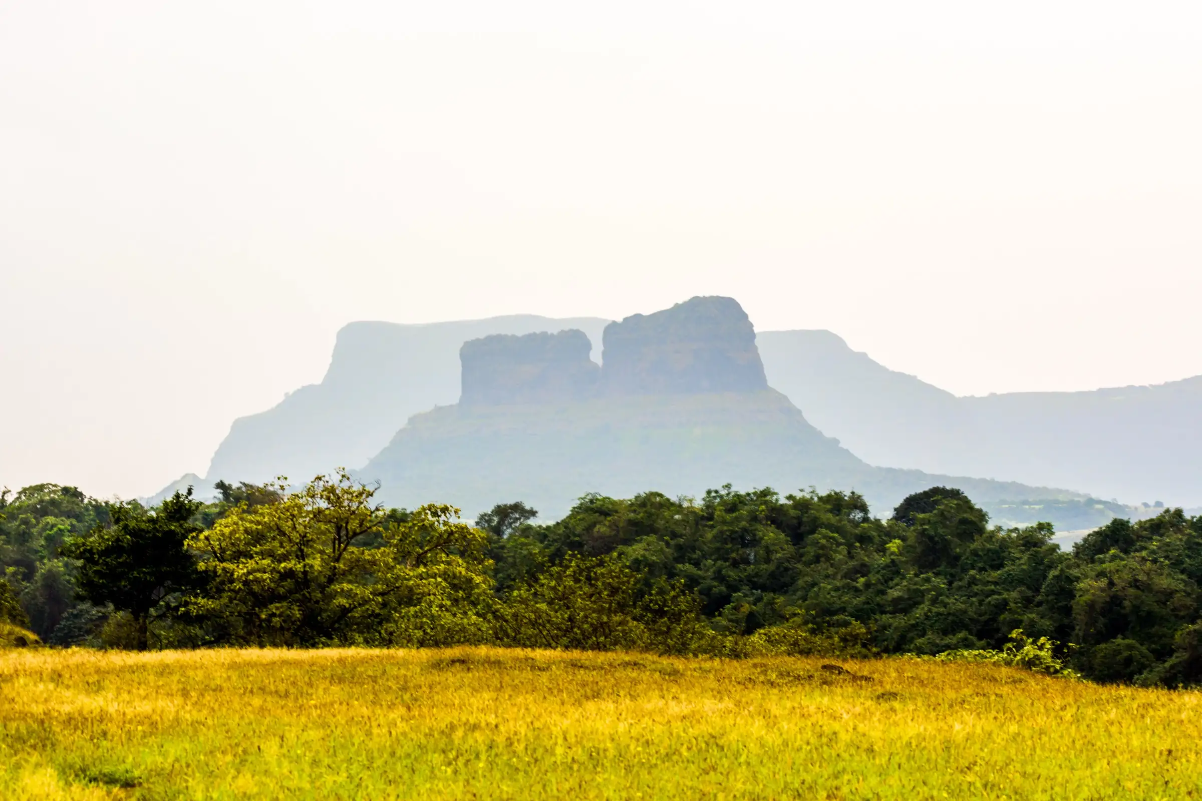 1,012 mhighest point
- Max altitude
- 1,012 m
- Satellite terrain suggests about 731 m
- Days
- 1 day
- Distance
- 3 km
- Difficulty
- Challenging
The walk from Telbaila village up the ridge to the V-shaped notch between the two walls is short (Durgbharari: about 30–45 minutes to the machi and 2–2.5 hours for the notch and back) and needs no gear. Going higher is a technical rock climb: Durgbharari says the southern wall needs ropes and the northern wall full mountaineering technique, and a trip report calls the ascent one that needs high technical mountaineering skill. Operators sell the summit only as a guided climbing and rappelling trip with fixed ropes.
The route
Day by day
Day 1 · highest point
Telbaila village → Telbaila village (via the ridge, the machi and the notch between the walls; the wall tops only by a guided rope climb)
663 m → 1,012 m → 663 m
Ups and downs
Altitude profile
Where it is
Map
Trailhead and high point only — not a recorded track. Use it with a proper map.
Weather
Next 5 days on the trail
Live forecast for the trailhead and the high point. Mountain weather changes fast — check again on the morning you start.
Trailhead · Telbaila (Tailbaila) village
at 663 mLoading forecast…
High point · Tailbaila twin walls (top of the dyke walls)
at 1,012 mLoading forecast…
Each day: high / low °C · rain mm and chance · snow cm · wind km/h
Weather data: Open-Meteo.comModel forecast, not an official warning. For alerts follow IMD and the local administration.
Plan the trip
How to reach
- Trailhead
- Telbaila (Tailbaila) village (nearest town: Lonavala)
- Nearest railway
- Lonavala, about 35 km by road (Durgbharari)
- Nearest airport
- Pune International Airport (Lohegaon), roughly 100 km
- By road
- Lonavala via Bhushi Dam, the Korigad base and Salter; Telbaila is about 3 km from the turn-off after Salter Pass, about 35 km in all (Durgbharari recommends a private vehicle as the road sees little traffic); Pune via Pirangut, Paud, Tamhini and Salter Khind (LBB), about 94–100 km; Lonavala via Ghusal Khamb and Machgaon (LBB)
- Drive
- About 3 h from Pune
Plan the trip
Permits and fees
We could not confirm the current permit rules and fees from an official source. Check with the local forest department or tourism office before you go.
Plan the trip
Cost
Self-guided
₹300–1,500
With an operator
₹2,000
Per person. Guided: Treks and Trails India lists ₹2,000 for its Tailbaila rock climbing and rappelling trip ex-Pune (overnight bus, climbing gear, technical team and a village lunch described in the itinerary; checked October 2026). We found no second operator's current published price. Self-guided (walk to the notch only) is our estimate ex-Lonavala: fuel or a share of a hired vehicle plus a home-cooked meal in the village. Do not attempt the wall climbs without a qualified team and ropes. We found no official notice of any permit or fee, so check locally.
Gear
Top picks for this trek
The gear that matters most on this route, chosen from its altitude, season and risks.
 Ad · affiliate link
 Ad · affiliate link
 Ad · affiliate link
 Ad · affiliate link
 Ad · affiliate link
 Ad · affiliate link
 Ad · affiliate link
- Ad · affiliate link
Store buttons open a search on that store, not a product we picked. As an Amazon Associate we earn from qualifying purchases. Photos show the kind of item, not a specific product. Affiliate disclosure
Packing checklist
Matched to this trek: altitude, season, days and the risks on the route.
Packed 0 of 19
Tick each item as it goes in the bag.
Know before you go
Good to know
- Mobile network
- Not confirmed by our sources; expect weak or patchy coverage in the Salter–Telbaila valley.
- Last ATM
- Lonavala; carry cash and UPI.
- Nearest hospital
- Lonavala, about 35 km by road; emergency number 112. We could not confirm a clinic nearer than that.
- Water
- Durgbharari reports two perennial cisterns in the cave at the notch and a stone tank of drinkable water in a cave on the southern wall, plus a dry tank by the northern caves. Carry at least 2 litres anyway; Treks and Trails India says bottles can be refilled at a homestay in the village.
Highlights
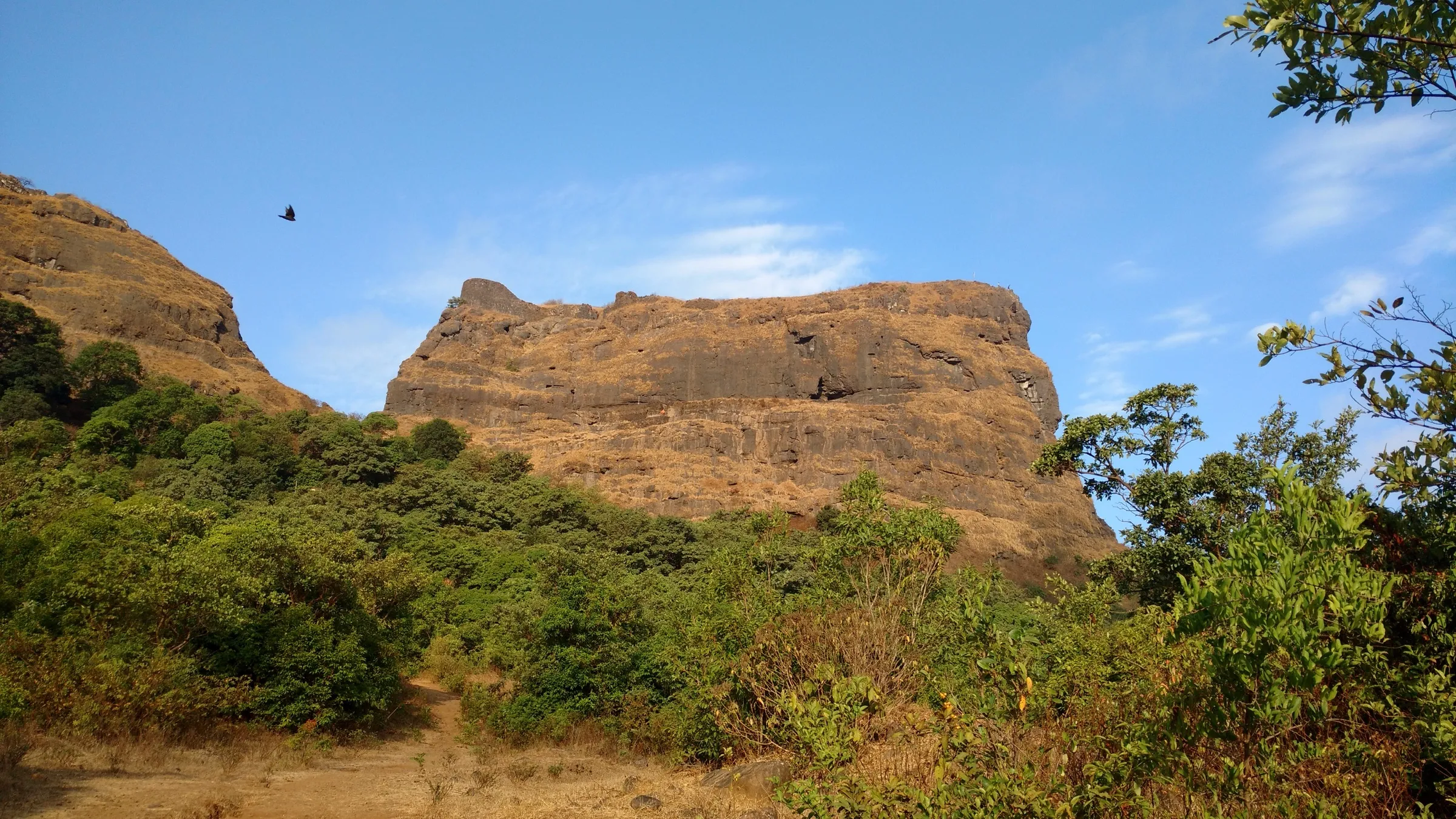
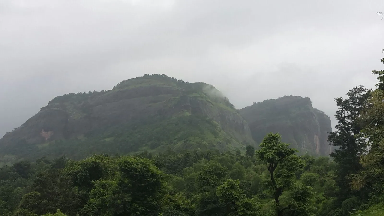
- The twin vertical basalt walls of Tailbaila, a volcanic dyke split by a V-shaped notch, visible from far across the Sahyadri
- The notch between the walls, with cliffs rising around it, reached on foot without gear
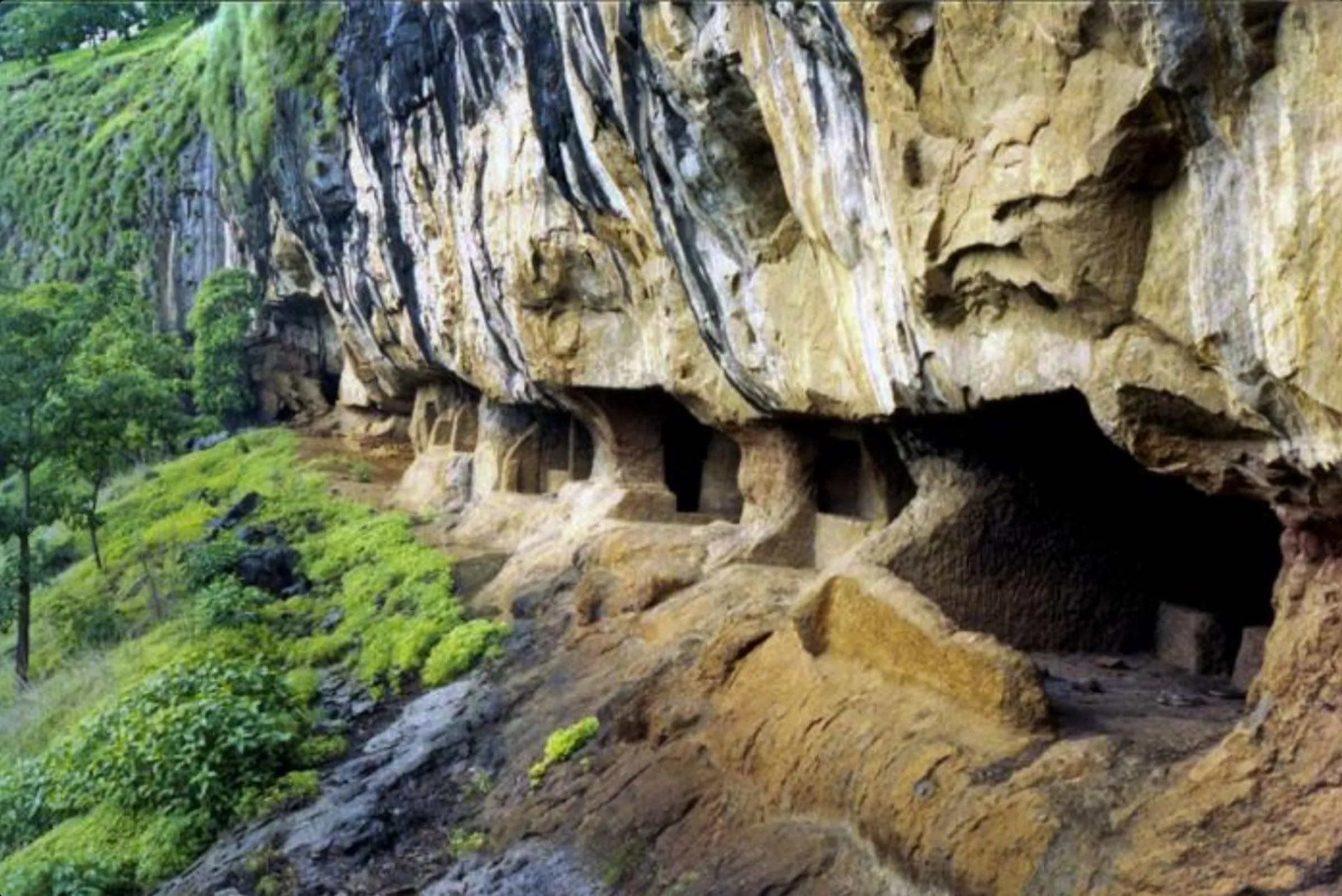
- A small Shiva mandir (Shivalaya) where the two walls meet, and rock-cut caves with water cisterns
- Views of Sudhagad, Ghangad, Korigad and the top of Sarasgad from the walls
- A watch fort on the old trade route from the Konkan ports at Pali up to the Lonavala–Khandala plateau
- Guided rock climbing and rappelling on the walls, among the best-known climbs near Pune; Ghangad is a few kilometres away and can be added the same day
Risks
- Above the notch, both walls are technical rock climbs (ropes on the southern wall, full mountaineering technique on the northern wall per Durgbharari). Never free-climb; go only with a qualified team that fixes ropes, and rappel down.
- Sheer drops around the notch and on the walls; keep away from the edges, especially in wind or mist.
- In the monsoon the rock and the ridge path become very slippery and the climbs are not safe. The Pune district administration has issued prohibitory orders for forts, dams and waterfalls in Mulshi and Maval talukas during heavy rain (for example in July 2024); check current orders before a monsoon visit.
- Summer heat on the bare rock; start early and carry water.
- There are no toilets at the base village or on the trail (Treks and Trails India), and the access road is narrow and lightly used.
Know before you go
Questions
Can beginners do the Tailbaila trek?
Fit beginners can walk from Telbaila village up the ridge to the notch between the two walls, about 2–2.5 hours there and back (Durgbharari). Reaching the top of the walls is a technical rock climb that needs ropes, so beginners should only go with a guided climbing team; Treks and Trails India runs such trips for people above 16.
What is the height of Tailbaila?
Durgbharari's text and Treks and Trails India give 3,322 ft (about 1,012 m) above sea level for the walls; Durgbharari's page header says 2,515 ft. A 90 m terrain model reads about 730 m, which smooths out the narrow walls, so treat the figure as approximate. The walls themselves rise about 200–250 ft above their base (Treks and Trails India).
Where is Tailbaila and how do I get there?
Tailbaila is in Mulshi taluka of Pune district. From Lonavala drive about 35 km via Bhushi Dam, Korigad and Salter, then 3 km from the turn-off after Salter Pass to Telbaila village (Durgbharari). From Pune it is about 94–100 km via Paud, Tamhini and Salter Khind.
Is there water and a place to stay at Tailbaila?
Durgbharari mentions perennial cisterns in the notch cave and a tank of drinkable water in a southern-wall cave, and says trekkers can stay in the Hanuman mandir in the village. Treks and Trails India and a trip report say villagers serve home-cooked lunch; LBB mentions camping near the village.
Can I combine Tailbaila with Ghangad?
Yes. Treks and Trails India notes the two forts are only a few kilometres apart and can be done in the same plan.
In an emergency
Save these numbers before you lose signal. Tap to call.
- 112All emergenciesIndia’s single emergency number — works in every state
- 108Ambulance
- 1077District disaster control room
You are in
District: PuneMaharashtra
- Nearest hospital
- Lonavala, about 35 km by road; emergency number 112. We could not confirm a clinic nearer than that.
- Last ATM
- Lonavala; carry cash and UPI.
- Phone network
- Not confirmed by our sources; expect weak or patchy coverage in the Salter–Telbaila valley.
Before you set off
- Tell someone your route and when you will be back.
- Carry a charged phone and a power bank.
- Download an offline map of the route.
- Turn back if the weather turns bad — the mountain will wait.
Questions about Tailbaila
No questions yet. Ask something and trekkers who have done it can answer.
Share your trek photo with #TreksAndTrails
I trekked this
Did Tailbaila look different from this page? Tell us what changed and we will check it.
Where this comes from
Sources
Last reviewed:
- Telbaila — Durgbharari
- Tailbaila Rock Climbing and Rappelling — Treks and Trails India
- Tailbaila Trek — Tripoto (trip report by Shubham Ganbote)
- Adventure Junkies, Trek & Camp At This Hidden Hamlet Near Lonavala — LBB
- तैलबैला — Marathi Wikipedia
Photos: Vijayshinare, CC BY-SA 4.0