Shumga Top Trek
Kullu, Himachal Pradesh
Opens without signal on this phone, with the map file and checklist. Saved for offline →
- Max altitude
- 3,810 m
- Days
- 5 days
- Distance
- 25 km
- Difficulty
- Moderate
Operators rate it moderate: about 4-6 hours of walking a day and a climb of roughly 1,750 m from Shangarh (about 2,050 m) to the 3,810 m ridge over two days, through forest and then open alpine meadow. It needs good fitness and acclimatisation, but no technical sections are described.
Photos
On the trail
The route
Day by day
Day 1
Mandi (drive via Pandoh Dam, the Aut tunnel and Sainj) → Shangarh
760 m → 2,050 m
Day 2
Shangarh → Sara Lake (through pine forest above Barshangarh)
2,050 m → 2,744 m
Day 3 · highest point
Sara Lake → Shumga Thach (via Shumga Top)
2,744 m → 3,810 m → 3,500 m
Day 4
Shumga Thach → Barshangarh, then drive to Shangarh
3,500 m → 2,050 m
Day 5
Shangarh → Mandi (drive)
2,050 m → 760 m
Ups and downs
Altitude profile
Where it is
Map
Trailhead and high point only — not a recorded track. Use it with a proper map.
Weather
Next 5 days on the trail
Live forecast for the trailhead and the high point. Mountain weather changes fast — check again on the morning you start.
Trailhead · Shangarh
at 2,050 mLoading forecast…
High point · Shumga Top, on the Sainj-Tirthan ridge south-east of Sara Lake (position approximate; not mapped on OpenStreetMap)
at 3,810 mLoading forecast…
Each day: high / low °C · rain mm and chance · snow cm · wind km/h
Weather data: Open-Meteo.comModel forecast, not an official warning. For alerts follow IMD and the local administration.
Plan the trip
How to reach
- Trailhead
- Shangarh (nearest town: Sainj)
- Nearest railway
- Joginder Nagar (narrow gauge); Chandigarh or Kiratpur for broad-gauge trains
- Nearest airport
- Kullu-Manali Airport, Bhuntar (about 53 km, 2 hours from the Sainj valley per Safar with Sasha)
- By road
- Mandi: operators drive Mandi - Pandoh - Aut tunnel - Sainj - Shangarh; Aut on the Chandigarh-Manali highway: about 35 km to Shangarh (Safar with Sasha); buses run from Aut to Sainj through the day; Chandigarh: about 242 km and 5-6 hours to the Sainj valley (Safar with Sasha)
- Drive
- About 6 h from Chandigarh
Plan the trip
Permits and fees
We could not confirm the current permit rules and fees from an official source. Check with the local forest department or tourism office before you go.
Plan the trip
Cost
Self-guided
₹6,000–10,000
With an operator
₹14,999
Per person, ex-Mandi. Only Escape2Explore publishes a price: ₹14,999 (5 days, Mandi to Mandi, transport, meals, tents and permits included; list price ₹21,427). Himalayan Hikers and Himalayan Daredevils sell the same 5-day Mandi-to-Mandi itinerary but do not show a full price (Himalayan Daredevils' 'Book Now at ₹2,000' looks like a booking amount). Self-guided is our estimate: taxi Mandi or Aut to Shangarh and back, two homestay nights in Shangarh, a local guide and porter for the two camping nights (the upper trail is not described as marked), food, and any GHNP or forest fee charged at the Sainj/Ropa range office.
Gear
Top picks for this trek
The gear that matters most on this route, chosen from its altitude, season and risks.
 Ad · affiliate link
 Ad · affiliate link
 Ad · affiliate link
 Ad · affiliate link
 Ad · affiliate link
 Ad · affiliate link
 Ad · affiliate link
 Ad · affiliate link
Store buttons open a search on that store, not a product we picked. As an Amazon Associate we earn from qualifying purchases. Photos show the kind of item, not a specific product. Affiliate disclosure
Packing checklist
Matched to this trek: altitude, season, days and the risks on the route.
Packed 0 of 33
Nights near 3,810 m can drop close to freezing even in summer. Pack one more warm layer than you think.
Tick each item as it goes in the bag.
Know before you go
Good to know
- Mobile network
- Escape2Explore says mobile signal is limited or absent on most of the trek. Not confirmed by an official source.
- Last ATM
- Not confirmed by our sources; Sainj is the valley's market town. Carry cash from Aut or Mandi.
- Nearest hospital
- Not confirmed by our sources; basic health facilities in Sainj and Banjar, Regional Hospital Kullu for anything serious.
- Water
- Sara Lake is a sacred lake used as a campsite; do not wash in it or take water from it without asking locals. Carry 2 litres and treat stream water. Water above the tree line was not described by our sources.
Highlights
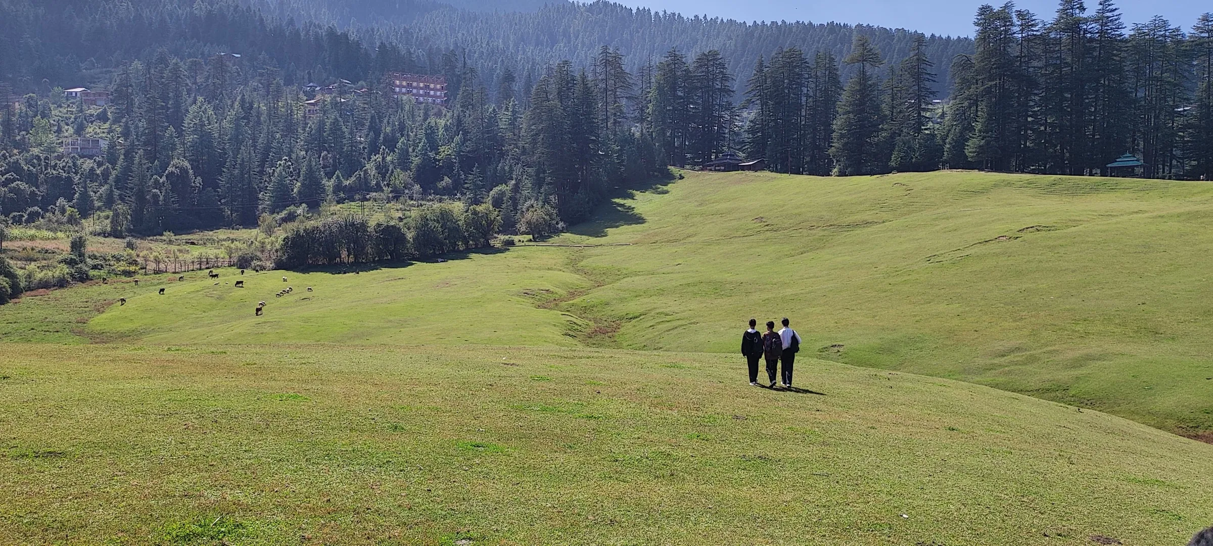
- Starts from Shangarh, a village of wide green meadows and tower temples in the Sainj valley on the edge of the Great Himalayan National Park.
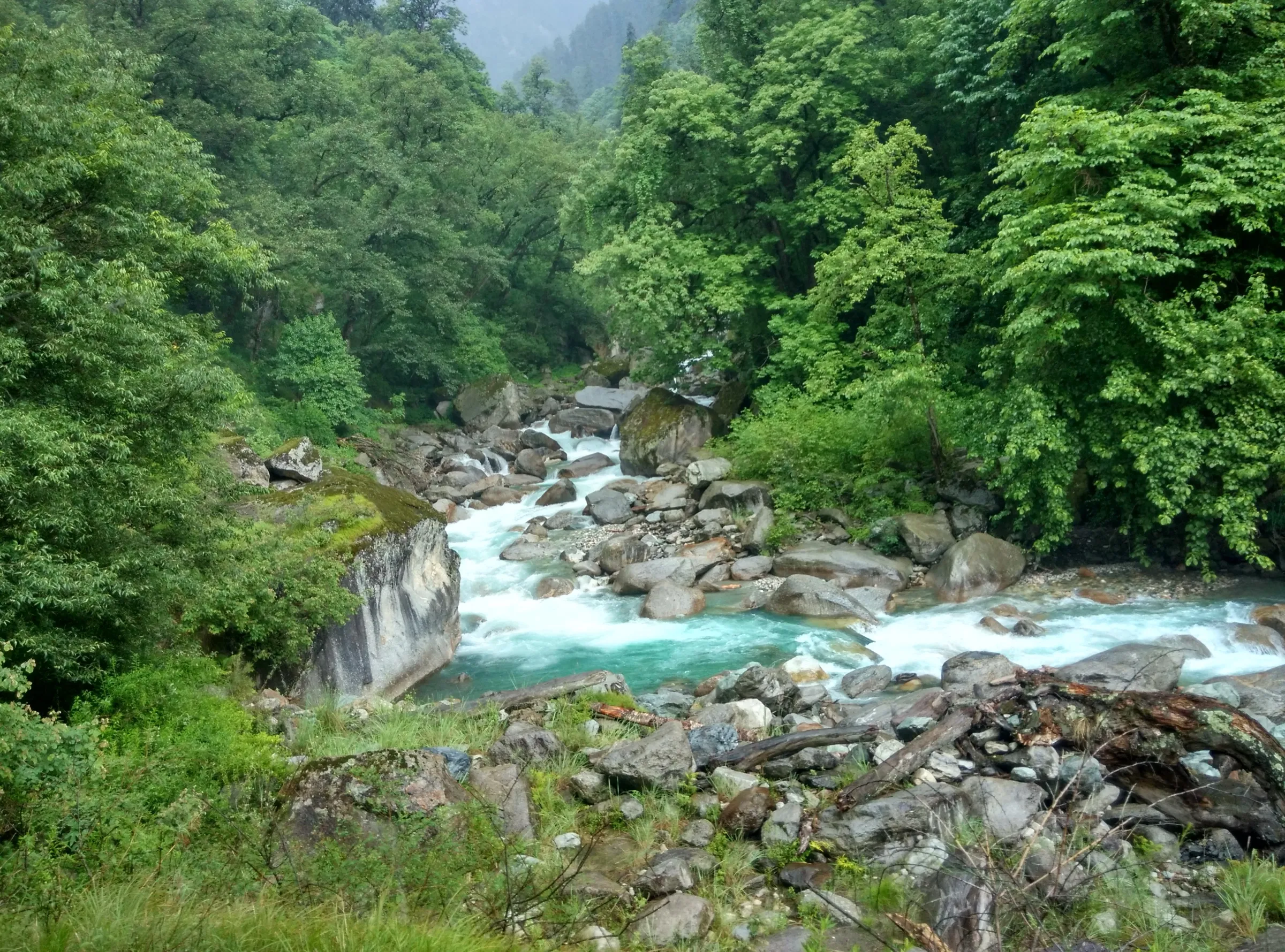
- A forest walk of pine, cedar and rhododendron above Barshangarh to camp beside the sacred Sara Lake (about 2,744 m).
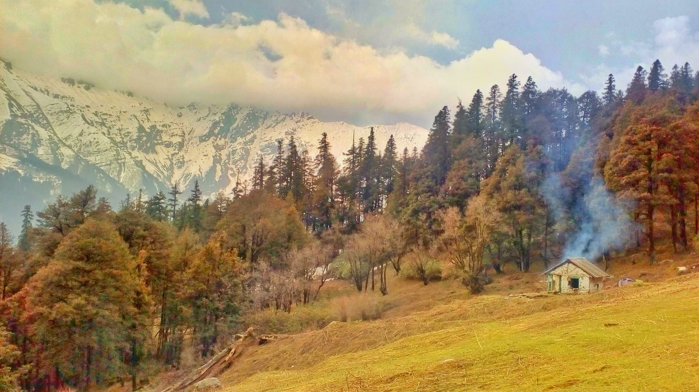
- Above the tree line the trail opens into the alpine meadows of Shumga, where operators report sightings of monal, koklass and tragopan pheasants.
- Shumga Top (about 3,810 m) is a ridge between the Sainj and Tirthan valleys with a shrine of Jogni Mata and prayer flags; locals revere her as the protector of these mountains.
- Summit views south to Banjar, Mandi and Thachi and north to the Great Himalayan peaks; operators say Kinnaur and Spiti ranges show on a clear day.
Risks
- Lesser-known route: the upper trail to Shumga Top is not mapped on OpenStreetMap and few independent trip reports exist. Go with a local guide from Shangarh or Barshangarh.
- Altitude: the route climbs about 1,750 m in two days to 3,810 m; watch for altitude-sickness symptoms and descend if they worsen.
- Cold nights: Himalayan Hikers gives night temperatures of 0-7°C in season; in winter the upper ridge is under snow.
- Monsoon (July-August): Safar with Sasha warns that Sainj valley roads are often cut by landslides in the monsoon; forest trails become slippery and leech-ridden.
- Great Himalayan National Park rules: the ridge lies on the edge of the park and its eco-zone. GHNP asks visitors to get permission from the park office, use certified guides and porters on multi-day treks and light no open fires; no current dated fee table is published, so ask at the Sainj/Ropa range office.
- In May 2025 and May 2026 the Forest Department closed the Rolla-Shilt-Rakhundi-Ghumtaro area on the Tirthan side of the same ridge for Western Tragopan breeding. That order did not name Shumga, but check for any similar order before a May trek.
- Sara Lake and the Jogni Mata shrine are sacred to the valley: keep them clean and ask locals about customs (footwear, food, alcohol) before camping near them.
Know before you go
Questions
How high is Shumga Top and where is it?
Operators give the height as 3,810 m (12,500 ft). It is a ridge top between the Sainj and Tirthan valleys in Kullu district, above the village of Barshangarh near Shangarh, on the edge of the Great Himalayan National Park.
How many days does the Shumga Top trek take?
Operators run it as 5 days from Mandi to Mandi: drive to Shangarh, trek to Sara Lake, climb Shumga Top and camp at Shumga Thach, descend to Barshangarh, and drive back. The walking part takes 3 days. Escape2Explore says 3 to 5 days depending on the itinerary.
What is the best time for the Shumga Top trek?
Escape2Explore recommends April to June and September to October or November. Himalayan Hikers lists it as open throughout the year, but snow covers the upper ridge in winter and the July-August monsoon brings landslides on valley roads.
Is Shumga Top good for beginners?
Operators rate it moderate. Escape2Explore says no prior trekking experience is needed if you have basic fitness, but Himalayan Hikers asks for proper conditioning, warm gear for sub-zero nights and acclimatisation because you reach 3,810 m.
Do I need a permit for Shumga Top?
Operators include 'forest permits and entrance fees' in their packages. The Great Himalayan National Park asks visitors to get permission from its offices before entering the park; there is no current official fee list for this route, so check at the Sainj/Ropa range office.
In an emergency
Save these numbers before you lose signal. Tap to call.
- 112All emergenciesIndia’s single emergency number — works in every state
- 108Ambulance
- 1077District disaster control room
You are in
District: KulluHimachal Pradesh
- Nearest hospital
- Not confirmed by our sources; basic health facilities in Sainj and Banjar, Regional Hospital Kullu for anything serious.
- Last ATM
- Not confirmed by our sources; Sainj is the valley's market town. Carry cash from Aut or Mandi.
- Phone network
- Escape2Explore says mobile signal is limited or absent on most of the trek. Not confirmed by an official source.
Before you set off
- Tell someone your route and when you will be back.
- Carry a charged phone and a power bank.
- Download an offline map of the route.
- Turn back if the weather turns bad — the mountain will wait.
Questions about Shumga Top
No questions yet. Ask something and trekkers who have done it can answer.
Share your trek photo with #TreksAndTrails
I trekked this
Did Shumga Top look different from this page? Tell us what changed and we will check it.
Where this comes from
Sources
Last reviewed:
- Shumga Top Trek a raw trek in Himachal — Himalayan Hikers
- Shumga Top Trek – Scenic Himalayan Adventure Trail — Escape2Explore
- Shumga Top Trek — Himalayan Daredevils
- Sainj Valley Itinerary : Perfect 3, 4, 5 or 6 days guide — Safar with Sasha
- Fees, Rules and Guidelines — Great Himalayan National Park (HP Forest Department) (official)
Photos: Rajani Gairshail, CC BY 4.0; Rajani Gairshail, CC BY-SA 4.0