Jiwa Nala Trek
Kullu, Himachal Pradesh
Opens without signal on this phone, with the map file and checklist. Saved for offline →
- Max altitude
- 4,700 m
- Days
- 7 days
- Distance
- 90 km
- Difficulty
- Difficult
A remote crossover through the core of Great Himalayan National Park with two passes (Kandi Galu about 3,700 m and Phangchi Galu about 4,700 m), 8-11 hour days, climbs and descents of about 1,500 m on most days, faint or missing trail through thick bushes, and a steep scree descent from Phangchi Galu. Sources rate it moderate-difficult and ask for several years of high-altitude experience.
Photos
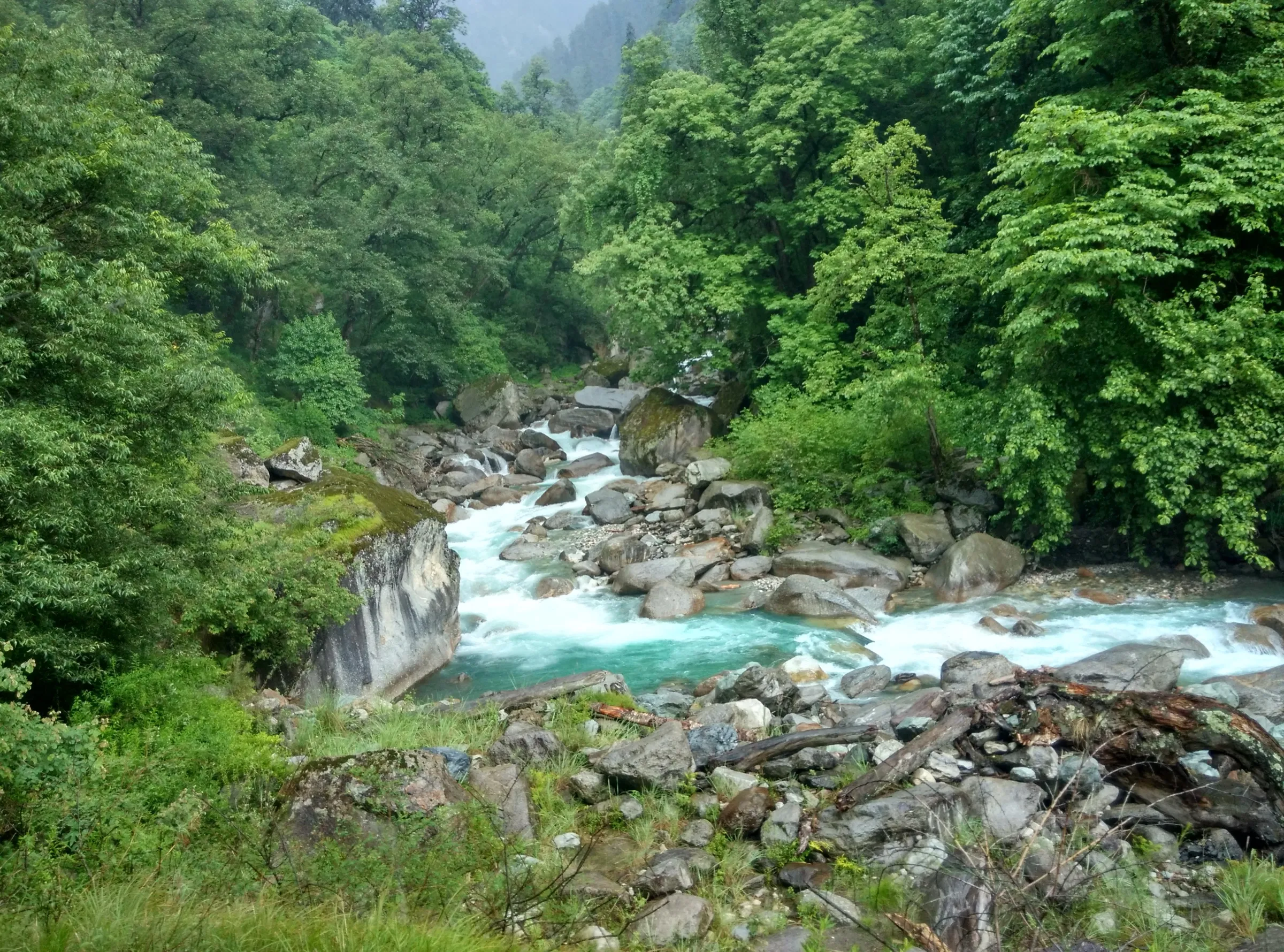
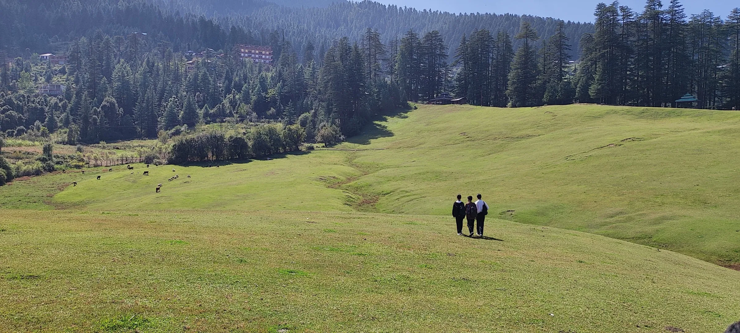
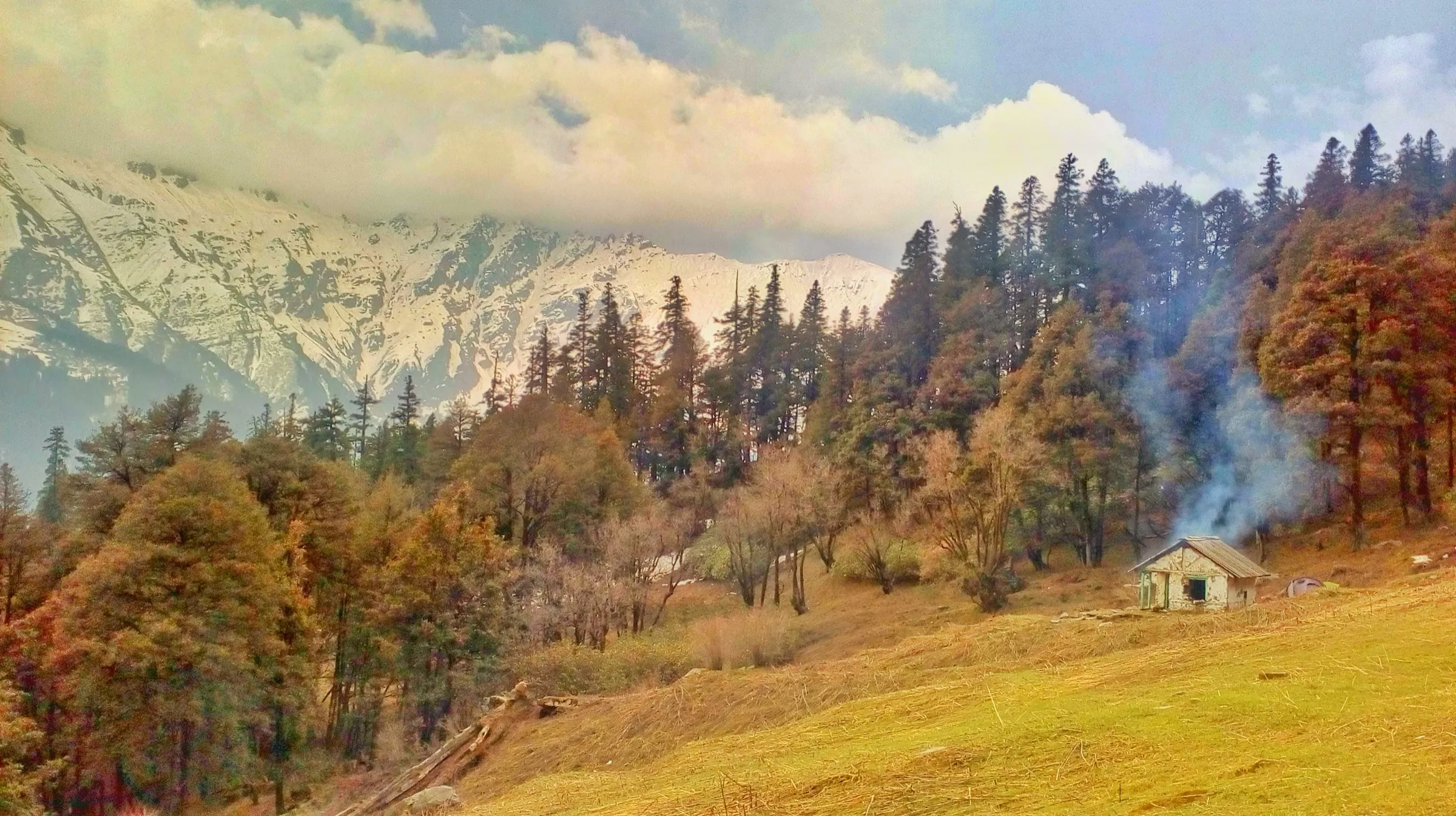
On the trail
The route
Day by day
Day 1
Aut → Sainj / Neuli (permit at the GHNP Sainj range office)
950 m → 1,500 m
Day 2
Shanshar (drive from Sainj) → Bhagi Kashyari
2,100 m → 2,600 m
Day 3
Bhagi Kashyari → Subli Thach (via Kandi Galu)
2,600 m → 3,700 m → 3,300 m
Day 4
Subli Thach → Dwada Thach
3,300 m → 3,150 m
Day 5
Dwada Thach → Lalbatti (via Sarthu Pond and Khandedhar Top)
3,150 m → 4,400 m → 4,000 m
Day 6 · highest point
Lalbatti → Chippi (via Phangchi Galu)
4,000 m → 4,700 m → 3,400 m
Day 7
Chippi → Barshaini (via Pulga; drive to Manikaran or Kasol)
3,400 m → 2,200 m
Ups and downs
Altitude profile
Where it is
Map
Trailhead and high point only — not a recorded track. Use it with a proper map.
Weather
Next 5 days on the trail
Live forecast for the trailhead and the high point. Mountain weather changes fast — check again on the morning you start.
Trailhead · Shanshar (Shenshar)
at 2,100 mLoading forecast…
High point · Phangchi Galu
at 4,700 mLoading forecast…
Each day: high / low °C · rain mm and chance · snow cm · wind km/h
Weather data: Open-Meteo.comModel forecast, not an official warning. For alerts follow IMD and the local administration.
Plan the trip
How to reach
- Trailhead
- Shanshar (Shenshar) (nearest town: Sainj)
- Nearest railway
- Chandigarh (about 270 km); Joginder Nagar narrow gauge is closer
- Nearest airport
- Kullu-Manali Airport, Bhuntar
- By road
- Delhi (about 550 km): overnight Volvo bus towards Manali, get off at Aut, then about 1.5 hours by local bus or taxi to Sainj; Aut (about 1.5 hours to Sainj; the road continues to Neuli and Shanshar, the last motorable point); Barshaini, at the Parvati Valley end: local buses and taxis to Manikaran, Kasol and Bhuntar
- Drive
- About 9 h from Chandigarh
Plan the trip
Permits and fees
We could not confirm the current permit rules and fees from an official source. Check with the local forest department or tourism office before you go.
Plan the trip
Cost
Self-guided
₹10,000–25,000
With an operator
₹25,000–40,000
Per person, ex-Aut/Sainj. No operator publishes a current price for this trek (Bikat Adventures' listing now returns an error page), so both ranges are our estimates. Self-guided: the park requires multi-day trekkers to hire certified guides and porters; Discover with Dheeraj (April 2026) puts a solo trekker at about ₹17,000-25,000 (Delhi transport, permit, guide, porter, food) and about ₹10,000-15,000 each in a group of 3-4. Guided: a local Sainj agency with tents, cook and porters for 7-8 days typically costs more; confirm in Sainj.
Gear
Top picks for this trek
The gear that matters most on this route, chosen from its altitude, season and risks.
 Ad · affiliate link
 Ad · affiliate link
 Ad · affiliate link
 Ad · affiliate link
 Ad · affiliate link
 Ad · affiliate link
 Ad · affiliate link
 Ad · affiliate link
Store buttons open a search on that store, not a product we picked. As an Amazon Associate we earn from qualifying purchases. Photos show the kind of item, not a specific product. Affiliate disclosure
Packing checklist
Matched to this trek: altitude, season, days and the risks on the route.
Packed 0 of 34
Nights near 4,700 m can drop close to freezing even in summer. Pack one more warm layer than you think.
Tick each item as it goes in the bag.
Know before you go
Good to know
- Mobile network
- No mobile network for most of the trek; expect signal only around Sainj before the start and at Barshaini at the end.
- Last ATM
- Not confirmed by our sources; draw cash in Mandi, Aut or Kullu before driving into the Sainj valley.
- Nearest hospital
- District Hospital Kullu (60+ km from the trailhead) for serious cases
- Water
- Streams at Bhagi Kashyari, Subli Thach, Dwada Thach and Chippi, and the Jiwa Nala itself; Lalbatti has little water and no firewood. Treat all water.
Highlights
- Crossing from the Sainj and Jiwa Nal valleys into the Parvati valley over two passes, Kandi Galu and Phangchi Galu
- Sarthu (Sartoo) Pond, the small emerald glacial pond that is the source of the Jiwa Nala
- Deep solitude in the core zone of the Great Himalayan National Park, a UNESCO World Heritage Site, with very few people on the trail
- Meadow camps at Subli Thach and Dwada Thach, and the old village of Pulga on the way down to Barshaini
Risks
- The trail is faint or missing in many places (only cairns, or burjis, mark it); thick bushes hide the path and getting lost is a real risk without a local guide.
- Phangchi Galu (about 4,700 m) has a very steep scree descent with a high chance of rockfall; Acute Mountain Sickness is a serious risk above about 3,600 m.
- River and stream crossings on the Jiwa Nala and below Chippi; bridges upstream are often washed away, and water rises in the afternoon and after rain.
- There are no easy exits and no rescue nearby; carry food for two extra days.
- July and August monsoon rain makes the forest trail slippery and the river crossings dangerous (avoid); in December to February the passes are under snow.
Know before you go
Questions
Do I need a permit for the Jiwa Nala trek?
Yes. The trek runs through the core zone of the Great Himalayan National Park, and entry is by permit only. Get it from the GHNP Sainj range office at Ropa, near Neuli, or the head office at Shamshi. The park's website says to check the latest fees with the park office. The officer at Sainj often does not arrive before 11 am.
Is a guide compulsory?
The park's rules say multi-day trekkers must hire certified guides and porters, and route plans must be approved by a GHNP range officer before entry. Even apart from the rule, the trail is so faint that every source advises a local guide.
What is the highest point of the Jiwa Nala trek?
Phangchi Galu, about 4,700 m (15,419 ft) according to Indiahikes; Outlook Traveller gives 4,636 m. The first pass, Kandi Galu, is about 3,700 m.
When is the best time to do the trek?
May-June and September-October. In May-June the meadows are green and the passes are usually clear of heavy snow from mid-May; September-October gives clear views. Avoid the July-August monsoon, and the passes are under snow in winter.
Is the Jiwa Nala trek suitable for beginners?
No. Indiahikes says it is for trekkers with 3-4 years of high-altitude experience: 8-10 hour days, climbs and descents of about 1,500 m on most days, and almost no other people on the trail.
Where does the trek start and end?
Most trekkers drive from Sainj to Shanshar, the last motorable point, and walk to Bhagi Kashyari on the first day; starting at Neuli adds about 14-15 km. The trek ends at Barshaini in the Parvati valley, from where buses and taxis go to Manikaran and Kasol.
In an emergency
Save these numbers before you lose signal. Tap to call.
- 112All emergenciesIndia’s single emergency number — works in every state
- 108Ambulance
- 1077District disaster control room
You are in
District: KulluHimachal Pradesh
- Nearest hospital
- District Hospital Kullu (60+ km from the trailhead) for serious cases
- Last ATM
- Not confirmed by our sources; draw cash in Mandi, Aut or Kullu before driving into the Sainj valley.
- Phone network
- No mobile network for most of the trek; expect signal only around Sainj before the start and at Barshaini at the end.
Before you set off
- Tell someone your route and when you will be back.
- Carry a charged phone and a power bank.
- Download an offline map of the route.
- Turn back if the weather turns bad — the mountain will wait.
Questions about Jiwa Nala
No questions yet. Ask something and trekkers who have done it can answer.
Share your trek photo with #TreksAndTrails
I trekked this
Did Jiwa Nala look different from this page? Tell us what changed and we will check it.
Where this comes from
Sources
Last reviewed:
- Jiwa Nala – Parvati Valley Trek — Indiahikes
- Jiwa Nal Trek 2026 – Complete Travel Guide for GHNP Trekkers — Discover with Dheeraj
- Jiwa Nala Trek – A COMPLETE Travel Guide — Vargis Khan
- Great Himalayan National Park — Outlook Traveller
- Jiwa Nal Valley — Great Himalayan National Park (HP Forest Department) (official)
- Fees, Rules and Guidelines — Great Himalayan National Park (HP Forest Department) (official)
- Closing some selected areas of GHNP for Tourists/Trekkers/Visitors - approval thereof (2026) — Great Himalayan National Park (HP Forest Department) (official)
Photos: Rah.sin89, CC BY-SA 4.0; Gurpreet Singh, CC BY-SA 4.0