Prabalgad Trek
Raigad, Maharashtra
Opens without signal on this phone, with the map file and checklist. Saved for offline →
- Max altitude
- 701 m
- Days
- 1 day
- Distance
- 8 km
- Difficulty
- Moderate
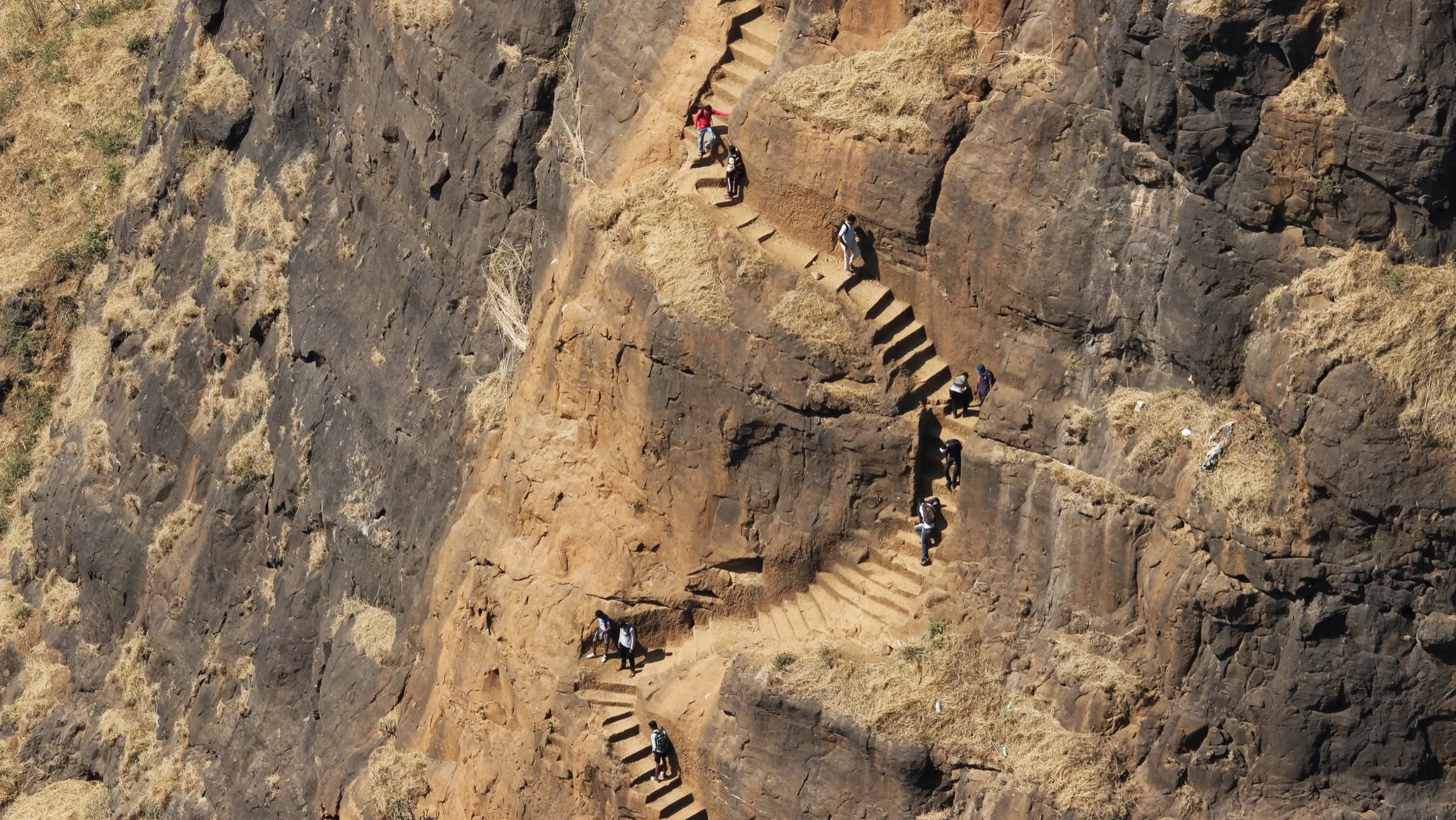
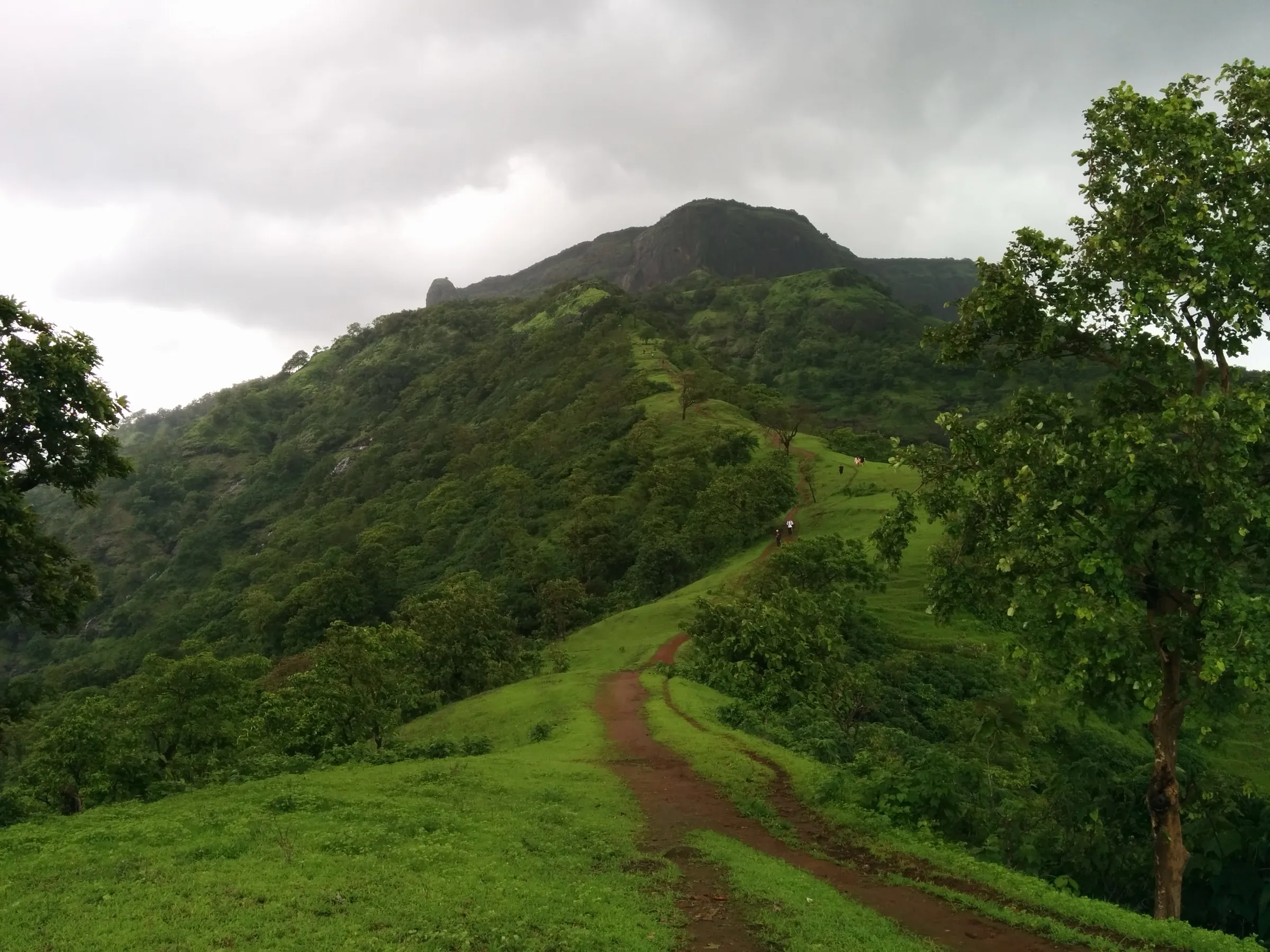
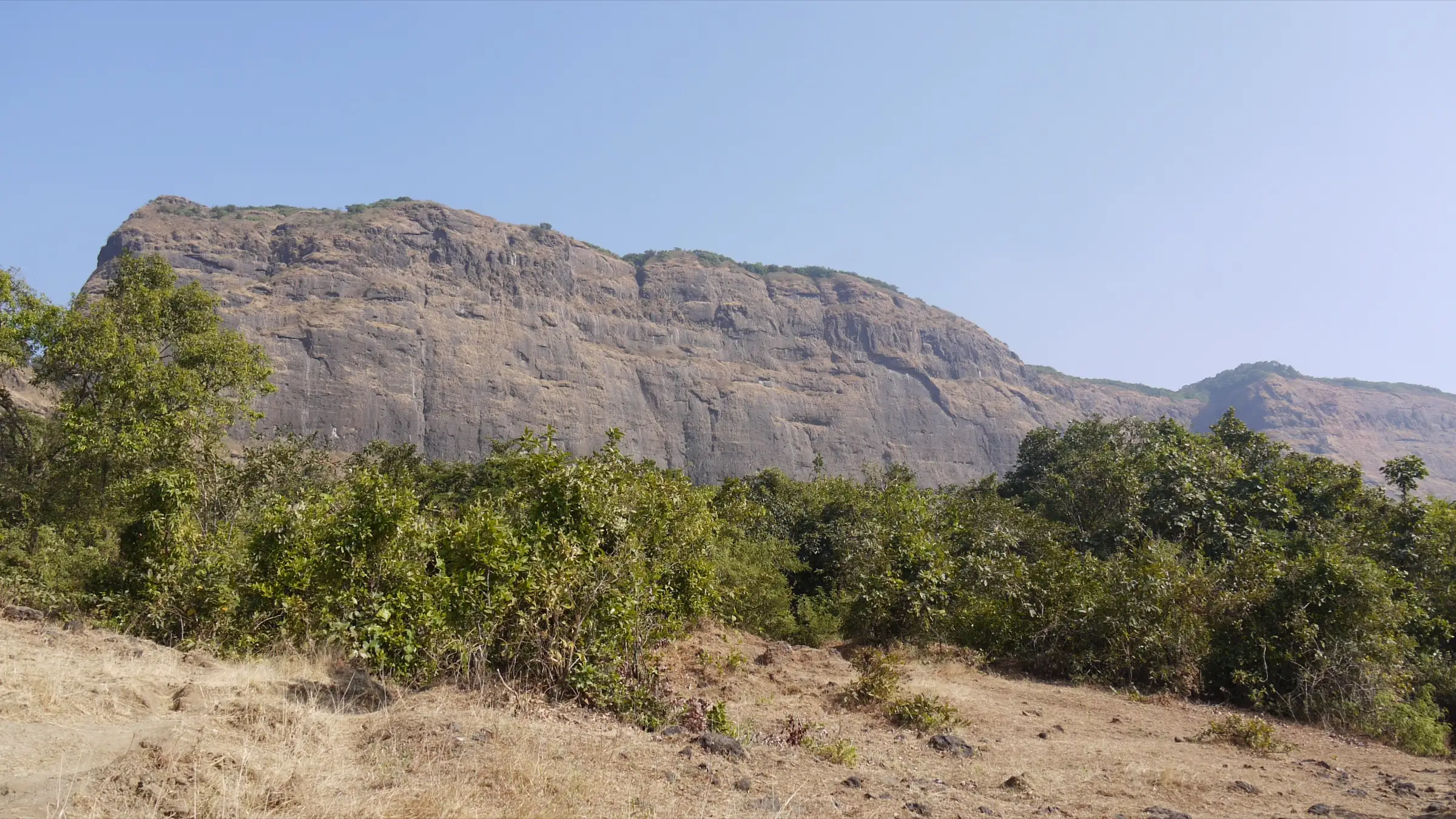
About 4 km each way with roughly 600 m of climbing: an easy forest path to the Prabalmachi plateau, then a steep, tiring climb past the Kalavantin col and up a gully on rock-cut steps to the fort gate. The forested top has faint, unmarked paths that are easy to lose.
Photos
On the trail
The route
Day by day
Day 1 · highest point
Thakurwadi → Thakurwadi (via Prabalmachi and Prabalgad)
90 m → 701 m → 90 m
Ups and downs
Altitude profile
Where it is
Map
Trailhead and high point only — not a recorded track. Use it with a proper map.
Weather
Next 5 days on the trail
Live forecast for the trailhead and the high point. Mountain weather changes fast — check again on the morning you start.
Trailhead · Thakurwadi
at 90 mLoading forecast…
High point · Prabalgad fort plateau (Balekilla)
at 701 mLoading forecast…
Each day: high / low °C · rain mm and chance · snow cm · wind km/h
Weather data: Open-Meteo.comModel forecast, not an official warning. For alerts follow IMD and the local administration.
Plan the trip
How to reach
- Trailhead
- Thakurwadi (nearest town: Panvel)
- Nearest railway
- Panvel
- Nearest airport
- Chhatrapati Shivaji Maharaj International Airport, Mumbai
- By road
- Panvel to Thakurwadi (about 14 km) by shared six-seater auto or the State Transport bus, turning off the old Mumbai–Pune highway at Shedung; Mumbai to Panvel by Harbour line local train or road
- Drive
- About 2 h from Mumbai
Plan the trip
Permits and fees
We could not confirm the current permit rules and fees from an official source. Check with the local forest department or tourism office before you go.
Plan the trip
Cost
Self-guided
₹200–700
With an operator
₹799–1,399
Per person, ex-Panvel / ex-Mumbai. Treks and Trails India lists its one-day Prabalgad trek at Rs 799 without transport and Rs 1,399 with a Mumbai pickup bus (breakfast and lunch included). Bhatakna lists a one-day Prabalmachi trek (the same base, not the fort top) at Rs 999. Only one operator price for the fort itself was found. Self-guided estimate: shared auto or ST bus from Panvel, any local committee fee at Thakurwadi, and food or drinks bought at Prabalmachi.
Gear
Top picks for this trek
The gear that matters most on this route, chosen from its altitude, season and risks.
 Ad · affiliate link
 Ad · affiliate link
 Ad · affiliate link
 Ad · affiliate link
 Ad · affiliate link
 Ad · affiliate link
- Ad · affiliate link
 Ad · affiliate link
Store buttons open a search on that store, not a product we picked. As an Amazon Associate we earn from qualifying purchases. Photos show the kind of item, not a specific product. Affiliate disclosure
Packing checklist
Matched to this trek: altitude, season, days and the risks on the route.
Packed 0 of 17
Tick each item as it goes in the bag.
Know before you go
Good to know
- Mobile network
- Not confirmed for the fort top; on the shared Thakurwadi–Prabalmachi trail Indiahikes reports Airtel, Vodafone and Jio signal on most of the way (see Kalavantin Durg)
- Last ATM
- Panvel
- Nearest hospital
- Panvel
- Water
- Stalls and houses at Prabalmachi sell water, lime juice and kokum sherbet. Durgbharari reports rock-cut cisterns with drinkable water near Kala Buruj and off the trail towards Kalavantin, but others are not drinkable and local guides rarely show them. Carry 2–3 litres from the base.
Highlights
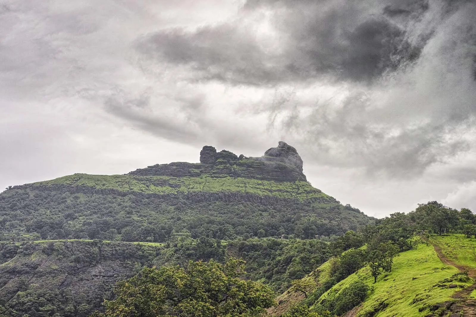
- A broad, forested fort plateau with eleven bastions, two ruined gates, rock-cut cisterns and four dressed-stone granary buildings
- Close-up views straight down onto the Kalavantin Durg pinnacle and its rock-cut staircase
- A Ganesh temple on the top with two Nandi idols and a Shivling behind the Ganesh murti
- Views of Matheran, Irshalgad, Chanderi, Peb, Karnala, Manikgad and Morbe Dam from Kala Buruj and Bori Sond
- Historic seat of the Maratha administration of North Konkan after Chhatrapati Shivaji Maharaj took it in 1656–57 and renamed Muranjan as Prabalgad
- Shares its base and the Prabalmachi plateau with Kalavantin Durg (slug kalavantin-durg), about 1.1 km to the north
Risks
- The path from Prabalmachi to the fort gate is steep, with rock-cut steps in a gully; it is slippery when wet and in heavy monsoon rain.
- The top is thick forest with faint, branching trails; trekkers have got lost on the Prabalgad side. Go with a local guide and start back well before dark.
- The neighbouring Kalavantin Durg climb is exposed rock-cut steps with no railing and a roped final patch; skip it if you are uneasy with heights.
- Monsoon (June–September) brings very heavy rain here (Wikipedia climate data: about 2,000 mm in July alone). No Raigad district ban naming Prabalgad was found for 2025 or 2026, but Raigad does close other spots each monsoon, so check local notices before a June–September visit.
- Little shade on the lower trail; March–May heat is severe, so start early and carry enough water.
- Weekend crowds and commercial stalls on Prabalmachi; go on a weekday for a quieter visit.
Know before you go
Questions
How long is the Prabalgad trek and how much time does it take?
TrekGo gives about 4 km one way: roughly 3 km (about 1.5 hours) from Thakurwadi to the Prabalmachi plateau, then about 1 km to the fort top. Plan 4–5 hours for the round trip plus time to explore the ruins; Treks and Trails India's one-day plan runs from 8:15 am to about 6 pm with meal breaks at Prabalmachi.
Can I do Prabalgad and Kalavantin Durg on the same day?
Yes. Both start from Thakurwadi and share the Prabalmachi plateau and col. TrekGo says combining them takes about 6–8 hours round trip. Many groups climb only Prabalgad and view Kalavantin's exposed staircase from the fort.
What is the best time to trek Prabalgad?
October to February is the safest and most popular season, with dry rock and clear views. The monsoon is green and foggy and some operators run it then, but the steps are slippery and the forest paths on top are easy to lose. March to May is very hot, so start early.
How do I reach the base village of Prabalgad?
Take a local train or road to Panvel, then a shared auto or State Transport bus to Thakurwadi, about 14 km away via Shedung on the old Mumbai–Pune highway. Vehicles cannot go up to Prabalmachi, so park at Thakurwadi.
Is there a permit or entry fee?
No official permit was found. A local committee at Thakurwadi has collected a small entry fee for the shared Prabalmachi trail, so carry some cash and check at the base.
In an emergency
Save these numbers before you lose signal. Tap to call.
- 112All emergenciesIndia’s single emergency number — works in every state
- 108Ambulance
- 1077District disaster control room
You are in
District: RaigadMaharashtra
- Nearest hospital
- Panvel
- Last ATM
- Panvel
- Phone network
- Not confirmed for the fort top; on the shared Thakurwadi–Prabalmachi trail Indiahikes reports Airtel, Vodafone and Jio signal on most of the way (see Kalavantin Durg)
Before you set off
- Tell someone your route and when you will be back.
- Carry a charged phone and a power bank.
- Download an offline map of the route.
- Turn back if the weather turns bad — the mountain will wait.
Questions about Prabalgad
No questions yet. Ask something and trekkers who have done it can answer.
Share your trek photo with #TreksAndTrails
I trekked this
Did Prabalgad look different from this page? Tell us what changed and we will check it.
Where this comes from
Sources
Last reviewed:
- Prabalgad — Wikipedia
- Prabalgad Trek (tour listing by the operator Treks and Trails India, treksandtrails.org; not this site) — Treks and Trails India
- Prabalgad Trek Guide: Route to the Fort Beside Kalavantin Durg — TrekGo
- Prabalgad | Durgbharari (text by Suresh Nimbalkar) — Durgbharari
- Prabalmachi Monsoon Trek (Bhatakna; covers the Prabalmachi plateau below the fort, not the fort top) — Bhatakna Tours and Travels
Photos: Dinesh Valke from Thane, India, CC BY-SA 2.0; Dinesh Valke from Thane, India, CC BY-SA 2.0; Pranavshindeuss, CC BY-SA 4.0; Dinesh Valke from Thane, India, CC BY-SA 2.0