Kalavantin Durg Trek
Raigad, Maharashtra
Opens without signal on this phone, with the map file and checklist. Saved for offline →
- Max altitude
- 686 m
- Days
- 1 day
- Distance
- 7.4 km
- Difficulty
- Moderate
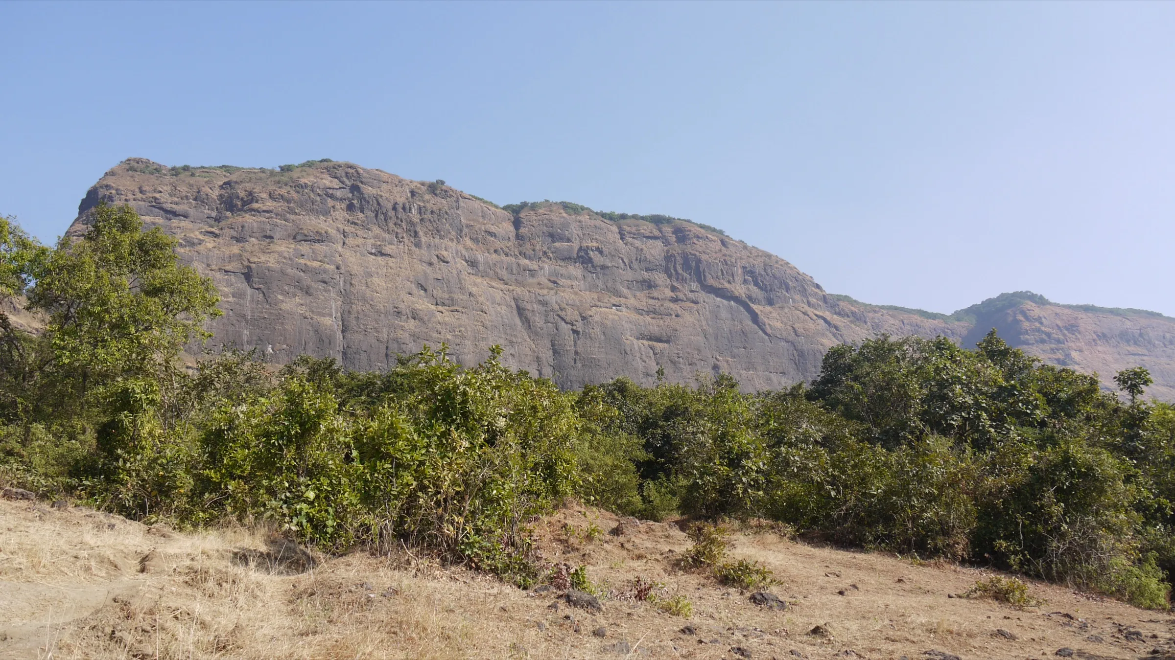
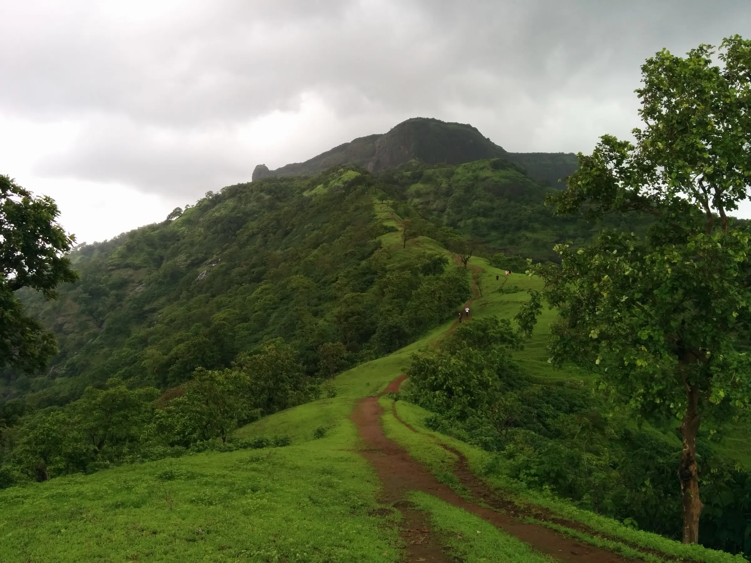
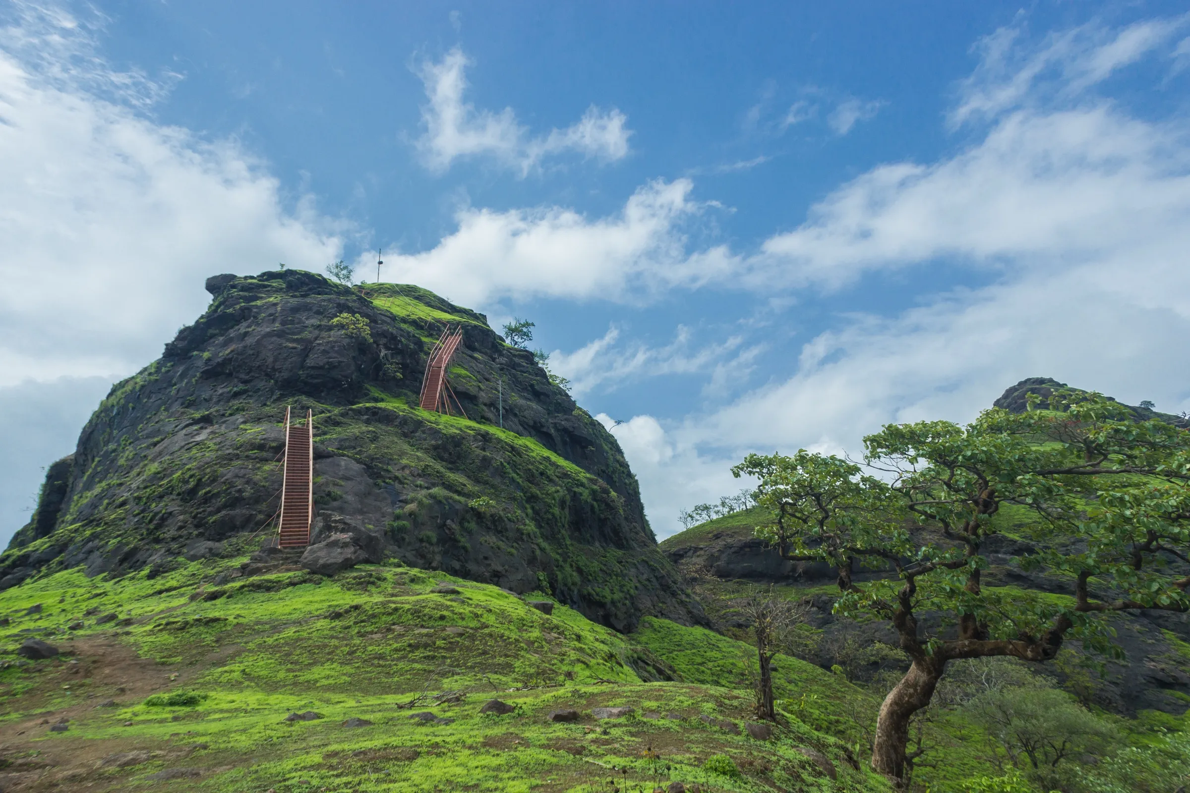
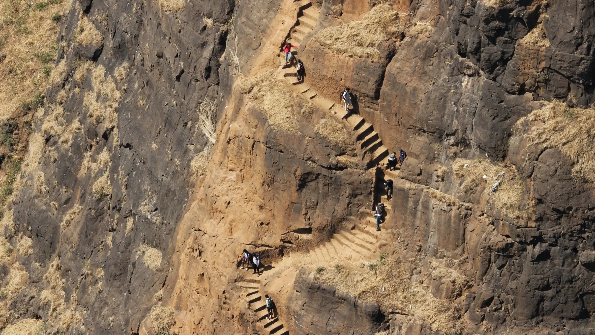
Short (about 3.7 km each way) but steep: a gentle climb to the Prabalmachi plateau, then a rough trail to the col and a near-vertical flight of rock-cut steps with no railing, ending in a smooth rock patch of about 15 ft that locals have fitted with a rope. Not for anyone afraid of heights.
Photos
On the trail
The route
Day by day
Day 1 · highest point
Thakurwadi → Thakurwadi
90 m → 686 m → 90 m
Ups and downs
Altitude profile
Where it is
Map
Trailhead and high point only — not a recorded track. Use it with a proper map.
Weather
Next 5 days on the trail
Live forecast for the trailhead and the high point. Mountain weather changes fast — check again on the morning you start.
Trailhead · Thakurwadi
at 90 mLoading forecast…
High point · Kalavantin Durg pinnacle
at 686 mLoading forecast…
Each day: high / low °C · rain mm and chance · snow cm · wind km/h
Weather data: Open-Meteo.comModel forecast, not an official warning. For alerts follow IMD and the local administration.
Plan the trip
How to reach
- Trailhead
- Thakurwadi (nearest town: Panvel)
- Nearest railway
- Panvel
- Nearest airport
- Chhatrapati Shivaji Maharaj International Airport, Mumbai (about 52 km)
- By road
- Panvel to Thakurwadi by ST bus, shared auto or jeep (about 30–60 minutes, via Shedung Phata); Mumbai to Panvel by Harbour line local train or road; Pune to Panvel by the Mumbai–Pune Expressway
- Drive
- About 2 h from Mumbai
Plan the trip
Permits and fees
We could not confirm the current permit rules and fees from an official source. Check with the local forest department or tourism office before you go.
Plan the trip
Cost
Self-guided
₹300–700
With an operator
₹899–1,299
Per person, ex-Panvel. Guided day treks with transport from Panvel are listed at Rs 899 (Bhatakna) and Rs 999–1,099 (Treks and Trails India); a Prabalmachi camping plus Kalavantin package is listed at about Rs 1,299. Bhatakna lists Rs 399 if you make your own way to the base. Self-guided estimate covers shared auto or ST bus from Panvel, the local committee entry fee (Indiahikes quotes about Rs 50), parking if driving and snacks from village stalls.
Gear
Top picks for this trek
The gear that matters most on this route, chosen from its altitude, season and risks.
 Ad · affiliate link
 Ad · affiliate link
 Ad · affiliate link
- Ad · affiliate link
 Ad · affiliate link
 Ad · affiliate link
 Ad · affiliate link
 Ad · affiliate link
Store buttons open a search on that store, not a product we picked. As an Amazon Associate we earn from qualifying purchases. Photos show the kind of item, not a specific product. Affiliate disclosure
Packing checklist
Matched to this trek: altitude, season, days and the risks on the route.
Packed 0 of 18
Hot days in Mar: start at first light and carry extra water and ORS.
Tick each item as it goes in the bag.
Know before you go
Good to know
- Mobile network
- Indiahikes reports signal from Airtel, Vodafone and Jio on most of the trail; Bikat says it is patchy in places
- Last ATM
- Panvel
- Nearest hospital
- Panvel (Indiahikes names Shree Hospital, about 11.5 km from the base)
- Water
- Hand pumps at Thakurwadi and Prabalmachi; lemon juice and snack stalls on the trail in season. Carry at least 2 litres
Highlights
- Near-vertical rock-cut steps winding up the Kalavantin pinnacle, the trek's best-known sight
- The grassy Prabalmachi plateau between Kalavantin and Prabalgad, a popular camping spot
- Summit views of Prabalgad, Matheran, Peb, Chanderi, Irshalgad and the Ulhas river
- Seasonal waterfalls on the neighbouring hills in the monsoon, and fireflies around Prabalmachi in late May and early June
- Can be combined with the climb to Prabalgad fort from the same plateau
Risks
- Exposure: the rock-cut steps are steep, narrow and have no railing, with a sheer drop on one side; trekkers have died here, including a fall 15 ft below the top in February 2018
- The last 15 ft rock patch lost its footholds after heavy rain and is now smooth; locals have fixed a rudimentary rope. Indiahikes advises stopping below it unless you are confident or carry your own rope
- Monsoon: the rock steps become slippery and Treks and Trails India strongly advises against climbing in heavy rain; the trail is muddy and slushy
- Severe crowding on monsoon and pre-monsoon weekends causes long queues on the single line of steps; go on a weekday or after the monsoon
- No district monsoon ban was found for Kalavantin or Prabalgad in 2025–26, but Raigad district bans entry to other spots (such as Devkund) every monsoon; check local notices before a June–September visit
- Afternoon sun heats the rock and makes it slick, so start early; the Prabalgad side has unmarked trails where trekkers have got lost
Know before you go
Questions
Do I need a permit for the Kalavantin Durg trek?
No official permission is needed, according to Indiahikes and Bikat. A local committee at Thakurwadi collects a small entry fee (Indiahikes quotes about Rs 50) used for trail upkeep and rescue ropes. After a fatal fall in 2018 the local administration brought in registration, a mandatory local guide and a ban on entry between 5 pm and 6 am; whether these rules are still enforced was not confirmed, so check at the base.
How long is the Kalavantin Durg trek and how much time does it take?
About 3–4 km each way from Thakurwadi: roughly 2.8 km to the Prabalmachi plateau, 0.6 km to the col and 150 m of rock-cut steps to the top. Most people take 2.5–4 hours to reach the top and about 6 hours for the round trip.
Is Kalavantin Durg dangerous for beginners?
Most of the trail is easy, but the final steps are steep and exposed with no railing, and the last rock patch needs a rope. Fit beginners who are not afraid of heights can do it with care; anyone with acrophobia should stop at the col, where the views are almost the same.
When is the best time to climb Kalavantin Durg?
October to March, after the monsoon, when the steps are dry, the views are clear and crowds are smaller. The monsoon is popular for greenery and waterfalls but the rock is slippery and weekends are very crowded.
Can I combine Kalavantin with Prabalgad or camp overnight?
Yes. Both start from the Prabalmachi plateau: Kalavantin is the trail to the left and Prabalgad to the right. Camping on the plateau needs no permission; villagers rent tents (Indiahikes quotes about Rs 200 for a two-person tent), so you can climb Prabalgad the next day.
Is Kalavantin Durg actually a fort?
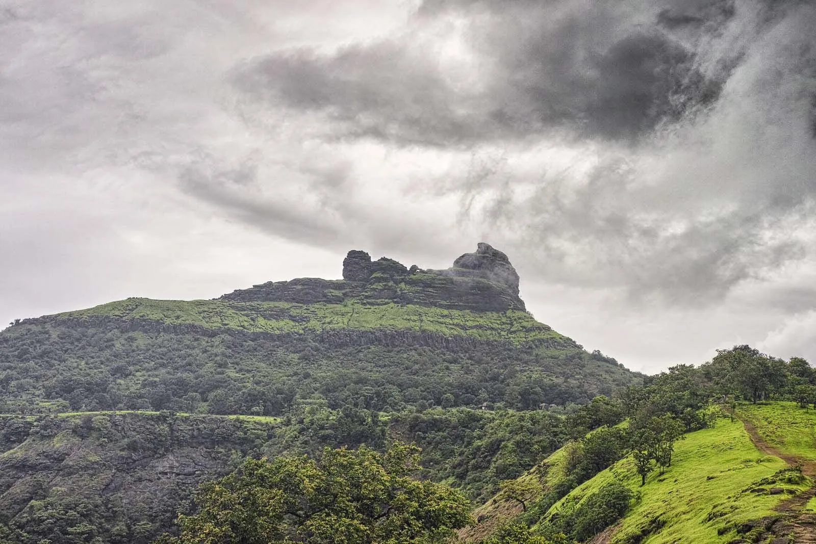
No. Despite the name 'Durg', there is no fort on top. It is a rock pinnacle with steps cut into it, used as a watchtower over the old Mumbai–Pune route next to Prabalgad fort.
In an emergency
Save these numbers before you lose signal. Tap to call.
- 112All emergenciesIndia’s single emergency number — works in every state
- 108Ambulance
- 1077District disaster control room
You are in
District: RaigadMaharashtra
- Nearest hospital
- Panvel (Indiahikes names Shree Hospital, about 11.5 km from the base)
- Last ATM
- Panvel
- Phone network
- Indiahikes reports signal from Airtel, Vodafone and Jio on most of the trail; Bikat says it is patchy in places
Before you set off
- Tell someone your route and when you will be back.
- Carry a charged phone and a power bank.
- Download an offline map of the route.
- Turn back if the weather turns bad — the mountain will wait.
Questions about Kalavantin Durg
No questions yet. Ask something and trekkers who have done it can answer.
Share your trek photo with #TreksAndTrails
I trekked this
Did Kalavantin Durg look different from this page? Tell us what changed and we will check it.
Where this comes from
Sources
Last reviewed:
- Kalavantin Durg — Wikipedia
- The Complete Guide to Kalavantin Durg Trek — Indiahikes
- Kalavantin Durg Trek — Bikat Adventures
- Kalavantin Durg Trek (tour listing by the operator Treks and Trails India, treksandtrails.org; not this site) — Treks and Trails India
- Kalavantin Durg Trek from Pune (Treks and Trails India, treksandtrails.org; not this site) — Treks and Trails India
- Kalavantin Durg One Day Trek — Bhatakna Tours and Travels
Photos: Anthonyrosyl, CC BY-SA 4.0; rohit gowaikar, CC BY-SA 2.0; Dinesh Valke from Thane, India, CC BY-SA 2.0; rohit gowaikar, CC BY-SA 2.0