Nelji Hill Trek
Kodagu, Karnataka
Opens without signal on this phone, with the map file and checklist. Saved for offline →
- Max altitude
- 1,597 m
- Days
- 2 days
- Distance
- 10 km
- Difficulty
- Moderate
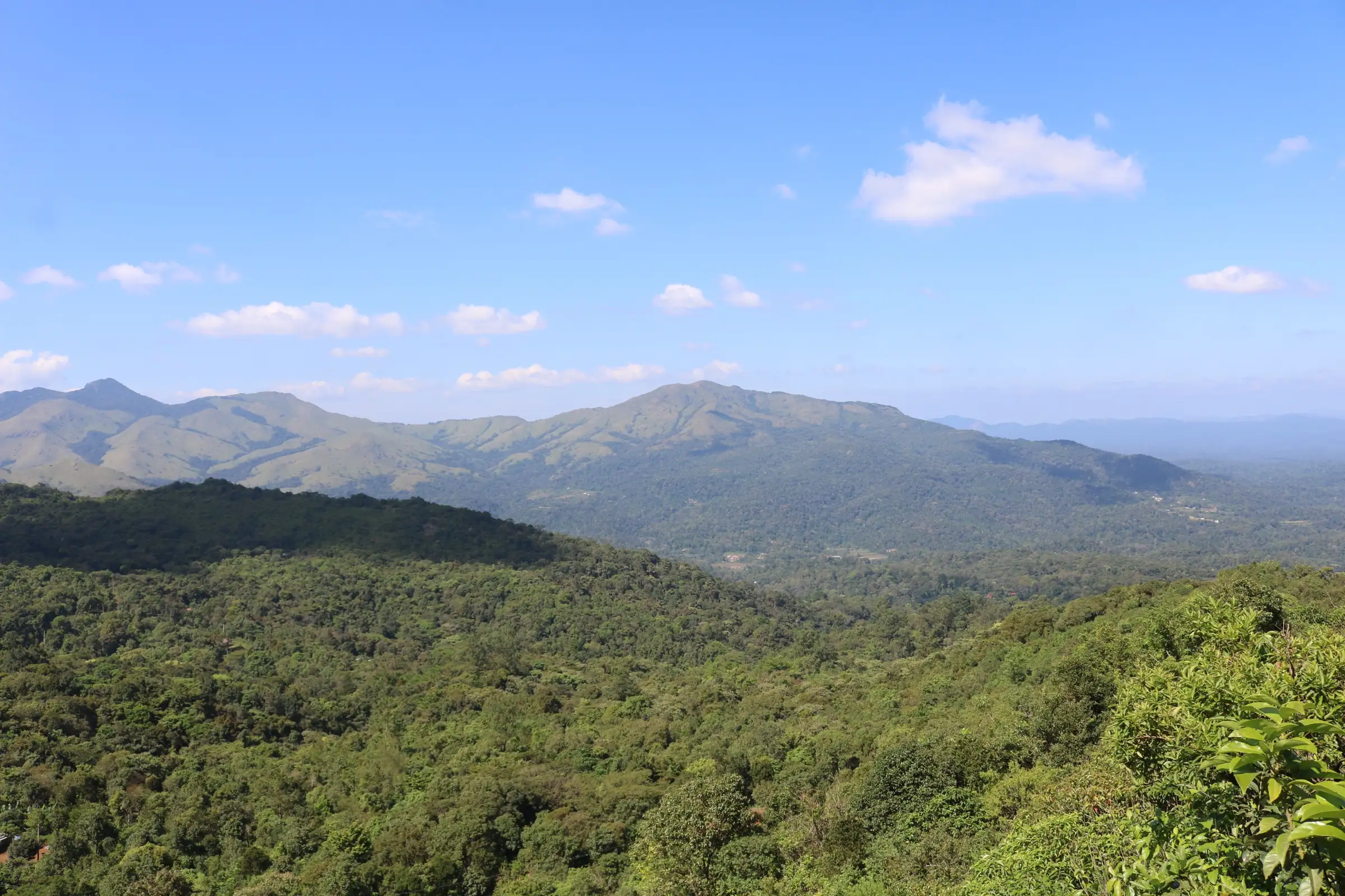
One long day of about 10 km and 7-8 hours with almost no flat ground: a steep first 2 km through shola forest, a steady climb of about 700 m to the grassy ridge, and a long knee-testing descent on muddy, slippery trail.
Photos
On the trail
The route
Day by day
Day 1
Madikeri → Nelji (coffee-estate homestay)
1,150 m → 915 m
Day 2 · highest point
Nelji → Nelji (via Maakath Motte summit), drive to Madikeri
915 m → 1,597 m → 915 m
Ups and downs
Altitude profile
Where it is
Map
Trailhead and high point only — not a recorded track. Use it with a proper map.
Weather
Next 5 days on the trail
Live forecast for the trailhead and the high point. Mountain weather changes fast — check again on the morning you start.
Trailhead · Nelji village
at 915 mLoading forecast…
High point · Maakath Motte summit (approximate position)
at 1,597 mLoading forecast…
Each day: high / low °C · rain mm and chance · snow cm · wind km/h
Weather data: Open-Meteo.comModel forecast, not an official warning. For alerts follow IMD and the local administration.
Plan the trip
How to reach
- Trailhead
- Nelji village (nearest town: Napoklu)
- Nearest railway
- Mysuru Junction (about 117 km from Madikeri)
- Nearest airport
- Kannur International (Kerala); Mangaluru International is the alternative
- By road
- Madikeri (about 28 km via Napoklu; Bhagamandala buses from the Madikeri private bus stand stop at Nelaji junction); Virajpet via Kakkabe; Bengaluru (about 270 km, 6-7 hours)
- Drive
- About 6.5 h from Bengaluru
Plan the trip
Permits and fees
We could not confirm the current permit rules and fees from an official source. Check with the local forest department or tourism office before you go.
Plan the trip
Cost
Self-guided
₹2,000–3,500
With an operator
₹3,400–4,800
Per person, ex-Madikeri/Nelji (₹4,800 is ex-Bengaluru). Trekplore India's published 2-day package: ₹3,400 joining at Nelji village, ₹4,800 with Bengaluru transport, including homestay, meals, local guide and trek permit charges. Indiahikes runs this trek but its fee was not visible on the page we could read; its Madikeri-Nelji transfer is ₹600 + 5% GST each way. Self-guided is an estimate (Madikeri bus, a homestay night with meals, a local guide and the landowners' permission fee); the trail crosses private land, so you cannot walk it without local permission.
Gear
Top picks for this trek
The gear that matters most on this route, chosen from its altitude, season and risks.
 Ad · affiliate link
 Ad · affiliate link
 Ad · affiliate link
 Ad · affiliate link
 Ad · affiliate link
 Ad · affiliate link
 Ad · affiliate link
 Ad · affiliate link
Store buttons open a search on that store, not a product we picked. As an Amazon Associate we earn from qualifying purchases. Photos show the kind of item, not a specific product. Affiliate disclosure
Packing checklist
Matched to this trek: altitude, season, days and the risks on the route.
Packed 0 of 23
Tick each item as it goes in the bag.
Know before you go
Good to know
- Mobile network
- Indiahikes reports signal along the whole trek; Airtel, BSNL and Jio are strongest.
- Last ATM
- Napoklu, about 6 km from the Nelji homestays
- Nearest hospital
- Government Hospital, Napoklu for first care; Kodagu Institute of Medical Sciences or the Government Hospital in Madikeri for serious cases
- Water
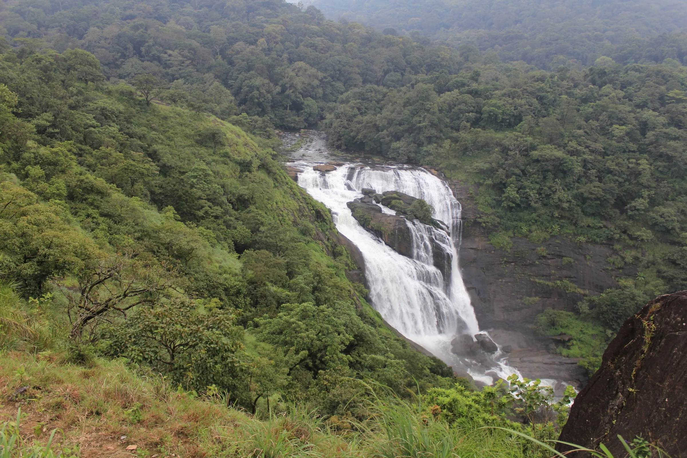
- A clear stream about 1 km from the start and a second forest stream on the trail; nothing on the open ridge, so fill up at the streams and treat the water.
Highlights
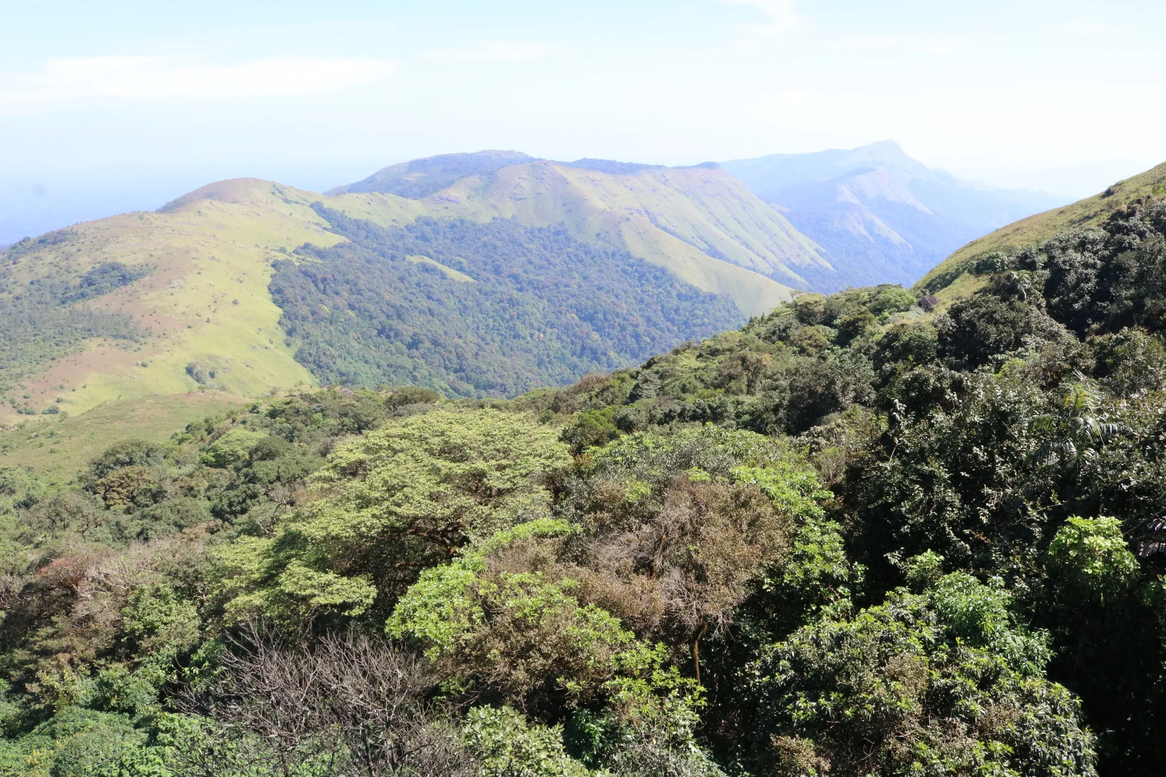
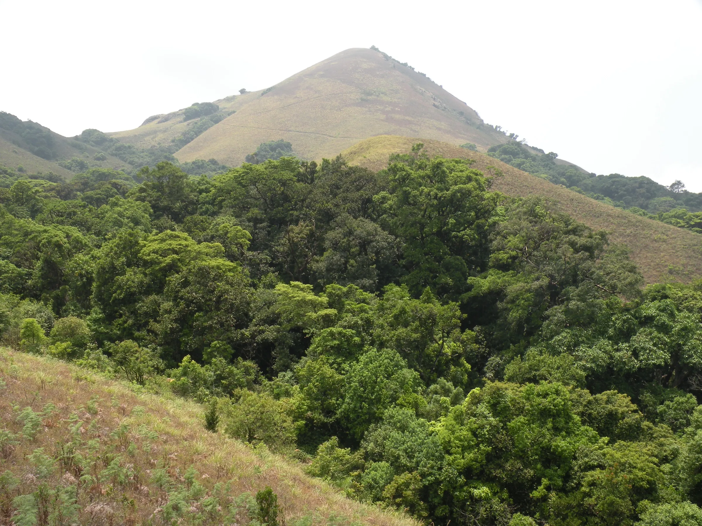
- Ridge walk to Maakath Motte with Brahmagiri Wildlife Sanctuary on one side and Tadiandamol, Coorg's highest peak, on the other
- Shola forest and montane grassland mosaic, with wild jackfruit and mountain gooseberry trees and moss-covered trees near the summit
- Base at a coffee-estate homestay with a stream behind it and dark skies for stargazing
- Good birding: wagtails, drongos, sunbirds and magpie robins, and winter migrants such as the Malabar whistling thrush
Risks
- The route crosses private land and cannot be done on your own: go with an organised group or get the landowners' permission first.
- Elephants use these forests next to Brahmagiri Wildlife Sanctuary; operators report signs of elephant movement along the trail. In May 2026 Karnataka's Chief Wildlife Warden suspended trekking paths in areas with leopards, tigers, elephants or bears until each trail is certified safe; check the current status locally before you go.
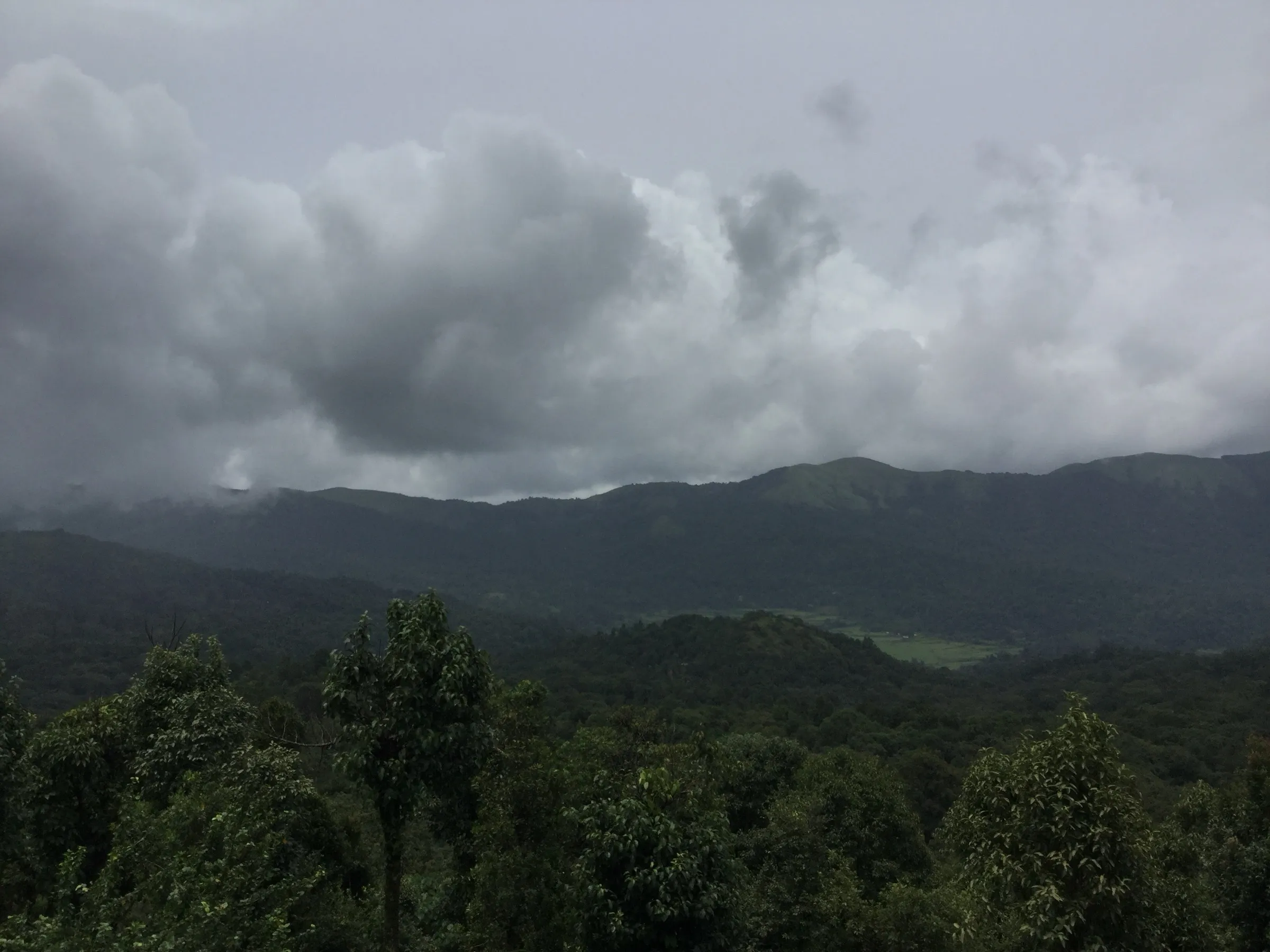
- In the monsoon (July to mid-August) the muddy trail is very slippery, leeches are active from May to September, and the Perur stream can rise too high to cross.
- Steep, abrupt edges on the summit ridge; keep well back from them.
- The 7-8 hour day is harder than the 'easy-moderate' label suggests for unprepared beginners; the long descent is where most people tire.
Know before you go
Questions
Can I do the Nelji Hill trek on my own?
No. The forest and the start of the trail are on private land, so you need to go with an organised group (Indiahikes' InTrek club and Bengaluru operators run it) or get permission from the local landowners.
How long and how difficult is the Nelji Hill trek?
It is a single trek day of about 10-12 km out and back, 7-8 hours, from about 3,000 ft at Nelji to 5,240 ft (about 1,600 m) at Maakath Motte. Operators rate it easy-moderate to moderate; the first 2 km are steep and there are few flat sections.
When is the best time to do the Nelji Hill trek?
Indiahikes says the trek is accessible all year, with November to February the best season (cool, clear, migratory birds). July to mid-August brings the heaviest rain, lush forest, gushing streams and many leeches.
How do I reach Nelji?
Nelji is about 28 km from Madikeri. Take an overnight bus to Madikeri, then a Bhagamandala bus via Napoklu to Nelaji junction, or a taxi. By car it is about 270 km (6-7 hours) from Bengaluru via Madikeri-Napoklu or Virajpet-Kakkabe.
Is there mobile network and an ATM near the trek?
Indiahikes reports network along the trek, with Airtel, BSNL and Jio strongest. The nearest ATM is in Napoklu, about 6 km from the homestay.
In an emergency
Save these numbers before you lose signal. Tap to call.
- 112All emergenciesIndia’s single emergency number — works in every state
- 108Ambulance
- 1077District disaster control room
You are in
District: KodaguKarnataka
- Nearest hospital
- Government Hospital, Napoklu for first care; Kodagu Institute of Medical Sciences or the Government Hospital in Madikeri for serious cases
- Last ATM
- Napoklu, about 6 km from the Nelji homestays
- Phone network
- Indiahikes reports signal along the whole trek; Airtel, BSNL and Jio are strongest.
Before you set off
- Tell someone your route and when you will be back.
- Carry a charged phone and a power bank.
- Download an offline map of the route.
- Turn back if the weather turns bad — the mountain will wait.
Questions about Nelji Hill
No questions yet. Ask something and trekkers who have done it can answer.
Share your trek photo with #TreksAndTrails
I trekked this
Did Nelji Hill look different from this page? Tell us what changed and we will check it.
Where this comes from
Sources
Last reviewed:
- Coorg Nelji Hill Trek 2026 | A Weekend Western Ghats Trek — Indiahikes
- Nelji hill Trek - Trekplore India — Trekplore India
- Manja Motte & Makaat Motte Peak Trek — Bangalore Mountaineering Club (BMC Adventures)
Photos: Vinayaraj, CC BY-SA 4.0; Vinayaraj, CC BY-SA 4.0; Earth-Bound Misfit, I, CC BY 2.0