Neelkanth Mahadev Rishikesh Trek
Pauri Garhwal, Uttarakhand
Opens without signal on this phone, with the map file and checklist. Saved for offline →
- Max altitude
- 1,280 m
- Days
- 1 day
- Distance
- 12 km
- Difficulty
- Moderate
A long day on an old pilgrim footpath through forest: operators quote about 12 km one way and 4-5 hours up. The path climbs steadily from about 350 m at the Ganga to a ridge near 1,280 m, then drops to the temple at about 940 m. Himalaya Shelter rates it easy, Himalayan Dream Treks and the Viator listing call it moderate and steep.
Photos
On the trail
The route
Day by day
Day 1 · highest point
Ram Jhula (Swargashram side), Rishikesh → Neelkanth Mahadev Temple (return to Rishikesh by shared jeep or taxi)
350 m → 1,280 m → 940 m
Ups and downs
Altitude profile
Where it is
Map
Trailhead and high point only — not a recorded track. Use it with a proper map.
Weather
Next 5 days on the trail
Live forecast for the trailhead and the high point. Mountain weather changes fast — check again on the morning you start.
Trailhead · Ram Jhula, Swargashram side
at 350 mLoading forecast…
High point · Ridge crest on the Ram Jhula–Neelkanth footpath, above the temple
at 1,280 mLoading forecast…
Each day: high / low °C · rain mm and chance · snow cm · wind km/h
Weather data: Open-Meteo.comModel forecast, not an official warning. For alerts follow IMD and the local administration.
Plan the trip
How to reach
- Trailhead
- Ram Jhula, Swargashram side (nearest town: Rishikesh)
- Nearest railway
- Yog Nagari Rishikesh; Haridwar Junction has more trains
- Nearest airport
- Jolly Grant Airport, Dehradun
- By road
- Rishikesh town to Ram Jhula by auto or on foot; cross the bridge to the Swargashram side; Return from the temple by road: about 22 km to Ram Jhula or 32 km to Rishikesh via the barrage (Pauri district administration); taxis and shared jeeps run
- Drive
- About 6.5 h from Delhi
Plan the trip
Permits and fees
We could not confirm the current permit rules and fees from an official source. Check with the local forest department or tourism office before you go.
Plan the trip
Cost
Self-guided
₹200–1,000
With an operator
₹1,300–3,700
Per person, ex-Rishikesh (Ram Jhula). Guided prices seen on 16 Oct 2026: Himalaya Shelter ₹3,500 per person plus 5% GST (a ₹500 backpack fee is extra); a Viator guided trek sold through AAA from about US$14.53-23 per person (about ₹1,300-2,000) with a guide, tea and a private vehicle back to the start. Self-guided is an estimate: snacks and water, plus a shared jeep back to Ram Jhula; Himalaya Shelter quotes ₹2,000-3,000 for a whole taxi from Neelkanth to Ram Jhula. Chal Banjare lists temple entry as free. Himalaya Shelter lists a forest permit among its inclusions; ask the forest office in Rishikesh whether walkers need one.
Gear
Top picks for this trek
The gear that matters most on this route, chosen from its altitude, season and risks.
 Ad · affiliate link
 Ad · affiliate link
 Ad · affiliate link
 Ad · affiliate link
- Ad · affiliate link
 Ad · affiliate link
 Ad · affiliate link
 Ad · affiliate link
Store buttons open a search on that store, not a product we picked. As an Amazon Associate we earn from qualifying purchases. Photos show the kind of item, not a specific product. Affiliate disclosure
Packing checklist
Matched to this trek: altitude, season, days and the risks on the route.
Packed 0 of 18
Hot days in Mar: start at first light and carry extra water and ORS.
Tick each item as it goes in the bag.
Know before you go
Good to know
- Mobile network
- Not confirmed by our sources. Expect signal in Swargashram and at the temple, and patchy signal in the forest between.
- Last ATM
- Swargashram / Ram Jhula area and Rishikesh town; carry cash for prasad shops and jeeps.
- Nearest hospital
- Rishikesh (AIIMS Rishikesh and city hospitals). Chal Banjare notes there are no medical facilities at the temple.
- Water
- Carry 1.5-2 litres per person (Himalaya Shelter). The temple has small shops and eateries, toilets and a spring in its premises; do not count on water along the forest path.
Highlights
- Darshan of Bhagwan Shiva as Neelkanth: the Shastras tell that at the Samudra Manthan Mahadev drank the halahal poison and held it in his throat, which turned blue
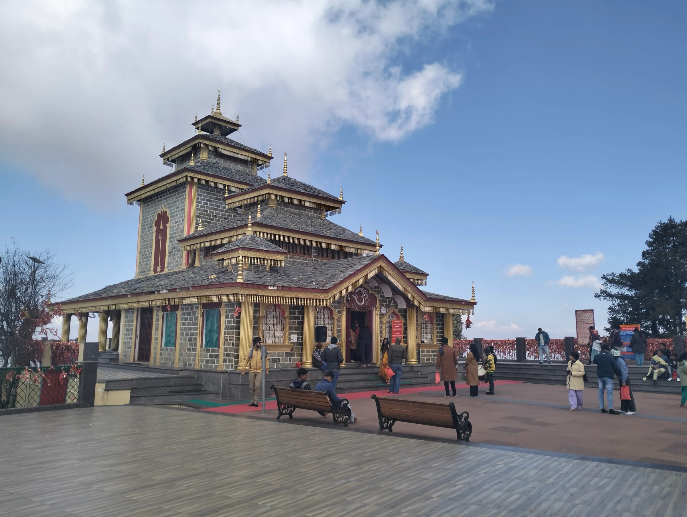
- An old pilgrim footpath that climbs from the Ganga at Ram Jhula through forest to a ridge near 1,280 m, with views back over the Rishikesh hills
- The temple sits between the Vishnukoot, Brahmakoot and Manikoot hills at the meeting of the Madhumati and Pankaja streams (Pauri district administration)
- Kanwariyas walk to the temple in great numbers for Shravan Shivratri, and a second fair is held on Maha Shivratri
- A one-way walk: return to Rishikesh by shared jeep or taxi on the road
Risks
- Shravan (July-August) Kanwar Yatra: huge crowds of Kanwariyas walk to the temple for Shravan Shivratri; expect long darshan queues, packed paths and road traffic rules. Maha Shivratri also brings very large crowds.
- Monsoon (July-August): Chal Banjare and Himalaya Shelter say heavy rain makes the forest path slippery. Avoid walking in heavy rain.
- The path runs through the forested Rajaji landscape east of the Ganga, where elephants and leopards live. Walk in daylight, in a group, start early, and stay on the main path.
- Steep and long: Himalayan Dream Treks calls the trail steep and rugged; the Viator listing asks for at least moderate fitness and says it is not suitable for people with heart or spine problems.
- The descent from the ridge to the temple is steep; allow time to get back by road before dark.
Know before you go
Questions
How long is the walk from Ram Jhula to Neelkanth Mahadev?
Himalaya Shelter, the Viator guided-trek listing and the Pauri district website give about 12 km one way. Himalayan Dream Treks gives 16 km for the round trip (7-8 hours up and down). Most walkers go up on foot in 4-5 hours and come back by jeep or taxi.
How high is Neelkanth Mahadev Temple?
Many travel sites quote about 1,330 m, while the Pauri district website gives 926 m. Satellite elevation data (SRTM) puts the temple at about 940 m and the highest ridge on the footpath at about 1,280 m, so the climb from Ram Jhula (about 350 m) is close to 1,000 m.
What is the best time to walk to Neelkanth Mahadev?
October to March, according to Himalayan Dream Treks and Chal Banjare. July and August bring heavy rain and slippery paths, and the Shravan month brings the Kanwar Yatra crowds.
How do I get back from Neelkanth Mahadev to Rishikesh?
By road. Shared jeeps and taxis run from the temple; Himalaya Shelter quotes about ₹2,000-3,000 for a taxi to Ram Jhula. The road is about 22 km to Ram Jhula or 32 km to Rishikesh via the barrage.
Why is the temple called Neelkanth?
The Shastras tell that during the Samudra Manthan the halahal poison rose from the ocean. Bhagwan Shiva drank it to protect the worlds and held it in his throat, which turned blue (neel), so he is worshipped here as Neelkanth Mahadev.
In an emergency
Save these numbers before you lose signal. Tap to call.
- 112All emergenciesIndia’s single emergency number — works in every state
- 108Ambulance
- 1077District disaster control room
You are in
District: Pauri GarhwalUttarakhand
- Nearest hospital
- Rishikesh (AIIMS Rishikesh and city hospitals). Chal Banjare notes there are no medical facilities at the temple.
- Last ATM
- Swargashram / Ram Jhula area and Rishikesh town; carry cash for prasad shops and jeeps.
- Phone network
- Not confirmed by our sources. Expect signal in Swargashram and at the temple, and patchy signal in the forest between.
Before you set off
- Tell someone your route and when you will be back.
- Carry a charged phone and a power bank.
- Download an offline map of the route.
- Turn back if the weather turns bad — the mountain will wait.
Questions about Neelkanth Mahadev Rishikesh
No questions yet. Ask something and trekkers who have done it can answer.
Share your trek photo with #TreksAndTrails
I trekked this
Did Neelkanth Mahadev Rishikesh look different from this page? Tell us what changed and we will check it.
Where this comes from
Sources
Last reviewed:
- Neelkanth Mahadev Temple Trek — Himalaya Shelter
- Neelkanth Mahadev — District Administration Pauri Garhwal (NIC) (official)
- Best hikes and treks near Rishikesh — Himalayan Dream Treks
- Rishikesh: Neelkanth Mahadev Trek With Guide — Viator guided trek (listed on AAA TripCanvas)
- Neelkanth Mahadev Temple Rishikesh – Sacred Himalayan Shiva Shrine — Chal Banjare
- Neelkanth Mahadev Temple — Wikipedia
- Visit at Neelkanth Mahadev in holy month of Saanwan — Ghumakkar (trip report, 2013)
- SRTM 30 m elevation along the OpenStreetMap footpath from Swargashram to Neelkanth Mahadev (highest sample) — OpenTopoData (NASA SRTM 30 m)
Photos: Madrishh, CC BY-SA 4.0; Gagandeep Bansal, CC BY-SA 4.0; Madrishh, CC BY-SA 4.0