Mullayanagiri Trek
Chikkamagaluru, Karnataka
Opens without signal on this phone, with the map file and checklist. Saved for offline →
- Max altitude
- 1,930 m
- Days
- 1 day
- Distance
- 6 km
- Difficulty
- Moderate
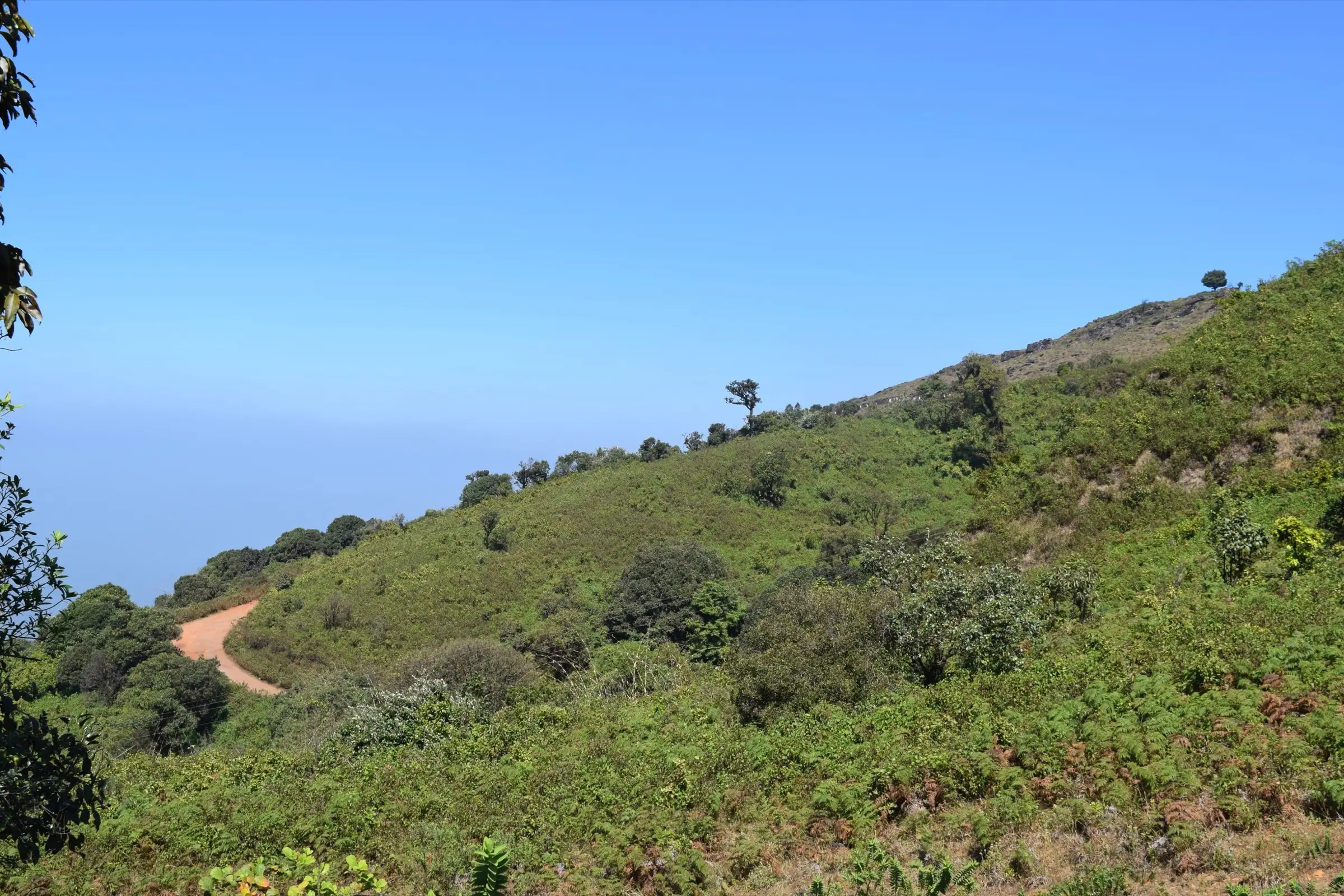
Only about 3 km each way, but the first stretch from Sarpadhari is very steep (operators describe it as close to 60 degrees), with zig-zags, a squeeze through a gap in the summit cliffs and loose, slippery ground in rain. Fit beginners manage it in 3–4 hours return.
Photos
On the trail
The route
Day by day
Day 1 · highest point
Sarpadhari → Sarpadhari (via Mullayanagiri summit)
1,660 m → 1,930 m → 1,660 m
Ups and downs
Altitude profile
Where it is
Map
Trailhead and high point only — not a recorded track. Use it with a proper map.
Weather
Next 5 days on the trail
Live forecast for the trailhead and the high point. Mountain weather changes fast — check again on the morning you start.
Trailhead · Sarpadhari (Sarpadari, Sarpadaari), roadside trailhead on the Chikkamagaluru–Mullayanagiri road
at 1,660 mLoading forecast…
High point · Mullayanagiri summit, Shiva temple and Mullappa Swamy gadduge
at 1,930 mLoading forecast…
Each day: high / low °C · rain mm and chance · snow cm · wind km/h
Weather data: Open-Meteo.comModel forecast, not an official warning. For alerts follow IMD and the local administration.
Plan the trip
How to reach
- Trailhead
- Sarpadhari (Sarpadari, Sarpadaari), roadside trailhead on the Chikkamagaluru–Mullayanagiri road
- Nearest railway
- Chikkamagaluru railway station (few trains, on the branch line from Kadur); Kadur Junction has more trains
- Nearest airport
- Mangaluru International Airport (about 160 km); Kempegowda International Airport, Bengaluru, for most flights
- By road
- Bengaluru (about 250–280 km via Hassan and Belur to Chikkamagaluru, then the hill road towards Mullayanagiri and Baba Budangiri); Chikkamagaluru town (about 15 km to Sarpadhari by cab or auto; local buses on the Bababudangiri road are infrequent); Mangaluru (about 160 km via Charmadi Ghat and Mudigere)
- Drive
- About 5 h from Bengaluru
Plan the trip
Permits and fees
We could not confirm the current permit rules and fees from an official source. Check with the local forest department or tourism office before you go.
Plan the trip
Cost
Self-guided
₹1,500–3,500
With an operator
₹3,500–4,500
Per person, ex-Bengaluru. Guided prices seen October 2026 for a 2-day weekend trip (overnight transport, campsite or dormitory stay, meals, guide): Trek Pool ₹3,500 (listed on TourTravelWorld) and Thrillophilia about ₹3,500–4,500. Self-guided is an estimate: KSRTC bus Bengaluru–Chikkamagaluru and back, a shared cab or auto to Sarpadhari, food and a budget room in Chikkamagaluru. No trekking fee is charged at Sarpadhari as far as we could find; check locally.
Gear
Top picks for this trek
The gear that matters most on this route, chosen from its altitude, season and risks.
 Ad · affiliate link
 Ad · affiliate link
 Ad · affiliate link
 Ad · affiliate link
 Ad · affiliate link
- Ad · affiliate link
 Ad · affiliate link
 Ad · affiliate link
Store buttons open a search on that store, not a product we picked. As an Amazon Associate we earn from qualifying purchases. Photos show the kind of item, not a specific product. Affiliate disclosure
Packing checklist
Matched to this trek: altitude, season, days and the risks on the route.
Packed 0 of 24
Monsoon months (Sep): pack everything in plastic or a dry bag and wear shoes with good grip.
Tick each item as it goes in the bag.
Know before you go
Good to know
- Mobile network
- Patchy on the slopes; usually some signal on the summit, where a police radio relay station stands. Do not rely on it.
- Last ATM
- Chikkamagaluru town, about 15 km from Sarpadhari
- Nearest hospital
- District hospital in Chikkamagaluru town (about 15–20 km)
- Water
- No water on the trail from Sarpadhari to the summit. Carry at least 2 litres; snack and tea stalls are only near the upper vehicle parking.
Highlights
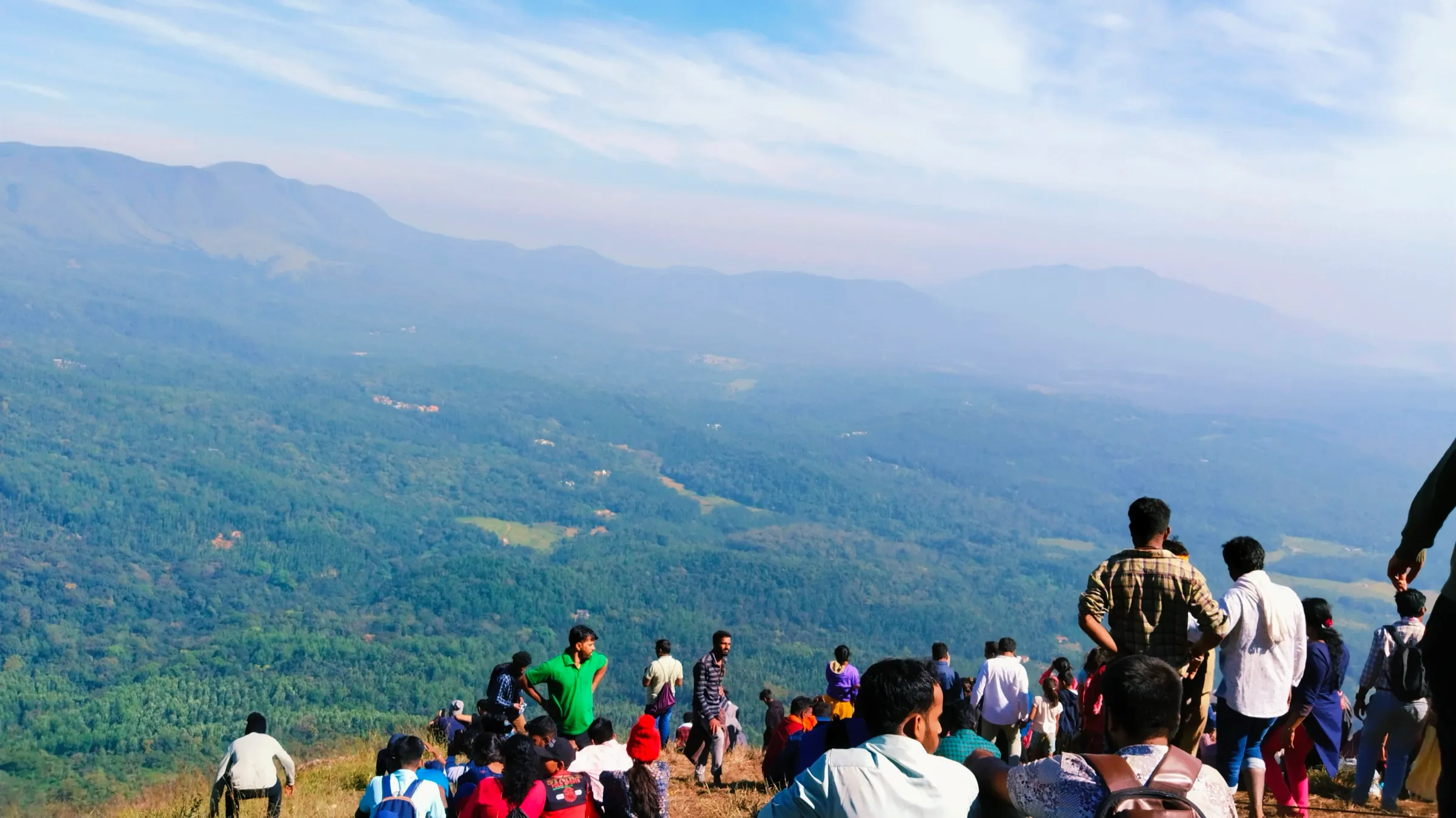
- Stand on the highest point in Karnataka, about 1,930 m, with the whole Chandra Drona (Baba Budangiri) range around you
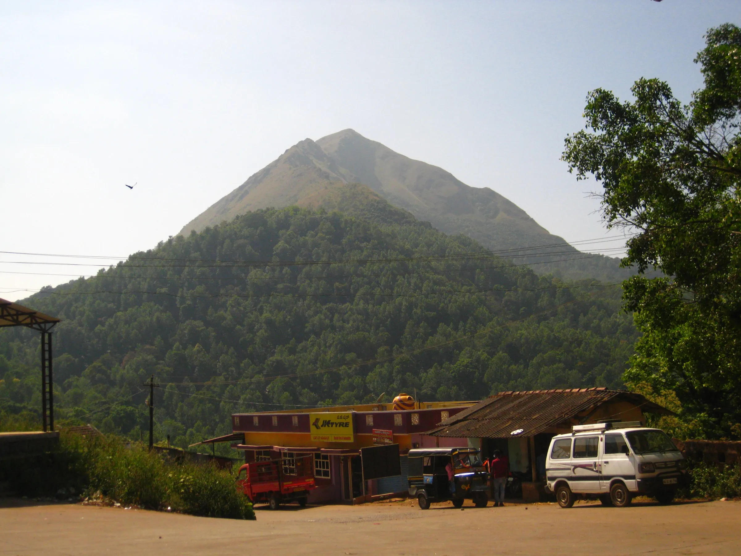
- The old Sarpadhari ('snake path') trail, a quiet zig-zag climb away from the road and the stone steps used by most visitors
- Shiva temple and the gadduge of Mullappa Swamy on the summit, with caves just below it where the sage did tapasya
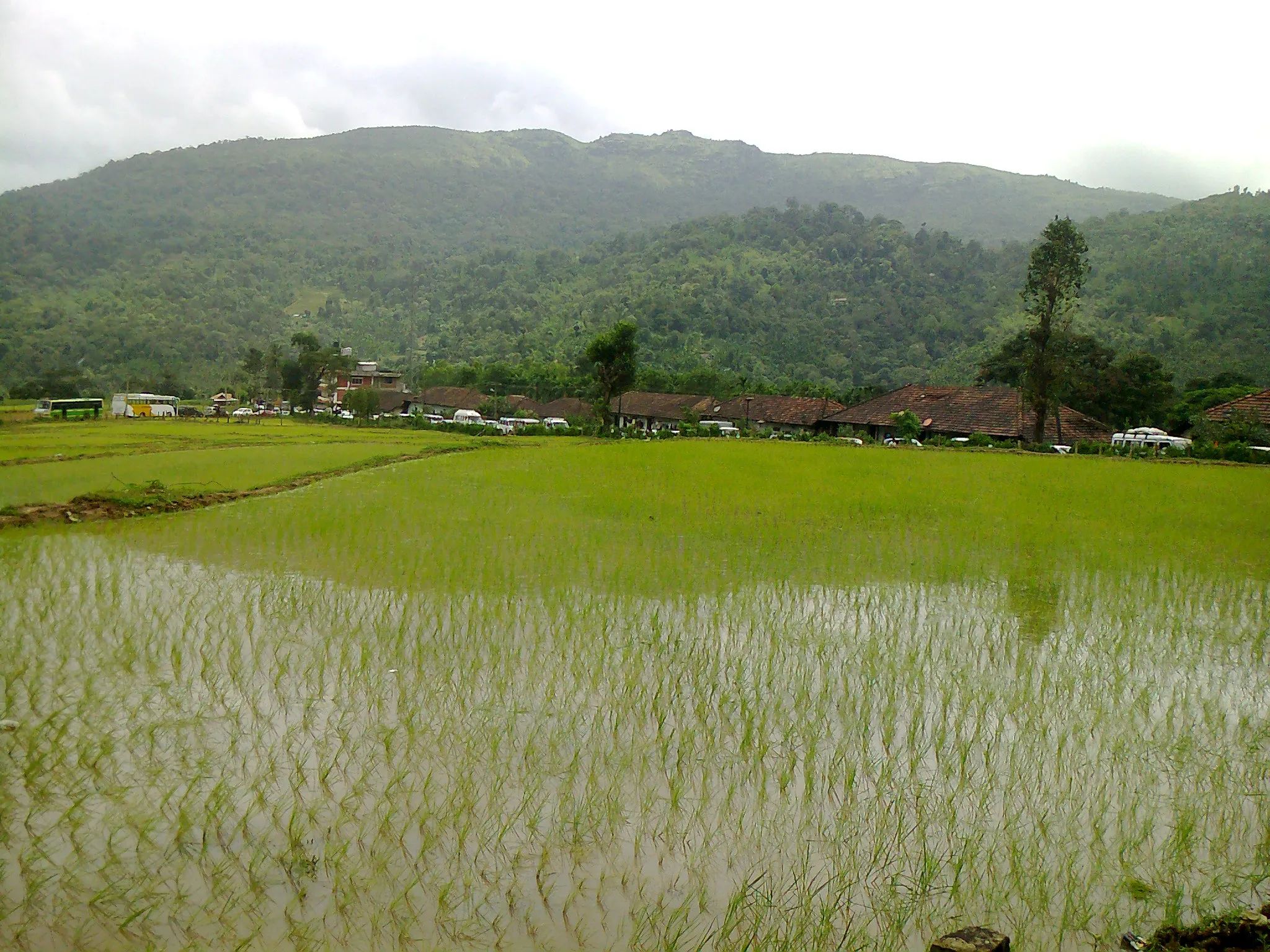
- Shola forest and rolling grassland, often with clouds filling the valleys after the monsoon
- Option to continue along the ridge towards Baba Budangiri (about 10–12 km) for a full-day walk
Risks
- 11 May 2026: Karnataka's Chief Wildlife Warden suspended trekking paths in areas with leopards, tigers, elephants or bears 'until further orders'; a trail reopens only after the forest officer certifies it. We found no notice naming Mullayanagiri or Sarpadhari, and the trail is not on the Aranya Vihaara booking portal, so ask at Chikkamagaluru (forest office or police) before you go.
- Very steep start from Sarpadhari; the trail becomes slippery mud and running water in the June–September monsoon, with fog cutting visibility to a few metres. Go in dry weather and wear shoes with good grip.
- Strong wind and an exposed summit: carry a windproof layer.
- Heavy weekend crowds at the summit by road. Since July 2025 the district administration has been introducing vehicle slots (6 am–noon and 1–6 pm, up to 600 vehicles each), online pre-booking and parking at Seethalayyanagiri; vehicle access stops during red alerts and religious events.
- Camping is not allowed on the hill, and the ridge walk to Baba Budangiri passes a forest checkpost at Gundi where permission is needed; it can be restricted.
- Hill-road landslides in heavy rain have closed the road to Mullayanagiri in past monsoons.
Know before you go
Questions
How high is Mullayanagiri?
About 1,930 m (6,330 ft), the highest peak in Karnataka. Wikipedia gives 1,925 m and one operator page 1,950 m; OpenStreetMap and most trek operators give 1,930 m.
Can you drive to the top of Mullayanagiri?
Almost. A tarred road climbs to an upper parking area, and from there about 450–500 stone and concrete steps lead to the summit temple. The trek is the older Sarpadhari trail, which starts lower down beside the road and climbs about 3 km through scrub, shola and grassland to the top.
How long does the Sarpadhari trek take?
About 3 km each way. Allow 1.5–3 hours up, depending on fitness, and about 1–1.5 hours down; 3–4 hours return plus time at the summit. You can come down the steps instead, but then you need a ride back from the parking.
Can I trek from Mullayanagiri to Baba Budangiri?
Yes, a ridge trail of about 10–12 km continues from behind the summit temple past grassland and the Gundi forest checkpost towards Manikyadhara falls and Baba Budangiri. Take permission at the checkpost and carry water; parts can be restricted.
When is the best time to trek Mullayanagiri?
September to February: green hills and cloud views after the monsoon, then clear, cool winter days. March to May is warm and dry; June to August brings heavy rain, fog and a slippery trail.
Do I need a permit or booking for the Mullayanagiri trek?
We found no trekking permit or fee for the Sarpadhari trail, and it is not listed on the Karnataka Forest Department's Aranya Vihaara booking portal. Vehicles going up to the summit road are being put on a slot and pre-booking system. Rules have changed often since 2024, so check in Chikkamagaluru before you go.
In an emergency
Save these numbers before you lose signal. Tap to call.
- 112All emergenciesIndia’s single emergency number — works in every state
- 108Ambulance
- 1077District disaster control room
You are in
District: ChikkamagaluruKarnataka
- Nearest hospital
- District hospital in Chikkamagaluru town (about 15–20 km)
- Last ATM
- Chikkamagaluru town, about 15 km from Sarpadhari
- Phone network
- Patchy on the slopes; usually some signal on the summit, where a police radio relay station stands. Do not rely on it.
Before you set off
- Tell someone your route and when you will be back.
- Carry a charged phone and a power bank.
- Download an offline map of the route.
- Turn back if the weather turns bad — the mountain will wait.
Questions about Mullayanagiri
No questions yet. Ask something and trekkers who have done it can answer.
Share your trek photo with #TreksAndTrails
I trekked this
Did Mullayanagiri look different from this page? Tell us what changed and we will check it.
Where this comes from
Sources
Last reviewed:
- Mullayanagiri Trek: Trek to the Highest Peak in Karnataka — Indiahikes
- Mullayanagiri Trek — Bikat Adventures
- Trek to Mullayanagiri — BMC Adventures (Bangalore Mountaineering Club)
- Mullayanagiri Trek Guide: Highest Peak in Karnataka & Trail — Trekgo
- Mullayanagiri Trek, Chikmagalur | With Transfers & Meals Included — Thrillophilia
- Mullayanagiri Trek (Trek Pool, 2 Days Chikmagalur Budget Holiday) — Trek Pool
- Mullayanagiri — Wikipedia
- Mullayyanagiri (peak, ele 1930) — OpenStreetMap
- Karnataka: Authorities to regulate vehicle flow to Mullayanagiri hill station to prevent landslides (PTI, 16 Jul 2025) — PTI via The Week
- Karnataka suspends trekking routes in areas with leopards, tigers, elephants and bears (11 May 2026 circular) — Green Minute
Photos: రవిచంద్ర, CC BY-SA 4.0; iMahesh, CC BY-SA 4.0; Likhith N.P, CC BY-SA 3.0