Deviramma Betta Trek
Chikkamagaluru, Karnataka
Opens without signal on this phone, with the map file and checklist. Saved for offline →
- Max altitude
- 1,750 m
- Days
- 1 day
- Distance
- 9 km
- Difficulty
- Moderate
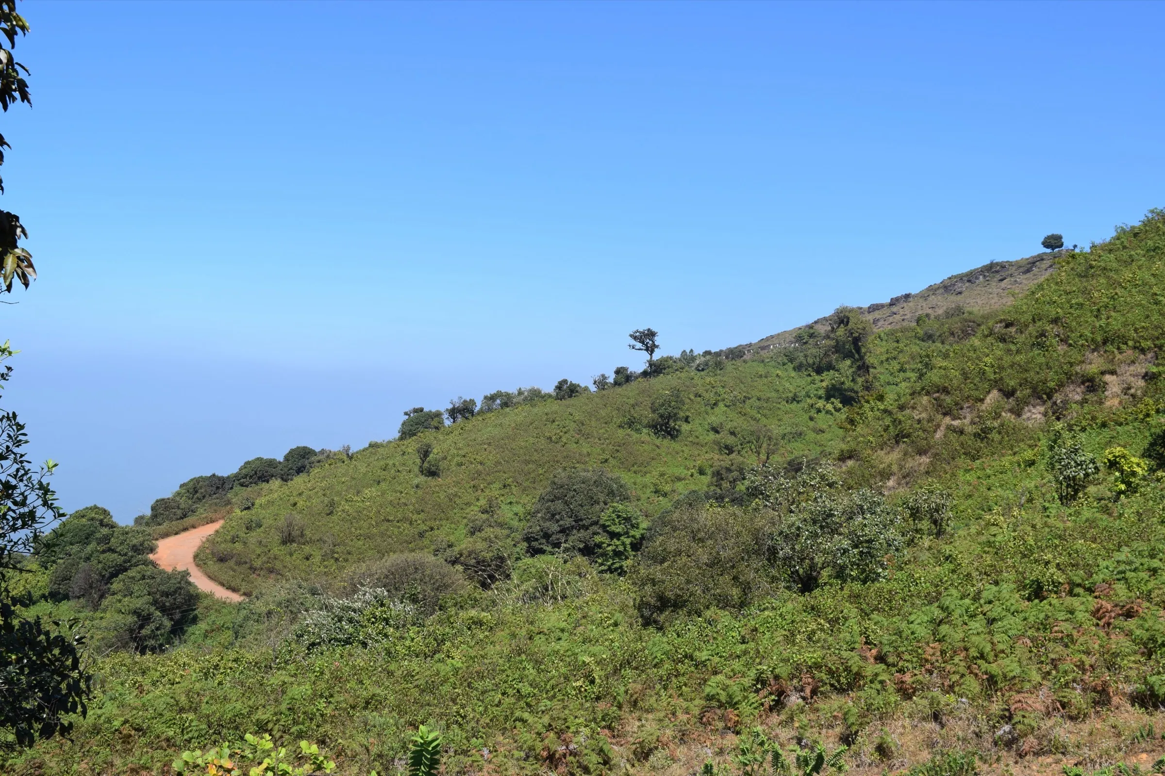
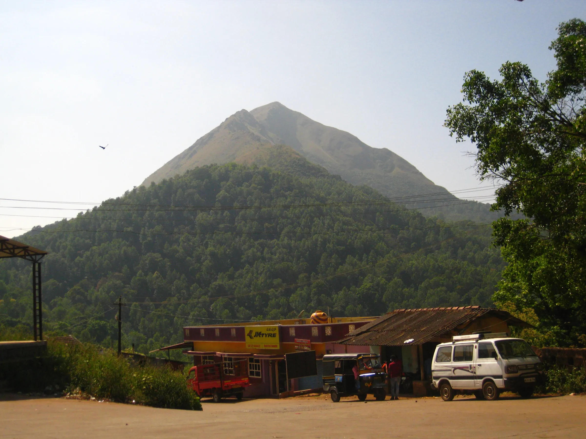
A short day, but about 670 m of steep climbing on a narrow dirt trail through coffee estate and open grass slopes, done barefoot by most pilgrims and in a very large crowd; the descent is where most slips and injuries happen.
Photos
On the trail
The route
Day by day
Day 1 · highest point
Bindiga (Deviramma Temple) → Bindiga (via Deviramma Betta hilltop shrine)
1,080 m → 1,750 m → 1,080 m
Ups and downs
Altitude profile
Where it is
Map
Trailhead and high point only — not a recorded track. Use it with a proper map.
Weather
Next 5 days on the trail
Live forecast for the trailhead and the high point. Mountain weather changes fast — check again on the morning you start.
Trailhead · Bindiga (Deviramma Temple, Mallenahalli)
at 1,080 mLoading forecast…
High point · Deviramma Betta hilltop shrine
at 1,750 mLoading forecast…
Each day: high / low °C · rain mm and chance · snow cm · wind km/h
Weather data: Open-Meteo.comModel forecast, not an official warning. For alerts follow IMD and the local administration.
Plan the trip
How to reach
- Trailhead
- Bindiga (Deviramma Temple, Mallenahalli) (nearest town: Chikkamagaluru)
- Nearest railway
- Chikkamagaluru railway station (about 25 km); Kadur Junction has more trains
- Nearest airport
- Shivamogga Airport (about 110 km); Mangaluru or Bengaluru for most flights
- By road
- Chikkamagaluru town (about 25 km to Mallenahalli and Bindiga; extra buses run from Chikkamagaluru during the jatre); Bengaluru (about 270 km via Hassan and Belur to Chikkamagaluru)
- Drive
- About 5.5 h from Bengaluru
Plan the trip
Permits and fees
We could not confirm the current permit rules and fees from an official source. Check with the local forest department or tourism office before you go.
Plan the trip
Cost
Self-guided
₹1,200–3,000
With an operator
₹1,200–3,000
Per person, ex-Bengaluru. No trek operator sells this climb: it is a once-a-year festival pilgrimage, so the guided range repeats the self-guided estimate. Estimate: KSRTC bus Bengaluru–Chikkamagaluru and back, a festival bus or shared jeep to Bindiga, food, and a budget room in Chikkamagaluru. We found no entry fee; check locally.
Gear
Top picks for this trek
The gear that matters most on this route, chosen from its altitude, season and risks.
 Ad · affiliate link
 Ad · affiliate link
 Ad · affiliate link
 Ad · affiliate link
 Ad · affiliate link
 Ad · affiliate link
 Ad · affiliate link
 Ad · affiliate link
Store buttons open a search on that store, not a product we picked. As an Amazon Associate we earn from qualifying purchases. Photos show the kind of item, not a specific product. Affiliate disclosure
Packing checklist
Matched to this trek: altitude, season, days and the risks on the route.
Packed 0 of 21
Tick each item as it goes in the bag.
Know before you go
Good to know
- Mobile network
- Not confirmed; expect weak and overloaded signal on the hill during the festival crowd.
- Last ATM
- Chikkamagaluru town, about 25 km away
- Nearest hospital
- Mallegowda District Hospital, Chikkamagaluru (about 25 km); emergency teams stand by on the festival day
- Water
- No stalls on the upper hill. Carry enough water from the base; many pilgrims climb while fasting.
Highlights
- Darshan of Devi Deviramma at an open hilltop shrine with no walls or doors, opened to pilgrims only on Naraka Chaturdashi
- Deepotsava in the evening, when oil lamps are lit with firewood on the hilltop
- Sunrise views over the Chandradrona (Bababudangiri) range and the green valleys of Chikkamagaluru
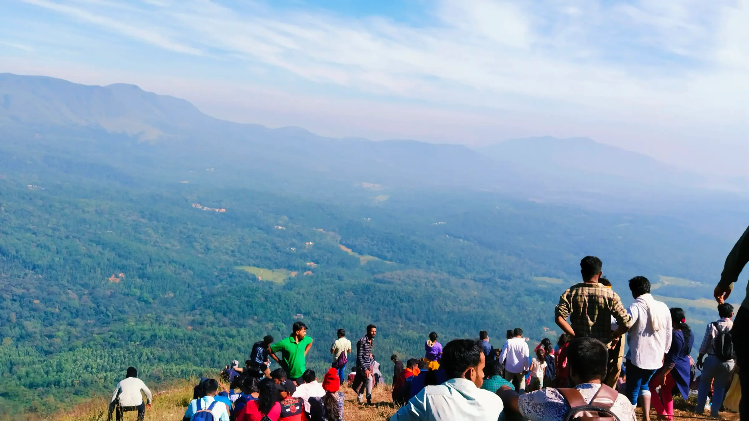
- A walk among tens of thousands of barefoot pilgrims, many of them fasting until they come down
Risks
- Very large crowds: over 1.5 lakh pilgrims came in 2024, and at least 10 were hurt in a stampede-like rush on the descent. Start early, keep to the side on steep sections and do not push.
- The trail is steep, narrow dirt and becomes slippery after rain, which often lingers into October–November. In a past rain year the district administration barred the climb and allowed it only from 4 am on the festival day; follow police and temple-committee instructions.
- Outside the festival the shrine is closed and the trail crosses forest land that needs Forest Department permission; do not try it on other days.
- 11 May 2026: Karnataka's Chief Wildlife Warden suspended trekking paths in areas with leopards, tigers, elephants or bears 'until further orders'. We found no notice naming Deviramma Betta, which is not on the Aranya Vihaara booking portal and is opened each year as a festival climb; check the district's arrangements before you go.
- Vehicles are stopped well short of the temple on the festival day, so expect extra walking; injured pilgrims have had to be stretchered about 5 km down to the road.
Know before you go
Questions
When is Deviramma Betta open?
Only on Naraka Chaturdashi, the day before Deepavali. In 2025 the hilltop shrine opened on 19 and 20 October; for 2026 the jatre listing gives 8 November. The temple trust's event listing gives trekking hours of 2 am to 6 pm on Naraka Chaturdashi, with the Deepotsava from 4 to 6 pm.
How long is the Deviramma Betta trek?
Figures differ. The temple trust's listing calls it an 8 km trek; a trekking blog gives 4–5 km uphill from the base. Plan for about 4–5 km each way and 2–3 hours up in the festival crowd; rescuers carried injured pilgrims about 5 km down in 2024.
Where does the climb start and how do I get there?
From Bindiga near Mallenahalli, about 25 km from Chikkamagaluru, where the lower Deviramma temple stands. Extra buses run from Chikkamagaluru during the jatre, and vehicles are stopped short of the temple on the festival day.
Do pilgrims really climb barefoot?
Yes. By tradition devotees climb barefoot, many fasting until they come down, and chant as they go. Trekkers who are not used to it can wear shoes; the descent on steep, often wet dirt is the riskiest part.
Can I climb Deviramma Betta on other days?
No. The hilltop shrine is closed the rest of the year, and the trail crosses forest land where access needs Forest Department permission.
In an emergency
Save these numbers before you lose signal. Tap to call.
- 112All emergenciesIndia’s single emergency number — works in every state
- 108Ambulance
- 1077District disaster control room
You are in
District: ChikkamagaluruKarnataka
- Nearest hospital
- Mallegowda District Hospital, Chikkamagaluru (about 25 km); emergency teams stand by on the festival day
- Last ATM
- Chikkamagaluru town, about 25 km away
- Phone network
- Not confirmed; expect weak and overloaded signal on the hill during the festival crowd.
Before you set off
- Tell someone your route and when you will be back.
- Carry a charged phone and a power bank.
- Download an offline map of the route.
- Turn back if the weather turns bad — the mountain will wait.
Questions about Deviramma Betta
No questions yet. Ask something and trekkers who have done it can answer.
Share your trek photo with #TreksAndTrails
I trekked this
Did Deviramma Betta look different from this page? Tell us what changed and we will check it.
Where this comes from
Sources
Last reviewed:
- Devirammajatre, Bindiga — Utsav (Ministry of Tourism) – listing by Deviramma Temple Trust
- Deviramma Temple Opens on Oct 19-20 for Diwali — Tirtha Yatra
- Mallenahalli Sri Deviramma Temple Jatre — Hindu Blog
- The Deviramma Temple Pilgrimage: A Test of Devotion and Endurance — TechnoSports
- Deviramma Temple in Chikmagalur — Muddie Trails
- Devotees offer special pooja to Goddess Deviramma on Deepotsava — Deccan Herald
- Deviramman Betta Trek (Bindga) – path — OpenStreetMap
Photos: Yakshitha, CC BY-SA 4.0; Yakshitha, CC BY-SA 4.0; Yakshitha, CC BY-SA 4.0