Manikgad Trek
Raigad, Maharashtra
Opens without signal on this phone, with the map file and checklist. Saved for offline →
- Max altitude
- 572 m
- Days
- 1 day
- Distance
- 10 km
- Difficulty
- Moderate
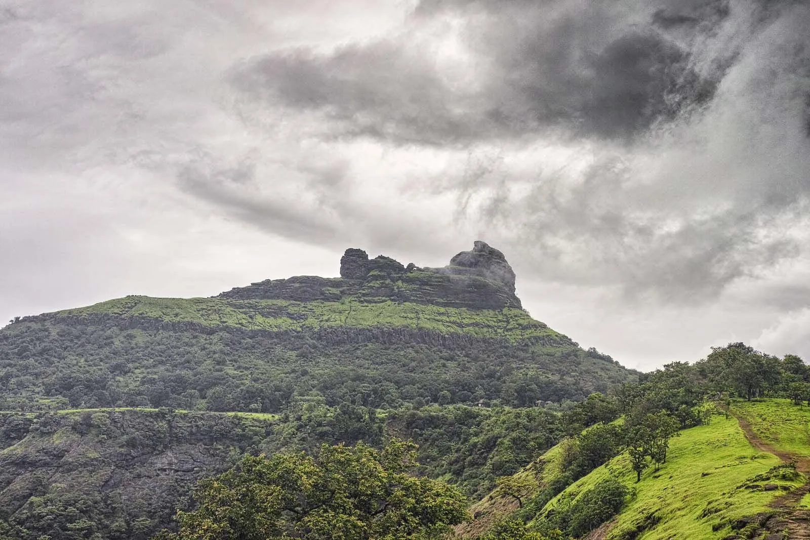
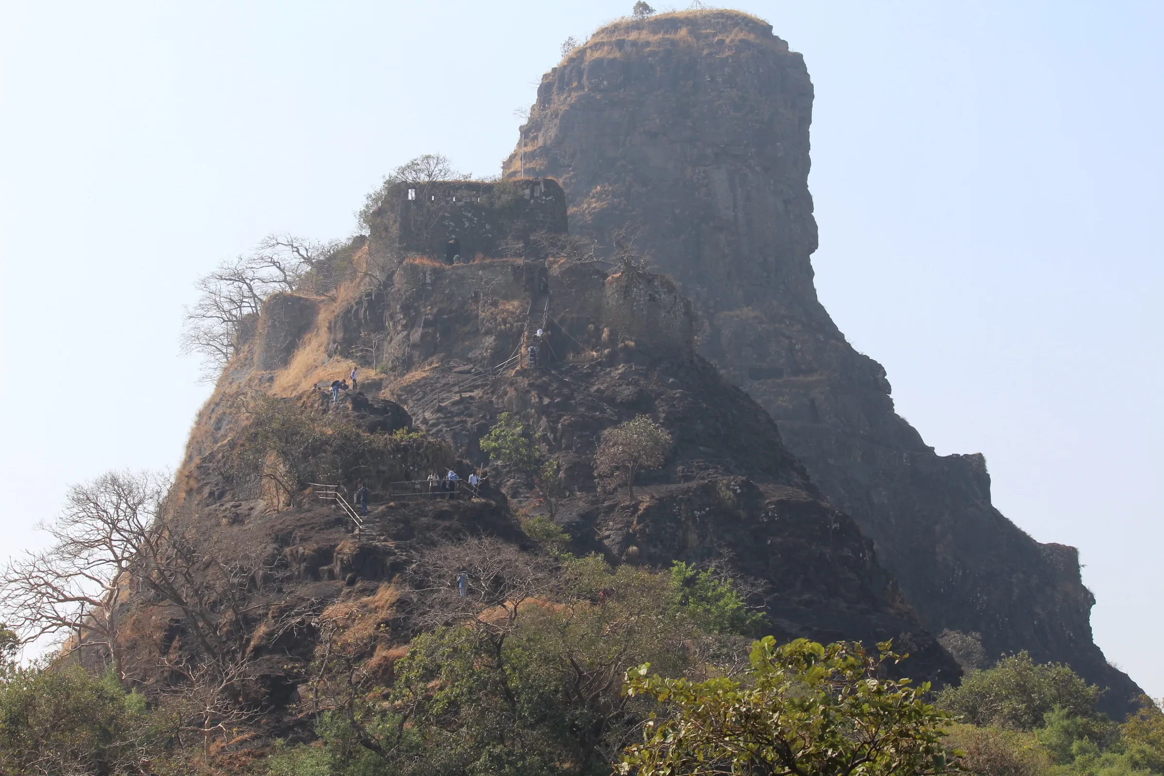
About 5 km each way with roughly 500 m of ascent; the walk to the Hanuman mandir is mostly flat, then the trail climbs through karvi scrub and circles the fort to the entrance on the north side. Operators grade it easy to medium, but the many cattle trails make route-finding hard and the open plateau is very hot outside the monsoon.
Photos
On the trail
The route
Day by day
Day 1 · highest point
Vashivali (Washivali) Thakurwadi → Vashivali (Washivali) Thakurwadi (via Dhangarwadi, the Hanuman mandir and Manikgad Fort)
200 m → 572 m → 200 m
Ups and downs
Altitude profile
Where it is
Map
Trailhead and high point only — not a recorded track. Use it with a proper map.
Weather
Next 5 days on the trail
Live forecast for the trailhead and the high point. Mountain weather changes fast — check again on the morning you start.
Trailhead · Vashivali (Washivali) Thakurwadi
at 200 mLoading forecast…
High point · Manikgad Fort top
at 572 mLoading forecast…
Each day: high / low °C · rain mm and chance · snow cm · wind km/h
Weather data: Open-Meteo.comModel forecast, not an official warning. For alerts follow IMD and the local administration.
Plan the trip
How to reach
- Trailhead
- Vashivali (Washivali) Thakurwadi (nearest town: Panvel)
- Nearest railway
- Panvel (Harbour line and long-distance trains) from the Mumbai side; Karjat from the Pune side
- Nearest airport
- Chhatrapati Shivaji Maharaj International Airport, Mumbai (Navi Mumbai International Airport is closer once its flights suit you)
- By road
- Panvel (about 27 km to Vashivali near Rasayani MIDC; Panvel–Vashivali ST buses, or shared Eeco/rickshaw to Mohopada, Rasayani, then a small auto to Vashivali); Karjat (buses or a hired Eeco to Vashivali or Vadgaon); Mumbai (via Panvel)
- Drive
- About 2 h from Mumbai
Plan the trip
Permits and fees
We could not confirm the current permit rules and fees from an official source. Check with the local forest department or tourism office before you go.
Plan the trip
Cost
Self-guided
₹150–800
With an operator
₹800–999
Per person, ex-Panvel. Guided: Treks and Trails India (treksandtrails.org) lists ₹800 for a one-day trek with Panvel–Panvel local transport, breakfast, tea and a trek leader (lunch and train tickets not included); T Trikon listed ₹999 from Panvel but shows no current departures. Self-guided estimate covers a shared rickshaw (a 2022 blog quotes about ₹50 per head) or ST bus from Panvel, an auto to Vashivali/Thakurwadi, food, and an optional local guide (vatadya) from Thakurwadi or Dhangarwadi, which is worth hiring on this confusing trail.
Gear
Top picks for this trek
The gear that matters most on this route, chosen from its altitude, season and risks.
 Ad · affiliate link
 Ad · affiliate link
 Ad · affiliate link
 Ad · affiliate link
- Ad · affiliate link
 Ad · affiliate link
 Ad · affiliate link
 Ad · affiliate link
Store buttons open a search on that store, not a product we picked. As an Amazon Associate we earn from qualifying purchases. Photos show the kind of item, not a specific product. Affiliate disclosure
Packing checklist
Matched to this trek: altitude, season, days and the risks on the route.
Packed 0 of 20
Monsoon months (Aug–Sep): pack everything in plastic or a dry bag and wear shoes with good grip.
Tick each item as it goes in the bag.
Know before you go
Good to know
- Mobile network
- Not confirmed; expect signal near Vashivali and the Rasayani highway, patchy in the forest
- Last ATM
- Rasayani/Mohopada or Panvel; carry cash
- Nearest hospital
- Rasayani/Mohopada area; larger hospitals in Panvel (about 27 km)
- Water
- Carry 2–3 litres. Shops are only on the highway at Vashivali; none in Thakurwadi or Dhangarwadi. Rock-cut tanks near the Shiv mandir on top are cleaned by villagers, but treat the water before drinking. Streams flow only in the monsoon
Highlights
- Trail that circles the fort anticlockwise before the final climb, so the usual route is itself a parikrama of Manikgad
- Darya take, a large rock-cut rainwater tank, plus several smaller cisterns on top
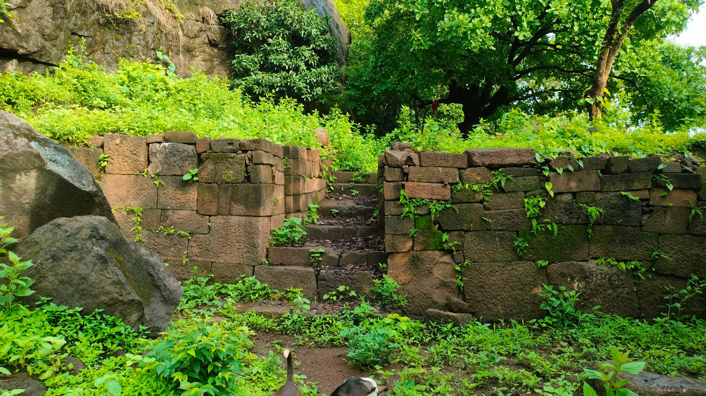
- Ganesh gate (the only standing structure), Hanuman gate, bastion and palace ruins, a stone lime-mixing trench and a small Shiv mandir with a Shivling
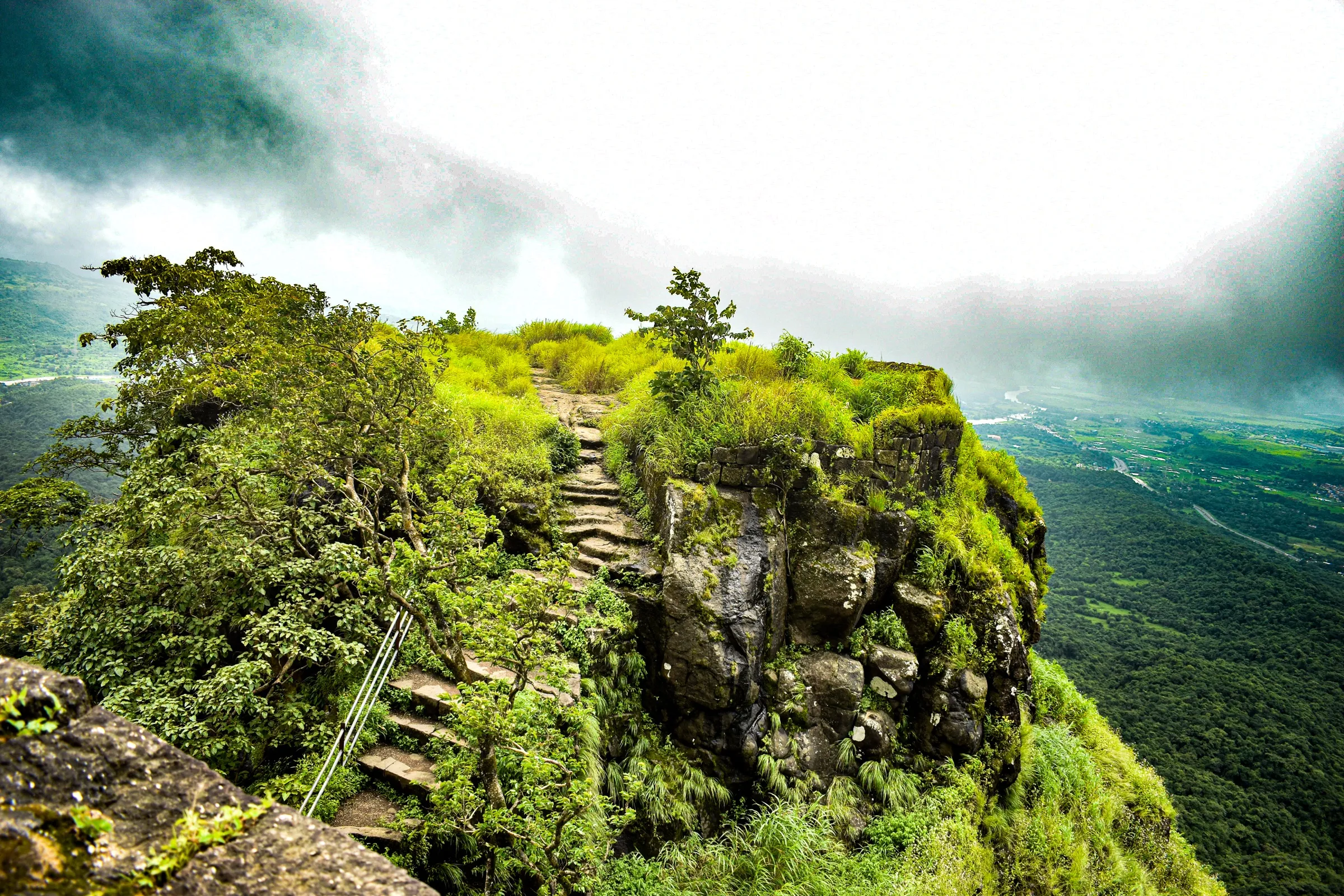
- Views of Karnala, Sankshi, Prabalgad, Kalavantin, Irshalgad, Matheran, Sondai, Kothaligad and Rajmachi on a clear day
- Fort built by Sarkhel Kanhoji Angre to watch the trade route from the coastal ports to Maval; monsoon flowers such as yellow sonki carpet the top in September
Risks
- Very easy to get lost: many cattle and village trails cross the route between Dhangarwadi, the Hanuman mandir and the start of the climb. Keep the fort on your left, do not miss the left turn behind (south of) the fort, and consider a local guide
- The Vadgaon approach is reported to be more confusing than the Vashivali–Thakurwadi route; one 2022 blogger got lost on it
- Summer treks are very hot and need strong endurance; there is no shade on the top plateau
- Monsoon: slippery mud and rock, swollen streams, and a side trail on the north side that leads down to a waterfall instead of the entrance
- No 2025–26 ban order naming Manikgad was found, but Raigad district has closed other monsoon spots (e.g. Devkund) from June to September; check local orders before a monsoon visit
- Fort walls and gates are in ruins; stay away from crumbling edges and the cistern rims
Know before you go
Questions
Where does the Manikgad trek start?
From Vashivali near Rasayani MIDC, about 27 km from Panvel. A road now goes to Thakurwadi (cars) and Dhangarwadi (bikes); the trail starts from there. Vadgaon is the other base village, but its route is harder to follow.
How long and how hard is the Manikgad trek?
Operators quote about 5 km one way and around five hours up and down, with roughly 1,700 ft of ascent from the base. It is graded easy to medium; the length and route-finding make it harder than it looks.
Do I need a guide for Manikgad?
Beginners should take a local guide (vatadya) from Thakurwadi or Dhangarwadi, as the trail has many branching tracks. Experienced trekkers with a map can manage alone.
How do I reach Manikgad from Mumbai?
Take a train to Panvel, then an ST bus to Vashivali or a shared Eeco/rickshaw to Mohopada (Rasayani) and a small auto to Vashivali. From Pune, get off at Karjat and take a bus or cab to Vashivali or Vadgaon.
Is there water and food on the trek?
Shops and eateries are only on the highway at Vashivali. Carry lunch and enough water; tanks near the Shiv mandir on top hold water, but treat it before drinking.
In an emergency
Save these numbers before you lose signal. Tap to call.
- 112All emergenciesIndia’s single emergency number — works in every state
- 108Ambulance
- 1077District disaster control room
You are in
District: RaigadMaharashtra
- Nearest hospital
- Rasayani/Mohopada area; larger hospitals in Panvel (about 27 km)
- Last ATM
- Rasayani/Mohopada or Panvel; carry cash
- Phone network
- Not confirmed; expect signal near Vashivali and the Rasayani highway, patchy in the forest
Before you set off
- Tell someone your route and when you will be back.
- Carry a charged phone and a power bank.
- Download an offline map of the route.
- Turn back if the weather turns bad — the mountain will wait.
Questions about Manikgad
No questions yet. Ask something and trekkers who have done it can answer.
Share your trek photo with #TreksAndTrails
I trekked this
Did Manikgad look different from this page? Tell us what changed and we will check it.
Where this comes from
Sources
Last reviewed:
- Manikgad Fort Trek — Treks and Trails India (treksandtrails.org)
- Manikgad (Raigad) — Wikipedia
- Manikgad Monsoon Trek — T Trikon (Travel Trikon)
- Manikgad Trek Blog – Avoid my mistakes & don't get lost here — TheFreeBird (thefreebird.net)
- Manikgad Trek FAQs: All Your Questions Answered — Tata Neu
Photos: Ccmarathe, via Wikimedia Commons, CC BY-SA 3.0; Ccmarathe, via Wikimedia Commons, CC BY-SA 3.0; Ccmarathe, via Wikimedia Commons, CC BY-SA 3.0; Ccmarathe, via Wikimedia Commons, CC BY-SA 3.0