Karnala Fort Trek
Raigad, Maharashtra
Opens without signal on this phone, with the map file and checklist. Saved for offline →
- Max altitude
- 439 m
- Days
- 1 day
- Distance
- 6 km
- Difficulty
- Easy
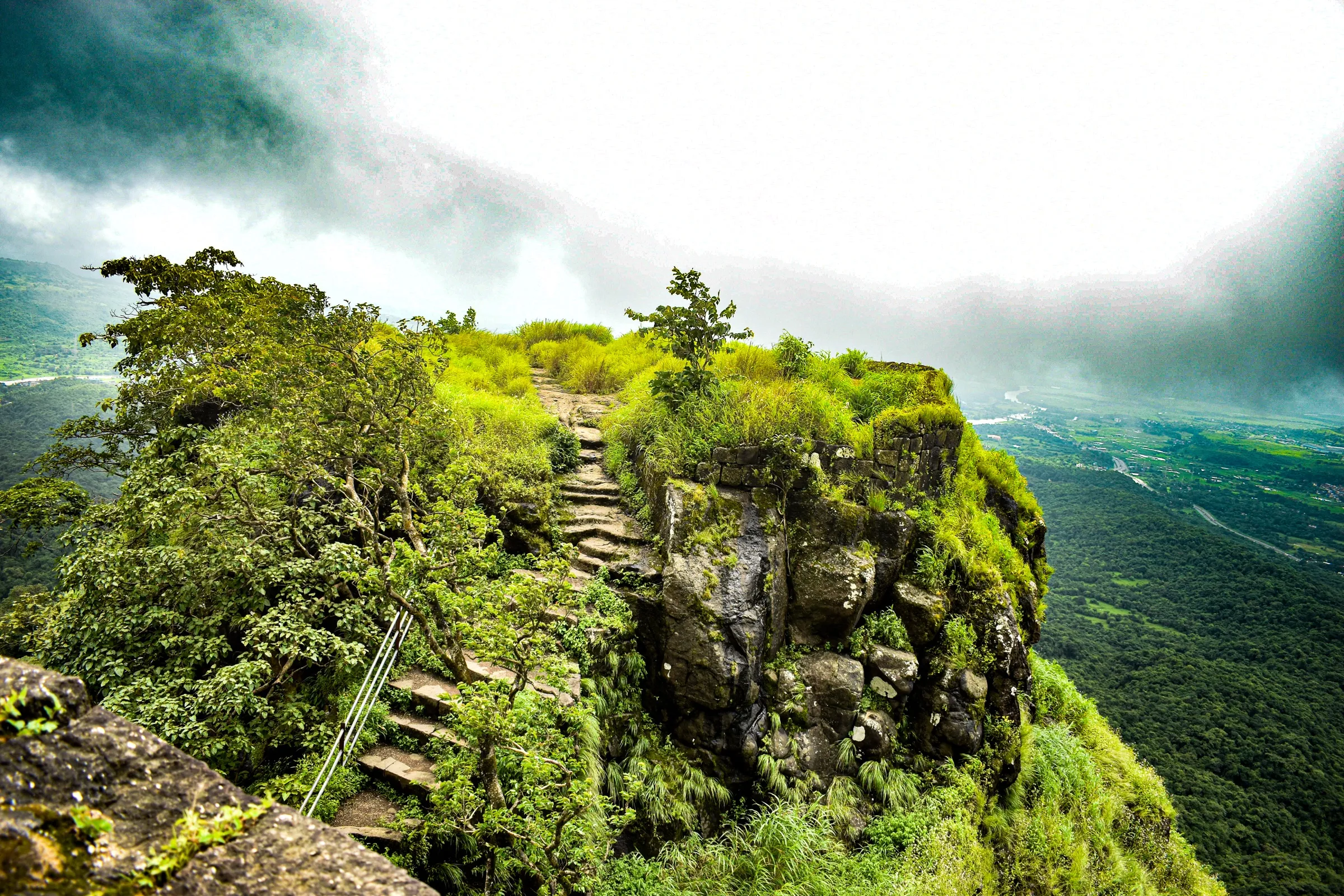
A short forest climb of about 3 km each way and roughly 350–400 m of ascent, with loose soil, muddy scree and stone steps with railings near the fort entrance; easy for beginners and families in dry weather.
Photos
On the trail
The route
Day by day
Day 1 · highest point
Karnala Bird Sanctuary entrance → Karnala Bird Sanctuary entrance (via Karnala Fort)
60 m → 439 m → 60 m
Ups and downs
Altitude profile
Where it is
Map
Trailhead and high point only — not a recorded track. Use it with a proper map.
Weather
Next 5 days on the trail
Live forecast for the trailhead and the high point. Mountain weather changes fast — check again on the morning you start.
Trailhead · Karnala Bird Sanctuary entrance
at 60 mLoading forecast…
High point · Karnala Fort pinnacle (Pandu's tower)
at 439 mLoading forecast…
Each day: high / low °C · rain mm and chance · snow cm · wind km/h
Weather data: Open-Meteo.comModel forecast, not an official warning. For alerts follow IMD and the local administration.
Plan the trip
How to reach
- Trailhead
- Karnala Bird Sanctuary entrance (nearest town: Panvel)
- Nearest railway
- Panvel (Central Railway suburban and long-distance trains), about 10–12 km away
- Nearest airport
- Chhatrapati Shivaji Maharaj International Airport, Mumbai (Navi Mumbai International Airport is closer once its flights suit you)
- By road
- Panvel (about 10–12 km on the Mumbai–Goa highway, NH 66; shared jeeps, autos and ST buses); Mumbai (about 60–65 km); Pune (via the Mumbai–Pune expressway and Panvel)
- Drive
- About 1.5 h from Mumbai
Plan the trip
Permits and fees
We could not confirm the current permit rules and fees from an official source. Check with the local forest department or tourism office before you go.
Plan the trip
Cost
Self-guided
₹150–600
With an operator
₹999–1,299
Per person, ex-Panvel. Guided: Treks and Trails India (treksandtrails.org) lists ₹999 without transport and ₹1,299 with a Panvel–Karnala–Panvel vehicle, including breakfast, leader and the forest entry fee; no second operator's current price was found. Self-guided estimate covers a shared jeep or bus from Panvel, the sanctuary entry fee collected at the gate (amount not confirmed from an official source), and food at the base canteen. Extra forest charges apply for DSLR/video cameras, and operators mention a refundable deposit for plastic items.
Gear
Top picks for this trek
The gear that matters most on this route, chosen from its altitude, season and risks.
 Ad · affiliate link
 Ad · affiliate link
 Ad · affiliate link
 Ad · affiliate link
- Ad · affiliate link
 Ad · affiliate link
 Ad · affiliate link
 Ad · affiliate link
Store buttons open a search on that store, not a product we picked. As an Amazon Associate we earn from qualifying purchases. Photos show the kind of item, not a specific product. Affiliate disclosure
Packing checklist
Matched to this trek: altitude, season, days and the risks on the route.
Packed 0 of 18
Hot days in Mar: start at first light and carry extra water and ORS.
Tick each item as it goes in the bag.
Know before you go
Good to know
- Mobile network
- Expected near the highway and sanctuary gate; coverage on the upper trail is not confirmed
- Last ATM
- Panvel; carry cash for the entry fee and canteen
- Nearest hospital
- Panvel (about 10–12 km); first aid is reported at the forest guest house in the sanctuary
- Water
- Carry 1.5–2 litres. A canteen at the base refills bottles; rock-cut cisterns on top hold water that may not be potable
Highlights
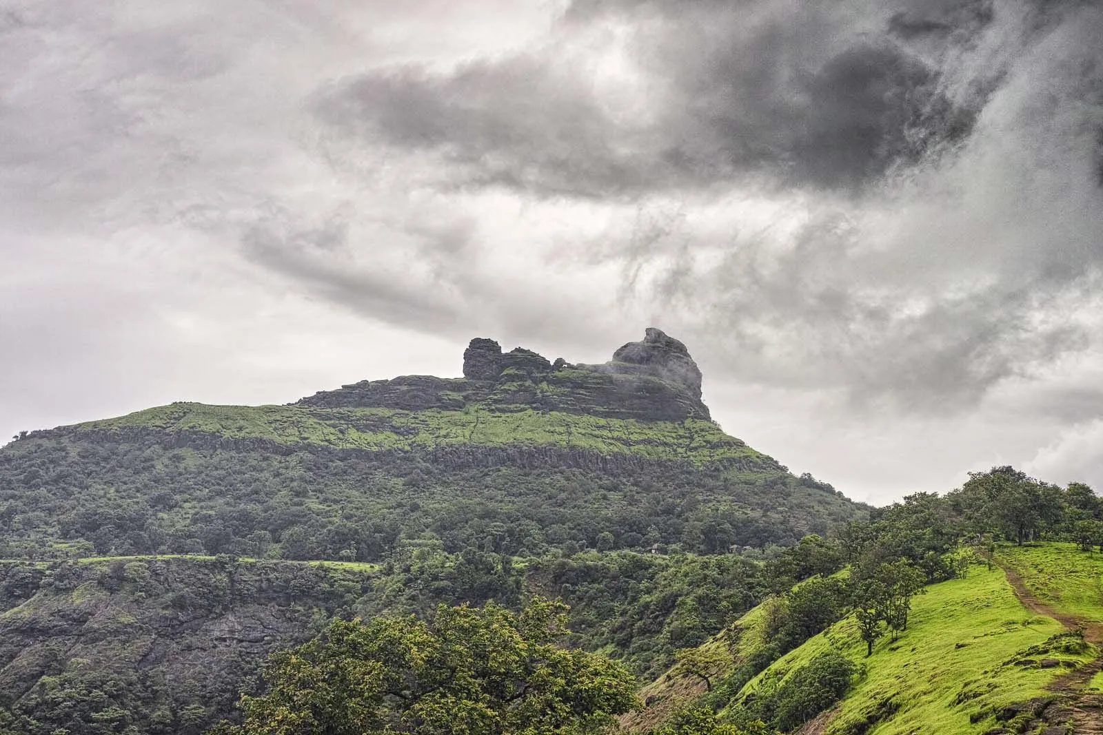
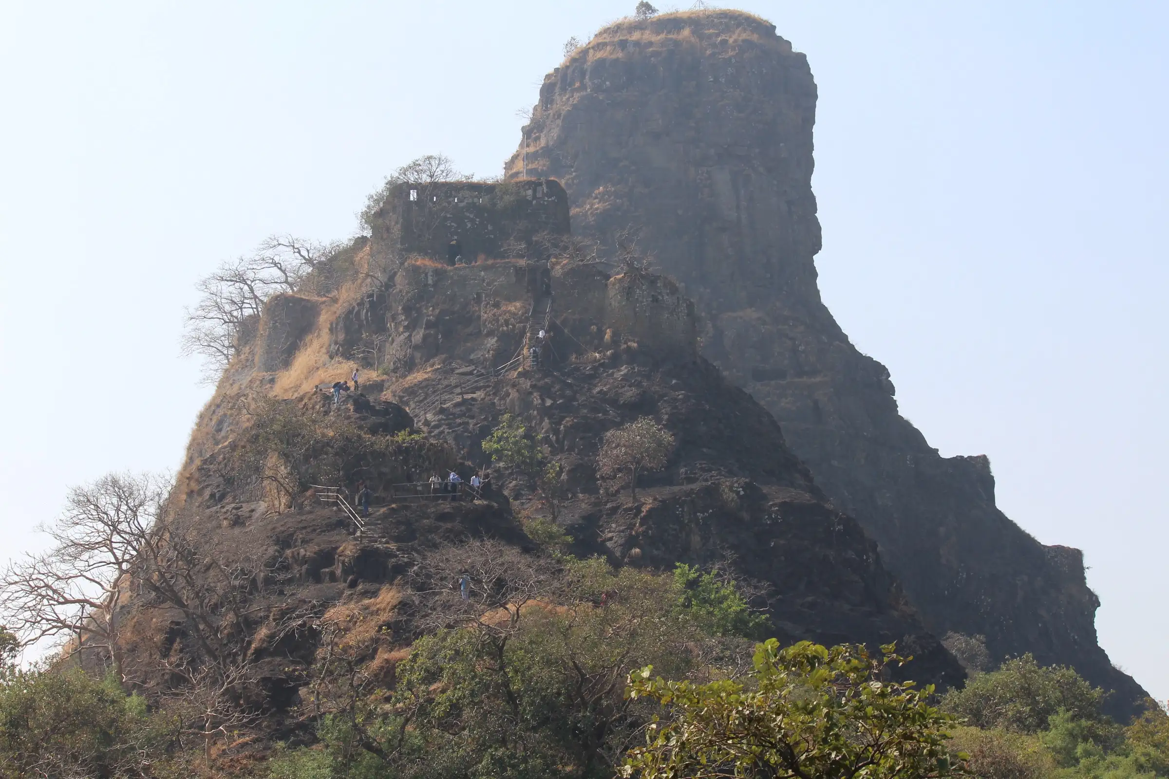
- Basalt pinnacle about 125 ft (38 m) high, called Pandu's tower, that gives Karnala its 'Funnel Hill' shape
- Trail through Karnala Bird Sanctuary, with over 150 bird species and migrants between November and February
- Stone steps with railings to the old fort gateway and ramparts with a 360-degree view
- Views of the Panvel plains, Prabalgad, Matheran and, on clear days, the Mumbai harbour
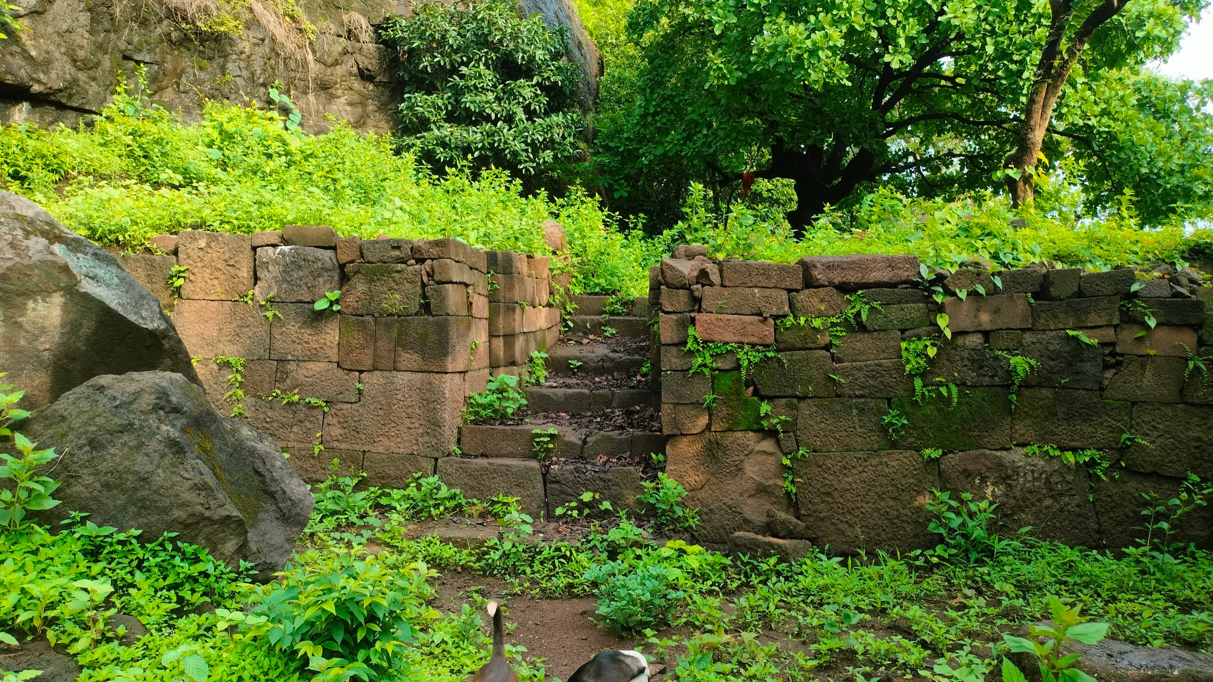
- Rock-cut water cisterns and fort walls that once guarded the Bor pass trade route
Risks
- The Forest Department closed both Karnala trails to visitors from 12 August 2022 after cracks appeared in the fort's walls; no official reopening notice was found, although operators sell the trek again. Confirm with the Karnala range office at the gate before you go
- Rock bees nest on the pinnacle: do not cook, light fires or make noise below it, and do not try to climb the pinnacle (it has caused at least one death)
- Loose soil and muddy scree on the steep upper trail; slippery, with leeches, from June to September
- Stone steps with railings near the entrance are narrow and crowded on weekends; one source describes a short rock-crevice section near the top
- The sanctuary closes in the evening (reported hours range from 7am–3pm to sunrise–sunset); start early and descend well before the gate closes
- Exposed final approach in the sun; carry water and a cap outside the monsoon
Know before you go
Questions
How long does the Karnala Fort trek take?
About 1.5–2 hours to the top and about 90 minutes down from the sanctuary gate, so plan 3–4 hours for the round trip.
Is the Karnala Fort trek good for beginners and children?
Yes. Operators describe it as a beginner's trek suitable for families, though the upper trail is steep in places with loose soil and stone steps.
How do I reach Karnala Fort from Mumbai?
Take a train to Panvel, then a shared jeep, auto or bus about 10–12 km along the Mumbai–Goa highway (NH 66) to the Karnala Bird Sanctuary gate. By car it is about 60–65 km from Mumbai.
Is there an entry fee?
Yes, the Forest Department collects an entry fee at the sanctuary gate, with extra charges for cameras. We could not confirm the current amount from an official source, so check at the gate.
Is Karnala Fort open now?
The fort trails were closed in August 2022 after cracks were found in the walls. Operators and recent guides describe the trek as running again, but we found no official reopening notice; confirm with the forest office before you go.
When is the best time to trek Karnala?
October to March. Winter (November–February) brings migratory birds and cool weather; the monsoon is green but slippery and leech-prone.
In an emergency
Save these numbers before you lose signal. Tap to call.
- 112All emergenciesIndia’s single emergency number — works in every state
- 108Ambulance
- 1077District disaster control room
You are in
District: RaigadMaharashtra
- Nearest hospital
- Panvel (about 10–12 km); first aid is reported at the forest guest house in the sanctuary
- Last ATM
- Panvel; carry cash for the entry fee and canteen
- Phone network
- Expected near the highway and sanctuary gate; coverage on the upper trail is not confirmed
Before you set off
- Tell someone your route and when you will be back.
- Carry a charged phone and a power bank.
- Download an offline map of the route.
- Turn back if the weather turns bad — the mountain will wait.
Questions about Karnala Fort
No questions yet. Ask something and trekkers who have done it can answer.
Share your trek photo with #TreksAndTrails
I trekked this
Did Karnala Fort look different from this page? Tell us what changed and we will check it.
Where this comes from
Sources
Last reviewed:
- Karnala Fort — Wikipedia
- Karnala Fort Trek 2026 | Day Trek near Mumbai — Treks and Trails India (treksandtrails.org)
- Karnala Fort Trek (documented trek) — Indiahikes
- Karnala Fort Trek — Bikat Adventures
- Karnala Fort Trek Guide — Trekgo
- Maharashtra's Karnala Fort to be revamped, will be made more trekker-friendly (14 Sep 2022) — Curly Tales
Photos: Sharithab, via Wikimedia Commons, CC BY-SA 4.0; Incredible Mother Earth, via Wikimedia Commons, CC BY-SA 4.0; Shishirdasika, via Wikimedia Commons, CC BY-SA 4.0; Bhuppigraphy, via Wikimedia Commons, CC BY-SA 4.0