Kang La Trek
Lahaul and Spiti (Himachal Pradesh) and Kargil (Ladakh), Himachal Pradesh & Ladakh
Opens without signal on this phone, with the map file and checklist. Saved for offline →
- Max altitude
- 5,468 m
- Days
- 9 days
- Distance
- 85 km
- Difficulty
- Challenging
About 24 km of travel on the crevassed Miyar Glacier, a roped-up climb to a 5,468 m pass and a 17 km pass day, deep in a remote valley with no road access or phone signal; operators sell it only to experienced high-altitude trekkers.
Photos
On the trail
The route
Day by day
Day 1
Manali → Changut (drive via Atal Tunnel or Rohtang and Udaipur, about 135 km)
2,050 m → 3,200 m
Day 2
Changut → Yolithang (via Shukto roadhead and Khanjer)
3,200 m → 3,750 m
Day 3
Yolithang → Zardung
3,750 m → 3,900 m
Day 4
Zardung → Kesar Yon Chhap
3,900 m → 3,990 m
Day 5
Kesar Yon Chhap → Kesar Yon Chhap (rest and acclimatisation)
3,990 m → 3,990 m
Day 6
Kesar Yon Chhap → Miyar Glacier Camp
3,990 m → 4,450 m
Day 7
Miyar Glacier Camp → Kang La Base Camp
4,450 m → 4,800 m
Day 8 · highest point
Kang La Base Camp → Temasa Tongpo (via Kang La)
4,800 m → 5,468 m → 4,420 m
Day 9
Temasa Tongpo → Padum (trek to the Bardan roadhead, then 12 km drive)
4,420 m → 3,600 m
Ups and downs
Altitude profile
Where it is
Map
Trailhead and high point only — not a recorded track. Use it with a proper map.
Weather
Next 5 days on the trail
Live forecast for the trailhead and the high point. Mountain weather changes fast — check again on the morning you start.
Trailhead · Khanjer / Khanjar (Shukto roadhead)
at 3,200 mLoading forecast…
High point · Kang La pass
at 5,468 mLoading forecast…
Each day: high / low °C · rain mm and chance · snow cm · wind km/h
Weather data: Open-Meteo.comModel forecast, not an official warning. For alerts follow IMD and the local administration.
Plan the trip
How to reach
- Trailhead
- Khanjer / Khanjar (Shukto roadhead) (nearest town: Udaipur (Lahaul))
- Nearest railway
- Chandigarh (broad gauge); Joginder Nagar narrow-gauge station is closer to Manali
- Nearest airport
- Bhuntar (Kullu-Manali) Airport at the start; Leh Airport (about 180 km from Padum) at the end
- By road
- Manali to Changut in the Miyar valley via Tandi and Udaipur (about 135 km); From Padum: Manali about 245 km (6-7 hours) or Leh about 180 km (5-6 hours), as quoted by Bikat Adventures; or Kargil over Penzi La
- Drive
- About 7 h from Manali
Plan the trip
Permits and fees
We could not confirm the current permit rules and fees from an official source. Check with the local forest department or tourism office before you go.
Plan the trip
Cost
Self-guided
₹45,000–80,000
With an operator
₹99,500–1,04,475
Per person, ex-Manali (ending at Padum). Bikat Adventures lists ₹99,500 + 5% GST (₹1,04,475) for its 10-day Manali-to-Padum departure, permits included. White Magic and Himalayan High quote only on request, so this is a single-operator range. Self-guided is an estimate for a small group hiring a Lahauli or Zanskari guide, cook and porters or horses, glacier rope and crampons, plus the drives to Changut and out of Padum; it should never be attempted without an experienced glacier guide.
Gear
Top picks for this trek
The gear that matters most on this route, chosen from its altitude, season and risks.
 Ad · affiliate link
 Ad · affiliate link
 Ad · affiliate link
 Ad · affiliate link
 Ad · affiliate link
 Ad · affiliate link
 Ad · affiliate link
 Ad · affiliate link
Store buttons open a search on that store, not a product we picked. As an Amazon Associate we earn from qualifying purchases. Photos show the kind of item, not a specific product. Affiliate disclosure
Packing checklist
Matched to this trek: altitude, season, days and the risks on the route.
Packed 0 of 35
Nights near 5,468 m can drop close to freezing even in summer. Pack one more warm layer than you think.
Tick each item as it goes in the bag.
Know before you go
Good to know
- Mobile network
- No mobile signal at the campsites; Bikat reports only occasional patches. Manali has all networks.
- Last ATM
- Manali, per Bikat Adventures; carry cash for the whole trip. Padum may have ATMs but do not rely on them.
- Nearest hospital
- Health centre at Udaipur (Lahaul) on the Himachal side and the hospital at Padum on the Zanskar side; serious cases go to Kullu/Manali or Leh. Rescue from the glacier is by foot to a roadhead.
- Water
- Plentiful glacial streams and the Miyar Nala in the valley; on the glacier water comes from melt streams or melted snow. Treat all water.
Highlights
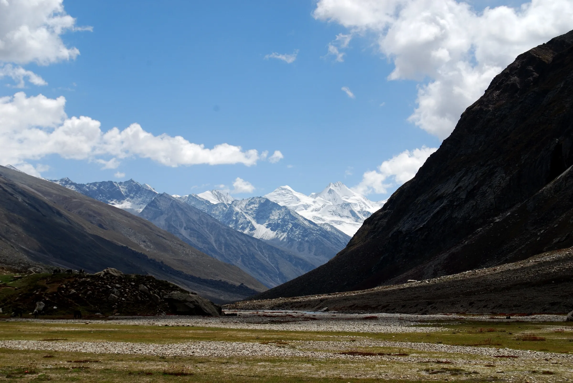
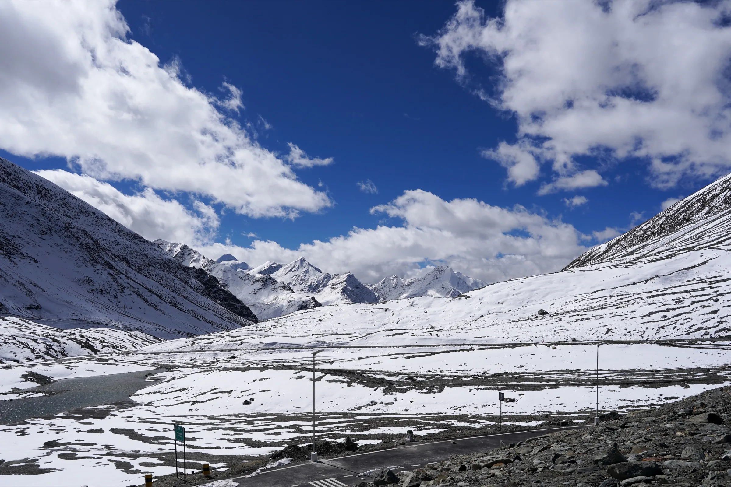
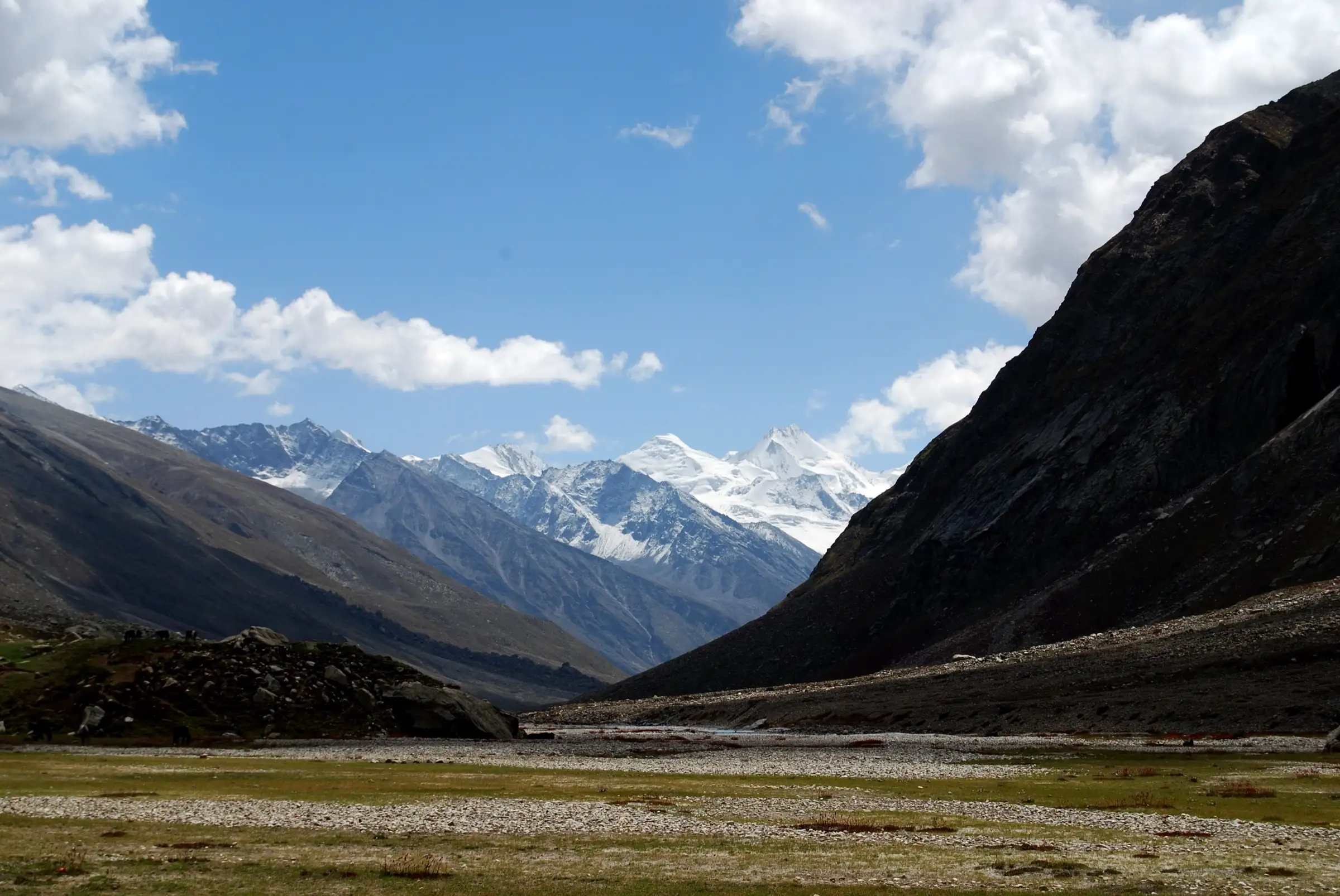
- Crossing the Great Himalayan Range from green Lahaul into arid Zanskar in Ladakh
- About 24 km on the Miyar Glacier, described by operators as one of the longest glacier approaches to any pass in the Indian Himalaya
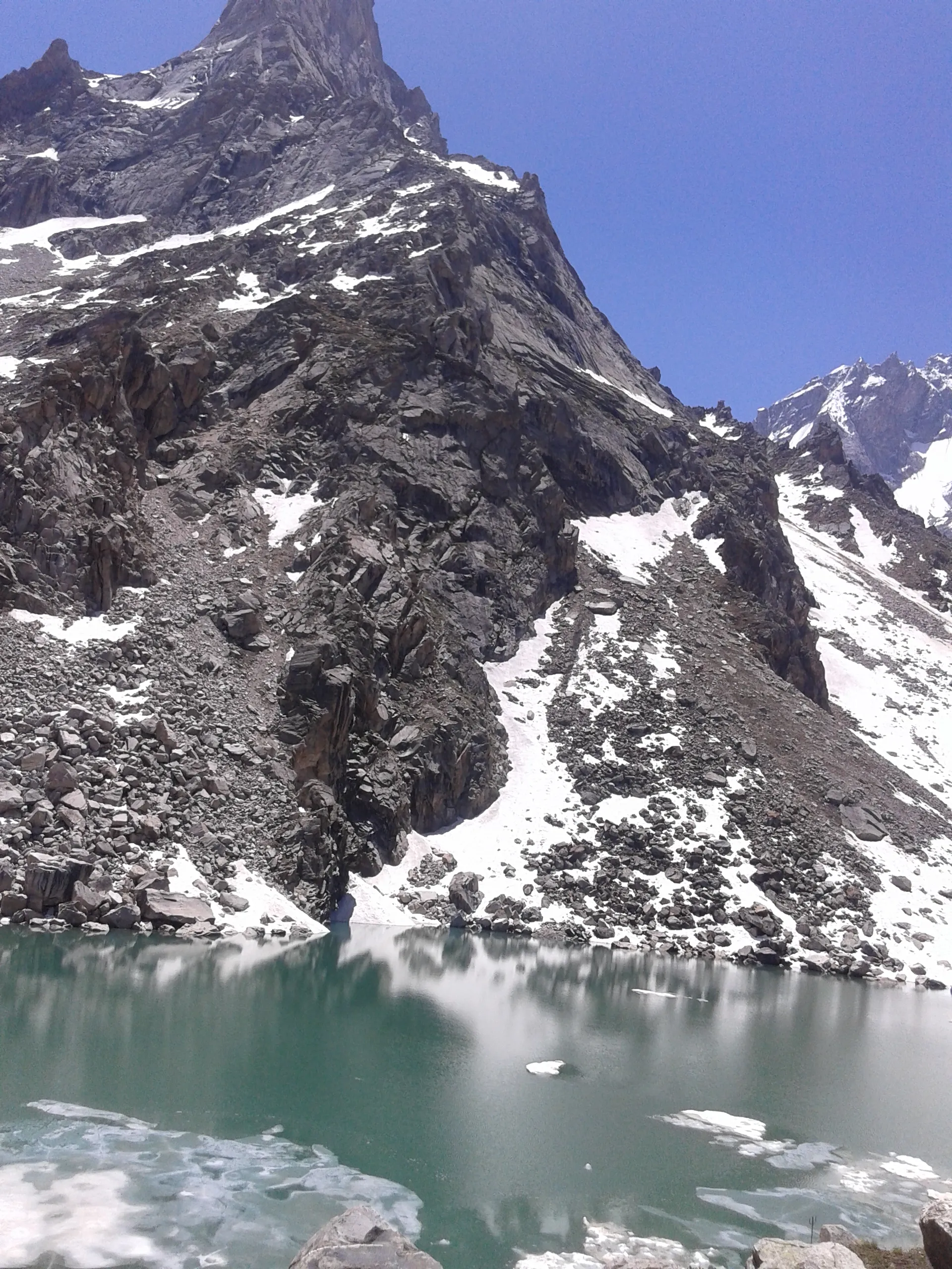
- Wildflower meadows and Gaddi shepherd camps along the Miyar valley, and the emerald lakes at Kesar Yon Chhap
- Granite spires of the upper Miyar valley and the descent down the Temasa valley to Bardan Gompa and Padum
Risks
- Crevassed glacier: the climb to the pass is done roped up, and operators issue crampons, harness, ice axe and helmet. Only go with a guide who knows the glacier.
- High altitude: the pass is about 5,468 m and pass day is about 17 km and 8-10 hours; acute mountain sickness, HAPE and HACE are real risks. Build in the acclimatisation day at Kesar Yon Chhap.
- Wide, cold glacial stream crossings below the Miyar Glacier snout, worst in the afternoon.
- Extreme remoteness: no phone signal and several days' walk from a road on either side; carry insurance that covers evacuation. Bikat keeps a reserve day for weather.
- Monsoon spells and early snow (late September-October) can close the pass for days; one source advises avoiding monsoon and winter.
Know before you go
Questions
How difficult is the Kang La trek?
It is one of the harder trekking passes in Himachal. Bikat rates it Difficult (its BRS 6) and takes only trekkers who have done a comparable trek; White Magic describes a roped climb through crevasses to the pass. Expect long glacier days and a pass day of 8-10 hours.
What is the altitude of Kang La?
Operators give 5,450-5,468 m: Himalayan High and White Magic quote 5,468 m, Bikat 5,465 m, and a 2018 trip report by Jean-Claude Latombe 5,450 m. Satellite terrain at the pass reads about 5,430 m.
When can you cross Kang La?
Operators run it from mid-June to October, when the snow has melted off the lower valley. July to September is the most reliable window; outside it the pass is snowbound.
Where does the trek start and end?
It starts at Shukto/Khanjer, the last village of the Miyar valley in Lahaul (about 135 km from Manali via Udaipur), and ends at Bardan near Padum in Zanskar, Ladakh. Some operators run it the other way, from Padum to Manali.
Do I need permits for Kang La?
Bikat says several permits are needed and arranges them; White Magic includes entry, camping and trekking permit fees. We found no official fee schedule, so check current Lahaul-Spiti and Ladakh requirements with your operator or the local administration.
In an emergency
Save these numbers before you lose signal. Tap to call.
- 112All emergenciesIndia’s single emergency number — works in every state
- 108Ambulance
- 1077District disaster control room
You are in
District: Lahaul and Spiti (Himachal Pradesh) and Kargil (Ladakh)Himachal Pradesh · Ladakh
- Nearest hospital
- Health centre at Udaipur (Lahaul) on the Himachal side and the hospital at Padum on the Zanskar side; serious cases go to Kullu/Manali or Leh. Rescue from the glacier is by foot to a roadhead.
- Last ATM
- Manali, per Bikat Adventures; carry cash for the whole trip. Padum may have ATMs but do not rely on them.
- Phone network
- No mobile signal at the campsites; Bikat reports only occasional patches. Manali has all networks.
Before you set off
- Tell someone your route and when you will be back.
- Carry a charged phone and a power bank.
- Download an offline map of the route.
- Turn back if the weather turns bad — the mountain will wait.
Questions about Kang La
No questions yet. Ask something and trekkers who have done it can answer.
Share your trek photo with #TreksAndTrails
I trekked this
Did Kang La look different from this page? Tell us what changed and we will check it.
Where this comes from
Sources
Last reviewed:
- Kang La Trek — Bikat Adventures
- Kangla & Miyar Glacier Trek - Explore Lahaul & Zanskar — Himalayan High
- KANG LA (5468m) TREK — White Magic Adventure
- India (July-August 2018): Across Kang La (5450m) and Umasi La (5300m) — Jean-Claude Latombe (trip report)
- Kang La Trek (documented trek; text closely paraphrases Bikat's itinerary, so no claims counted) — TrekUp India
Photos: Michael Scalet, CC BY-SA 2.0; Ingo Mehling, CC BY-SA 4.0