Darcha to Padum Trek
Lahaul and Spiti (Himachal Pradesh) and Kargil (Zanskar, Ladakh), Himachal Pradesh & Ladakh
Opens without signal on this phone, with the map file and checklist. Saved for offline →
- Max altitude
- 5,090 m
- Days
- 9 days
- Distance
- 92.7 km
- Difficulty
- Difficult
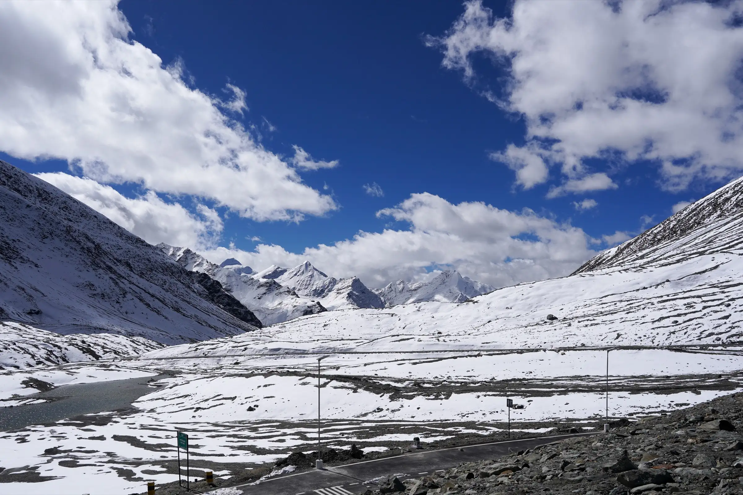
A 5,090 m pass reached only two or three days after leaving Manali (2,050 m), long walking days of 10-22 km in the cold desert of Zanskar, snowfields near the pass early in the season and several knee-deep stream crossings. The pass itself is not technical.
Photos
On the trail
The route
Day by day
Day 1
Manali → Darcha (drive via Atal Tunnel and Keylong)
2,050 m → 3,360 m
Day 2
Darcha → Ramjak (drive on the Darcha-Shinku La road past Palamo and Zanskar Sumdo)
3,360 m → 4,380 m
Day 3
Ramjak → Ramjak (acclimatisation day; short walk towards Chumik Nakpo)
4,380 m → 4,380 m
Day 4 · highest point
Ramjak → Lakhang (over Shingo La, via Chumik Nakpo)
4,380 m → 5,090 m → 4,470 m
Day 5
Lakhang → Kargyak (past Gonbo Rangjon)
4,470 m → 4,050 m
Day 6
Kargyak → Purne (via Tanze and Testa)
4,050 m → 3,700 m
Day 7
Purne → Purne (return walk to Phuktal Gompa)
3,700 m → 3,858 m → 3,700 m
Day 8
Purne → Changpa Tsetan
3,700 m → 3,680 m
Day 9
Changpa Tsetan → Raru (then drive to Padum)
3,680 m → 3,600 m
Ups and downs
Altitude profile
Where it is
Map
Trailhead and high point only — not a recorded track. Use it with a proper map.
Weather
Next 5 days on the trail
Live forecast for the trailhead and the high point. Mountain weather changes fast — check again on the morning you start.
Trailhead · Darcha
at 4,380 mLoading forecast…
High point · Shingo La (Shinku La)
at 5,090 mLoading forecast…
Each day: high / low °C · rain mm and chance · snow cm · wind km/h
Weather data: Open-Meteo.comModel forecast, not an official warning. For alerts follow IMD and the local administration.
Plan the trip
How to reach
- Trailhead
- Darcha (nearest town: Keylong (Lahaul); Padum (Zanskar) at the far end)
- Nearest railway
- Chandigarh (then bus or taxi to Manali); Jammu Tawi if leaving from Padum via Kargil
- Nearest airport
- Bhuntar (Kullu-Manali) at the start; Leh at the Padum end (Padum-Kargil-Leh is about two days by road)
- By road
- Manali to Darcha (about 5-6 hours via the Atal Tunnel and Keylong), then the BRO road towards Shinku La to the roadhead the season allows; From Padum: taxi or bus back over Shinku La to Manali when the road is open, or via Kargil to Leh
- Drive
- About 6 h from Manali
Plan the trip
Permits and fees
We could not confirm the current permit rules and fees from an official source. Check with the local forest department or tourism office before you go.
Plan the trip
Cost
Self-guided
₹25,000–50,000
With an operator
₹45,000–1,00,000
Per person, ex-Manali; both ranges are our estimates. No operator we checked publishes a current price for this trek: Bikat Adventures (Darcha-Lamayuru) quotes 'on request' and Himalayan Hikers shows no price. For comparison, Bikat sells its 10-day Kang La trek, Manali to Padum on a neighbouring route, at ₹99,500 + 5% GST, and Aquaterra sells a 17-day Leh-Lamayuru-Padum (Zanskar) trek at ₹86,500 + 5% GST. Self-guided estimate: shared or hired taxi Manali-Ramjak, a local guide and horseman for about seven days, tent and stove hire, food, and the HRTC bus or a taxi out of Padum.
Gear
Top picks for this trek
The gear that matters most on this route, chosen from its altitude, season and risks.
 Ad · affiliate link
 Ad · affiliate link
 Ad · affiliate link
 Ad · affiliate link
 Ad · affiliate link
 Ad · affiliate link
 Ad · affiliate link
 Ad · affiliate link
Store buttons open a search on that store, not a product we picked. As an Amazon Associate we earn from qualifying purchases. Photos show the kind of item, not a specific product. Affiliate disclosure
Packing checklist
Matched to this trek: altitude, season, days and the risks on the route.
Packed 0 of 36
Nights near 5,090 m can drop close to freezing even in summer. Pack one more warm layer than you think.
Tick each item as it goes in the bag.
Know before you go
Good to know
- Mobile network
- Usually none between the Darcha side of the pass and Kargyak. A solar-powered Reliance Jio tower stood at Kargyak in October 2022 (Commons photo), and Phuktal Gompa has a solar internet link; Padum has mobile coverage. Check locally, as coverage is changing with the road.
- Last ATM
- Keylong or Manali on the Himachal side; carry enough cash for the whole trek, as there is nothing on the trail until Padum.
- Nearest hospital
- Keylong (about 30 km from Darcha) on the Himachal side; Padum at the Zanskar end. Evacuation from the pass area is by road over Shinku La when it is open.
- Water
- Glacial streams and the Kargyak and Tsarap rivers run beside every camp, and villages from Kargyak onwards have springs. Treat all water.
Highlights
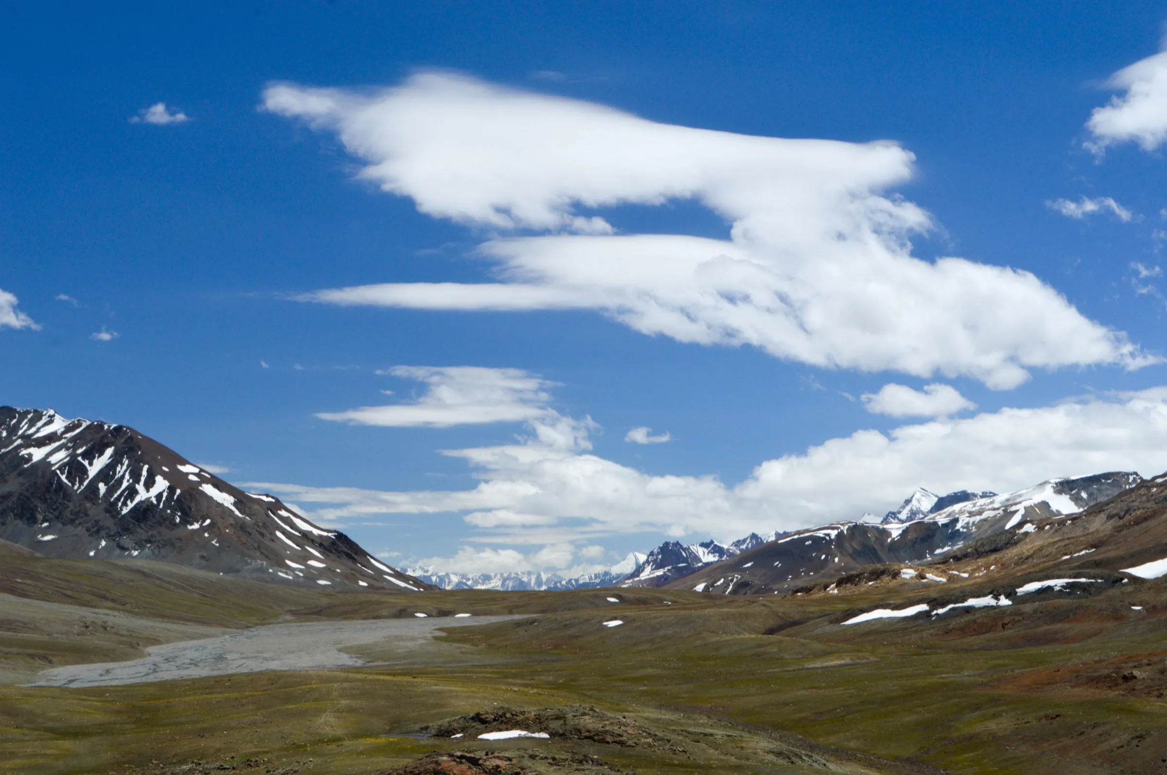
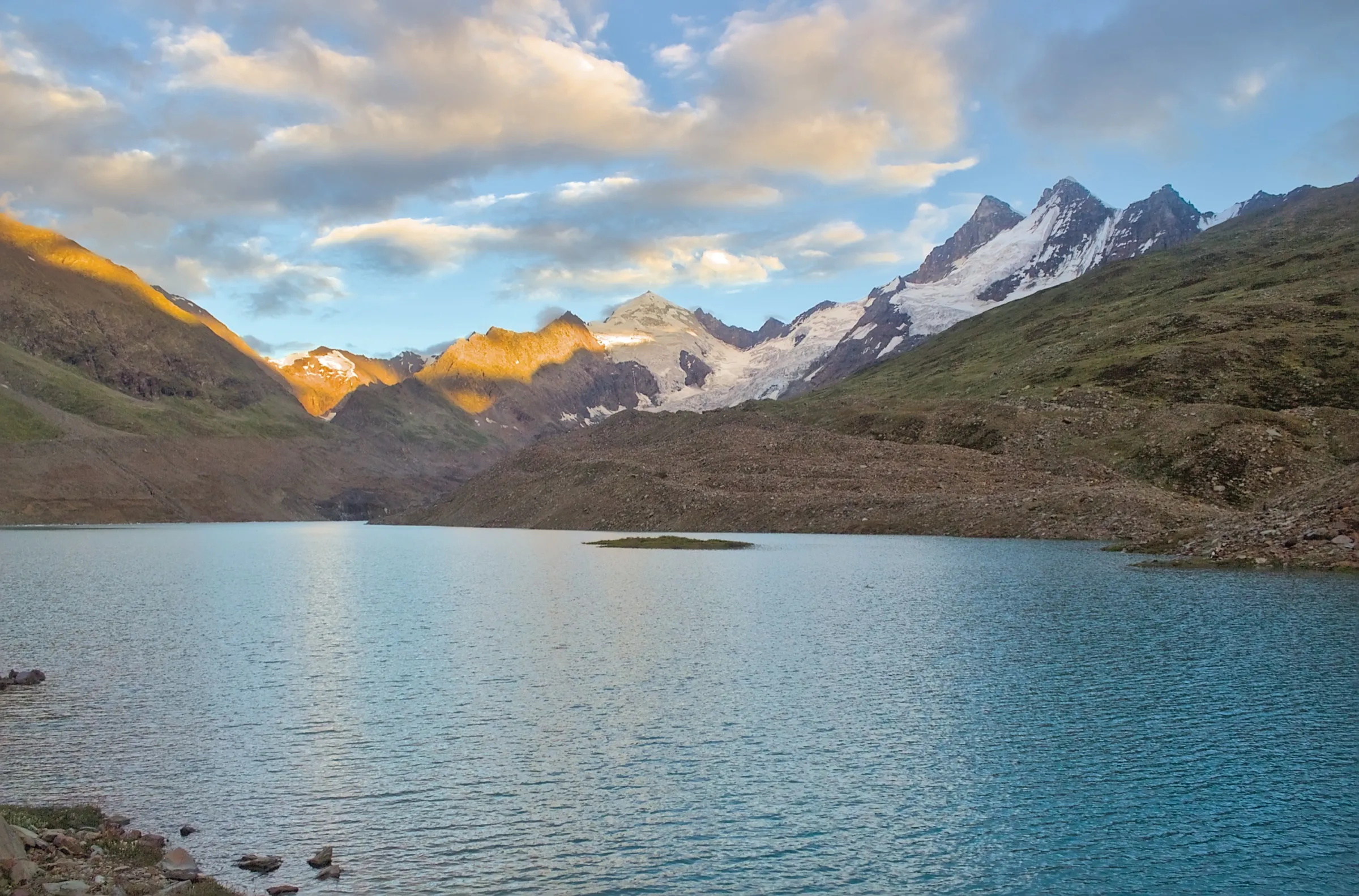
- Shingo La (Shinku La), about 5,090 m, with a small lake, prayer flags and glacier views on the Himachal-Ladakh border
- Gonbo Rangjon, the lone rock tower above Kargyak that Zanskaris call God's Mountain
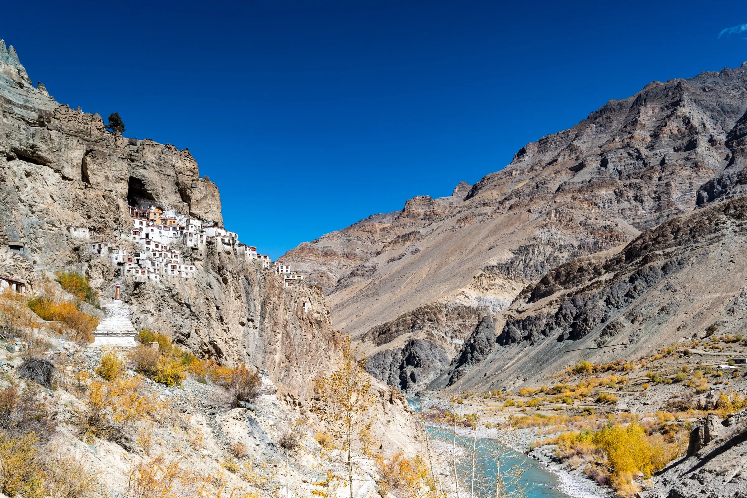
- Phuktal (Phugtal) Gompa, a monastery built into a cliff cave above the Tsarap river
- The villages of the Lungnak valley (Kargyak, Tanze, Testa, Purne) with chortens, mani walls and barley fields
- The old Lahaul-Zanskar trade path, crossing from green Lahaul into the cold desert of Zanskar
Risks
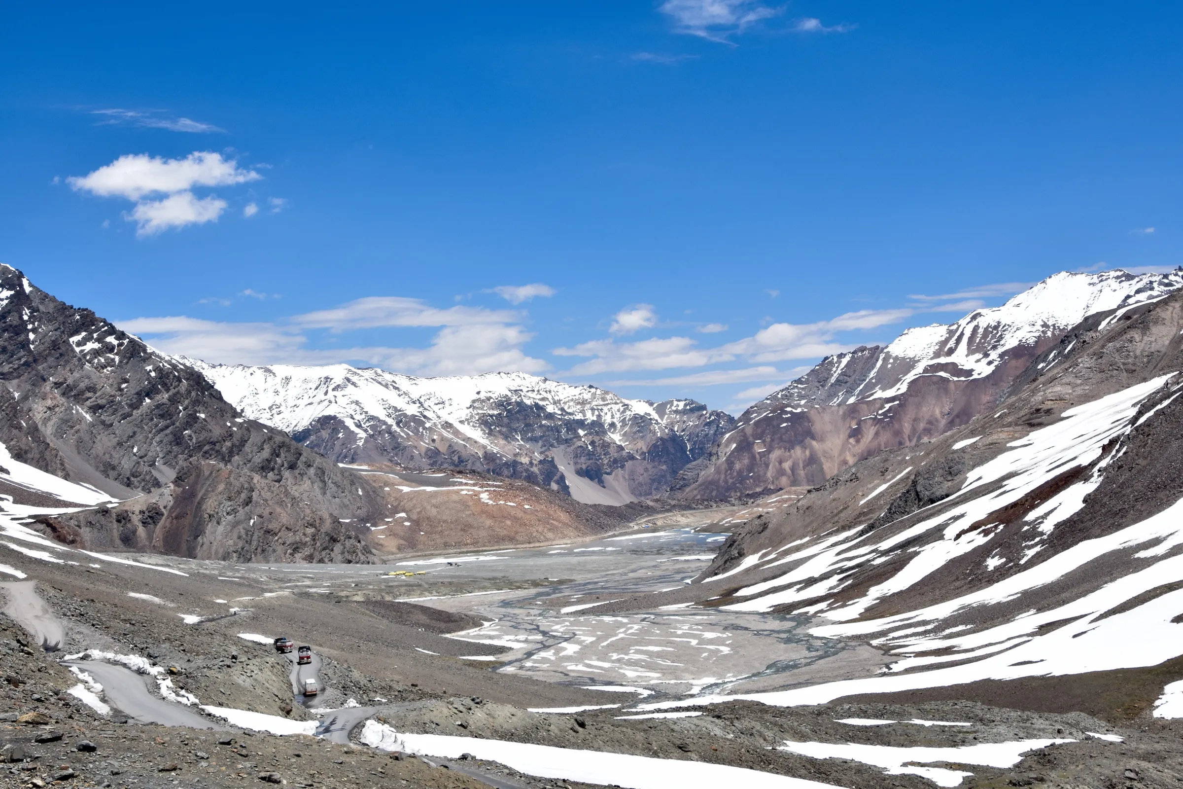
- The classic footpath is now largely a road. A rough road built by Tsultrim Chonjor from Ramjak to Kargyak via Shingo La (2014-2017) was taken over and black-topped by BRO; the Darcha-Shinku La-Padum road carries traffic in summer, an HRTC bus runs to Padum, and a tunnel under the pass is being built (due August 2028). Operators now drive to Ramjak or Chumik Nakpo and pick up near Raru or Hanumil; expect vehicles and road works on parts of the walk.
- Altitude: the pass is reached two or three days after leaving 2,050 m, so acute mountain sickness is a real risk. Outlook Traveller advises walking from Padum to Darcha for better acclimatisation.
- Snow and snowfields near the pass early in the season, and knee-deep or barefoot stream crossings (worst between Lakhang and Kargyak and just beyond the pass).
- The Shinku La road closes after heavy snow (in April 2025 about 45 tourists were stranded on the Zanskar side until BRO cleared it); trekkers can be stranded at either end.
- Since June 2026 the Lahaul-Spiti DDMA requires every trekker to register their route, team and emergency contact with an authorised officer before starting and to check out on return; unauthorised trekking can be fined, and solo trekking is discouraged.
- Remote cold desert with strong sun and wind; long days of 6-8 hours with few shade or water stops on the Zanskar side.
Know before you go
Questions
Is there now a road over Shingo La?
Yes. The Darcha-Shinku La-Padum road is open to traffic in summer (BRO reopened it after snow in April 2025), and a tunnel under the pass is due in 2028. Operators still sell the trek but drive the first and last stages; the walk over the pass, through the Lungnak valley and to Phuktal is still done on foot.
When is the best time for the Darcha Padum trek?
July to September. Himalayan Hikers and TrekUp India give July-September (TrekUp says mid-July to mid-September for safe river crossings); Outlook Traveller gives June to September. The pass is usually snowbound from October to April.
How high is Shingo La and how hard is the trek?
Operators give 5,050-5,100 m; the official sign on the pass reads 16,615.5 ft (about 5,064 m). The pass is not technical, but the quick gain in height and long days make it a difficult trek for most people.
Do I need a permit?
On the Lahaul side, the DDMA has required all trekkers to register with an authorised officer and check out on return since June 2026. We could not confirm an official fee or the current rules on the Zanskar (Ladakh) side, so check in Keylong and Padum before starting.
Should I start from Darcha or Padum?
Either works. From Darcha you reach the pass in two or three days and must acclimatise carefully; from Padum the climb is gradual and you are well acclimatised by the time you cross the pass, which is why Outlook Traveller recommends that direction.
In an emergency
Save these numbers before you lose signal. Tap to call.
- 112All emergenciesIndia’s single emergency number — works in every state
- 108Ambulance
- 1077District disaster control room
You are in
District: Lahaul and Spiti (Himachal Pradesh) and Kargil (Zanskar, Ladakh)Himachal Pradesh · Ladakh
- Nearest hospital
- Keylong (about 30 km from Darcha) on the Himachal side; Padum at the Zanskar end. Evacuation from the pass area is by road over Shinku La when it is open.
- Last ATM
- Keylong or Manali on the Himachal side; carry enough cash for the whole trek, as there is nothing on the trail until Padum.
- Phone network
- Usually none between the Darcha side of the pass and Kargyak. A solar-powered Reliance Jio tower stood at Kargyak in October 2022 (Commons photo), and Phuktal Gompa has a solar internet link; Padum has mobile coverage. Check locally, as coverage is changing with the road.
Before you set off
- Tell someone your route and when you will be back.
- Carry a charged phone and a power bank.
- Download an offline map of the route.
- Turn back if the weather turns bad — the mountain will wait.
Questions about Darcha to Padum
No questions yet. Ask something and trekkers who have done it can answer.
Share your trek photo with #TreksAndTrails
I trekked this
Did Darcha to Padum look different from this page? Tell us what changed and we will check it.
Where this comes from
Sources
Last reviewed:
- The Complete Guide to Darcha Padum Trek (trip report by Rupankar Mahanta, trek done 2011) — Indiahikes
- Darcha Padum Trek — Himalayan Hikers
- Darcha Lamayuru Trek — Bikat Adventures
- Darcha Lamayuru Trek (published 28 Jan 2025) — TrekUp India
- Padum to Darcha Trek — Outlook Traveller
- Shinku La — Wikipedia
- Darcha-Shinku La-Padum road thrown open, 45 stranded tourists evacuated (25 Apr 2025) — The Tribune
- Trekkers must register before hitting Lahaul-Spiti trails now (25 Jun 2026) — The Tribune
- Winter sets in, trekking, climbing banned in Lahaul-Spiti dist (27 Nov 2024) — The Tribune
Photos: Timothy A. Gonsalves, CC BY-SA 4.0; Timothy A. Gonsalves, CC BY-SA 4.0; Timothy A. Gonsalves, CC BY-SA 4.0