Jenukal Gudda Trek
Hassan, Karnataka
Opens without signal on this phone, with the map file and checklist. Saved for offline →
- Max altitude
- 1,380 m
- Days
- 1 day
- Distance
- 8 km
- Difficulty
- Moderate
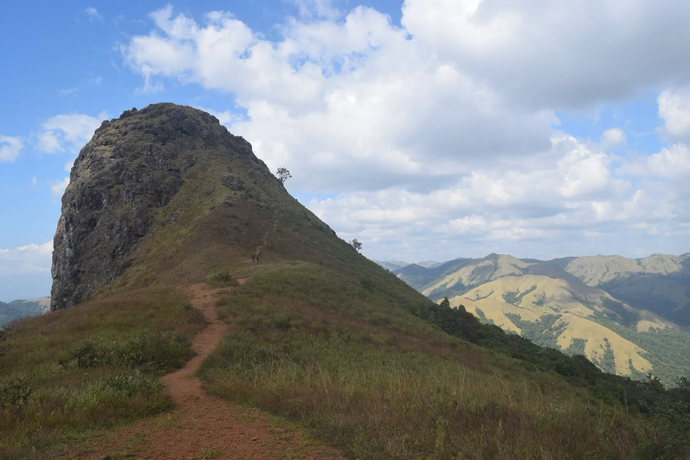
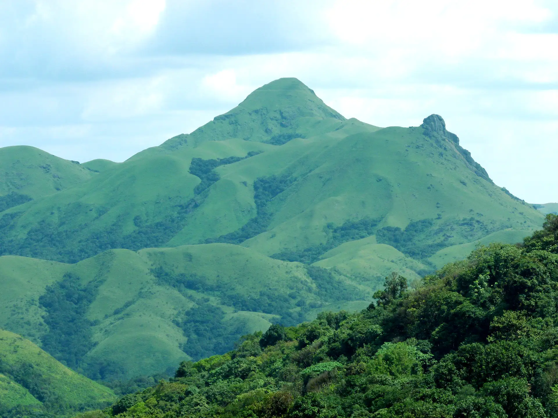
Guides describe the first part from the temple as a gradual climb on a mud road through estates and forest, but the final stretch is very steep, on narrow rocky paths with a drop on one side, and it turns slippery and risky in rain. The round trip takes about 4–5 hours.
Photos
On the trail
The route
Day by day
Day 1 · highest point
Bettada Bhairaveshwara Temple, Mekanagadde → Bettada Bhairaveshwara Temple, Mekanagadde
1,060 m → 1,380 m → 1,060 m
Ups and downs
Altitude profile
Where it is
Map
Trailhead and high point only — not a recorded track. Use it with a proper map.
Weather
Next 5 days on the trail
Live forecast for the trailhead and the high point. Mountain weather changes fast — check again on the morning you start.
Trailhead · Bettada Bhairaveshwara Temple, Mekanagadde
at 1,060 mLoading forecast…
High point · Jenukal Gudda summit
at 1,380 mLoading forecast…
Each day: high / low °C · rain mm and chance · snow cm · wind km/h
Weather data: Open-Meteo.comModel forecast, not an official warning. For alerts follow IMD and the local administration.
Plan the trip
How to reach
- Trailhead
- Bettada Bhairaveshwara Temple, Mekanagadde (nearest town: Sakleshpur)
- Nearest railway
- Sakleshpur
- Nearest airport
- Mangaluru International
- By road
- Sakleshpur (about 35–40 km via Hanbal; the last stretch to the temple is a rough road, and some visitors park about 500 m short and walk); Mudigere (Chikkamagaluru side, via Hosakere); Bengaluru via Hassan and Sakleshpur
- Drive
- About 6 h from Bengaluru
Plan the trip
Permits and fees
We could not confirm the current permit rules and fees from an official source. Check with the local forest department or tourism office before you go.
Plan the trip
Cost
Self-guided
₹1,500–3,500
With an operator
₹1,500–3,000
Per person, ex-Sakleshpur. No operator we found publishes a Jenukal Gudda package, so both ranges are estimates. Guided: Sakleshpur homestays and local guides arrange the walk; for comparison, Thrillophilia's 2-day Sakleshpur camping packages sell at ₹1,499–2,699 per adult (Oct 2026). Self-guided: shared jeep or taxi from Sakleshpur to the temple and back, a homestay night with food, and a local guide's fee if you take one. Check locally whether the Forest Department charges an entry fee.
Gear
Top picks for this trek
The gear that matters most on this route, chosen from its altitude, season and risks.
 Ad · affiliate link
 Ad · affiliate link
 Ad · affiliate link
 Ad · affiliate link
 Ad · affiliate link
 Ad · affiliate link
 Ad · affiliate link
- Ad · affiliate link
Store buttons open a search on that store, not a product we picked. As an Amazon Associate we earn from qualifying purchases. Photos show the kind of item, not a specific product. Affiliate disclosure
Packing checklist
Matched to this trek: altitude, season, days and the risks on the route.
Packed 0 of 17
Tick each item as it goes in the bag.
Know before you go
Good to know
- Mobile network
- Not confirmed by our sources; expect weak or no signal on the ridge.
- Last ATM
- Sakleshpur
- Nearest hospital
- Government taluk hospital, Sakleshpur (about 35–40 km)
- Water
- No water source on the trail is reported; carry at least 2 litres from the homestay or village.
Highlights
- Wikipedia lists it as the highest peak in Hassan district (about 1,380 m), on the Western Ghats crest above the Bisle valley
- The walk starts at the old Bettada Bhairaveshwara temple of Bhagwan Bhairava, set in forest on the ridge
- Path through coffee estates, forest and patches of shola, opening onto open grassland near the top
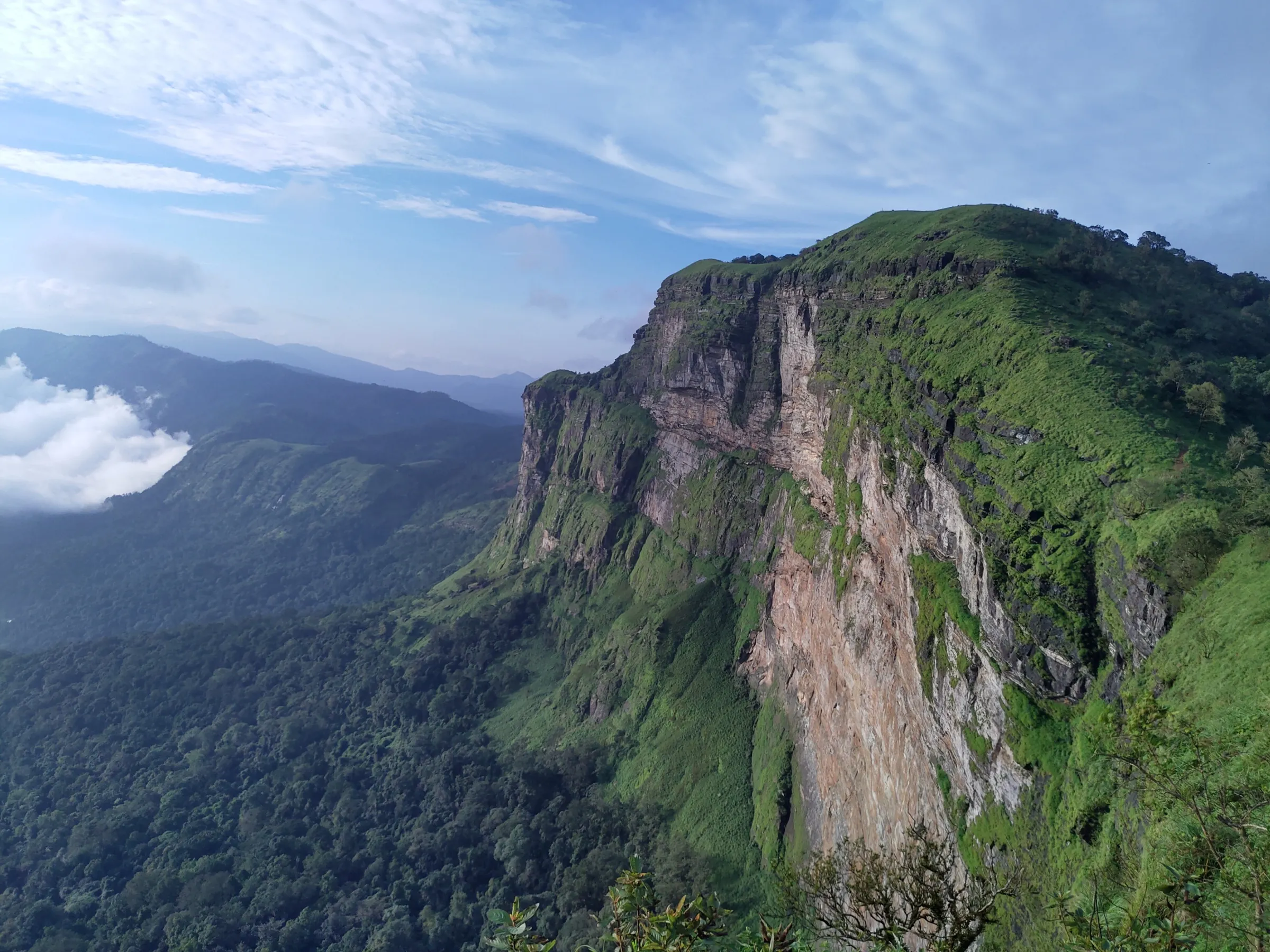
- Summit views over the Western Ghats, with Ettina Bhuja, Deepadakallu and Ombattu Gudda around; guides say the Arabian Sea shows on very clear days
- Name means 'honey rock' in Kannada, after the wild bees and honeycombs on its cliffs
Risks
- Forest status unconfirmed: the upper slopes may be reserve forest under the Karnataka Forest Department, and Hassan district has no treks on the official Aranya Vihaara booking portal (17 Oct 2026). Ask the Sakleshpur range forest office or your homestay before going.
- On 11 May 2026 Karnataka's Chief Wildlife Warden suspended all trekking paths in areas with leopards, tigers, elephants or bears until each is certified safe; this area has elephants, so check that the route is open.
- Final stretch is very steep, narrow and rocky with a drop on one side; guides advise against climbing in the monsoon
- Rough, lonely road to the temple; a trip report advises going in a group of 4–5 and starting early
- Leeches and slippery mud in and after the monsoon; carry salt
- The temple is usually open only briefly in the morning, so do not count on finding anyone there
Know before you go
Questions
How high is Jenukal Gudda?
Wikipedia gives about 1,380 m (4,530 ft) and calls it the highest peak in Hassan district; satellite terrain data reads about 1,360 m at the summit. Some travel sites call it the second-highest peak in Karnataka or print 1,738 m, but those figures are wrong: Mullayanagiri, Kudremukh and others are higher.
Where does the Jenukal Gudda trek start and how long is it?
Most guides start at the Bettada Bhairaveshwara temple near Mekanagadde, about 35–40 km from Sakleshpur. Holidify puts the route at about 8 km and the round trip at 4–5 hours; other guides quote 5 km or less, depending on how far you drive up the estate road.
When is the best time to trek Jenukal Gudda?
October to February, after the monsoon, when the sky is clear and the trail is dry. Guides advise avoiding the monsoon because the steep final section becomes slippery and risky.
Do I need a guide or a permit?
Guides say the trek is best done with a local guide, as the paths through the estates are not marked. We could not confirm a permit or entry fee; the trek is not on the Forest Department's Aranya Vihaara portal, so check with the Sakleshpur forest office or your homestay before you go.
In an emergency
Save these numbers before you lose signal. Tap to call.
- 112All emergenciesIndia’s single emergency number — works in every state
- 108Ambulance
- 1077District disaster control room
You are in
District: HassanKarnataka
- Nearest hospital
- Government taluk hospital, Sakleshpur (about 35–40 km)
- Last ATM
- Sakleshpur
- Phone network
- Not confirmed by our sources; expect weak or no signal on the ridge.
Before you set off
- Tell someone your route and when you will be back.
- Carry a charged phone and a power bank.
- Download an offline map of the route.
- Turn back if the weather turns bad — the mountain will wait.
Questions about Jenukal Gudda
No questions yet. Ask something and trekkers who have done it can answer.
Share your trek photo with #TreksAndTrails
I trekked this
Did Jenukal Gudda look different from this page? Tell us what changed and we will check it.
Where this comes from
Sources
Last reviewed:
- Jenukallu betta, Sakleshpura — Wikipedia
- Jenukal Gudda, Sakleshpur — Holidify
- Best Hiking Spots in Sakleshpur: Trekker's Paradise — Machaan Plantation Resort
- Sakleshpur (trip report) — Tripoto
- Sakleshpur — Wikipedia (Sakleshpur article)
- Sakleshpur | Places to Visit | Waterfalls | Trekking — Karnataka Tourism (official)
- Jenukal Gudda, Sakleshpura — Muddie Trails
- Things to Do in Sakleshpur — Thrillophilia
Photos: L. Shyamal / Wikimedia Commons, CC BY-SA 3.0; L. Shyamal / Wikimedia Commons, CC BY-SA 3.0; Rakdept / Wikimedia Commons, CC BY-SA 4.0