Doddabetta and Abbey Vari Falls Trek
Kodagu, Karnataka
Opens without signal on this phone, with the map file and checklist. Saved for offline →
- Max altitude
- 1,121 m
- Days
- 1 day
- Distance
- 10 km
- Difficulty
- Easy
About 10 km over 5-6 hours with gentle ascents and descents, but the forest path fades under leaf litter and the final drop to Abbey Vari Falls is a steep, slippery scramble with no clear trail; a local guide is advised.
Photos
On the trail
The route
Day by day
Day 1 · highest point
Mallalli Falls trailhead, Kumaralli → Abbey Vari Falls and back to the Heggadahalli road (via Doddabetta summit)
920 m → 1,121 m → 900 m
Ups and downs
Altitude profile
Where it is
Map
Trailhead and high point only — not a recorded track. Use it with a proper map.
Weather
Next 5 days on the trail
Live forecast for the trailhead and the high point. Mountain weather changes fast — check again on the morning you start.
Trailhead · Mallalli Falls trailhead, Kumaralli
at 920 mLoading forecast…
High point · Doddabetta (Gaaligudda) summit, Kodagu
at 1,121 mLoading forecast…
Each day: high / low °C · rain mm and chance · snow cm · wind km/h
Weather data: Open-Meteo.comModel forecast, not an official warning. For alerts follow IMD and the local administration.
Plan the trip
How to reach
- Trailhead
- Mallalli Falls trailhead, Kumaralli (nearest town: Somwarpet)
- Nearest railway
- Hassan
- Nearest airport
- Mangaluru International Airport
- By road
- Somwarpet (about 22 km to the trailhead by auto or homestay vehicle; a private bus leaves Somwarpet for Kumaralli around 7.30 am); Bengaluru (about 280 km; overnight KSRTC and private buses run to Somwarpet)
- Drive
- About 6 h from Bengaluru
Plan the trip
Permits and fees
We could not confirm the current permit rules and fees from an official source. Check with the local forest department or tourism office before you go.
Plan the trip
Cost
Self-guided
₹600–1,500
With an operator
₹1,000–2,500
Per person, ex-Somwarpet, estimates only: no operator sells a published package for this trek. Indiahikes (March 2025) quotes a local guide at about ₹1,500 per group and an auto from Somwarpet to Mallalli at about ₹600 per vehicle (shared by three). Self-guided covers the shared auto both ways, packed food and a share of a guide for the Abbey Vari section; the guided range adds a homestay-arranged guide and vehicle for the Heggadahalli pickup.
Gear
Top picks for this trek
The gear that matters most on this route, chosen from its altitude, season and risks.
 Ad · affiliate link
 Ad · affiliate link
 Ad · affiliate link
 Ad · affiliate link
 Ad · affiliate link
 Ad · affiliate link
- Ad · affiliate link
 Ad · affiliate link
Store buttons open a search on that store, not a product we picked. As an Amazon Associate we earn from qualifying purchases. Photos show the kind of item, not a specific product. Affiliate disclosure
Packing checklist
Matched to this trek: altitude, season, days and the risks on the route.
Packed 0 of 20
Hot days in Mar: start at first light and carry extra water and ORS.
Tick each item as it goes in the bag.
Know before you go
Good to know
- Mobile network
- Not confirmed by our sources; expect patchy signal in the forest sections.
- Last ATM
- Somwarpet
- Nearest hospital
- Somwarpet for first care; Madikeri district hospital for serious cases
- Water
- Only the Giri Hole stream near the start and the pools at Abbey Vari Falls; carry 2-3 litres each. Treat all water.
Highlights
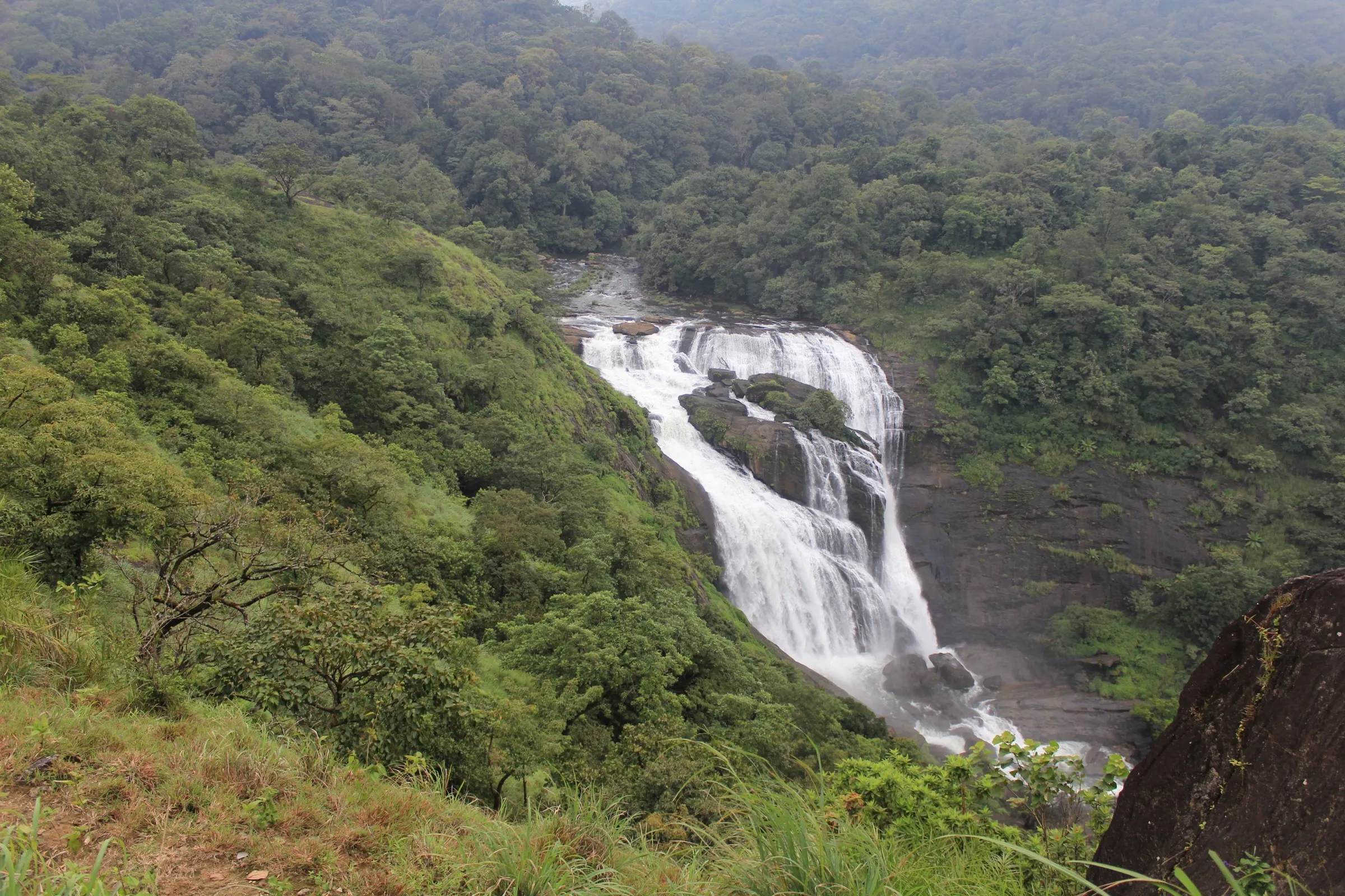
- Standing at the head of Mallalli Falls, looking down the drop that most visitors only see from the steps below
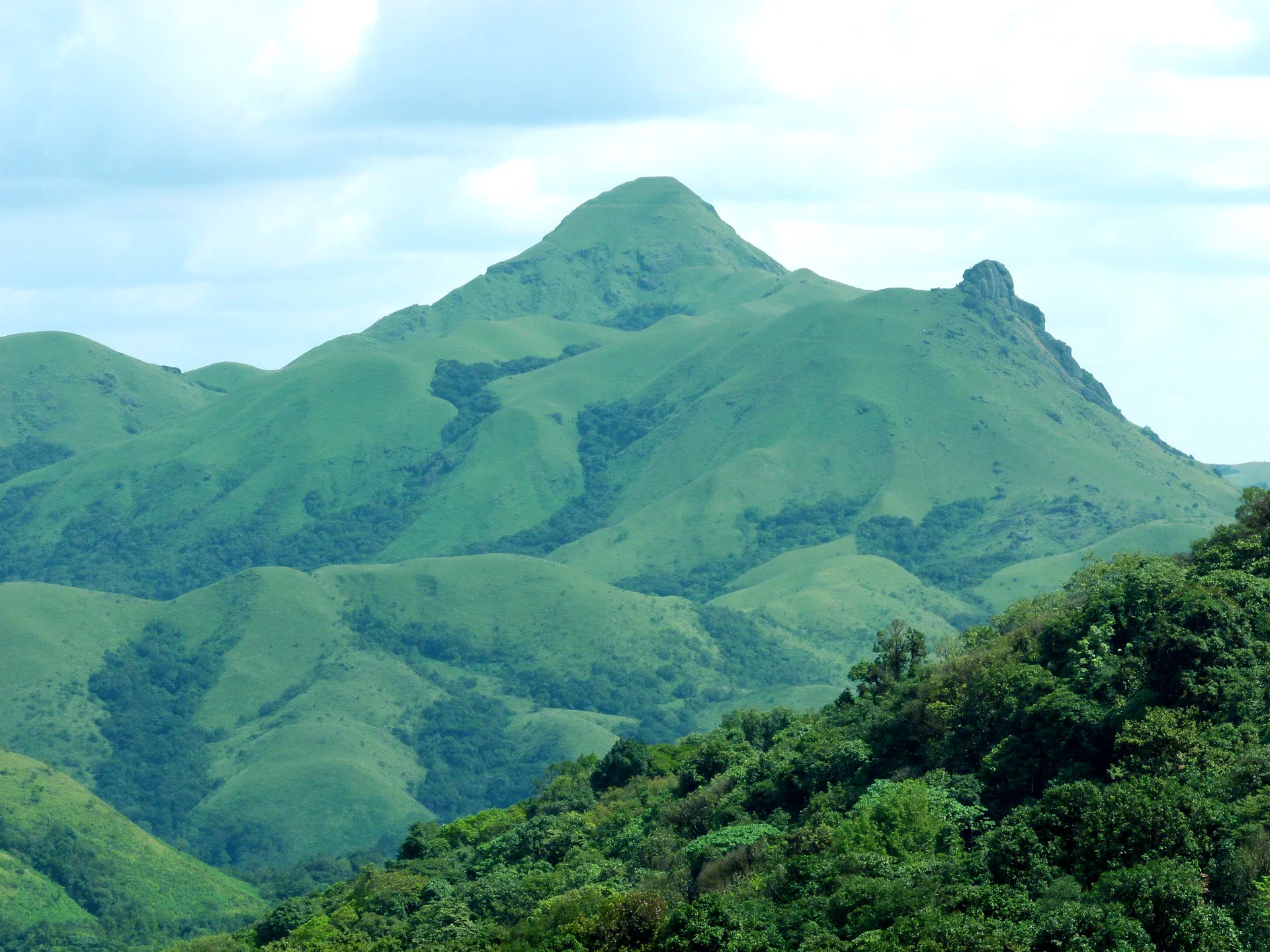
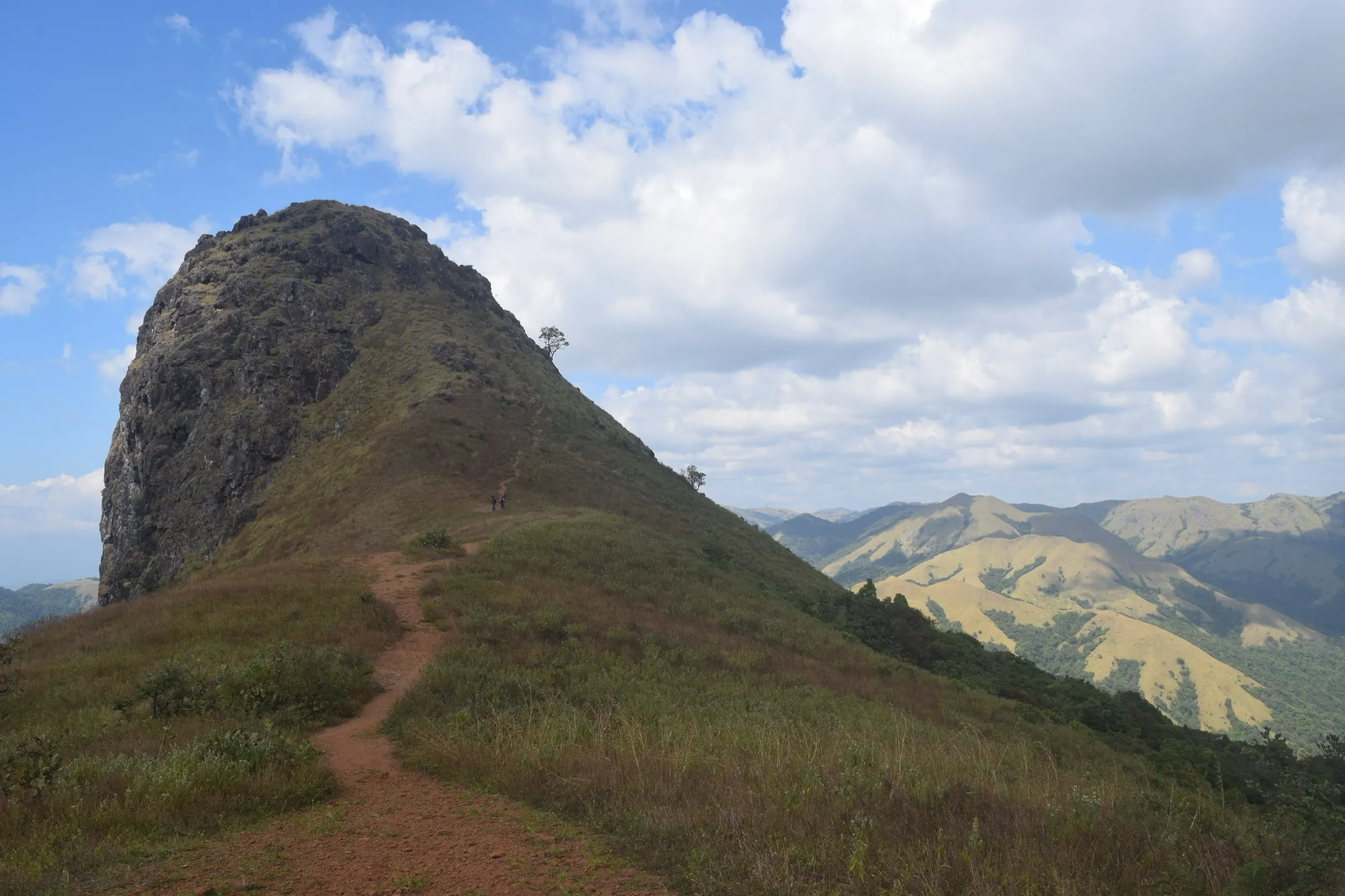
- Windy, waist-high grassland on the final climb to Doddabetta, known locally as Gaaligudda (windy hill)
- Close views of Kumara Parvatha and the Pushpagiri valleys from the summit cairn, with Kote Betta, the Baba Budan hills and Kudremukh in the distance
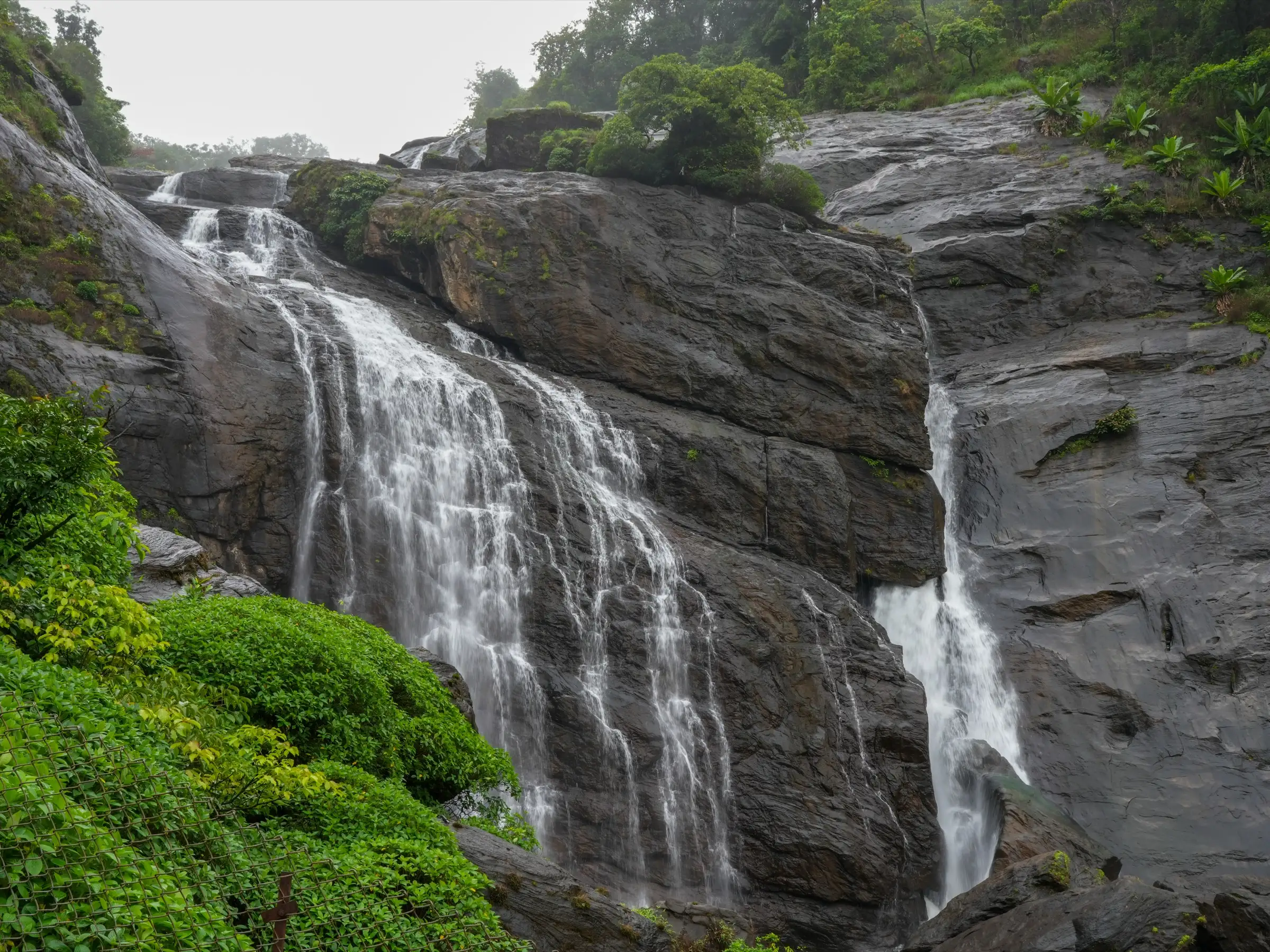
- The secluded Abbey Vari Falls, which spills in stages into clear pools deep in the forest
Risks
- The route to Abbey Vari Falls runs through dense forest where the path disappears under leaf litter and it is easy to get lost; Indiahikes advises a local guide or a recorded GPX track and a turnaround time of 4.30 pm.
- The final descent to Abbey Vari has no clear trail and the rocks at the falls are steep and slippery; in the monsoon the current is dangerously strong and crossing Giri Hole stream is risky, so do not go in heavy rain.
- Open grassland with no shade from the forest edge to the summit; the midday sun is harsh, and summer (after March) is not recommended.
- The trail borders Pushpagiri Wildlife Sanctuary (tracks of wild boar and wild dogs are seen). In May 2026 Karnataka's Chief Wildlife Warden suspended trekking paths in leopard, tiger, elephant and bear areas until each is certified against the trekking SOP; check with the Somwarpet forest office before going.
- There is only one bus back from Kumaralli to Somwarpet (about 4 pm); arrange a vehicle in advance.
Know before you go
Questions
Is this the same Doddabetta as the peak near Ooty?
No. This Doddabetta is a small grassy hill near Kumaralli village in Somwarpet taluk, Kodagu (Coorg), Karnataka, behind Kumara Parvatha. The famous Doddabetta near Ooty is in the Nilgiris of Tamil Nadu.
Do I need a permit for the Doddabetta-Abbey Vari trek?
Indiahikes (March 2025) says no permit is needed because the route lies just outside Pushpagiri Wildlife Sanctuary. We could not confirm this from an official source, and Karnataka tightened trekking rules in 2025-26, so check with the forest office in Somwarpet before you go.
Is the trek suitable for beginners?
Yes for the Doddabetta part: about 10 km in all with gentle climbs, rated easy to moderate. The last stretch to Abbey Vari Falls is a tricky, unmarked descent through forest, so beginners should take a local guide.
When is the best time to go?
September to March. September has full streams and wildflowers; winter turns the grassland golden and the streams are safe to cross. Peak monsoon makes the stream crossings risky, and after March the open grassland is very hot.
How do I reach the trailhead?
Take an overnight bus from Bengaluru to Somwarpet. From there a private bus to Kumaralli leaves around 7.30 am, or an auto costs about ₹600 per vehicle to Mallalli. The trailhead is about 22 km from Somwarpet, a short way before the Mallalli Falls parking.
In an emergency
Save these numbers before you lose signal. Tap to call.
- 112All emergenciesIndia’s single emergency number — works in every state
- 108Ambulance
- 1077District disaster control room
You are in
District: KodaguKarnataka
- Nearest hospital
- Somwarpet for first care; Madikeri district hospital for serious cases
- Last ATM
- Somwarpet
- Phone network
- Not confirmed by our sources; expect patchy signal in the forest sections.
Before you set off
- Tell someone your route and when you will be back.
- Carry a charged phone and a power bank.
- Download an offline map of the route.
- Turn back if the weather turns bad — the mountain will wait.
Questions about Doddabetta and Abbey Vari Falls
No questions yet. Ask something and trekkers who have done it can answer.
Share your trek photo with #TreksAndTrails
I trekked this
Did Doddabetta and Abbey Vari Falls look different from this page? Tell us what changed and we will check it.
Where this comes from
Sources
Last reviewed:
Photos: Timothy A. Gonsalves, CC BY-SA 4.0; Timothy A. Gonsalves, CC BY-SA 4.0; Nagaraj Sinhasan, CC BY-SA 4.0