Ballalarayana Durga Trek
Chikkamagaluru (Mudigere taluk), on the Dakshina Kannada border, Karnataka
Opens without signal on this phone, with the map file and checklist. Saved for offline →
- Max altitude
- 1,509 m
- Days
- 1 day
- Distance
- 6 km
- Difficulty
- Moderate
Only about 300 m of climb over 3 km each way, but the forest sections have a short rock step with uneven natural footholds, slippery landslide-prone slopes with a drop on one side, leeches in the rains and an exposed, very windy grassland ridge.
Photos
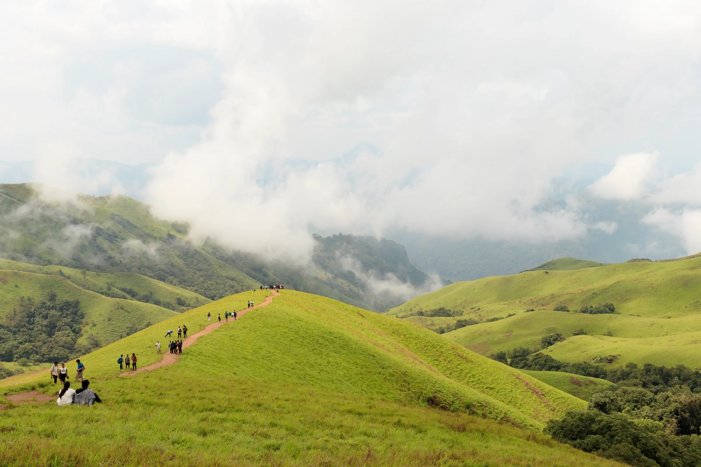
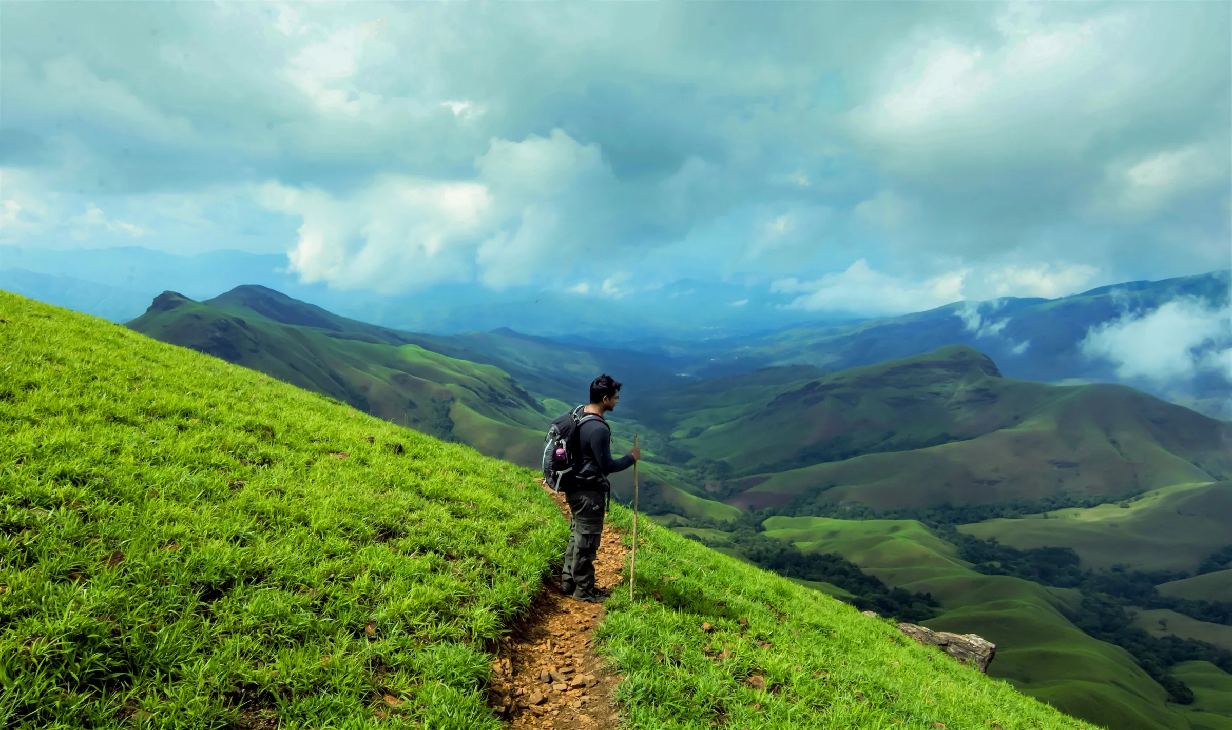
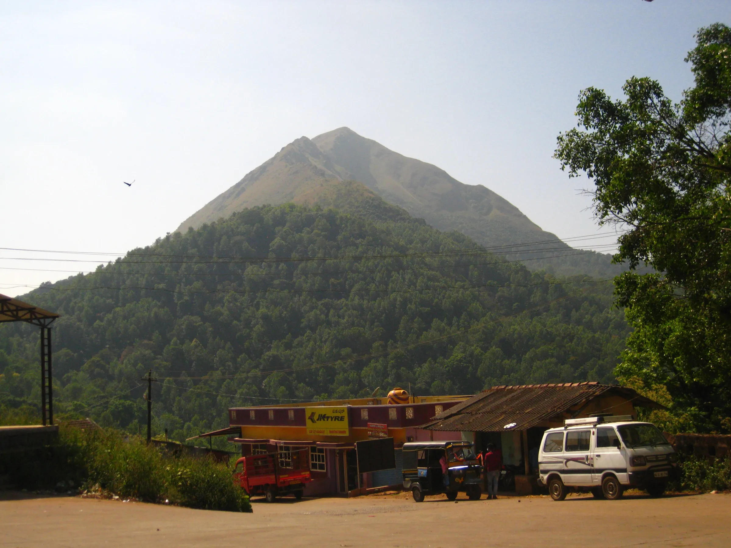
On the trail
The route
Day by day
Day 1 · highest point
Rani Jhari View Point road-head → Rani Jhari View Point road-head (via Ballalarayana Durga fort)
1,210 m → 1,509 m → 1,210 m
Ups and downs
Altitude profile
Where it is
Map
Trailhead and high point only — not a recorded track. Use it with a proper map.
Weather
Next 5 days on the trail
Live forecast for the trailhead and the high point. Mountain weather changes fast — check again on the morning you start.
Trailhead · Rani Jhari View Point road-head, above Durgadahalli
at 1,210 mLoading forecast…
High point · Ballalarayana Durga fort ruins
at 1,509 mLoading forecast…
Each day: high / low °C · rain mm and chance · snow cm · wind km/h
Weather data: Open-Meteo.comModel forecast, not an official warning. For alerts follow IMD and the local administration.
Plan the trip
How to reach
- Trailhead
- Rani Jhari View Point road-head, above Durgadahalli (nearest town: Mudigere)
- Nearest railway
- Mangaluru Central (about 118 km)
- Nearest airport
- Mangaluru International Airport
- By road
- Bengaluru (about 280 km via Hassan, Belur, Mudigere and Kottigehara; turn off the Kottigehara–Kalasa road at the Ballalarayana Durga arch near Sunkasale, then about 6.5 km to Durgadahalli); Mudigere (buses to Sunkasale; few jeeps run on from Sunkasale to Durgadahalli); Dharmasthala / Ujire, for the longer route up from Mundaje on the Dakshina Kannada side
- Drive
- About 6.5 h from Bengaluru
Plan the trip
Permits and fees
We could not confirm the current permit rules and fees from an official source. Check with the local forest department or tourism office before you go.
Plan the trip
Cost
Self-guided
₹2,000–4,500
With an operator
₹3,950–7,250
Per person, ex-Bengaluru. Guided prices seen October 2026 are for longer weekend trips that add Bandaje Falls: Muddie Trails from ₹3,950 (transport, homestay, forest fees) and BMC Adventures ₹7,250 (3 days, with Ettina Bhuja). Self-guided is an estimate: overnight bus to Mudigere and back, local bus or jeep to Durgadahalli, a homestay night, food and the Aranya Vihaara booking (fee not confirmed from a dated official notice; Indiahikes quotes an older ₹250).
Gear
Top picks for this trek
The gear that matters most on this route, chosen from its altitude, season and risks.
 Ad · affiliate link
 Ad · affiliate link
 Ad · affiliate link
 Ad · affiliate link
 Ad · affiliate link
- Ad · affiliate link
 Ad · affiliate link
 Ad · affiliate link
Store buttons open a search on that store, not a product we picked. As an Amazon Associate we earn from qualifying purchases. Photos show the kind of item, not a specific product. Affiliate disclosure
Packing checklist
Matched to this trek: altitude, season, days and the risks on the route.
Packed 0 of 23
Monsoon months (Jul–Sep): pack everything in plastic or a dry bag and wear shoes with good grip.
Tick each item as it goes in the bag.
Know before you go
Good to know
- Mobile network
- Major networks work at the road-head; Bikat Adventures reports no signal on the trail.
- Last ATM
- Mudigere (about 35 km); not confirmed for Kottigehara or Sunkasale.
- Nearest hospital
- Taluk hospital at Mudigere (about 35 km); larger hospitals in Ujire and Mangaluru on the coastal side.
- Water
- No drinking water at the road-head or on the trail (the tank at Kalabhyraveshwara Temple is not drinkable). Fill at least 2 litres per person at Sunkasale.
Highlights
- Ruins of a hill fort credited to the Hoysala king Veera Ballala I, with bastions and stone foundations on the summit
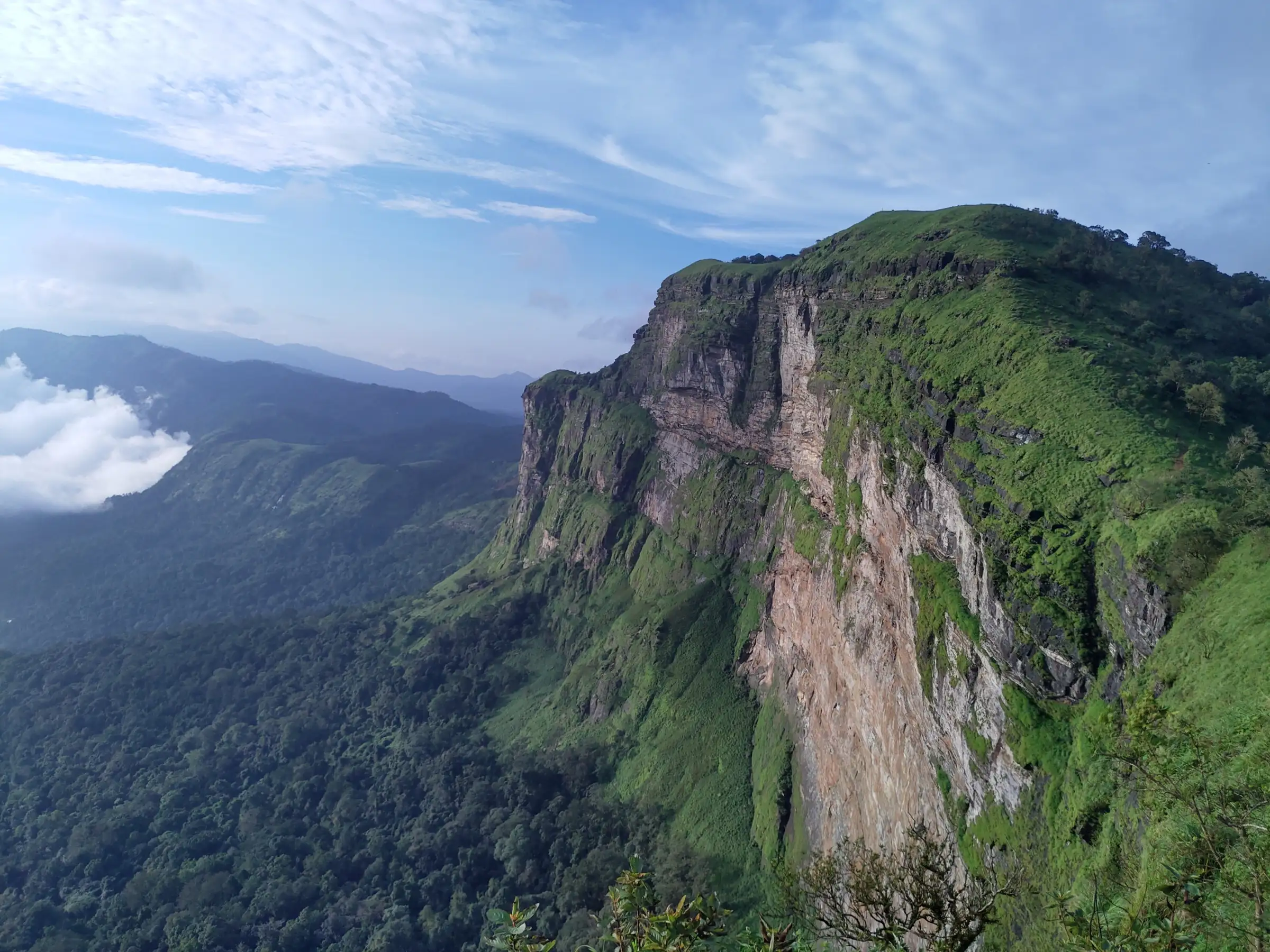
- Rani Jhari View Point, a sheer cliff edge looking over the Kudremukh range, a short detour near the start
- Shola forest with rock steps, then open shola grassland that turns bright green in the monsoon
- One of the few Western Ghats treks that operators run in the monsoon; the trail can be extended to Bandaje Falls (booked separately)
Risks
- Slippery mud and loose gravel in the forest sections in the rains, with a drop of about 15 m beside the trail on one stretch; use trekking poles.
- Strong cross-winds on the exposed grassland ridge beyond the fort, especially in the monsoon.
- Leeches in the forest from June to October.
- Little shade and hot, dry grassland in April–May; Indiahikes and Bikat Adventures advise against summer.
- Several forks in the forest; Indiahikes and Bikat advise keeping right at each fork. Unauthorised trekking is not allowed and camping on the trail is not permitted (Bikat).
Know before you go
Questions
Do I need to book the Ballalarayana Durga trek?
Yes. The Karnataka Forest Department sells slots on its Aranya Vihaara portal (aranyavihaara.karnataka.gov.in), listed as 'Ballalarayandurgakote' under Chikkamagaluru district: 6 km, about 4 hours, from Rani Jhari View Point to the fort. Bookings open up to 30 days ahead and close the day before. Check the portal for the current fee.
How long is the trek and how hard is it?
About 3 km each way (6 km return) and 4 hours from the Rani Jhari road-head. It is graded easy-moderate: the climb is only about 300 m, but the forest stretches are steep, slippery and leech-filled in the rains.
Can I do it in the monsoon?
Yes. Indiahikes and Bikat Adventures call it one of the few Western Ghats treks suited to the monsoon, recommended from July to March; skip April–May, when the grassland is dry and hot.
Can I continue to Bandaje Falls?
Yes, a trail continues about 3.5–4 km over grassland from the fort to the top of Bandaje Falls. The Forest Department lists it as a separate trek (Bandaje waterfall trek, 12 km, about 6 hours) on Aranya Vihaara, so book that one if you want to go on to the falls.
How do I reach the start?
Drive via Mudigere and Kottigehara towards Kalasa and turn at the Ballalarayana Durga arch near Sunkasale; Durgadahalli and its Kalabhyraveshwara Temple are about 6.5 km on. SUVs can go about 1 km further to the trail start; cars park at the temple. By bus, go to Mudigere, then Sunkasale, then find a jeep.
In an emergency
Save these numbers before you lose signal. Tap to call.
- 112All emergenciesIndia’s single emergency number — works in every state
- 108Ambulance
- 1077District disaster control room
You are in
District: Chikkamagaluru (Mudigere taluk), on the Dakshina Kannada borderKarnataka
- Nearest hospital
- Taluk hospital at Mudigere (about 35 km); larger hospitals in Ujire and Mangaluru on the coastal side.
- Last ATM
- Mudigere (about 35 km); not confirmed for Kottigehara or Sunkasale.
- Phone network
- Major networks work at the road-head; Bikat Adventures reports no signal on the trail.
Before you set off
- Tell someone your route and when you will be back.
- Carry a charged phone and a power bank.
- Download an offline map of the route.
- Turn back if the weather turns bad — the mountain will wait.
Questions about Ballalarayana Durga
No questions yet. Ask something and trekkers who have done it can answer.
Share your trek photo with #TreksAndTrails
I trekked this
Did Ballalarayana Durga look different from this page? Tell us what changed and we will check it.
Where this comes from
Sources
Last reviewed:
- Aranya Vihaara – Ballalarayandurgakote (Chikkamagaluru, trek id 85) — Karnataka Forest Department (official)
- ಬಲ್ಲಾಳ ರಾಯನ ದುರ್ಗ — Kannada Wikipedia
- The Complete Guide to Ballalarayana Durga Trek — Indiahikes
- A DIY Guide to Ballalarayana Durga-Bandaje Falls Trek — Bikat Adventures
- Bandaje Falls & Ettina Bhuja Trek - 3 Days — BMC Adventures
- Misty Trek To Ballalarayana Durga Fort — Thrillophilia
- Ballalarayanadurga Trek & Bandaje Waterfalls – Weekend Getaway From Bangalore — Muddie Trails
- Trek to Ballalaryandurga and Bandaje falls (path) — OpenStreetMap
Photos: solarisgirl, CC BY-SA 2.0; solarisgirl, CC BY-SA 2.0; Sumesh Always, Public domain