Netravathi Trek
Dakshina Kannada (summit, Belthangady taluk) / Chikkamagaluru (Samse base, Kalasa taluk), Karnataka
Opens without signal on this phone, with the map file and checklist. Saved for offline →
- Max altitude
- 1,520 m
- Days
- 1 day
- Distance
- 12 km
- Difficulty
- Moderate
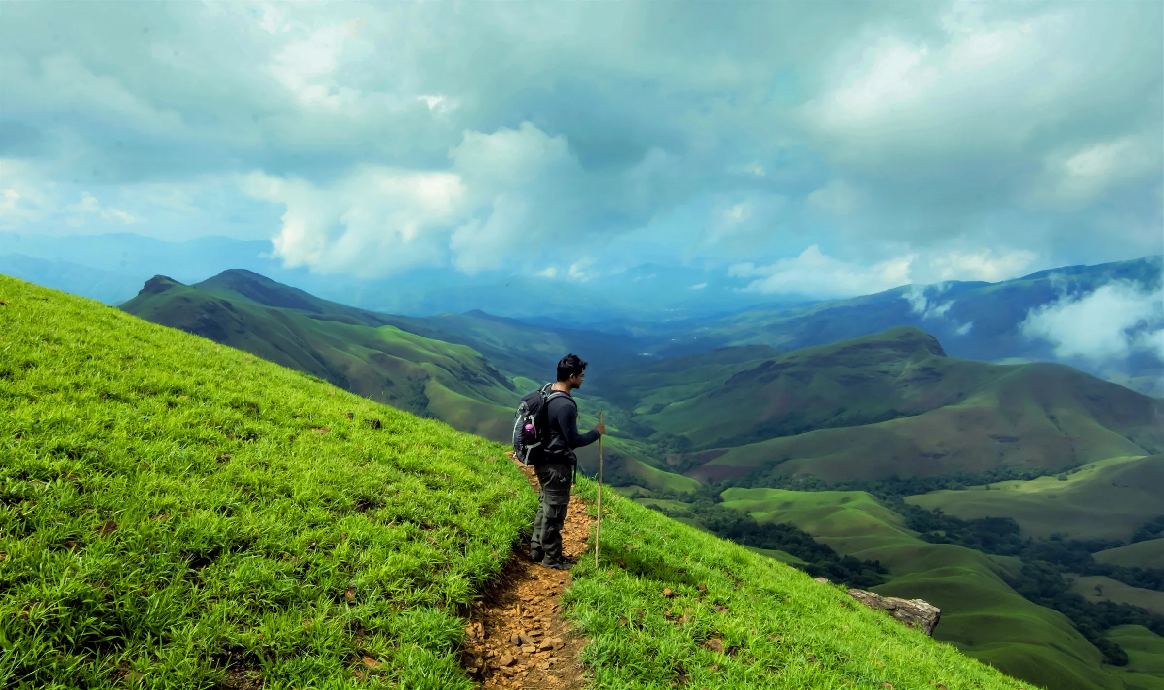
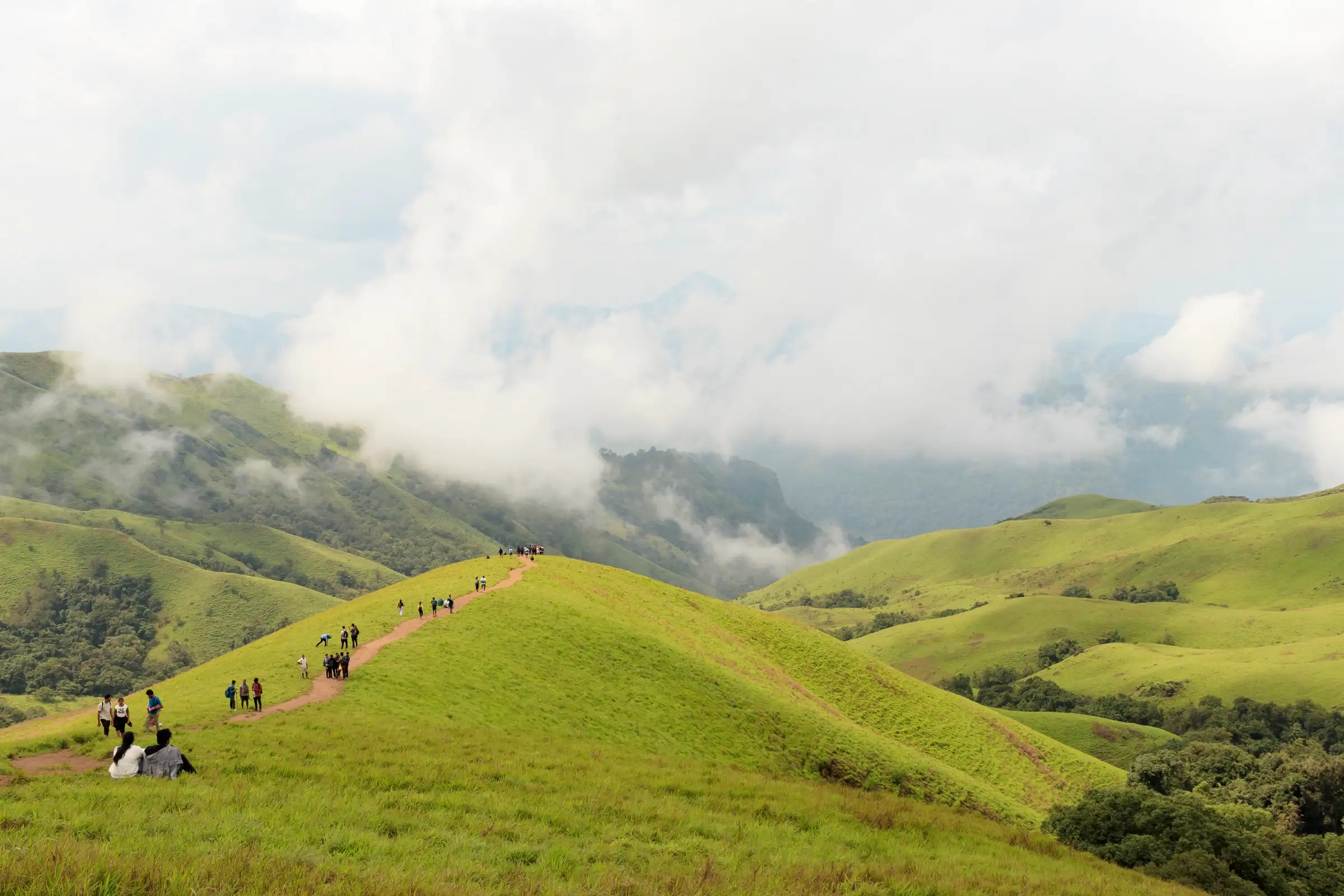
About 12 km there and back with roughly 700 m of climb. The first half is shola forest with two stream crossings that run high and slippery in the monsoon; the last stretch is a steep grassland climb over several false summits with little shade. No technical sections.
Photos
On the trail
The route
Day by day
Day 1 · highest point
Netravathi trek base, Samse → Netravathi trek base, Samse (via Netravathi Peak)
800 m → 1,520 m → 800 m
Ups and downs
Altitude profile
Where it is
Map
Trailhead and high point only — not a recorded track. Use it with a proper map.
Weather
Next 5 days on the trail
Live forecast for the trailhead and the high point. Mountain weather changes fast — check again on the morning you start.
Trailhead · Netravathi trek base (forest checkpost), Samse
at 800 mLoading forecast…
High point · Netravathi (Netravati) Peak summit, Kudremukh National Park
at 1,520 mLoading forecast…
Each day: high / low °C · rain mm and chance · snow cm · wind km/h
Weather data: Open-Meteo.comModel forecast, not an official warning. For alerts follow IMD and the local administration.
Plan the trip
How to reach
- Trailhead
- Netravathi trek base (forest checkpost), Samse (nearest town: Kalasa)
- Nearest railway
- Mangaluru Junction (about 130 km by road via Karkala or Belthangady–Kalasa), or Kadur / Chikkamagaluru on the Bengaluru side; then a bus to Kalasa
- Nearest airport
- Mangaluru International Airport (about 130 km); Kempegowda International Airport, Bengaluru (about 330 km)
- By road
- Bengaluru (about 326 km via Hassan, Mudigere and Kottigehara to Kalasa, then about 14 km to Samse). Overnight KSRTC and private buses leave Bengaluru around 9 PM and reach Kalasa by about 6 AM.; Kalasa (about 14 km): buses towards Karkala/Udupi stop at Samse, or take an auto (₹300–400); from Samse a hired jeep goes to the trek base (about ₹2,300 return for up to 7 people)
- Drive
- About 8 h from Bengaluru
Plan the trip
Permits and fees
We could not confirm the current permit rules and fees from an official source. Check with the local forest department or tourism office before you go.
Plan the trip
Cost
Self-guided
₹2,800–4,500
With an operator
₹4,450–4,839
Per person, ex-Bengaluru, overnight trip with one night at a Samse/Kalasa homestay. Guided prices seen October 2026: Muddie Trails ₹4,450 (transport, homestay or camp, meals, permits, jeep and forest guide) and BMC Adventures ₹4,839 (transport, dorm or tent, meals, forest permission; GST extra). Self-guided is an estimate: overnight bus Bengaluru–Kalasa and back, a shared jeep to the trek base, a share of the mandatory guide (Indiahikes quotes ₹1,500 per guide for up to 10 people), a homestay and the Aranya Vihaara fee (Indiahikes says ₹500 above age 12, but we found no dated official fee notice).
Gear
Top picks for this trek
The gear that matters most on this route, chosen from its altitude, season and risks.
 Ad · affiliate link
 Ad · affiliate link
 Ad · affiliate link
 Ad · affiliate link
 Ad · affiliate link
- Ad · affiliate link
 Ad · affiliate link
 Ad · affiliate link
Store buttons open a search on that store, not a product we picked. As an Amazon Associate we earn from qualifying purchases. Photos show the kind of item, not a specific product. Affiliate disclosure
Packing checklist
Matched to this trek: altitude, season, days and the risks on the route.
Packed 0 of 24
Monsoon months (Sep): pack everything in plastic or a dry bag and wear shoes with good grip.
Tick each item as it goes in the bag.
Know before you go
Good to know
- Mobile network
- Not confirmed by our sources. Expect weak or no signal on the trail; tell someone your plan before you leave Samse.
- Last ATM
- Kalasa, about 14 km from Samse
- Nearest hospital
- Kalasa for first care; Chikkamagaluru or Mangaluru for serious cases
- Water
- A two-tier waterfall about 0.8 km in and a stream about 2 km in carry water in and after the monsoon; there is none on the open grassland above. Samse is the last place for food. Carry 2 litres and purification tablets if unsure.
Highlights
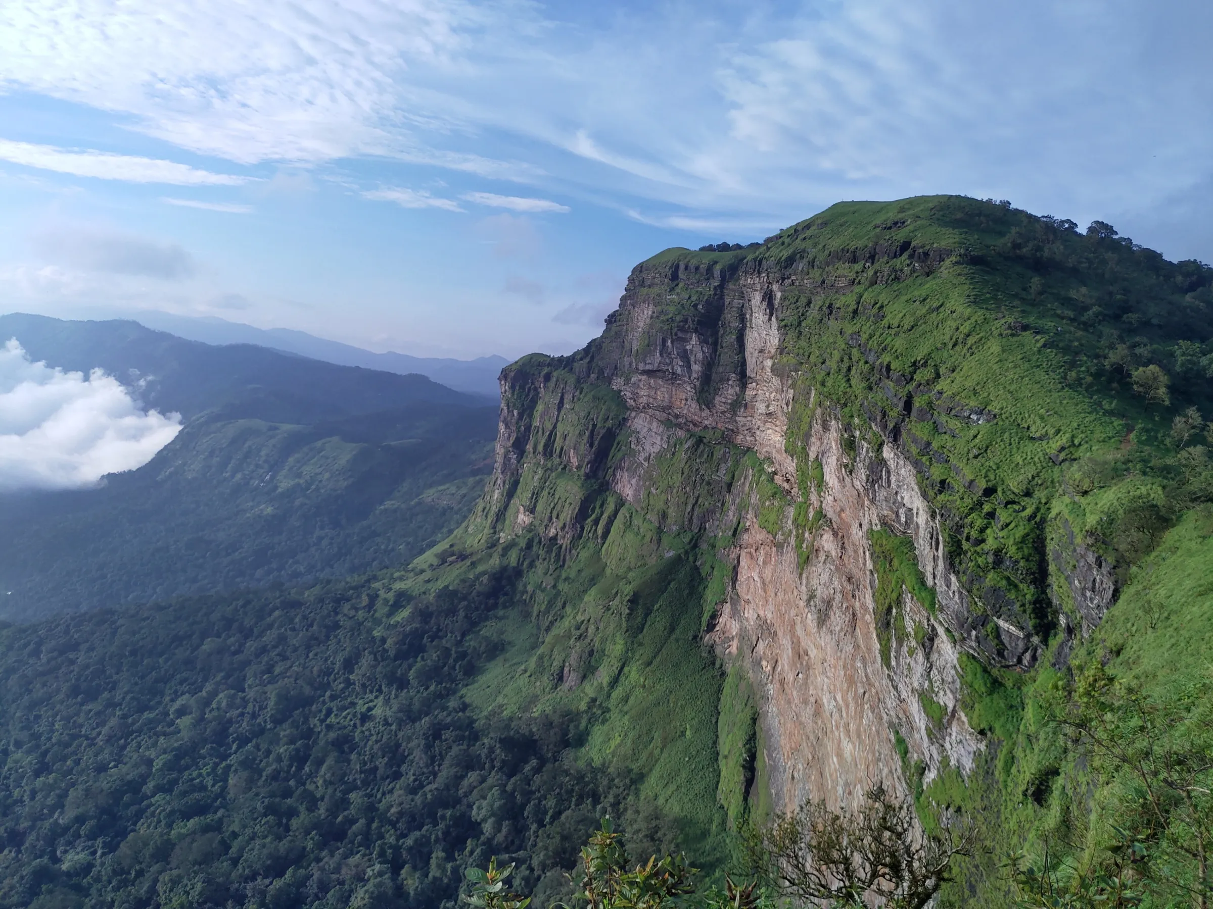
- Rolling shola grassland ridges with views of Kudremukh Peak and the Rani Jhari cliff on a clear day
- Looking straight down from the summit edge to the towns and villages of Belthangady
- Shola forest, a two-tier waterfall and stream crossings in the first half of the trail
- The Netravathi river rises in these hills of the Kudremukh range, and the peak takes its name from it
- Clouds pour over the ridges during and after the monsoon
Risks
- Entry only with an Aranya Vihaara booking (district Dakshina Kannada, 'Nethravathi Trek'); there are no walk-in or offline permits, and weekend slots sell out fast. Carry the ID used for booking.
- Trekking is allowed only by day: Indiahikes reports that nobody is let past the forest checkpoint after 2:30 PM. Start by 7 AM.
- A guide is compulsory: the Kudremukh Wildlife Division's 2026 SOP requires one guide for every batch of 10 trekkers.
- Stream crossings and moss-covered rocks are slippery, and water can run high at the peak of the monsoon; leeches are common in wet months.
- The dry-season fire closure can start as early as January (the 2026 calendar blocked almost all of January) — check the portal before planning a winter trip.
- Steep, exposed grassland near the top: heat and dehydration on clear days, poor visibility in cloud. Stay on the marked trail.
- A travel blog reports a cap of 50 trekkers a day and non-refundable permits from the 2026 season; we could not confirm this from an official notice.
Know before you go
Questions
How do I book the Netravathi Peak trek?
Only online, on the Karnataka Forest Department's Aranya Vihaara portal (aranyavihaara.karnataka.gov.in): choose district Dakshina Kannada and 'Nethravathi Trek'. Bookings open up to 30 days ahead and close a day before; there are no walk-in permits. Check the portal for the current fee and slot.
How long is the Netravathi trek and how long does it take?
About 12 km there and back from the trek base near Samse (operators quote 12–14 km), taking 6–7 hours with stops. Indiahikes lists 6.4 km for the forest sections alone, but its own timings (about 5 hours up and 3.5–4 hours down) fit the longer figure.
Is a guide mandatory for Netravathi?
Yes. Under the Kudremukh Wildlife Division's trekking SOP one guide goes with every batch of 10 trekkers. Homestays near Samse usually arrange the guide; Indiahikes quotes about ₹1,500 per guide.
Is the Netravathi trek open all year?
No. It shuts in the dry season for wildfire risk: in 2026 the booking calendar was blocked from 5 Jan to 31 May, and in 2025 the trail reopened on 1 May. It is open in the monsoon and after, though single days can be blocked for heavy rain. September to December is the most dependable window.
Netravathi or Kudremukh — which is easier?
Netravathi. It is about 12 km against Kudremukh's 20 km or more, with less sustained climbing and no technical sections, so fit beginners can do it. Kudremukh is the longer, harder full-day trek.
Where is the Netravathi trek base?
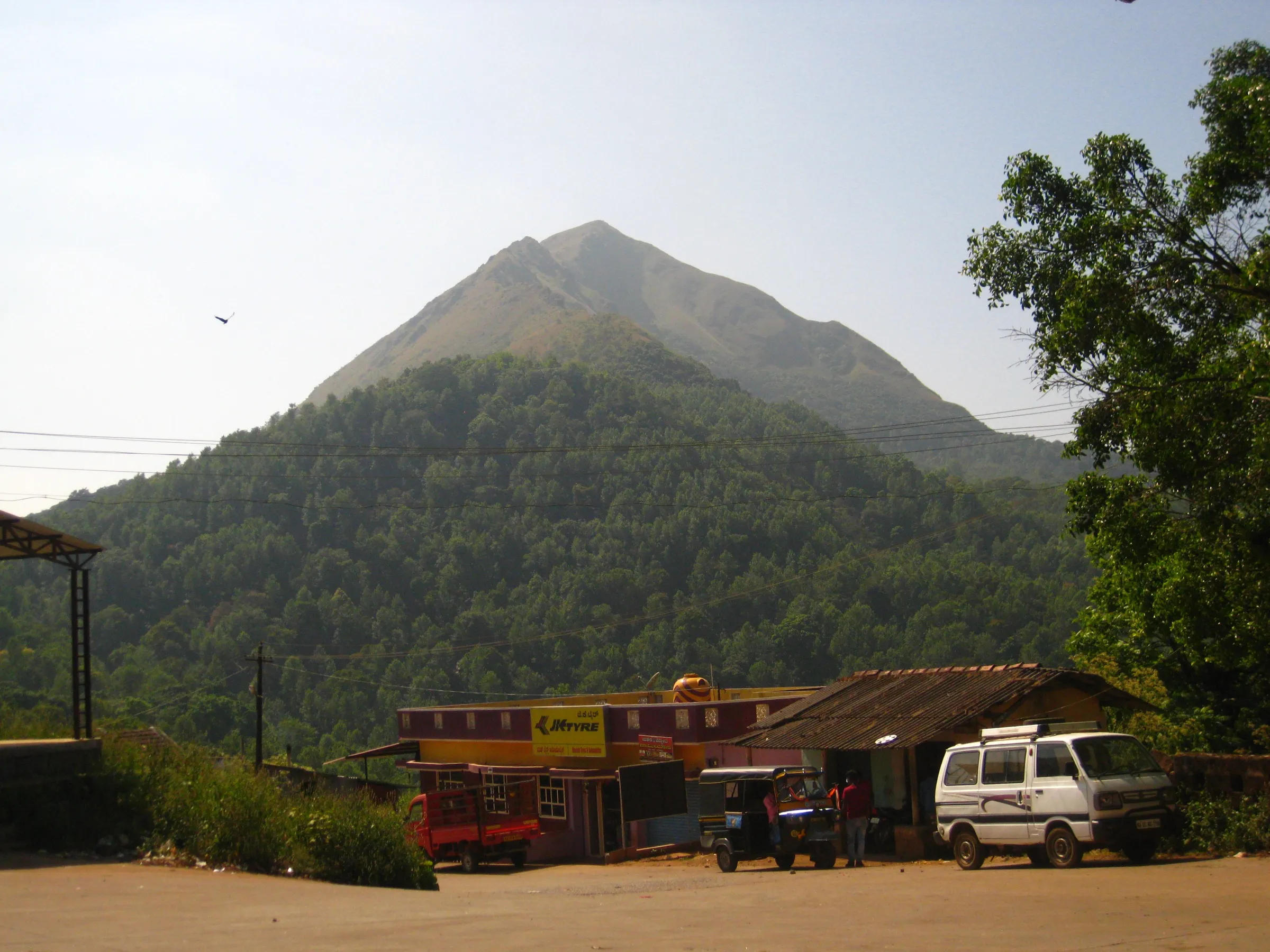
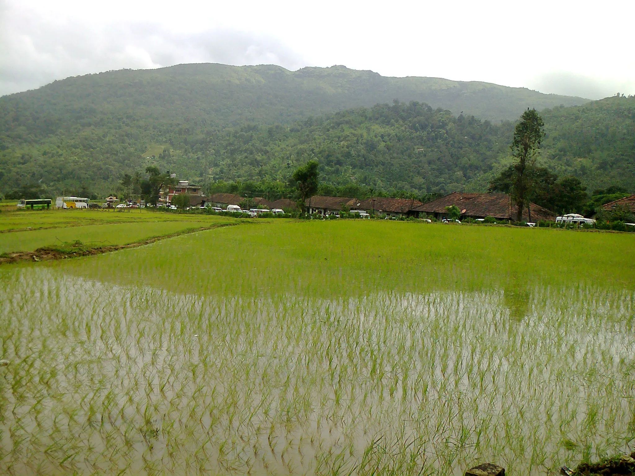
At Samse village in Kalasa taluk, Chikkamagaluru district, about 14 km from Kalasa. Most trekkers stay at a homestay near Samse and take a jeep to the forest checkpost, since cars struggle on the muddy track and there is no parking at the start.
In an emergency
Save these numbers before you lose signal. Tap to call.
- 112All emergenciesIndia’s single emergency number — works in every state
- 108Ambulance
- 1077District disaster control room
You are in
District: Dakshina Kannada (summit, Belthangady taluk) / Chikkamagaluru (Samse base, Kalasa taluk)Karnataka
- Nearest hospital
- Kalasa for first care; Chikkamagaluru or Mangaluru for serious cases
- Last ATM
- Kalasa, about 14 km from Samse
- Phone network
- Not confirmed by our sources. Expect weak or no signal on the trail; tell someone your plan before you leave Samse.
Before you set off
- Tell someone your route and when you will be back.
- Carry a charged phone and a power bank.
- Download an offline map of the route.
- Turn back if the weather turns bad — the mountain will wait.
Questions about Netravathi
No questions yet. Ask something and trekkers who have done it can answer.
Share your trek photo with #TreksAndTrails
I trekked this
Did Netravathi look different from this page? Tell us what changed and we will check it.
Where this comes from
Sources
Last reviewed:
- Aranya Vihaara – Nethravathi Trek (Dakshina Kannada, trek id 113), booking calendar — Karnataka Forest Department (official)
- Netravati Trek - An easy Alternate to Kudremukh Trek — Indiahikes
- Netravati Peak Trek | Bangalore Mountaineering Club — BMC Adventures
- Netravati Trek And Kodige Waterfalls From Bangalore — Muddie Trails
- Netravati Peak Trek: Karnataka's Easier Alternative to Kudremukh, Now Under New 2026 Rules — Explurger
- Trekkers rejoice as Karnataka reopens five major trails from May 1 — News Karnataka
- Karnataka introduces trekking SOP in Kudremukh, enforces new rules on four trails — The News Minute
Photos: iMahesh, CC BY-SA 4.0; iMahesh, CC BY-SA 4.0; iMahesh, CC BY-SA 4.0