Indrahar Pass Trek
Kangra, Himachal Pradesh
Opens without signal on this phone, with the map file and checklist. Saved for offline →
- Max altitude
- 4,342 m
- Days
- 4 days
- Distance
- 44 km
- Difficulty
- Difficult
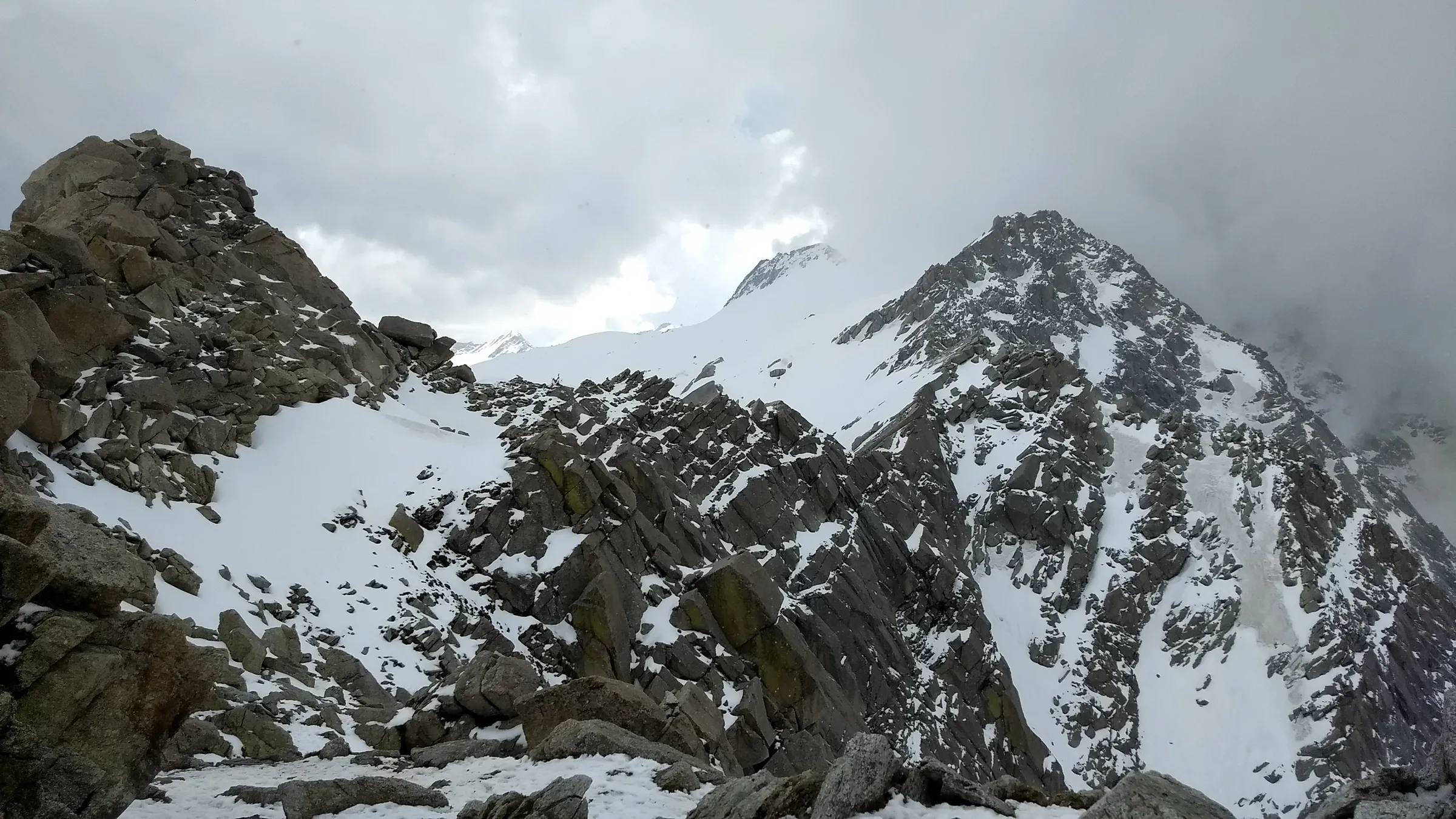
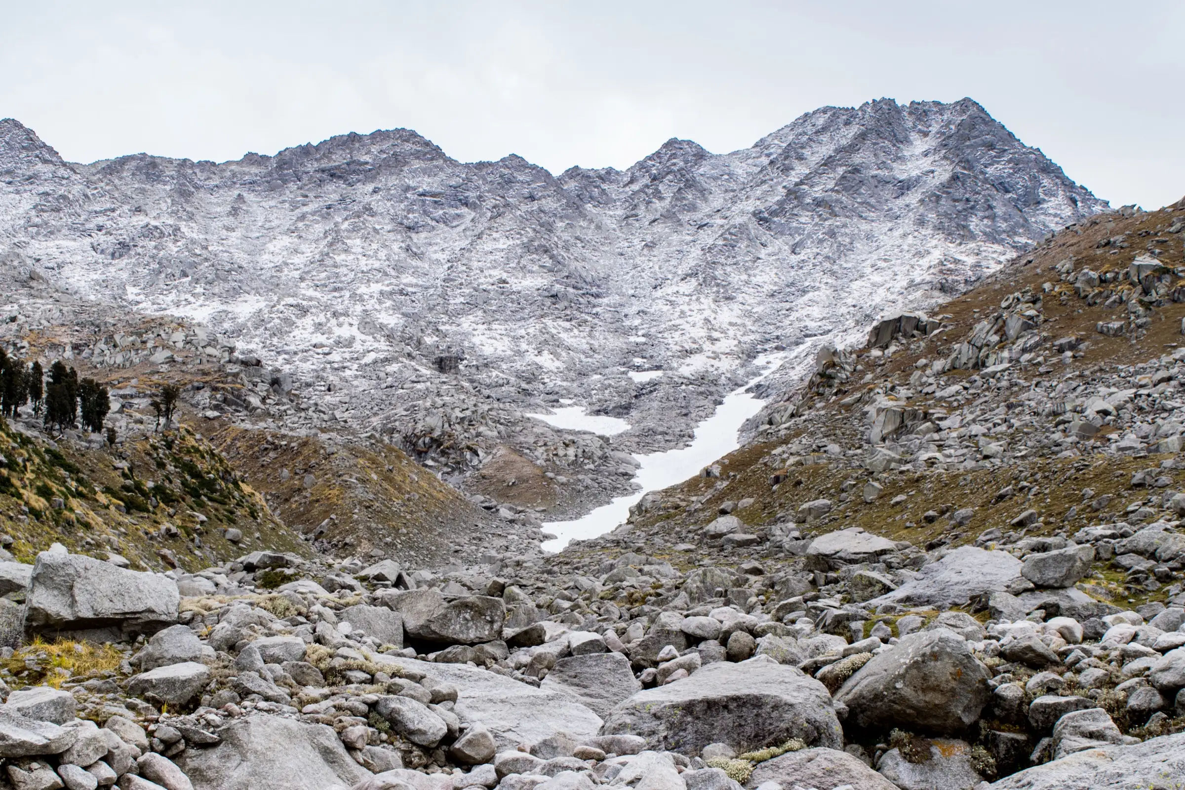
The summit day climbs about 850 m from Laka Got to 4,342 m over steep boulder fields and rock steps with cairns as the only waymarks, then returns the same way — around 10 hours and 12 km. Snow patches linger in early summer and weather turns fast on the Dhauladhar crest.
Photos
On the trail
The route
Day by day
Day 1
McLeod Ganj → Triund
1,788 m → 2,850 m
Day 2
Triund → Laka Got (via Snowline Café)
2,850 m → 3,500 m
Day 3 · highest point
Laka Got → Laka Got (via Lahesh Cave and Indrahar Pass)
3,500 m → 4,342 m → 3,500 m
Day 4
Laka Got → McLeod Ganj (via Triund)
3,500 m → 1,788 m
Ups and downs
Altitude profile
Where it is
Map
Trailhead and high point only — not a recorded track. Use it with a proper map.
Weather
Next 5 days on the trail
Live forecast for the trailhead and the high point. Mountain weather changes fast — check again on the morning you start.
Trailhead · McLeodganj (McLeod Ganj), via Dharamkot
at 1,788 mLoading forecast…
High point · Indrahar Pass (Kangra–Chamba border)
at 4,342 mLoading forecast…
Each day: high / low °C · rain mm and chance · snow cm · wind km/h
Weather data: Open-Meteo.comModel forecast, not an official warning. For alerts follow IMD and the local administration.
Plan the trip
How to reach
- Trailhead
- McLeodganj (McLeod Ganj), via Dharamkot
- Nearest railway
- Pathankot (about 90 km); the Kangra Valley narrow-gauge line also stops near Kangra
- Nearest airport
- Gaggal (Kangra) Airport, Dharamshala, about 18–20 km
- By road
- Dharamshala (about 10 km to McLeod Ganj); Pathankot (about 90 km); Delhi (overnight bus, 11–12 h)
- Drive
- About 11 h from Delhi
Plan the trip
Permits and fees
We could not confirm the current permit rules and fees from an official source. Check with the local forest department or tourism office before you go.
Plan the trip
Cost
Self-guided
₹2,500–8,000
With an operator
₹5,500–9,300
Per person for 4 days / 3 nights, ex-McLeod Ganj. Guided: Himtrek lists ₹5,500 + 5% GST (reporting at Dharamkot; forest permits included); Bikat Adventures lists ₹8,800 + 5% GST (McLeod Ganj to McLeod Ganj; forest permits/camping charges included). Self-guided estimate covers rented tent and sleeping bag, food for three nights, forest/camping charges and, strongly advised above Laka Got, a local guide (roughly ₹1,500–2,500 a day). Fees change; confirm at the Gallu (Galu Devi) Temple check post.
Gear
Top picks for this trek
The gear that matters most on this route, chosen from its altitude, season and risks.
 Ad · affiliate link
 Ad · affiliate link
 Ad · affiliate link
 Ad · affiliate link
 Ad · affiliate link
 Ad · affiliate link
 Ad · affiliate link
 Ad · affiliate link
Store buttons open a search on that store, not a product we picked. As an Amazon Associate we earn from qualifying purchases. Photos show the kind of item, not a specific product. Affiliate disclosure
Packing checklist
Matched to this trek: altitude, season, days and the risks on the route.
Packed 0 of 32
Nights near 4,342 m can drop close to freezing even in summer. Pack one more warm layer than you think.
Tick each item as it goes in the bag.
Know before you go
Good to know
- Mobile network
- Reliable in McLeod Ganj and Dharamkot; patchy at Triund and mostly none beyond Laka Got (check locally)
- Last ATM
- McLeod Ganj
- Nearest hospital
- Zonal Hospital, Dharamshala (below McLeod Ganj)
- Water
- Taps at Dharamkot and Galu Devi Temple; snow-melt streams near Laka Got and the boulder fields above it in season (treat before drinking); almost none on the final climb — carry 2 L from Laka Got
Highlights
- Cross the crest of the Dhauladhar at 4,342 m, the old Gaddi shepherd route between Kangra and Chamba
- From the pass, the Kangra Valley and plains to the south and the Pir Panjal and Mani Mahesh ranges to the north
- Camps at Triund ridge and at Laka Got below a small glacier snout
- Lahesh Cave, a natural rock shelter on the climb to the pass
- Rock-cut steps and cairns built by Gaddi shepherds on the final ascent
Risks
- Kangra district orders: on 6 January 2026 the Kangra District Disaster Management Authority was reported (PTI) to have banned trekking above 3,000 m until further notice, with prior SP Kangra permission needed for the Triund route; a December 2024 order did the same. We found no order lifting the 2026 ban as of 17 October 2026, though operators list October–December 2026 departures. Indrahar Pass (4,342 m) is above that limit — confirm with the Kangra district administration or SP office in Dharamshala before you go.
- Since November 2025 every trekker must register at the Gallu Temple check post (one of 10 Kangra trekking check posts); trekking without registration can bring action under the Disaster Management Act.
- The route above Laka Got crosses steep boulder fields where trails are easy to lose; trekkers have gone missing on the Triund–Indrahar trails. Go with a guide and keep to the cairns.
- Altitude sickness is possible: the summit day climbs to 4,342 m from a 3,500 m camp.
- Snow and ice in the boulder gullies in May–June and again from October; heavy winter snow blocks the route. Afternoon thunderstorms are common on the Dhauladhar.
- Monsoon (July–August) brings rockfall, slippery wet granite, landslides and swollen streams.
Know before you go
Questions
Is the Indrahar Pass trek allowed right now?
Check before you go. Kangra district has issued orders banning trekking above 3,000 m (December 2024, and again on 6 January 2026 'until further notice', as reported by PTI). We found no order lifting the 2026 ban as of 17 October 2026, although operators are selling October–December 2026 dates. Since November 2025 you must also register at the Gallu Temple check post above Dharamkot. Ask the SP office or district administration in Dharamshala.
How difficult is the Indrahar Pass trek?
Operators rate it from 'easy' (Bikat) to 'moderate to difficult' (Himalayan Hikers, Indiahikes). The first two days to Triund and Laka Got are steady forest and ridge walking. The summit day is the hard part: a steep, mostly trackless climb over boulders and rock steps from Lahesh Cave to 4,342 m and back, which operators put at around 10 hours and 12 km.
What is the best time for Indrahar Pass?
Spring–early summer (April–June) and autumn (September–October). Bikat lists April–June and September–November; Himtrek says May to October, with June and September clearest; Wikipedia gives a trekking season of April–October. July–August monsoon makes the rocks wet and dangerous, and winter snow closes the high route.
How long is the trek and where does it start?
The usual itinerary is 4 days from McLeod Ganj and back: McLeod Ganj–Triund (9 km), Triund–Laka Got (7 km), Laka Got–Indrahar Pass–Laka Got (12 km), Laka Got–McLeod Ganj (16 km), about 44 km in all. Some operators start from Dharamkot and quote 35 km. Longer versions cross the pass into Chamba and descend to Kuarsi.
Do I need a permit for Indrahar Pass?
Forest permits and camping charges apply and operators include them in their price; we could not find the current fee on an official site. You must register at the Gallu Temple check post and, under recent Kangra orders, may need prior permission from the SP Kangra. Confirm locally.
In an emergency
Save these numbers before you lose signal. Tap to call.
- 112All emergenciesIndia’s single emergency number — works in every state
- 108Ambulance
- 1077District disaster control room
You are in
District: KangraHimachal Pradesh
- Nearest hospital
- Zonal Hospital, Dharamshala (below McLeod Ganj)
- Last ATM
- McLeod Ganj
- Phone network
- Reliable in McLeod Ganj and Dharamkot; patchy at Triund and mostly none beyond Laka Got (check locally)
Before you set off
- Tell someone your route and when you will be back.
- Carry a charged phone and a power bank.
- Download an offline map of the route.
- Turn back if the weather turns bad — the mountain will wait.
Questions about Indrahar Pass
No questions yet. Ask something and trekkers who have done it can answer.
Share your trek photo with #TreksAndTrails
I trekked this
Did Indrahar Pass look different from this page? Tell us what changed and we will check it.
Where this comes from
Sources
Last reviewed:
- Indrahar Pass Trek - An Offbeat Trail Beyond Triund — Bikat Adventures
- Indrahar Pass Trek | Himtrek 2026 — Himtrek
- Indrahar Pass Trek 2026 | Complete Package, Itinerary, Costs — Himalayan Hikers
- Indrahar Pass — Wikipedia
- Indrahar Pass Trek (documented trek) — Indiahikes
- Check posts set up at 10 entry points to strengthen safety of trekkers in Kangra (15 Nov 2025) — The Tribune
- Dhauladhar Himachal Update: Temporary Ban on All Treks Above 3,000 metres (updated 13 Aug 2026) — Himalayan Dream Treks
Photos: Ashish Gupta from Noida, India, CC BY 2.0; Ashish Gupta from Noida, India, CC BY 2.0; Ashish Gupta from Noida, India, CC BY 2.0