Huliyurdurga Trek
Tumakuru (Kunigal taluk), Karnataka
Opens without signal on this phone, with the map file and checklist. Saved for offline →
- Max altitude
- 845 m
- Days
- 1 day
- Distance
- 3 km
- Difficulty
- Moderate
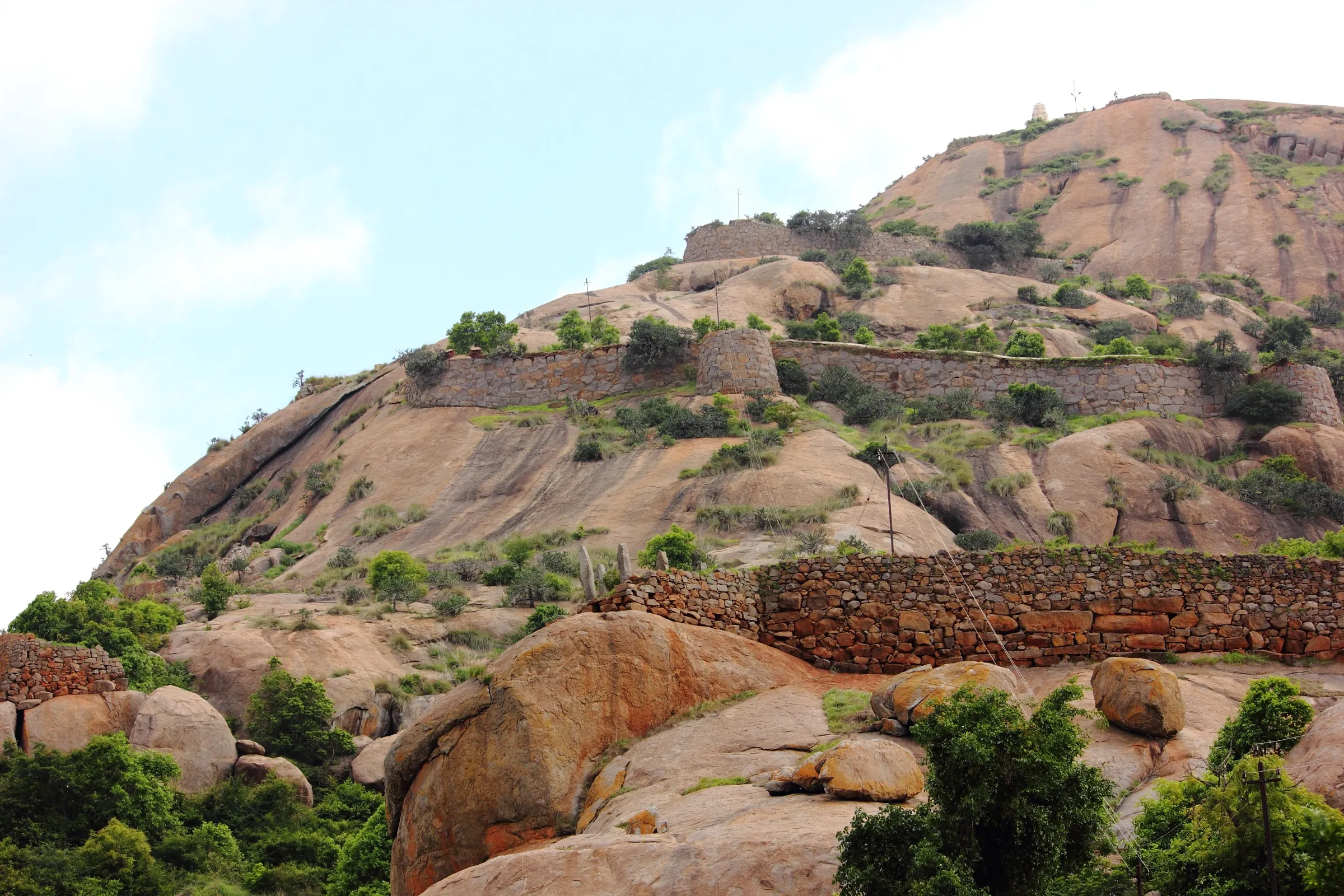
Short (about 3 km return, roughly 140 m of climb), but above the Kumbi Ganapathi temple the faint, arrow-marked trail turns into a hands-and-feet scramble with a near-vertical rock step of about 12 feet and a smooth slab with few footholds. Indiahikes grades it easy-moderate; Karnataka Tourism calls it moderate to difficult. Coming down the rock step is harder than going up.
Photos
On the trail
The route
Day by day
Day 1 · highest point
Huliyurdurga village → Huliyurdurga village (via the fort summit)
710 m → 845 m → 710 m
Ups and downs
Altitude profile
Where it is
Map
Trailhead and high point only — not a recorded track. Use it with a proper map.
Weather
Next 5 days on the trail
Live forecast for the trailhead and the high point. Mountain weather changes fast — check again on the morning you start.
Trailhead · Huliyurdurga village (parking by the temple ruins at the foot of the hill)
at 710 mLoading forecast…
High point · Huliyurdurga fort summit (Kumbi Betta)
at 845 mLoading forecast…
Each day: high / low °C · rain mm and chance · snow cm · wind km/h
Weather data: Open-Meteo.comModel forecast, not an official warning. For alerts follow IMD and the local administration.
Plan the trip
How to reach
- Trailhead
- Huliyurdurga village (parking by the temple ruins at the foot of the hill) (nearest town: Kunigal)
- Nearest railway
- Maddur (on the Bengaluru–Mysuru line), then a bus to Huliyurdurga
- Nearest airport
- Kempegowda International Airport, Bengaluru
- By road
- Bengaluru (about 75–90 km via Magadi, or via NH 75 to Kunigal); Kunigal (about 22–25 km; direct buses to Huliyurdurga); Maddur (direct buses to Huliyurdurga); Magadi (about 28 km)
- Drive
- About 2.5 h from Bengaluru
Plan the trip
Permits and fees
We could not confirm the current permit rules and fees from an official source. Check with the local forest department or tourism office before you go.
Plan the trip
Cost
Self-guided
₹300–1,200
With an operator
₹1,200–2,000
Per person, ex-Bengaluru, day trip. No operator's published group price for Huliyurdurga was found, so the guided range is an estimate based on what Bengaluru operators charge for similar Navadurga fort day treks (for example Makalidurga, ₹1,290–1,950 with transport). Self-guided is an estimate: KSRTC bus to Kunigal or Maddur and a local bus to Huliyurdurga (or shared fuel for a car), plus food. Karnataka Tourism states there is no entry fee.
Gear
Top picks for this trek
The gear that matters most on this route, chosen from its altitude, season and risks.
 Ad · affiliate link
 Ad · affiliate link
 Ad · affiliate link
 Ad · affiliate link
 Ad · affiliate link
 Ad · affiliate link
- Ad · affiliate link
 Ad · affiliate link
Store buttons open a search on that store, not a product we picked. As an Amazon Associate we earn from qualifying purchases. Photos show the kind of item, not a specific product. Affiliate disclosure
Packing checklist
Matched to this trek: altitude, season, days and the risks on the route.
Packed 0 of 16
Tick each item as it goes in the bag.
Know before you go
Good to know
- Mobile network
- Indiahikes reports Airtel, Vodafone Idea and Jio signal throughout the trek.
- Last ATM
- Huliyurdurga village (3–4 ATMs, not always working); Kunigal as backup
- Nearest hospital
- Primary Health Centre, Huliyurdurga (in the village, under 2 km from the trail); larger hospitals in Kunigal
- Water
- Shops and eateries in Huliyurdurga village; no shops or water on the trail. Carry 1.5–2 litres per person.
Highlights
- One of the Navadurgas, the hill forts around Bengaluru attributed to Kempe Gowda; ruined walls, granaries, powder magazines and a durbar hall survive on top
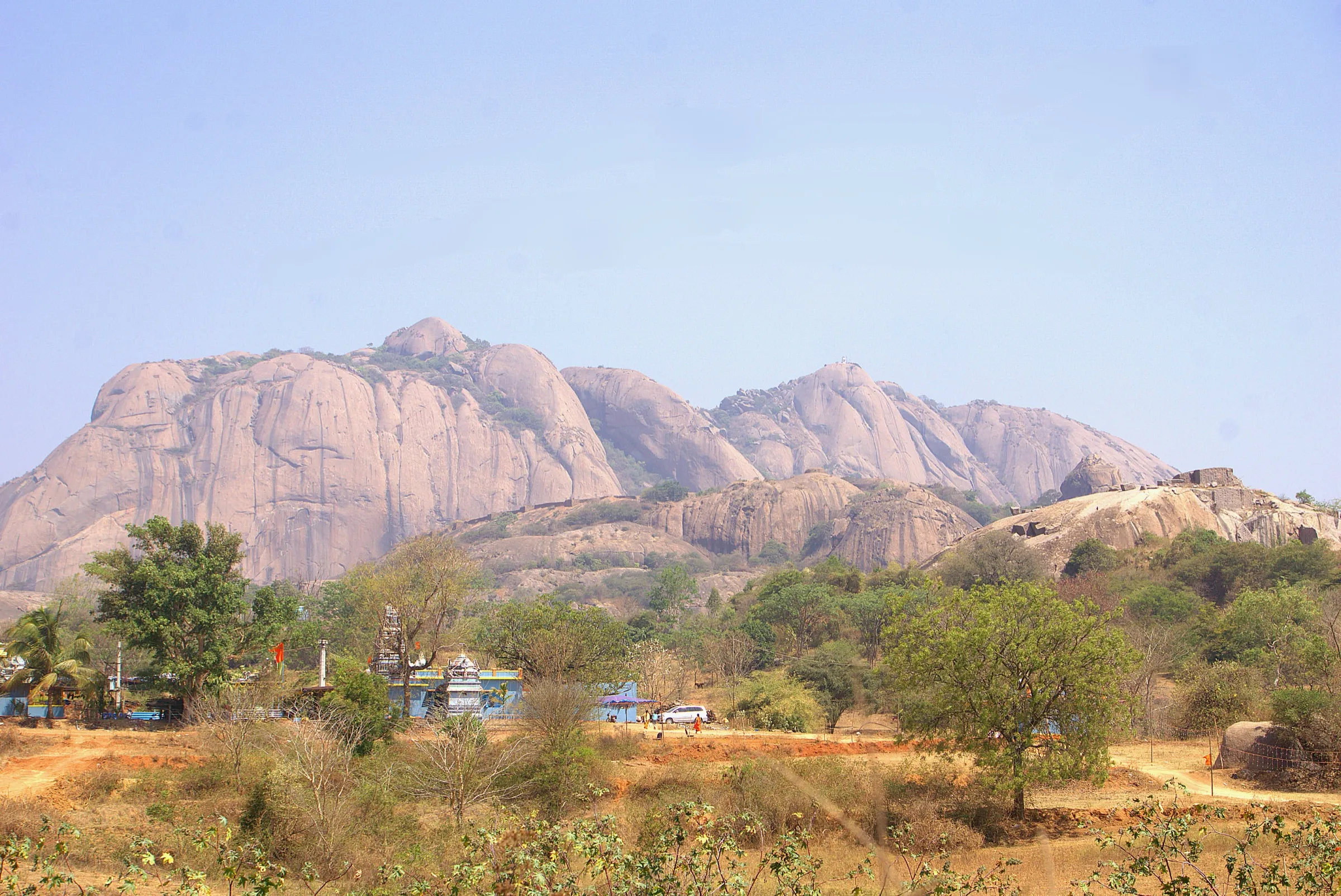
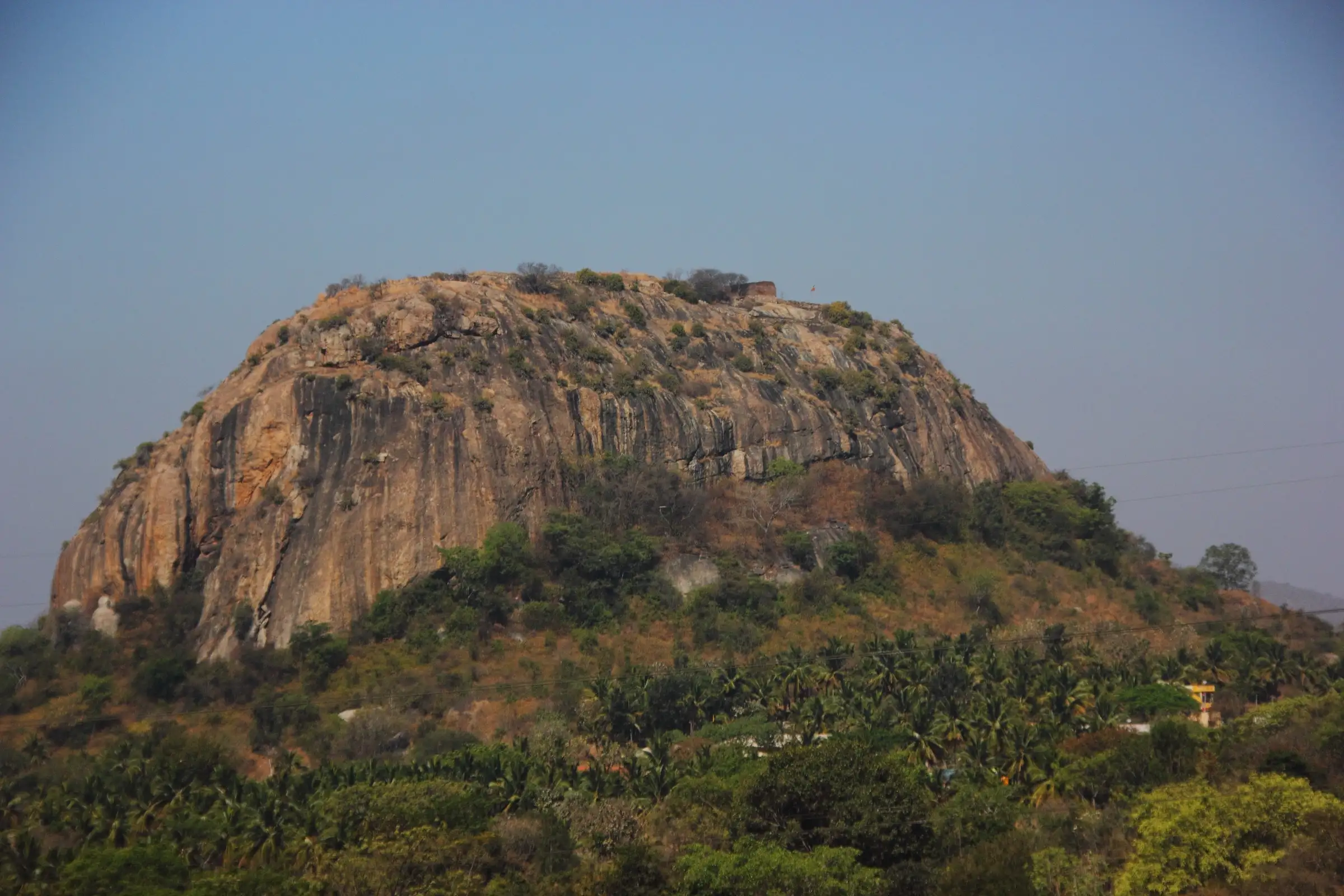
- A bare granite dome shaped like an inverted cup (Kumbi Betta), with a short rock scramble that most visitors give up on
- Steps to the Shri Kumbi Ganapathi temple at the foot of the climb, and the Venugopala Swamy temple of the Mysuru Wodeyar period at the base
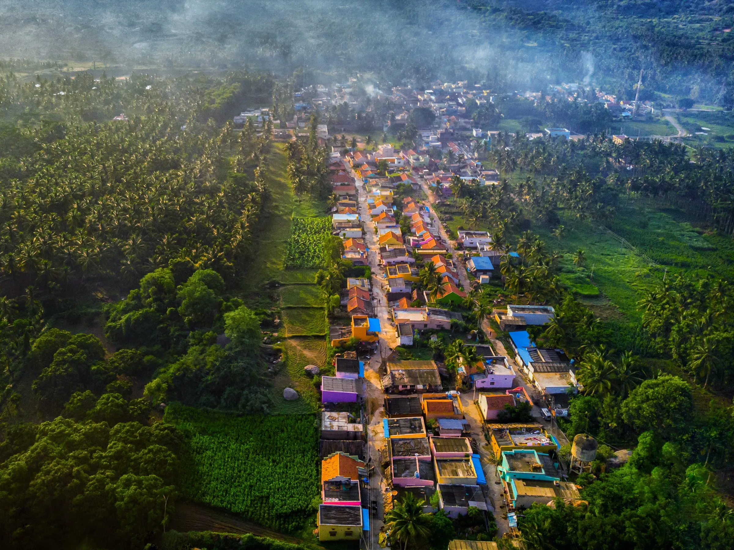
- Views over Huliyurdurga town, its lake and the Hemagiri hill with its Mallikarjuna temple
Risks
- A near-vertical rock step of about 12 feet and a smooth slab need basic rock-climbing moves; do not attempt it if water is running down the rock, and only go up if you are sure you can climb back down.
- Rocks become dangerously slippery in the June–September monsoon (Karnataka Tourism advises avoiding the monsoon); one source alone says this, so the trek is not treated as closed.
- The trail is faint and marked only by faded blue arrows; one branch on the left flank ends at a cliff. Go with someone who knows the route or start early with time to spare.
- Thorny overgrowth on the side path to the Nandi idol and pond; wear full sleeves and trousers.
- No shade on the upper rock and no water on the trail: heat in March–May. Start early in the morning or go in the late afternoon and finish in daylight.
- Locals advise against taking small children to the fort. Camping is not allowed near the base.
- In May 2026 Karnataka's Chief Wildlife Warden suspended trekking paths in areas with leopards, tigers, elephants or bears until each is certified safe. Huliyurdurga is reached from the village and needs no forest booking, but ask locally about any current restriction.
Know before you go
Questions
Do I need a permit or booking for Huliyurdurga?
No booking was found. Karnataka Tourism states there is no formal entrance fee or forest permission, and Indiahikes also says no permission is needed. Huliyurdurga is not listed on the Forest Department's Aranya Vihaara portal. Ask in the village or at the police station if rules change.
How hard is the Huliyurdurga climb?
The walk is short, about 3 km return in 1–2 hours, but the top part is a scramble. Above the Ganesha temple you climb on hands and feet, then face a rock step of about 12 feet and a smooth slab. Indiahikes grades it easy-moderate; Karnataka Tourism says moderate to difficult. Many people turn back at the rock step, and coming down is the hardest part.
How do I reach Huliyurdurga from Bengaluru?
It is about 75–90 km from Bengaluru. By bus, go to Kunigal or Maddur and take a direct local bus to Huliyurdurga village. By car or bike, drive via Magadi or Kunigal. The nearest railway station is Maddur.
Where does the trail start?
In Huliyurdurga village. Indiahikes describes taking the concrete road beside the police station, keeping right at the water tank, and parking at the clearing opposite a temple ruin. The trail then goes past the Ganesha (Kumbi Ganapathi) temple, where you look for blue arrow marks.
Is there food, water or a place to stay?
The village has shops and small eateries, but there are no shops on the trail and no hotels in Huliyurdurga, so do it as a day trip from Bengaluru or Maddur. Carry your own water and snacks.
When is the best time to go?
The cooler, dry months from October to February. Avoid the monsoon, when the rock is slippery, and the hottest hours of March–May.
In an emergency
Save these numbers before you lose signal. Tap to call.
- 112All emergenciesIndia’s single emergency number — works in every state
- 108Ambulance
- 1077District disaster control room
You are in
District: Tumakuru (Kunigal taluk)Karnataka
- Nearest hospital
- Primary Health Centre, Huliyurdurga (in the village, under 2 km from the trail); larger hospitals in Kunigal
- Last ATM
- Huliyurdurga village (3–4 ATMs, not always working); Kunigal as backup
- Phone network
- Indiahikes reports Airtel, Vodafone Idea and Jio signal throughout the trek.
Before you set off
- Tell someone your route and when you will be back.
- Carry a charged phone and a power bank.
- Download an offline map of the route.
- Turn back if the weather turns bad — the mountain will wait.
Questions about Huliyurdurga
No questions yet. Ask something and trekkers who have done it can answer.
Share your trek photo with #TreksAndTrails
I trekked this
Did Huliyurdurga look different from this page? Tell us what changed and we will check it.
Where this comes from
Sources
Last reviewed:
- Trekking to Huliyurdurga, Tumakuru District — Karnataka Tourism (Department of Tourism, Government of Karnataka) (official)
- The Complete Guide to Huliyurdurga Trek — Indiahikes
- Huliyurdurga — Wikipedia
- Huliyurdurga Fort - A Legacy of Sri Kempegowda — Team G Square
Photos: Gopakumar V R, CC BY-SA 4.0; Gopakumar V R, CC BY-SA 4.0; Gopakumar V R, CC BY-SA 4.0