Gandikota Trek
YSR Kadapa, Andhra Pradesh
Opens without signal on this phone, with the map file and checklist. Saved for offline →
- Max altitude
- 326 m
- Days
- 1 day
- Distance
- 4 km
- Difficulty
- Easy
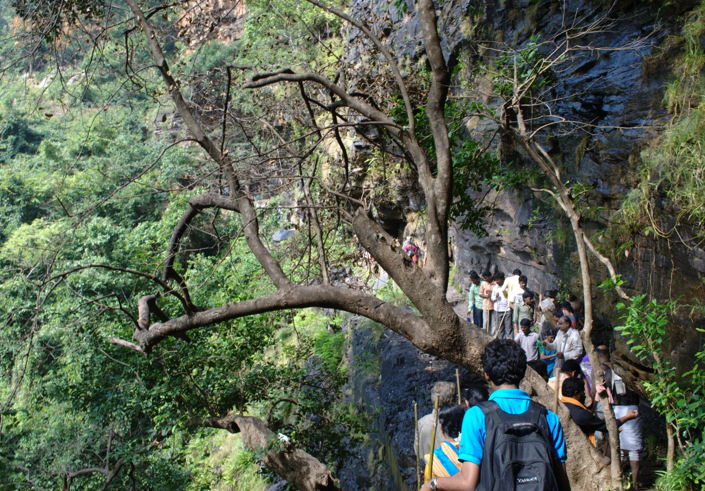
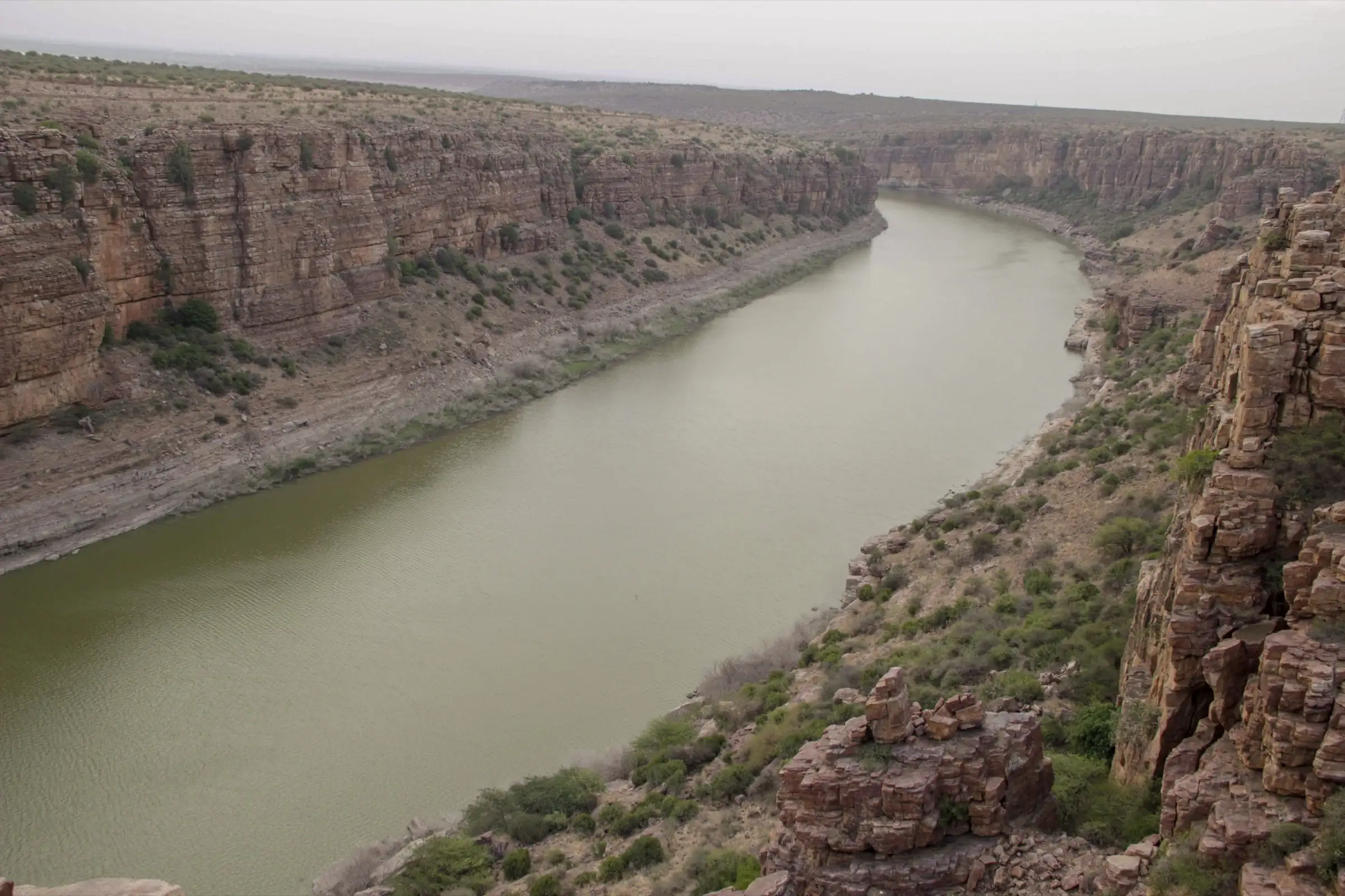
A short half-day walk across the fort plateau to the gorge rim, then a steep, unmarked scramble over loose quartzite rocks about 90 m (300 ft) down to the Penna riverbed, and the same climb back in the heat.
Photos
On the trail
The route
Day by day
Day 1 · highest point
Gandikota Fort → Gandikota Fort (via the gorge rim and the Penna riverbed)
326 m → 326 m
Ups and downs
Altitude profile
Where it is
Map
Trailhead and high point only — not a recorded track. Use it with a proper map.
Weather
Next 5 days on the trail
Live forecast for the trailhead and the high point. Mountain weather changes fast — check again on the morning you start.
Trailhead · Gandikota Fort
at 326 mLoading forecast…
High point · Gandikota fort plateau above the Penna gorge
at 326 mLoading forecast…
Each day: high / low °C · rain mm and chance · snow cm · wind km/h
Weather data: Open-Meteo.comModel forecast, not an official warning. For alerts follow IMD and the local administration.
Plan the trip
How to reach
- Trailhead
- Gandikota Fort (nearest town: Jammalamadugu)
- Nearest railway
- Yerraguntla Junction (47 km); Kondapuram is about 50 km
- Nearest airport
- Kadapa Airport (about 75-85 km)
- By road
- Jammalamadugu (16 km, about 20 minutes); Kadapa (85 km, about 90 minutes); Bengaluru (about 270-290 km via NH 44, Anantapur and Tadipatri)
- Drive
- About 6 h from Bengaluru
Plan the trip
Permits and fees
We could not confirm the current permit rules and fees from an official source. Check with the local forest department or tourism office before you go.
Plan the trip
Cost
Self-guided
₹1,500–4,000
With an operator
₹3,300–5,300
Per person, ex-Bengaluru, for a 2-day, 1-night trip. Guided: Treks and Trails India lists ₹3,300 Bangalore to Bangalore (transport, food, shared tent); Muddie Trails lists its Gandikota canyon hike with Belum Caves at ₹5,299 (sale price, October 2026). Self-guided is an estimate: bus to Jammalamadugu, a shared auto or taxi for the last 16 km, a night at a homestay or the APTDC Haritha resort, and meals.
Gear
Top picks for this trek
The gear that matters most on this route, chosen from its altitude, season and risks.
 Ad · affiliate link
 Ad · affiliate link
 Ad · affiliate link
 Ad · affiliate link
 Ad · affiliate link
 Ad · affiliate link
- Ad · affiliate link
 Ad · affiliate link
Store buttons open a search on that store, not a product we picked. As an Amazon Associate we earn from qualifying purchases. Photos show the kind of item, not a specific product. Affiliate disclosure
Packing checklist
Matched to this trek: altitude, season, days and the risks on the route.
Packed 0 of 16
Tick each item as it goes in the bag.
Know before you go
Good to know
- Mobile network
- Not confirmed by our sources. Expect a signal in Gandikota village and on the fort plateau; it may drop at the bottom of the gorge.
- Last ATM
- Jammalamadugu, 16 km away (carry cash)
- Nearest hospital
- Jammalamadugu for first care; Kadapa (85 km) for serious cases
- Water
- None on the trail. Carry at least 2 litres; the Penna river is not safe to drink untreated.
Highlights
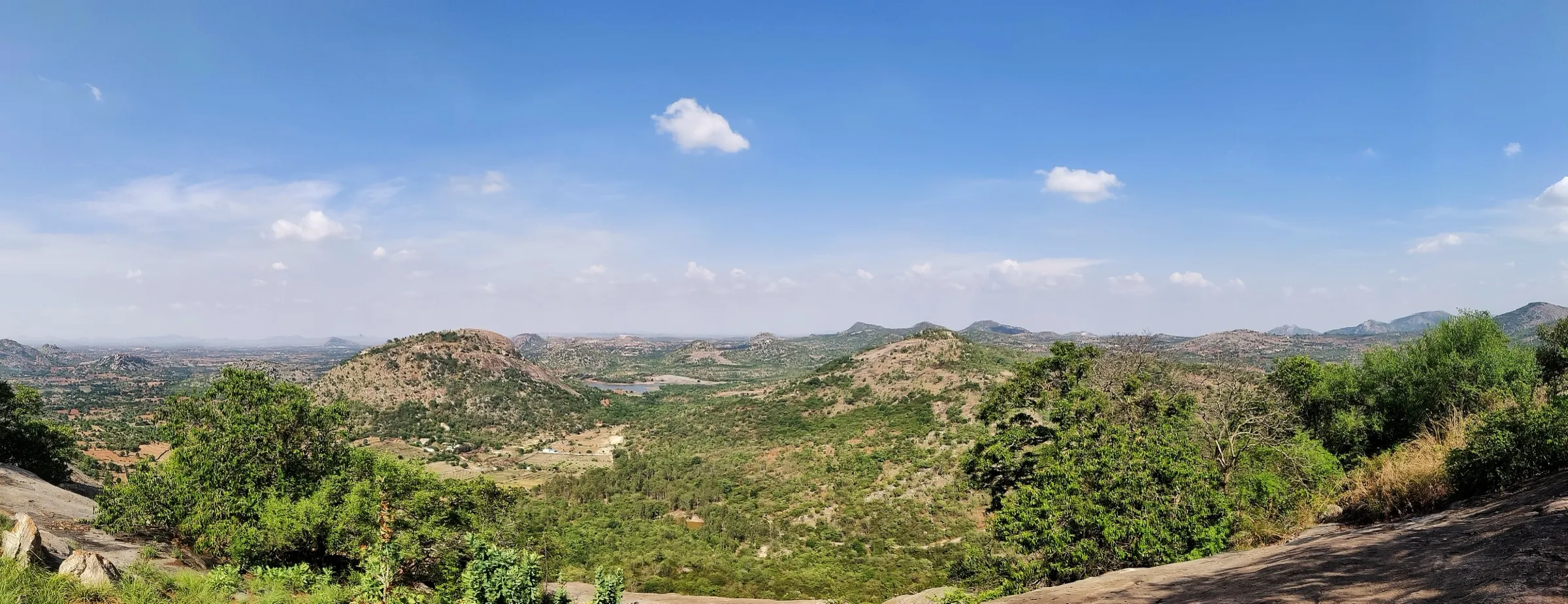
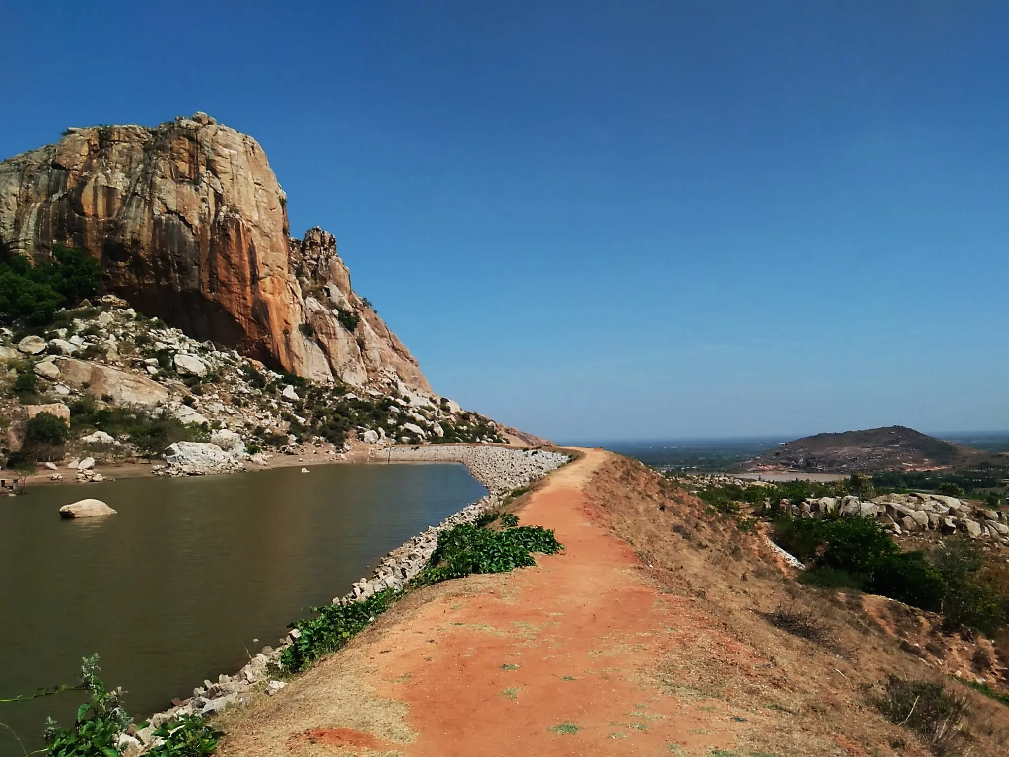
- Sunrise and sunset over the Penna gorge, where red quartzite cliffs of the Erramala hills squeeze the river to about 100 m wide
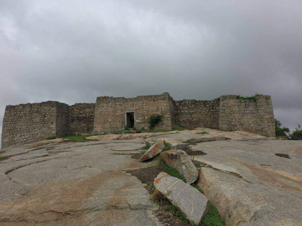
- Walking through a 12th-century fort with the Madhavaraya and Ranganatha Swamy temples, the Jamia Masjid and the old granary
- Scrambling down to the riverbed about 300 feet below the rim for a swim (with life jackets) or a coracle ride
- Camping on the canyon rim or the grassy bank by the river
Risks
- The descent to the river has no marked path and crosses steep, loose rock; go down in daylight and do not hike near the cliff edge after dark.
- From mid-March to May the gorge is very hot (highs near 40 °C); Muddie Trails does not run trips in those months. Start early and carry plenty of water.
- Rain makes the rocks slippery; take extra care in the monsoon.
- Swim in the Penna only with a life jacket.
- Snakes and scorpions live among the rocks; stay on the trail and watch where you put your hands.
Know before you go
Questions
How long does the Gandikota trek take?
It is a half-day walk. Indiahikes starts it at the Gandikota fort gate, past the mosque and the Ranganatha Swamy temple to the gorge rim, then down to the river. Most people combine it with a night at Gandikota to see both sunset and sunrise over the gorge.
Can you walk down to the river in Gandikota?
Yes. Visitors scramble down the rocks from the fort hill to the Penna riverbed, about 300 feet below the rim. The descent is steep and unmarked, so go early in the morning and in daylight. Swim only with a life jacket.
What is the best time to visit Gandikota?
October to February, when days are pleasant and sunrises clear. Holidify gives November to February; operators run trips from mid-September to February. Mid-March to May is very hot, and monsoon rain makes the rocks slippery.
How do I reach Gandikota?
Gandikota is 16 km from Jammalamadugu and 85 km from Kadapa. The nearest railway station is Yerraguntla (47 km) and the nearest airport is Kadapa. From Bengaluru it is about 280 km by road, roughly 6 hours via Anantapur and Tadipatri.
Where can I stay at Gandikota?
Andhra Pradesh Tourism runs the Haritha resort in Gandikota village, and operators run tented camps near the fort. You can also camp on the canyon rim or on the grassy riverbank below.
In an emergency
Save these numbers before you lose signal. Tap to call.
- 112All emergenciesIndia’s single emergency number — works in every state
- 108Ambulance
- 1077District disaster control room
You are in
District: YSR KadapaAndhra Pradesh
- Nearest hospital
- Jammalamadugu for first care; Kadapa (85 km) for serious cases
- Last ATM
- Jammalamadugu, 16 km away (carry cash)
- Phone network
- Not confirmed by our sources. Expect a signal in Gandikota village and on the fort plateau; it may drop at the bottom of the gorge.
Before you set off
- Tell someone your route and when you will be back.
- Carry a charged phone and a power bank.
- Download an offline map of the route.
- Turn back if the weather turns bad — the mountain will wait.
Questions about Gandikota
No questions yet. Ask something and trekkers who have done it can answer.
Share your trek photo with #TreksAndTrails
I trekked this
Did Gandikota look different from this page? Tell us what changed and we will check it.
Where this comes from
Sources
Last reviewed:
- Gandikota – The Grand Canyon of India — YSR Kadapa District Administration, Government of Andhra Pradesh (official)
- The Complete Guide to the Gandikota Trek — Indiahikes
- Gandikota Canyon Hike with Belum Caves from Bangalore — Muddie Trails
- Gandikota Camping and Trekking — Treks and Trails India
- Best Time To Visit Gandikota — Holidify
- The grandeur of Gandikota — Deccan Herald
- Gandikota – Grand Canyon of India (trekker's blog) — Bikat Adventures
- Gandikota — Wikipedia
Photos: Rajesh Cheemalakonda, CC BY-SA 4.0; Chaduvari, CC BY-SA 4.0; Bharat Kumar Jonnalagadda @ malkum, CC BY-SA 4.0