David Scott Trail Trek
East Khasi Hills, Meghalaya
Opens without signal on this phone, with the map file and checklist. Saved for offline →
- Max altitude
- 1,829 m
- Days
- 1 day
- Distance
- 16 km
- Difficulty
- Moderate
Meghalaya Tourism rates it easy and the altitude is low, but it is a 16 km, 5–6 hour day with rocky, muddy stretches, stream crossings on stones and a final climb to the Sohra road at Lad Mawphlang.
Photos
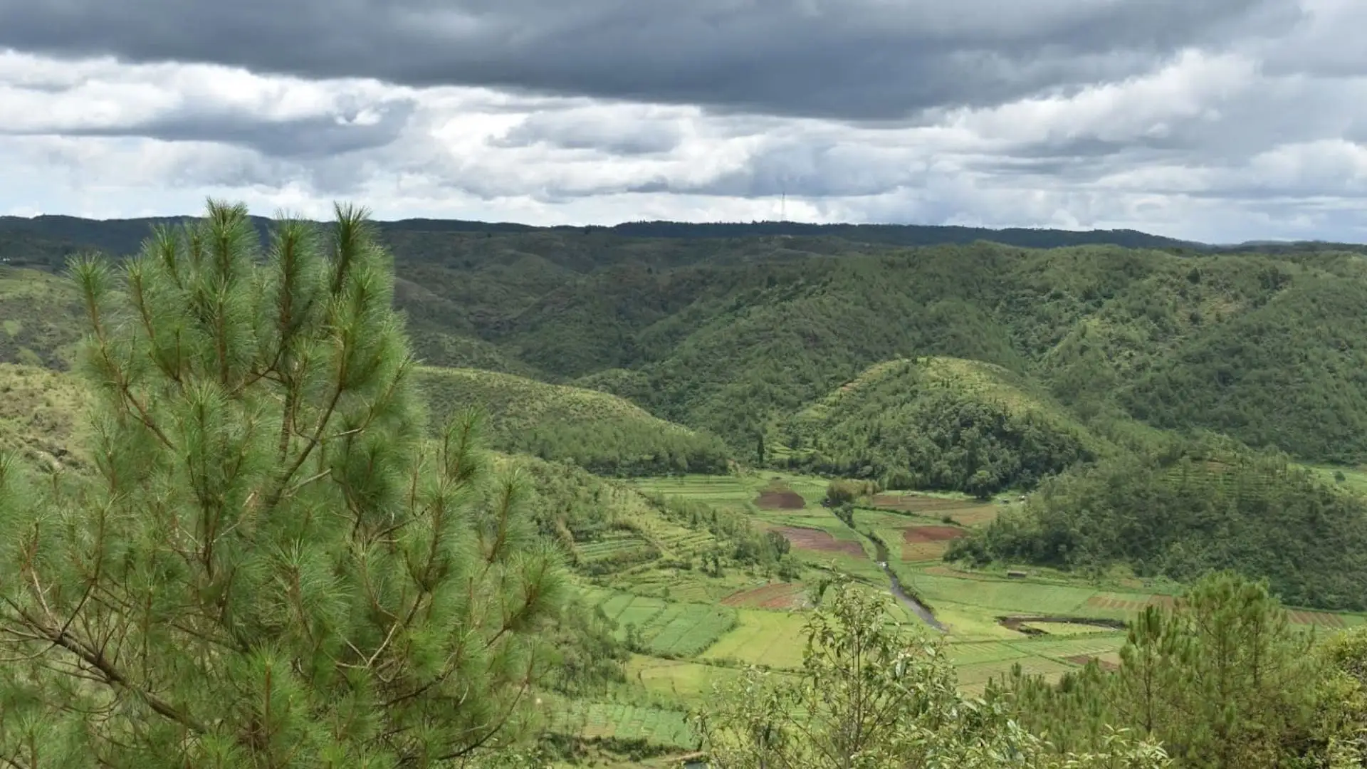
On the trail
The route
Day by day
Day 1 · highest point
Mawphlang → Lad Mawphlang (David Scott exit point, Sohra road)
1,829 m → 1,785 m
Ups and downs
Altitude profile
Where it is
Map
Trailhead and high point only — not a recorded track. Use it with a proper map.
Weather
Next 5 days on the trail
Live forecast for the trailhead and the high point. Mountain weather changes fast — check again on the morning you start.
Trailhead · Mawphlang
at 1,829 mLoading forecast…
High point · Mawphlang trailhead (Zero Point)
at 1,829 mLoading forecast…
Each day: high / low °C · rain mm and chance · snow cm · wind km/h
Weather data: Open-Meteo.comModel forecast, not an official warning. For alerts follow IMD and the local administration.
Plan the trip
How to reach
- Trailhead
- Mawphlang
- Nearest railway
- Guwahati (about 117 km from Shillong)
- Nearest airport
- Shillong Airport (Umroi), about 53–63 km; Guwahati (Lokpriya Gopinath Bordoloi International Airport) has more flights
- By road
- Shillong, about 25 km to Mawphlang; shared taxis and sumos leave from near Bada Bazaar; Lad Mawphlang exit point to Sohra (Cherrapunji), about 33 km, 40–45 minutes by cab
- Drive
- About 0.75 h from Shillong
Plan the trip
Permits and fees
We could not confirm the current permit rules and fees from an official source. Check with the local forest department or tourism office before you go.
Plan the trip
Cost
Self-guided
₹400–2,500
With an operator
₹1,500–6,800
Per person, ex-Shillong. Guided: Unexplored Northeast lists a ₹6,800 per person package (2 nights' stay, three meals, trek, mandatory local English-speaking guide, minimum group of eight; page undated); Indiahikes reports local guides charge ₹1,200–1,500 per group for the 5–6 hour walk, so a guided day walk for one or two people costs about ₹1,500 each. Only one operator's package price could be confirmed. Self-guided is an estimate: shared taxi Shillong–Mawphlang (₹80–100 reported), a shared or pre-booked cab from the Lad Mawphlang exit (₹100–150 per person shared, more for a private cab back to Shillong), any small entry fee at Mawphlang, and food.
Gear
Top picks for this trek
The gear that matters most on this route, chosen from its altitude, season and risks.
 Ad · affiliate link
 Ad · affiliate link
 Ad · affiliate link
 Ad · affiliate link
 Ad · affiliate link
 Ad · affiliate link
 Ad · affiliate link
 Ad · affiliate link
Store buttons open a search on that store, not a product we picked. As an Amazon Associate we earn from qualifying purchases. Photos show the kind of item, not a specific product. Affiliate disclosure
Packing checklist
Matched to this trek: altitude, season, days and the risks on the route.
Packed 0 of 20
Tick each item as it goes in the bag.
Know before you go
Good to know
- Mobile network
- Patchy in the valley; better at Mawphlang and on the Sohra road at the exit point
- Last ATM
- Shillong is the reliable option; carry cash for the guide, any entry fee, tea and the cab back
- Nearest hospital
- Shillong (about 25 km from Mawphlang)
- Water
- Shops at the Mawphlang trailhead, clear streams after Wahtham valley and tea stalls in Laitsohma village; carry 2 litres
Highlights
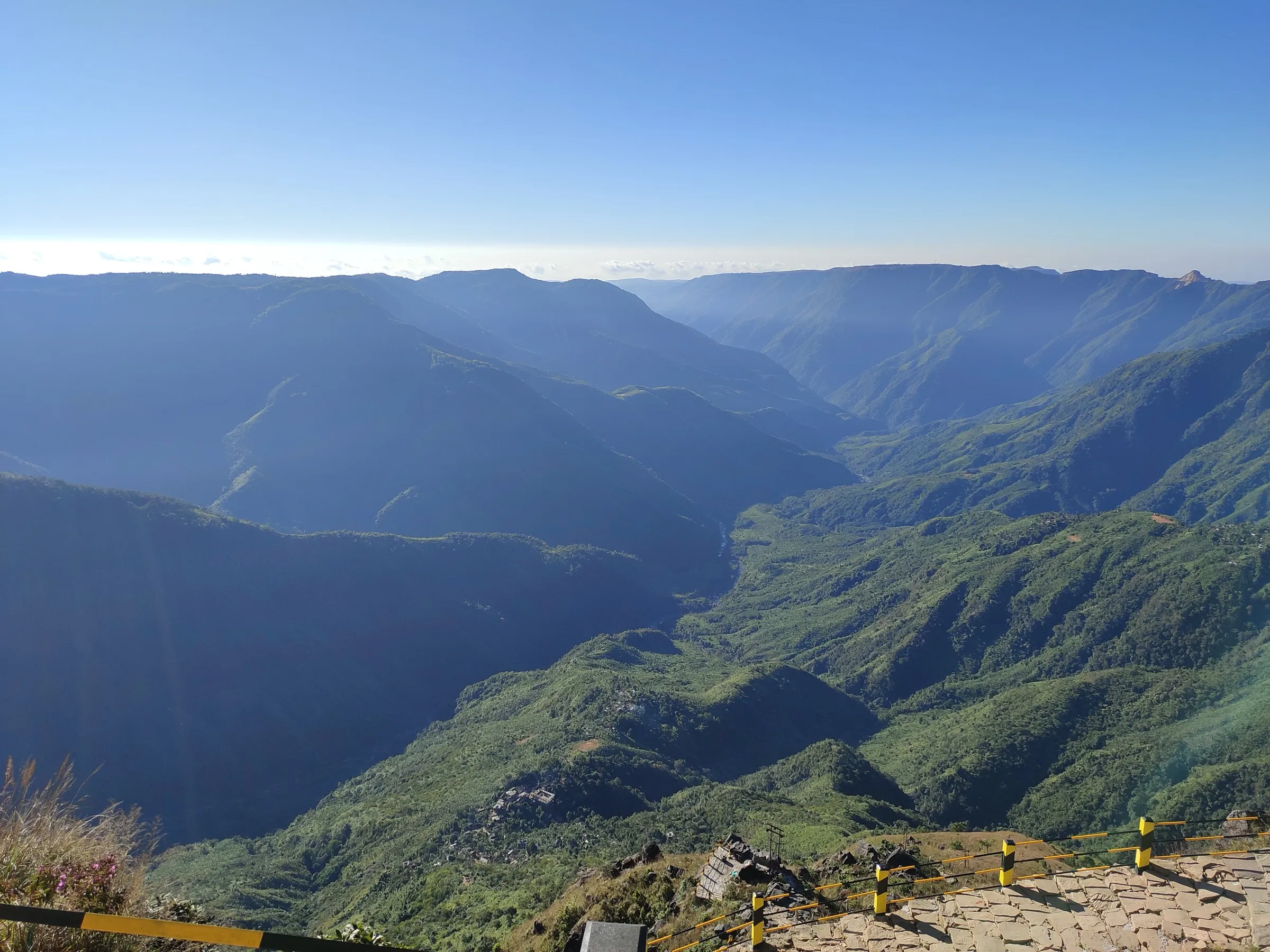
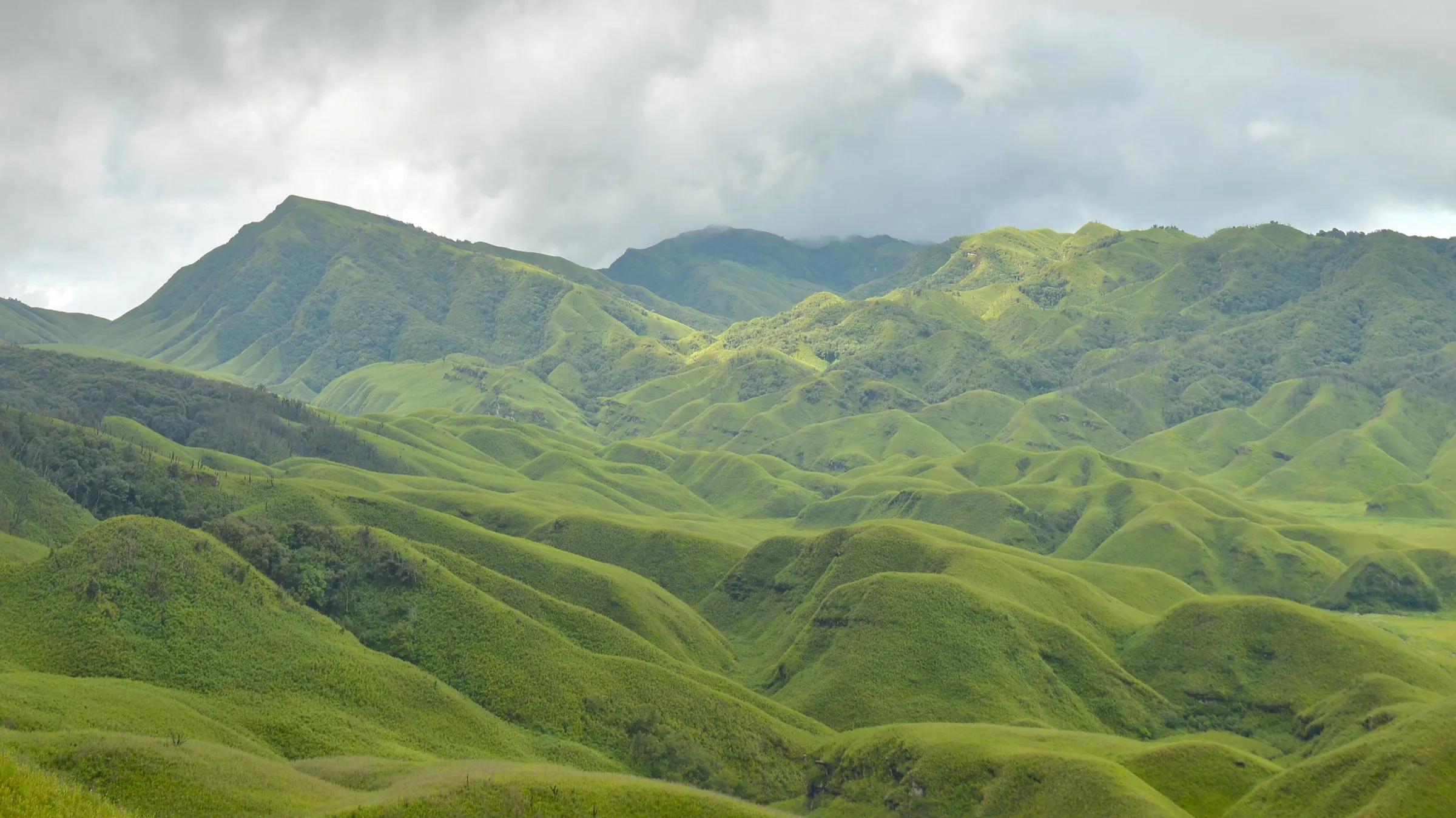
- A 16 km surviving stretch of the British-era horse track from Sohra towards Sylhet, named after the administrator David Scott
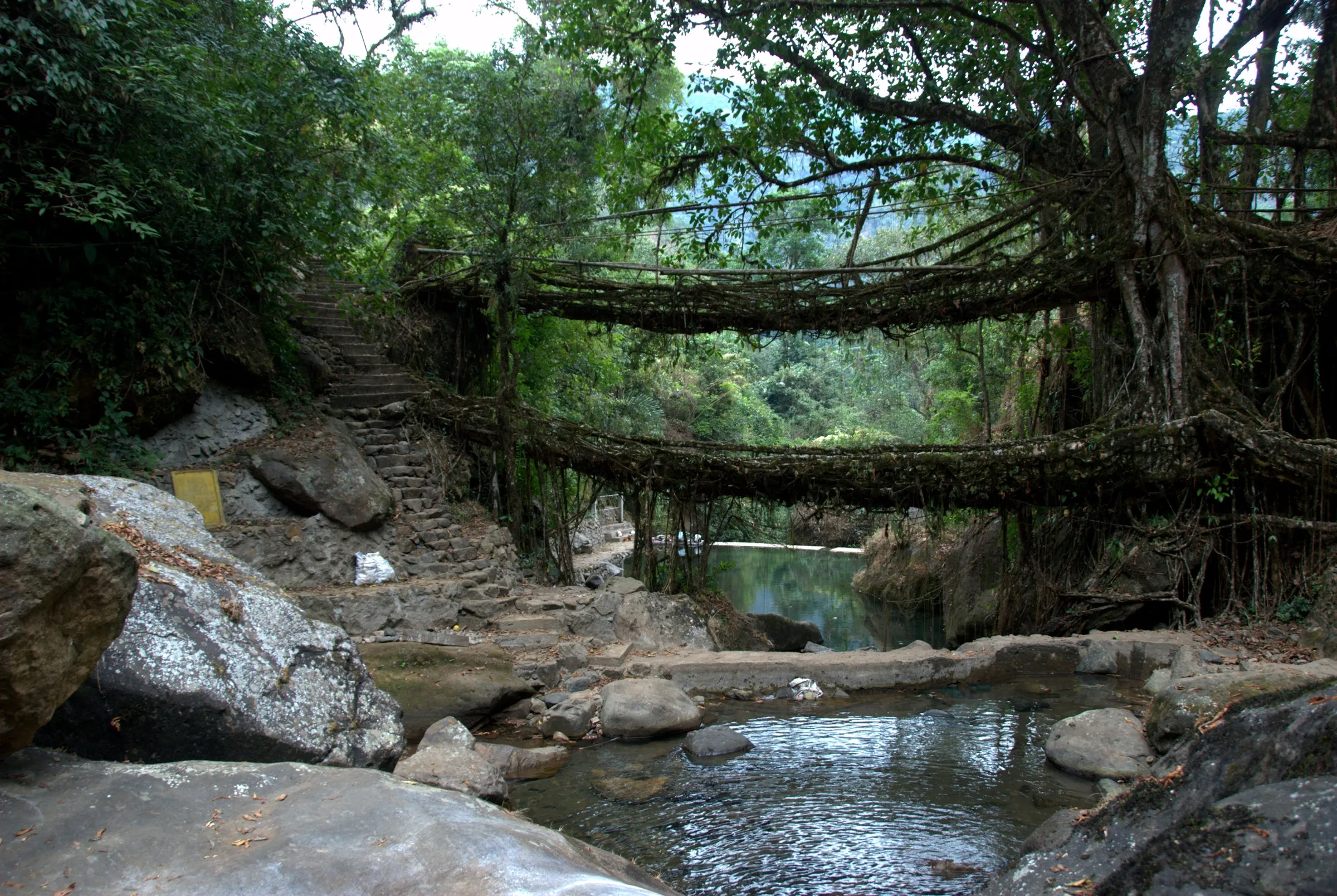
- The swaying suspension footbridge over the Umiam river at Weidung, rebuilt in 2012 after a 2007 flash flood
- Clear streams and natural swimming pools below Wahtham valley, the lowest point at about 1,525 m
- Red tea and wild blackberries (sohiong) in the small Khasi village of Laitsohma
- An old stone arch bridge, megalithic monoliths at Kor Parkti and the Mawnguid Briew rock of Khasi folklore
- Start or finish beside the Mawphlang Sacred Grove, one of the best-preserved Khasi sacred forests
Risks
- June to August (peak monsoon) brings swollen streams that can force you to turn back halfway, slippery muddy rock and leeches; Indiahikes advises avoiding these months
- Several shortcuts and side trails can confuse solo walkers; stay on the main route and do not be on the trail after dark
- Shared taxis are scarce at the Lad Mawphlang exit; book a cab or ask your guide to arrange one before you start
- Weather changes fast: sudden rain in the forest and strong sun on the open meadows
- Meghalaya Tourism advises watching for heavy-rain and landslide warnings in the monsoon
Know before you go
Questions
How long is the David Scott Trail and how long does it take?
The walk between Mawphlang and Lad Mawphlang is about 16 km. Most people finish it in one day, 4–6 hours; Indiahikes suggests starting before 10 am so you reach Lad Mawphlang by sunset. Meghalaya Tourism also lists a relaxed 2-day, 1-night version.
Do I need a permit for the David Scott Trail?
No trekking permit is required. Meghalaya Tourism mentions a small ticket kiosk at the Mawphlang trailhead, but we could not confirm the current fee, so carry cash and check locally.
Is a guide mandatory?
Not by rule. The main trail is fairly clear, but there are confusing side paths, so Meghalaya Tourism and Indiahikes both recommend a local guide, especially for solo or first-time walkers. Guides can be found in Mawphlang village and at the trailhead.
Should I start from Mawphlang or Lad Mawphlang?
Most walkers start at Mawphlang because the route is mostly a gradual descent that way. Meghalaya Tourism's trek page describes the reverse direction, ending at the Mawphlang Sacred Grove; starting from Lad Mawphlang adds more climbing, so allow an extra hour or two.
What is the best time to do the David Scott Trail?
October to April is the dry, cool season Meghalaya Tourism recommends. The trail is open all year, but June to August brings heavy rain and high river levels.
In an emergency
Save these numbers before you lose signal. Tap to call.
- 112All emergenciesIndia’s single emergency number — works in every state
- 108Ambulance
- 1077District disaster control room
You are in
District: East Khasi HillsMeghalaya
- Nearest hospital
- Shillong (about 25 km from Mawphlang)
- Last ATM
- Shillong is the reliable option; carry cash for the guide, any entry fee, tea and the cab back
- Phone network
- Patchy in the valley; better at Mawphlang and on the Sohra road at the exit point
Before you set off
- Tell someone your route and when you will be back.
- Carry a charged phone and a power bank.
- Download an offline map of the route.
- Turn back if the weather turns bad — the mountain will wait.
Questions about David Scott Trail
No questions yet. Ask something and trekkers who have done it can answer.
Share your trek photo with #TreksAndTrails
I trekked this
Did David Scott Trail look different from this page? Tell us what changed and we will check it.
Where this comes from
Sources
Last reviewed:
- David Scott Trail — Meghalaya Tourism (official)
- The David Scott Trek — Meghalaya Tourism (official)
- David Scott Trek - Trek through the Khasi Hills of Meghalaya — Indiahikes
- Offbeat Alert: Did You Know This Ancient Hiking Trail In Meghalaya Once Was A Trading Route — Outlook Traveller
- Trekking in Shillong — TravelTriangle
- A historical trail in Meghalaya — Unexplored Northeast
- Hike the David Scott Trail — The Outbound
Photos: Daniel Romanson, CC0; Wann Majaw, CC0