Bailey Trail Trek
West Kameng and Tawang, Arunachal Pradesh
Opens without signal on this phone, with the map file and checklist. Saved for offline →
- Max altitude
- 4,712 m
- Days
- 10 days
- Distance
- 70 km
- Difficulty
- Difficult
Six remote trekking days with no road or network, two long 9-hour stages over Poshing La, Pangi La and Tse La, and nights at about 4,350-4,640 m; Bikat Adventures grades it difficult and for experienced trekkers.
Photos
On the trail
The route
Day by day
Day 1
Guwahati → Guwahati
55 m → 55 m
Day 2
Guwahati → Bomdila
55 m → 2,400 m
Day 3
Bomdila (drive to Lagam) → Thungri
2,700 m → 3,200 m
Day 4
Thungri → Changla
3,200 m → 3,760 m
Day 5
Changla → Potok (via Poshing La and Pangi La)
3,760 m → 4,640 m
Day 6 · highest point
Potok → Lurthim (via Tse La)
4,640 m → 4,712 m → 4,350 m
Day 7
Lurthim → Mago
4,350 m → 3,600 m
Day 8
Mago → Thingbu Hydel (drive to Tawang via Jang)
3,600 m → 2,669 m
Day 9
Tawang → Bomdila (via Sela Pass)
2,669 m → 4,170 m → 2,400 m
Day 10
Bomdila → Guwahati
2,400 m → 55 m
Ups and downs
Altitude profile
Where it is
Map
Trailhead and high point only — not a recorded track. Use it with a proper map.
Weather
Next 5 days on the trail
Live forecast for the trailhead and the high point. Mountain weather changes fast — check again on the morning you start.
Trailhead · Lagam (Lagaam)
at 2,700 mLoading forecast…
High point · Tse La
at 4,712 mLoading forecast…
Each day: high / low °C · rain mm and chance · snow cm · wind km/h
Weather data: Open-Meteo.comModel forecast, not an official warning. For alerts follow IMD and the local administration.
Plan the trip
How to reach
- Trailhead
- Lagam (Lagaam) (nearest town: Bomdila)
- Nearest railway
- Guwahati (GHY); Rangapara North is closer to Bhalukpong but has fewer trains
- Nearest airport
- Lokpriya Gopinath Bordoloi International Airport, Guwahati; Tezpur airport is closer with fewer flights
- By road
- Guwahati to Bomdila (about 300 km, 8-9 hours via Bhalukpong check gate); Bomdila to Lagam (about 55 km via Thembang, the last motorable point)
- Drive
- About 12 h from Guwahati
Plan the trip
Permits and fees
We could not confirm the current permit rules and fees from an official source. Check with the local forest department or tourism office before you go.
Plan the trip
Cost
Self-guided
₹15,000–25,000
With an operator
₹30,000–45,000
Per person, ex-Guwahati. ESTIMATE ONLY: as of October 2026 no operator publishes a price (Bikat Adventures lists 'On Request' + 5% GST; TrekUp India and UnExploredNorthEast show no figure). The guided range is our estimate for a 10-day supported trek with Guwahati transport, camps, cook and porters/mules. Self-guided assumes shared Sumo to Bomdila and Lagam, a local guide and porter or mule from Lagam (strongly advised; the route is remote and needs army permission at Thungri), tent and food, and the Tawang-Guwahati return.
Gear
Top picks for this trek
The gear that matters most on this route, chosen from its altitude, season and risks.
 Ad · affiliate link
 Ad · affiliate link
 Ad · affiliate link
 Ad · affiliate link
 Ad · affiliate link
 Ad · affiliate link
 Ad · affiliate link
 Ad · affiliate link
Store buttons open a search on that store, not a product we picked. As an Amazon Associate we earn from qualifying purchases. Photos show the kind of item, not a specific product. Affiliate disclosure
Packing checklist
Matched to this trek: altitude, season, days and the risks on the route.
Packed 0 of 33
Nights near 4,712 m can drop close to freezing even in summer. Pack one more warm layer than you think.
Tick each item as it goes in the bag.
Know before you go
Good to know
- Mobile network
- Intermittent mobile network from Bomdila onwards; no network from Lagam until the road at Thingbu/Jang.
- Last ATM
- Bomdila (not confirmed by a source; carry enough cash for the whole trek)
- Nearest hospital
- District hospitals at Bomdila (start side) and Tawang (finish side); serious cases go to Tezpur or Guwahati
- Water
- Streams and small alpine lakes along most stages, including a sacred lake near Tse La; boil or treat all water.
Highlights
- Follows part of the route F. M. Bailey and H. T. Morshead walked in 1913 from Tibet to the plains, later used by both armies in the 1962 war
- Crossing Tse La, the highest point of the trek, with a sacred alpine lake near the pass
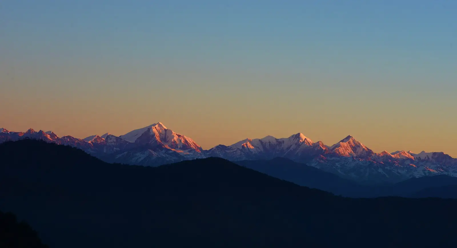
- Views of the Gorichen massif, Arunachal's highest peak (about 6,480 m)
- Old 1962 army bunkers above Thungri and rhododendron forest on the climb to Changla
- Ends in the high Mago valley and along the Tawang Chu, finishing at Tawang Monastery
Risks
- Remote high-altitude traverse: two nights at about 4,350-4,640 m and no evacuation road between Lagam and Thingbu; acclimatise at Bomdila first.
- The route runs close to the China border: army permission is checked at the Thungri camp and can delay or stop a group, and foreigners need a Protected Area Permit.
- Heavy snow from December to March; a NIMAS team made the first winter crossing only in January 2021, so winter is expedition-only.
- July-August monsoon brings rain, leeches, poor visibility and landslides on the approach roads; operators do not list these months.
- Two Tse La altitudes are published (about 4,712 m and 4,980 m); carry a GPS track, as the upper trail is faint in places.
Know before you go
Questions
Why is it called the Bailey Trail?
It is named after Lt Col F. M. Bailey, the British political officer who with H. T. Morshead explored and mapped this route from Tibet through Tawang and Mago to the plains in 1913. The same route was later used by both Indian and Chinese troops in the 1962 war.
Where does the Bailey Trail start and end?
Today's groups drive from Bomdila to Lagam, the last motorable point near Thembang, and walk via Thungri, Changla, Potok, Tse La, Lurthim and Mago to Thingbu Hydel, then drive to Tawang. Some older itineraries start walking from Thembang village.
When is the best time to do the Bailey Trail?
Late April to June and September to October. Winter brings deep snow on Tse La and the monsoon brings heavy rain, so operators do not run the trek in those months.
Which permits do I need?
Indian citizens need an Arunachal Pradesh Inner Line Permit and foreigners a Protected Area Permit; papers are checked at the Bhalukpong check gate. Forest and camping permission is arranged by operators, and the army checks groups at Thungri. We could not confirm current official fees, so check locally.
How difficult is the Bailey Trail?
It is graded difficult: six trekking days of 9-13 km, two of them about 9 hours long, crossing passes up to Tse La with camps above 4,300 m and no network. It suits trekkers who have done at least one high-altitude trek.
In an emergency
Save these numbers before you lose signal. Tap to call.
- 112All emergenciesIndia’s single emergency number — works in every state
- 108Ambulance
- 1077District disaster control room
You are in
District: West Kameng and TawangArunachal Pradesh
- Nearest hospital
- District hospitals at Bomdila (start side) and Tawang (finish side); serious cases go to Tezpur or Guwahati
- Last ATM
- Bomdila (not confirmed by a source; carry enough cash for the whole trek)
- Phone network
- Intermittent mobile network from Bomdila onwards; no network from Lagam until the road at Thingbu/Jang.
Before you set off
- Tell someone your route and when you will be back.
- Carry a charged phone and a power bank.
- Download an offline map of the route.
- Turn back if the weather turns bad — the mountain will wait.
Questions about Bailey Trail
No questions yet. Ask something and trekkers who have done it can answer.
Share your trek photo with #TreksAndTrails
I trekked this
Did Bailey Trail look different from this page? Tell us what changed and we will check it.
Where this comes from
Sources
Last reviewed:
- Gorichen Trek - Bailey Trail — Bikat Adventures
- Bailey Trail Trek 2026 | Historic Route, Itinerary & Best Time — TrekUp India
- Gorichen Trek — TrekUp India
- Bailey Trail — UnExploredNorthEast
- India (October-November 2019): Trekking in Arunachal Pradesh, plus Varanasi and more — Jean-Claude Latombe (Stanford University trip report)
- Trekking In Arunachal Pradesh: Discovering The Thrilling Routes And Nature's Allure — TripXL
- Do you have fire in your belly? Arunachal CM's challenge to trekkers — EastMojo
Photos: Koshy Koshy from Faridabad, Haryana, India, CC BY 2.0; Frederick Marshman Bailey, Public domain