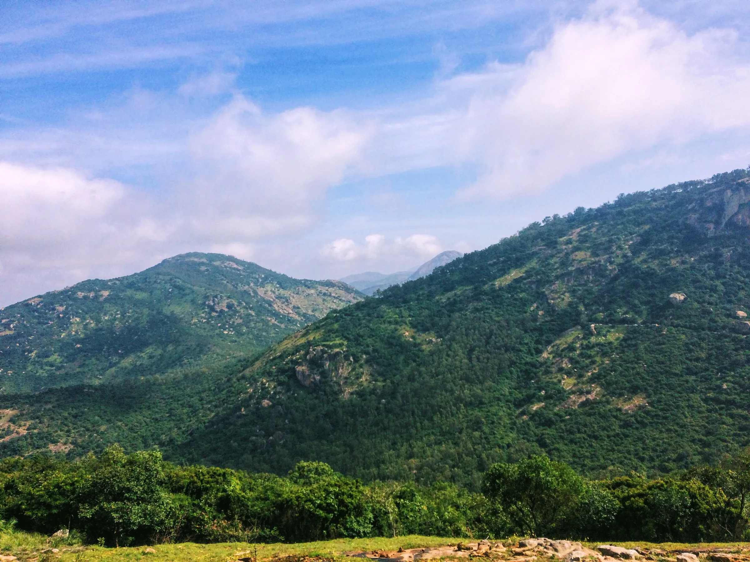
Nandi Hills Trek
Chikkaballapur, Karnataka
Opens without signal on this phone, with the map file and checklist. Saved for offline →
- Max altitude
- 1,478 m
- Days
- 1 day
- Distance
- 3 km
- Difficulty
- Easy
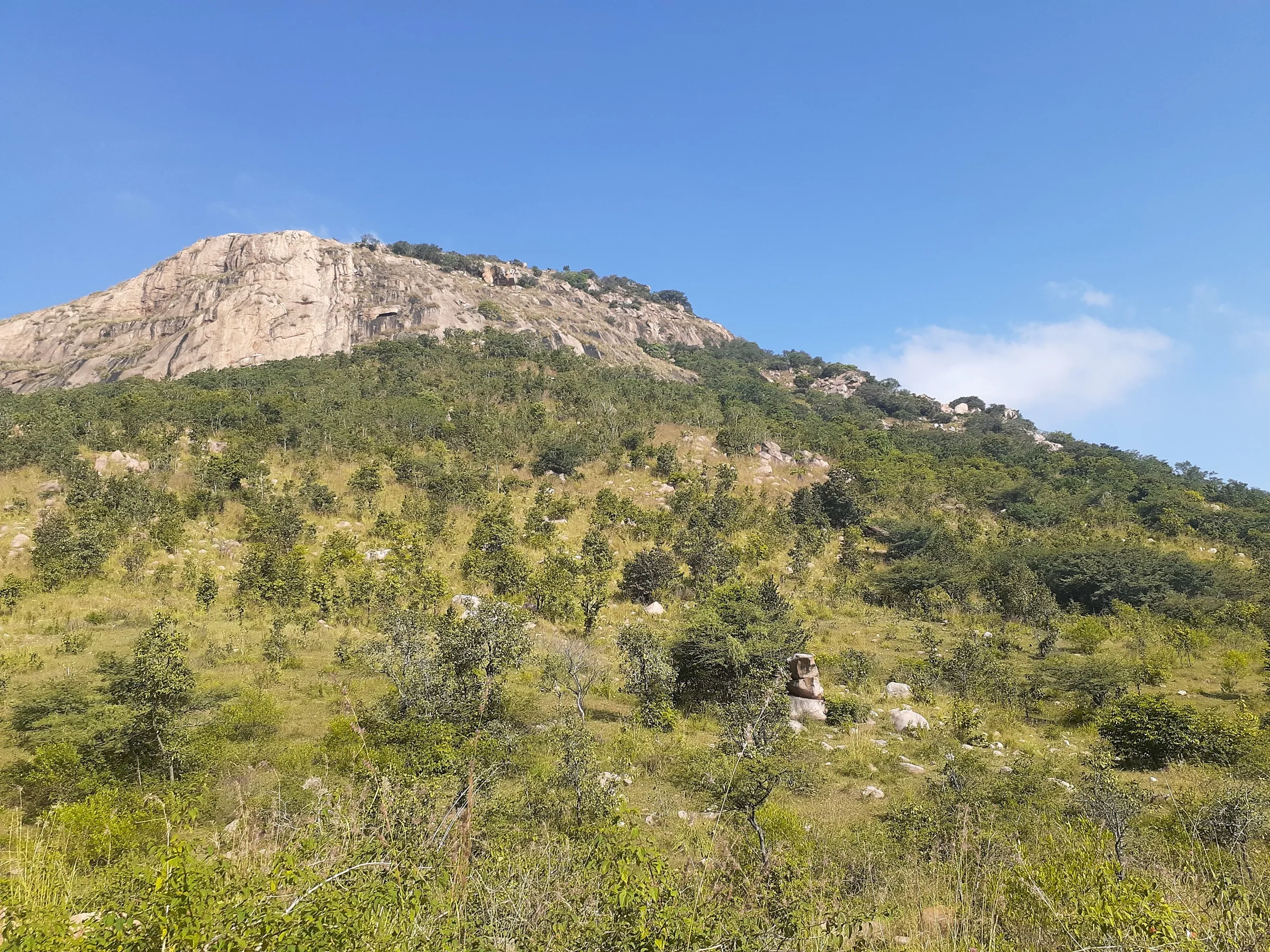
A short half-day climb on old granite steps, but it gains about 450 m in under 1.5 km; the stretch above the second ruins is steep, partly on steps cut into the rock, and slippery in fog and rain.
Photos
On the trail
The route
Day by day
Day 1 · highest point
Sultanpet (stone-steps trailhead) → Sultanpet (via Nandi Hills summit)
1,010 m → 1,478 m → 1,010 m
Ups and downs
Altitude profile
Where it is
Map
Trailhead and high point only — not a recorded track. Use it with a proper map.
Weather
Next 5 days on the trail
Live forecast for the trailhead and the high point. Mountain weather changes fast — check again on the morning you start.
Trailhead · Sultanpet
at 1,010 mLoading forecast…
High point · Nandi Hills summit (Yoga Nandeeshwara temple plateau)
at 1,478 mLoading forecast…
Each day: high / low °C · rain mm and chance · snow cm · wind km/h
Weather data: Open-Meteo.comModel forecast, not an official warning. For alerts follow IMD and the local administration.
Plan the trip
How to reach
- Trailhead
- Sultanpet (nearest town: Chikkaballapur)
- Nearest railway
- Nandi Halt (about 2 km walk to the trailhead); Chikkaballapur for more trains
- Nearest airport
- Kempegowda International Airport, Bengaluru
- By road
- Bengaluru (about 60 km via NH 44 to Devanahalli, SH 104 towards Chikkaballapur, Nandi village and Sultanpet); Chikkaballapur (shared autos to Sultanpet)
- Drive
- About 2 h from Bengaluru
Plan the trip
Permits and fees
We could not confirm the current permit rules and fees from an official source. Check with the local forest department or tourism office before you go.
Plan the trip
Cost
Self-guided
₹200–1,000
With an operator
₹10,000–11,500
Per person, ex-Bengaluru. We found no operator selling a guided steps-route package; the guided range is from private guided Nandi Hills sunrise day trips by car listed in October 2026 (TourRadar from about US$123 per person for two adults; Yo Tours on Travelocity about US$134 per traveller). Self-guided is an estimate: MEMU/DEMU train to Nandi Halt or KSRTC bus to Chikkaballapur plus a shared auto to Sultanpet, the hilltop entry ticket (check the current fee at the gate) and food at the summit cafes.
Gear
Top picks for this trek
The gear that matters most on this route, chosen from its altitude, season and risks.
 Ad · affiliate link
 Ad · affiliate link
 Ad · affiliate link
 Ad · affiliate link
 Ad · affiliate link
 Ad · affiliate link
 Ad · affiliate link
- Ad · affiliate link
Store buttons open a search on that store, not a product we picked. As an Amazon Associate we earn from qualifying purchases. Photos show the kind of item, not a specific product. Affiliate disclosure
Packing checklist
Matched to this trek: altitude, season, days and the risks on the route.
Packed 0 of 19
Tick each item as it goes in the bag.
Know before you go
Good to know
- Mobile network
- All major mobile networks work on the trail and at the summit (Indiahikes).
- Last ATM
- Chikkaballapur and the towns along the Bengaluru road; carry cash from Bengaluru. UPI works at most summit stalls.
- Nearest hospital
- District Hospital, Chikkaballapur (about 10 km)
- Water
- None on the steps route; carry at least 2 litres. Cafes and restaurants on the summit plateau.
Highlights
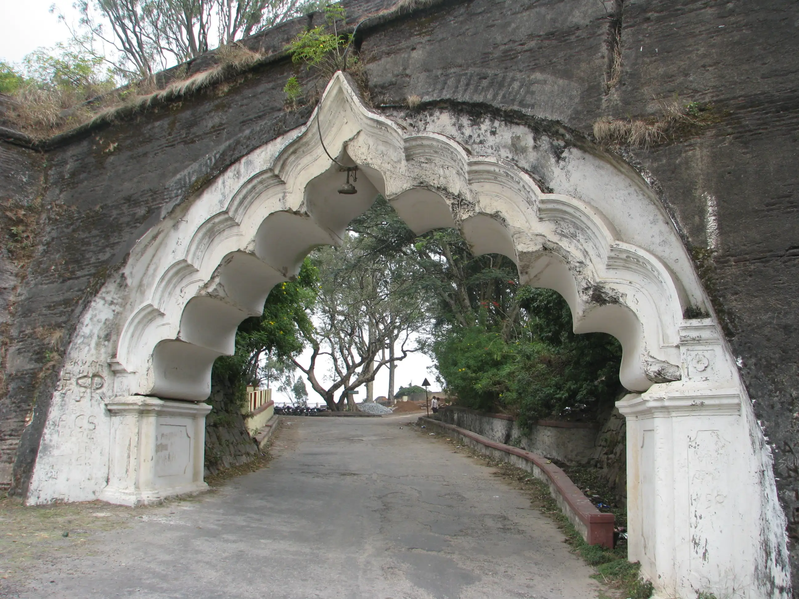
- The old granite stairway of Nandidurga fort, with stone archways, rest mantapas and ruined guard posts, used before the motor road existed
- Shaded forest on the upper slopes that catches the morning cloud, with views across to Skandagiri, Channagiri and the Dodballapur hills
- A small rock-cut temple on the cliff below the summit, then Tipu Sultan's summer residence and the Amrutha Sarovara stepped tank at the top
- Darshan at the Yoga Nandeeshwara temple of Bhagwan Shiva on the summit, and the 9th-century Bhoga Nandeeshwara temple in Nandi village at the foot of the hill
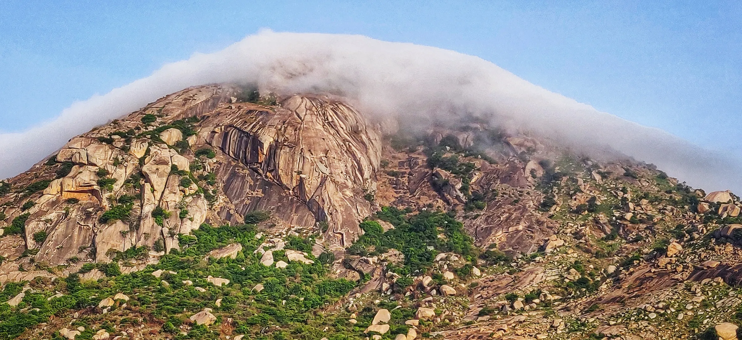
- Winter mornings when a sea of cloud fills the plains below the hill
Risks
- The steep upper steps, including those cut into the rock, get wet and slippery in fog and in the June-September monsoon; there are no views from the top on many monsoon days.
- Hilltop gates are open about 6 am to 6 pm; Indiahikes sets a 3 pm turn-around so you are down before dark. The district has shut the hill on some dates (New Year's Eve night, Valentine's Day 2026), so check before going on a holiday.
- Tipu's Drop and the fort edges are sheer cliffs; stay behind the railings. Monkeys at the summit snatch food and bottles.
- Weekends are very crowded on the motor road and summit; Indiahikes reports private vehicles have been stopped on weekends, and parking near the steps trailhead is limited.
- On 11 May 2026 Karnataka's Chief Wildlife Warden suspended trekking paths in forest areas with leopards, tigers, elephants or bears until each trail is certified safe. The Nandi Hills stairway is not a portal-booked forest trek and we found no closure notice for it, but check locally before climbing.
- March to May afternoons are hot on the exposed rock; start early.
Know before you go
Questions
Can you walk up Nandi Hills instead of driving?
Yes. Besides the motor road there is an old stone-step route from Sultanpet on the north side of the hill. Indiahikes measures it at about 1.5 km from the forest entrance to the summit, past fort archways, ruins and a cliff-side temple, and it takes about an hour to climb.
Do I need permission for the Nandi Hills steps trek?
Indiahikes says no permission is needed for the steps route; you go to the base and start. The hilltop itself is a ticketed tourist area open about 6 am to 6 pm, so pay the entry fee at the gate. This is a different trail from Nandi One (Brahmagiri/Horagina Betta), which needs Forest Department permission.
What is the best time to trek Nandi Hills?
October to February. Winter mornings are cool and often bring a sea of clouds below the hill. In the monsoon the steps are slippery and the top is usually in cloud, and March to May afternoons are hot.
How do I reach the Nandi Hills steps by public transport?
Take the early MEMU/DEMU from Bengaluru towards Chikkaballapur and get down at Nandi Halt, about a 2 km walk from the trailhead; or take a KSRTC bus to Chikkaballapur and a shared auto to Sultanpet.
Is there food and water on the trail?
No. Carry about 2 litres of water and a snack for the climb. There are many cafes and stalls on the summit, and most accept UPI.
In an emergency
Save these numbers before you lose signal. Tap to call.
- 112All emergenciesIndia’s single emergency number — works in every state
- 108Ambulance
- 1077District disaster control room
You are in
District: ChikkaballapurKarnataka
- Nearest hospital
- District Hospital, Chikkaballapur (about 10 km)
- Last ATM
- Chikkaballapur and the towns along the Bengaluru road; carry cash from Bengaluru. UPI works at most summit stalls.
- Phone network
- All major mobile networks work on the trail and at the summit (Indiahikes).
Before you set off
- Tell someone your route and when you will be back.
- Carry a charged phone and a power bank.
- Download an offline map of the route.
- Turn back if the weather turns bad — the mountain will wait.
Questions about Nandi Hills
No questions yet. Ask something and trekkers who have done it can answer.
Share your trek photo with #TreksAndTrails
I trekked this
Did Nandi Hills look different from this page? Tell us what changed and we will check it.
Where this comes from
Sources
Last reviewed:
- Nandi Hills Trek — Indiahikes
- Nandi Hills Trek Guide: Sultanpet Step Route, Sunrise & Tipu's Fort — TrekGo
- Nandi Hills Bangalore Insiders Guide — Treks and Trails India (treksandtrails.org)
- Nandi Hills - A small trek to the top — Yours Truly India
- Nandi Hills, India — Wikipedia
Photos: Tinucherian, CC BY-SA 3.0; L. Shyamal, CC BY-SA 3.0; Shyamal, CC BY-SA 3.0