Minkiani Pass Trek
Kangra (the pass is on the Dhauladhar crest on the Kangra-Chamba border), Himachal Pradesh
Opens without signal on this phone, with the map file and checklist. Saved for offline →
- Max altitude
- 4,350 m
- Satellite terrain suggests about 4,031 m
- Days
- 4 days
- Distance
- 48 km
- Difficulty
- Difficult
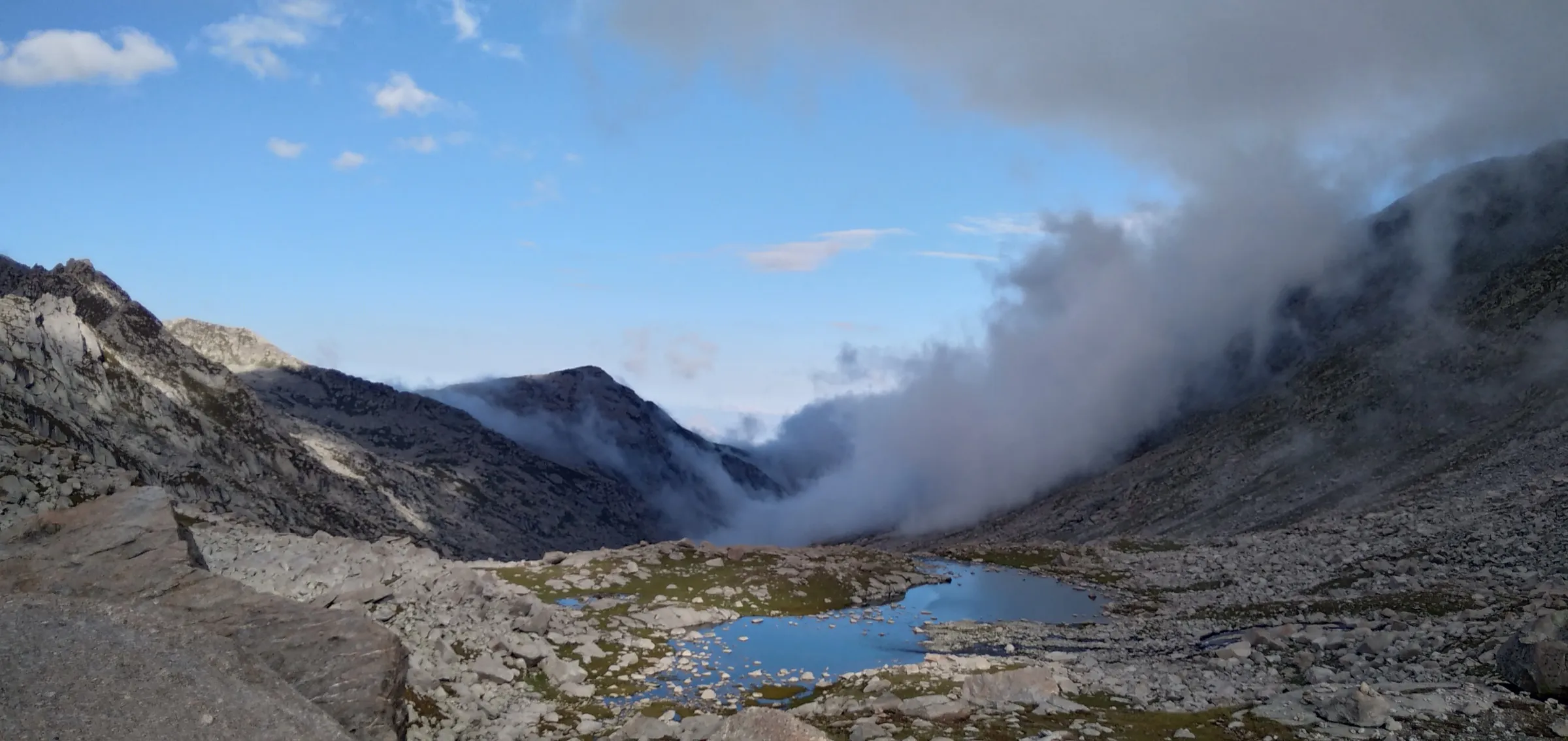
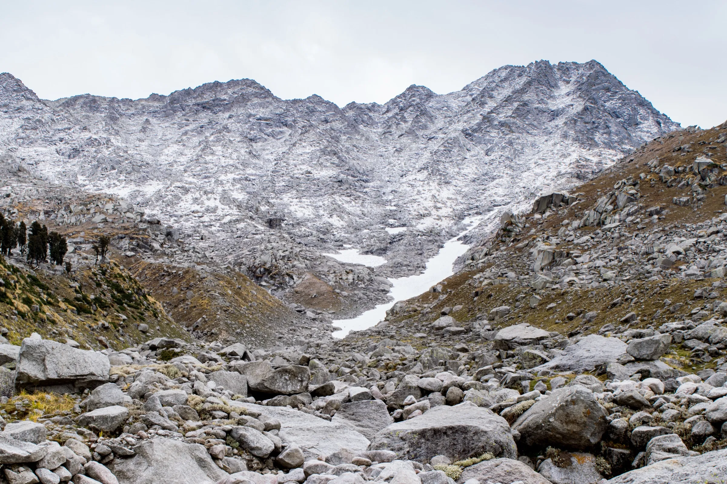
Operators grade it moderate to difficult: a climb of about 1,400 m from Kareri Lake to the pass and back down in one day, on boulder fields, wet rock and stone steps, often in cloud; snow lies on the pass early and late in the season, and the weather on the crest changes fast.
Photos
On the trail
The route
Day by day
Day 1
McLeodganj (drive to Satobari) → Kareri Village via Ghera
1,750 m → 1,800 m
Day 2
Kareri Village → Kareri Lake
1,800 m → 2,950 m
Day 3 · highest point
Kareri Lake → Kareri Lake (day climb to Minkiani Pass and back)
2,950 m → 4,350 m → 2,950 m
Day 4
Kareri Lake → Kareri Village (drive to McLeodganj)
2,950 m → 1,800 m
Ups and downs
Altitude profile
Where it is
Map
Trailhead and high point only — not a recorded track. Use it with a proper map.
Weather
Next 5 days on the trail
Live forecast for the trailhead and the high point. Mountain weather changes fast — check again on the morning you start.
Trailhead · Kareri Village
at 1,750 mLoading forecast…
High point · Minkiani Pass
at 4,350 mLoading forecast…
Each day: high / low °C · rain mm and chance · snow cm · wind km/h
Weather data: Open-Meteo.comModel forecast, not an official warning. For alerts follow IMD and the local administration.
Plan the trip
How to reach
- Trailhead
- Kareri Village (nearest town: McLeodganj (Dharamshala))
- Nearest railway
- Pathankot (about 90 km from Dharamshala)
- Nearest airport
- Gaggal (Kangra) Airport, about 20 km from Kareri
- By road
- McLeodganj or Dharamshala to Satobari or on to Kareri Village by taxi (about 30 minutes to Satobari); Delhi to Dharamshala/McLeodganj (about 500 km, roughly 10-13 hours by road or overnight bus)
- Drive
- About 12 h from Delhi
Plan the trip
Permits and fees
We could not confirm the current permit rules and fees from an official source. Check with the local forest department or tourism office before you go.
Plan the trip
Cost
Self-guided
₹4,000–9,000
With an operator
₹9,000–26,500
Per person, ex-McLeodganj. Himtrek lists the 4-day Kareri Lake-Minkiani Pass trek at ₹9,000 (reporting McLeodganj, tents, veg meals and transport to Kareri Village included). A 6-day variant that crosses Minkiani Pass to Chamba is listed on TourTravelWorld from ₹26,500. Himalaya Shelter sells a 7-day Delhi-to-Delhi version on request without a published price. Self-guided is our estimate: taxi to Satobari or Kareri Village, a local guide for the pass (strongly advised), tent and stove hire and four days of food.
Gear
Top picks for this trek
The gear that matters most on this route, chosen from its altitude, season and risks.
 Ad · affiliate link
 Ad · affiliate link
 Ad · affiliate link
 Ad · affiliate link
 Ad · affiliate link
 Ad · affiliate link
 Ad · affiliate link
 Ad · affiliate link
Store buttons open a search on that store, not a product we picked. As an Amazon Associate we earn from qualifying purchases. Photos show the kind of item, not a specific product. Affiliate disclosure
Packing checklist
Matched to this trek: altitude, season, days and the risks on the route.
Packed 0 of 33
Nights near 4,350 m can drop close to freezing even in summer. Pack one more warm layer than you think.
Tick each item as it goes in the bag.
Know before you go
Good to know
- Mobile network
- Phone signal in Kareri Village; patchy to none on the trail beyond the village and none expected at Kareri Lake or on the pass.
- Last ATM
- Dharamshala/McLeodganj; there is no ATM in Kareri Village
- Nearest hospital
- Zonal Hospital, Dharamshala for first care; Dr Rajendra Prasad Government Medical College, Tanda (Kangra) for serious cases
- Water
- Streams along the Kareri nullah up to the lake and snow-melt streams above it. Kareri Lake itself is marked not drinkable on OpenStreetMap; boil or treat all water.
Highlights
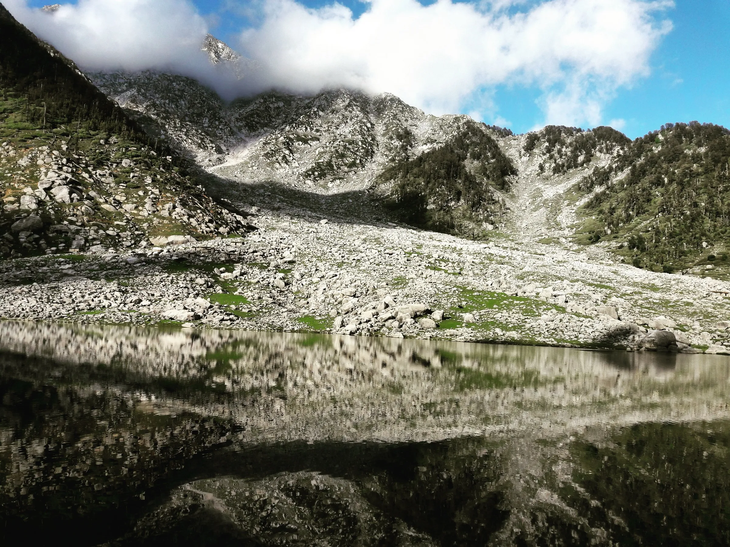
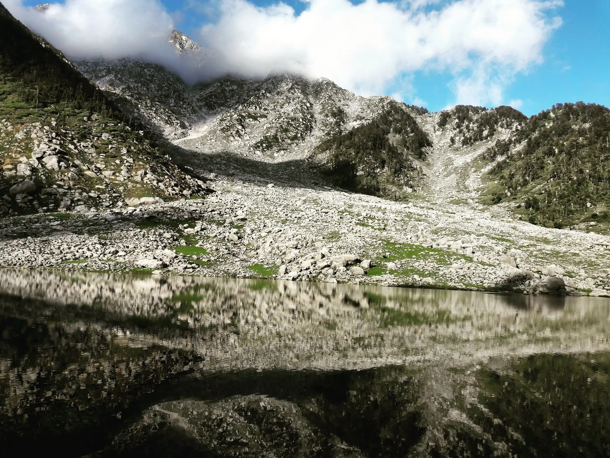
- Kareri Lake (about 2,950 m), a shallow glacial lake under the Dhauladhar wall with a temple of Bhagwan Shiv and Shakti on the hill above it; the Minkiani Pass rises straight opposite the lake
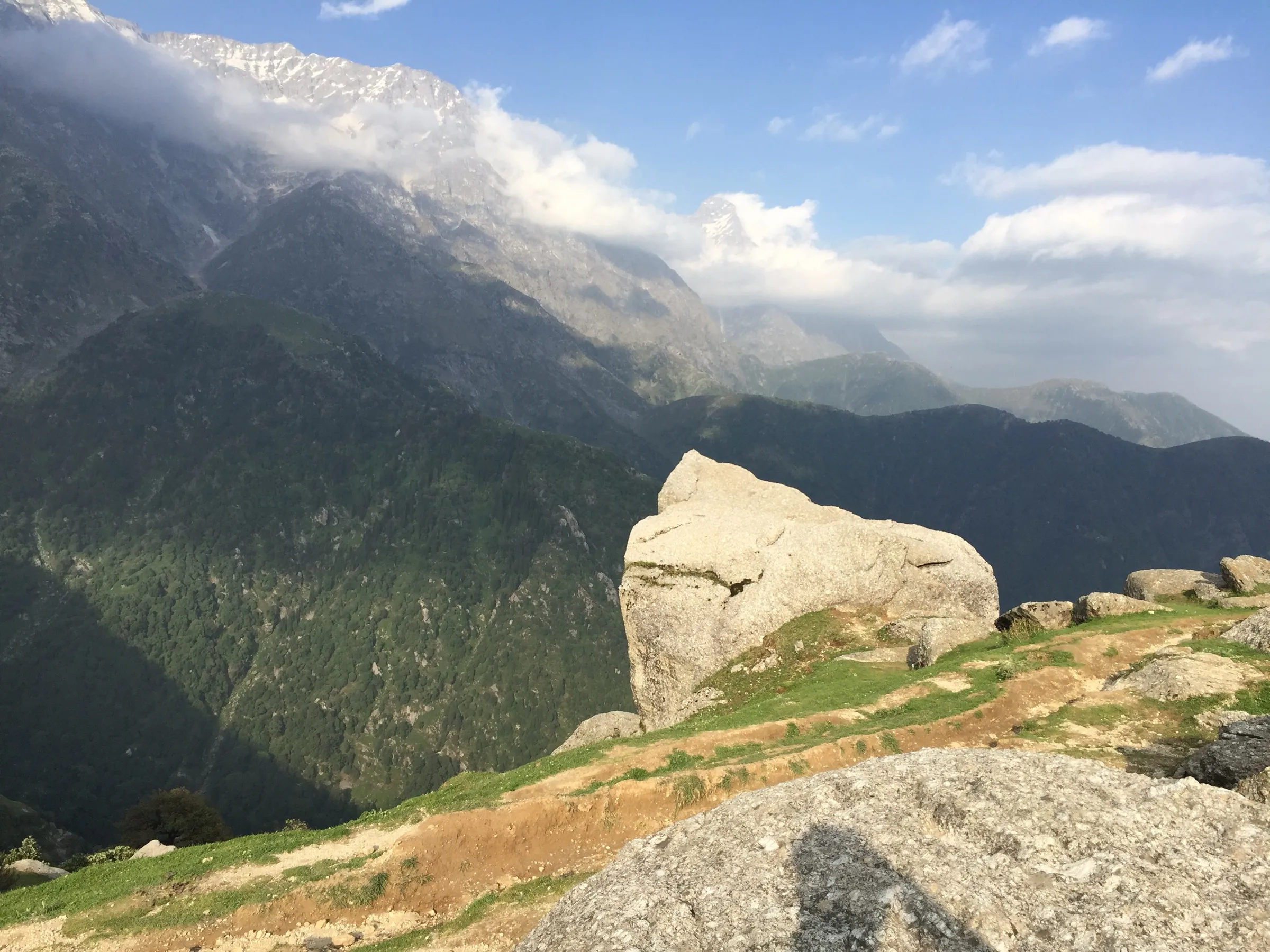
- Standing on the Dhauladhar crest at Minkiani Pass, with the Kangra valley to the south and the Chamba side to the north
- A well-laid stone trail through oak and rhododendron forest along the Kareri nullah, past Gaddi shepherd huts
- From the pass, longer routes go east to Lam Dal and the high Dhauladhar lakes or north down the Lamdal nullah to Drakund and Chamba
Risks
- Kangra district has repeatedly ordered a ban on trekking above 3,000 m (most recently on 6 January 2026, 'until further notice') and has required prior permission from the SP Kangra for the Kareri route; any weather alert cancels permissions. Minkiani Pass is above that limit. We found no order lifting the January 2026 ban as of 17 October 2026, although operators sell the trek. Confirm with the Kangra district administration or SP office in Dharamshala before you go.
- The pass's height is uncertain: operators quote 4,250-4,400 m, but satellite terrain data and OpenStreetMap put the saddle at about 4,000-4,030 m. Either way the summit day climbs about 1,100-1,400 m and is long.
- Sudden weather changes, blizzards and white-outs are common on the pass; the climb is over boulders, wet rock faces and steep stone steps, and cloud can cut visibility to a few metres.
- July and August bring heavy monsoon rain on the Dharamshala side, with landslide risk, slippery rock and low visibility.
- From November to March the trail can be fully snow-covered; Himalaya Shelter says winter crossings are not for inexperienced trekkers.
- Altitude sickness is possible above 3,500 m; go slowly, drink water and turn back if symptoms worsen.
Know before you go
Questions
How high is Minkiani Pass?
Operators quote about 4,250-4,400 m (Himalaya Shelter 14,270 ft / about 4,350 m; Himtrek about 4,400 m; Wikipedia 4,250 m). Satellite terrain data reads about 4,030 m at the saddle marked on OpenStreetMap, so treat the quoted figures as approximate.
Is the Minkiani Pass trek allowed right now?
Check first. The Kangra district administration banned trekking above 3,000 m on 6 January 2026 until further notice and has required SP Kangra permission for the Kareri route. We found no order lifting it as of 17 October 2026. Ask the SP office or district administration in Dharamshala before you go.
What is the best time for the Minkiani Pass trek?
May-June and September-October. Himtrek lists March to October and Himalaya Shelter lists April and June to October, but July-August is heavy monsoon with landslide risk, and in early spring snow still covers the pass.
How many days does the Minkiani Pass trek take?
Four days from McLeodganj: Satobari to Kareri Village, Kareri Village to Kareri Lake, a day climb to the pass and back to the lake, and the walk down. Delhi-to-Delhi packages run to seven days.
Can I go on from Minkiani Pass to Lam Dal or Chamba?
Yes. Beyond the pass the trail drops to the Minkiani Got meadow; east it leads to Lam Dal and the Dhauladhar lakes, and north it descends along the Lamdal nullah to Drakund and Dunali on the Chamba-Bharmour road. These are longer, separate routes.
In an emergency
Save these numbers before you lose signal. Tap to call.
- 112All emergenciesIndia’s single emergency number — works in every state
- 108Ambulance
- 1077District disaster control room
You are in
District: Kangra (the pass is on the Dhauladhar crest on the Kangra-Chamba border)Himachal Pradesh
- Nearest hospital
- Zonal Hospital, Dharamshala for first care; Dr Rajendra Prasad Government Medical College, Tanda (Kangra) for serious cases
- Last ATM
- Dharamshala/McLeodganj; there is no ATM in Kareri Village
- Phone network
- Phone signal in Kareri Village; patchy to none on the trail beyond the village and none expected at Kareri Lake or on the pass.
Before you set off
- Tell someone your route and when you will be back.
- Carry a charged phone and a power bank.
- Download an offline map of the route.
- Turn back if the weather turns bad — the mountain will wait.
Questions about Minkiani Pass
No questions yet. Ask something and trekkers who have done it can answer.
Share your trek photo with #TreksAndTrails
I trekked this
Did Minkiani Pass look different from this page? Tell us what changed and we will check it.
Where this comes from
Sources
Last reviewed:
- Minkiani Pass Trek – 4-Day Himachal Adventure — Himtrek
- Minkiani Pass Trek Himachal – Route, Difficulty, Best Time & Price — Himalaya Shelter
- Dhauladhar Dilemma (Himalayan Journal 65) — The Himalayan Club
- Kareri Lake — Wikipedia
- Trek to Chamba Over Minkiani Pass Tour — TourTravelWorld (operator listing)
- Himachal: Kangra administration bans trekking above 3,000 metres (PTI, 6 Jan 2026) — The Week (PTI)
Photos: Shorya Pathania, CC BY-SA 4.0; Ashish Gupta from Noida, India, CC BY 2.0; Ashish Gupta from Noida, India, CC BY 2.0