Khauli Pass Trek
Kullu, Himachal Pradesh
Opens without signal on this phone, with the map file and checklist. Saved for offline →
- Max altitude
- 3,750 m
- Satellite terrain suggests about 3,463 m
- Days
- 4 days
- Distance
- 40 km
- Difficulty
- Moderate
Two easy forest days up the Grahan Nala, then a steep, strenuous climb of about 900 m from Padri to the pass and back in one day, over soft snow in May-June, and a long 15 km descent to Kasol on the last day.
Photos
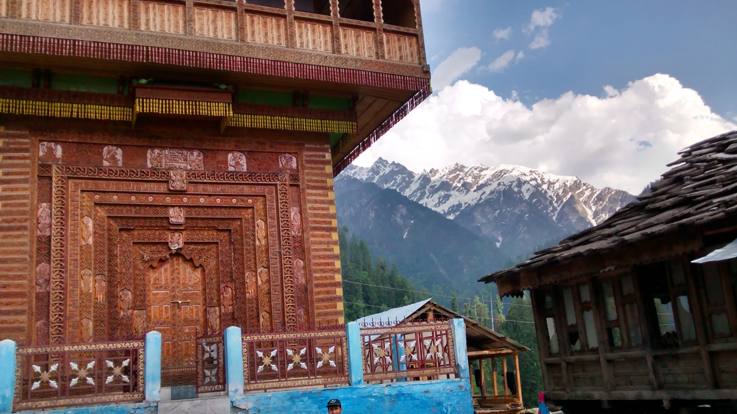
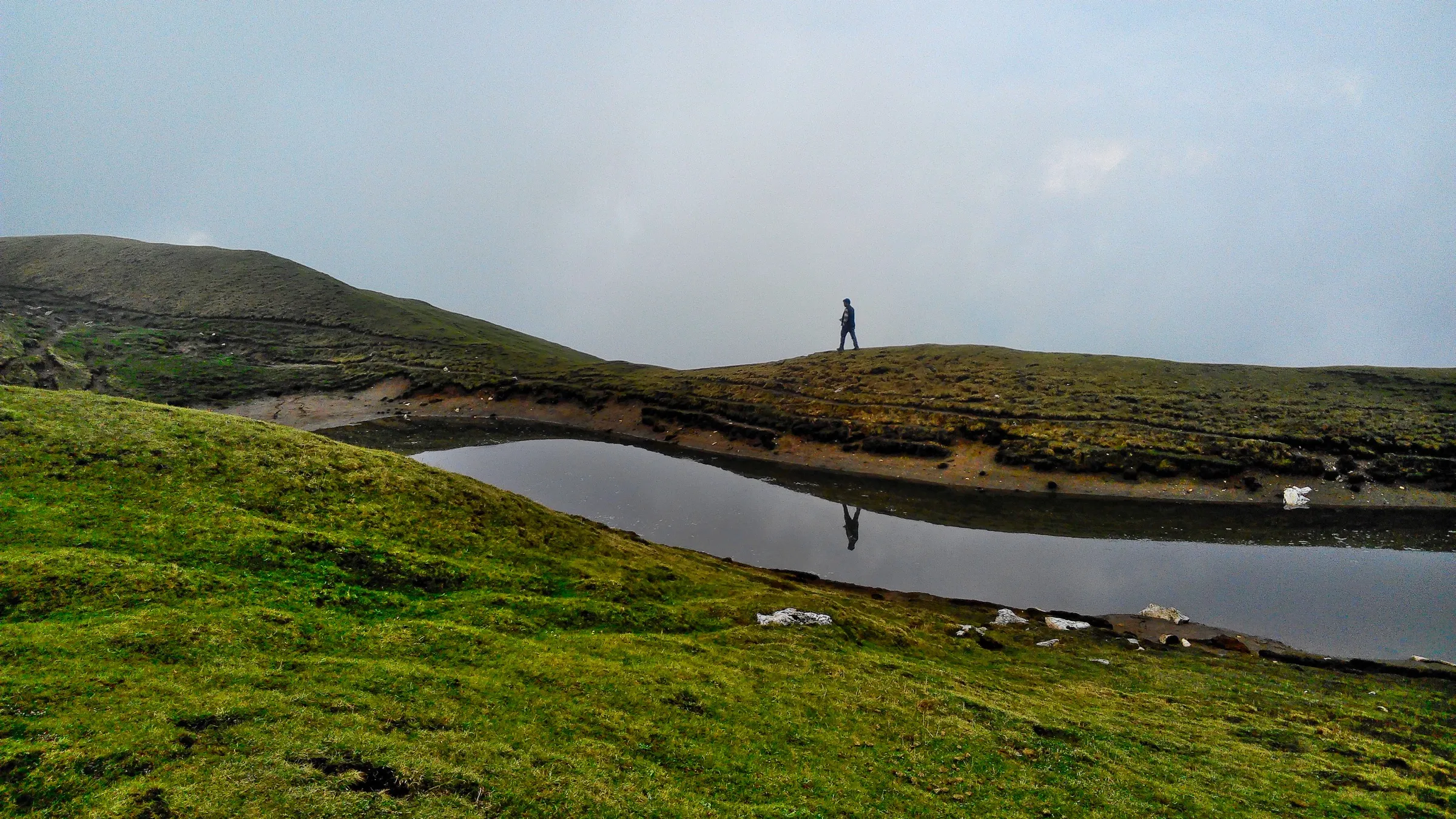
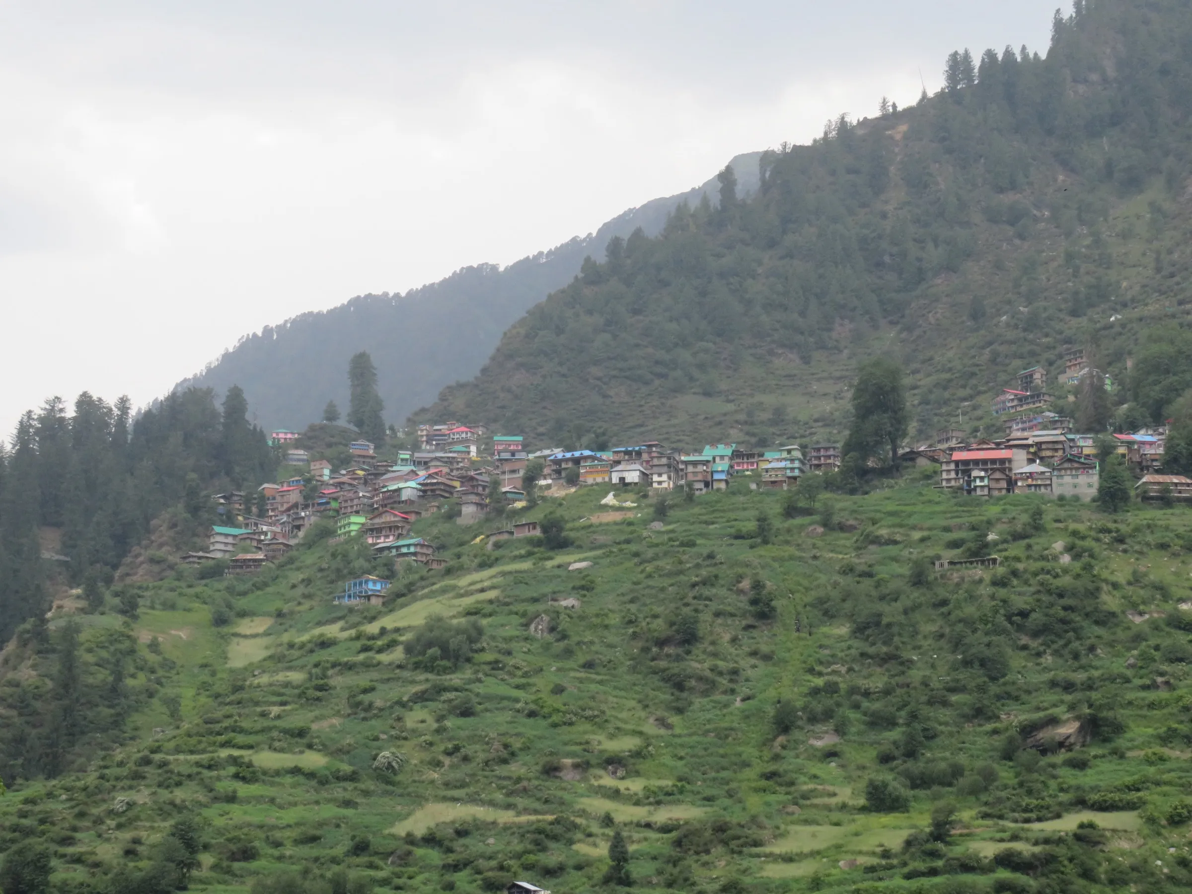
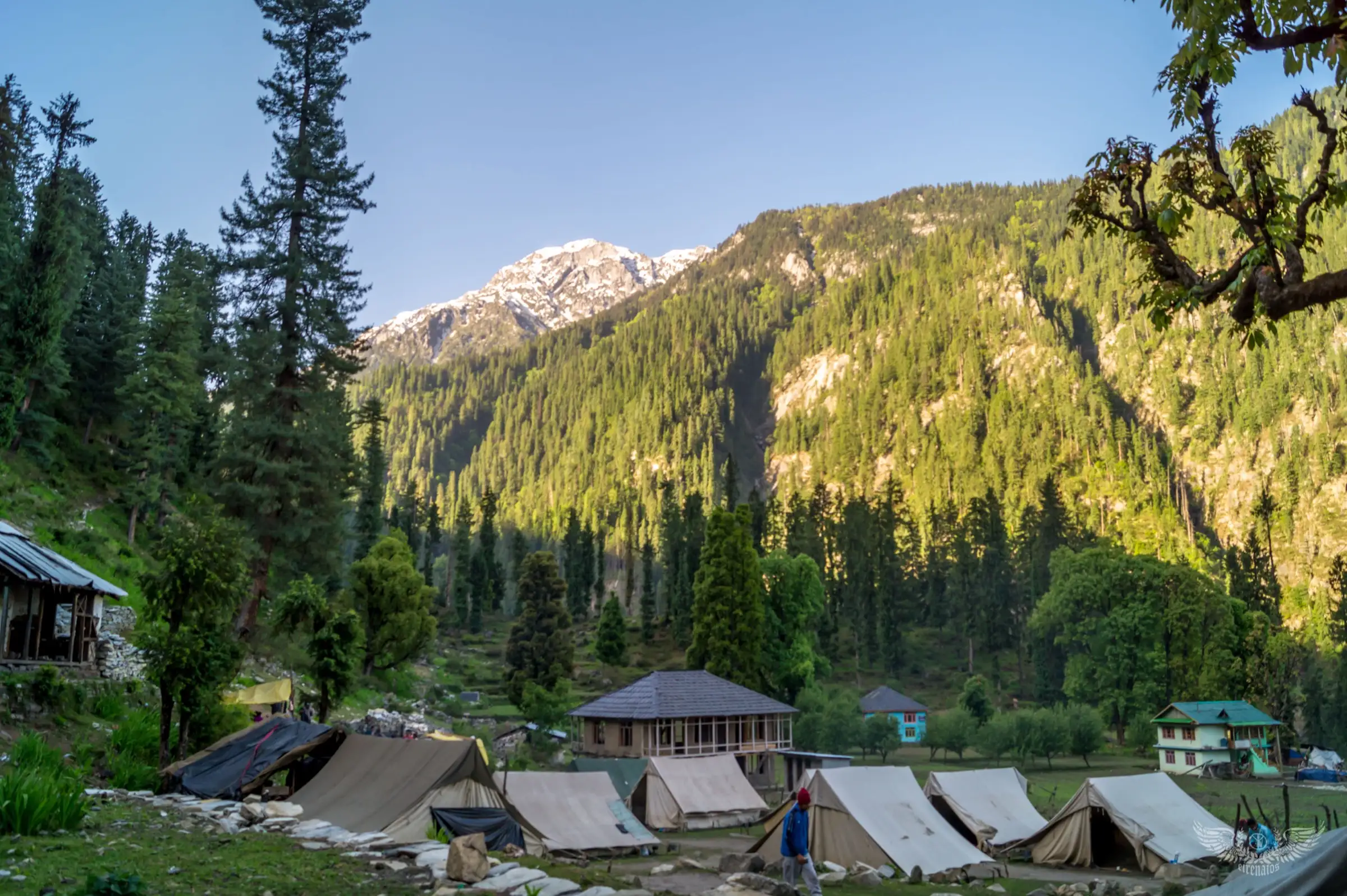
On the trail
The route
Day by day
Day 1
Kasol (drive from Kullu or Bhuntar) → Grahan
1,580 m → 2,286 m
Day 2
Grahan → Padri meadow
2,286 m → 2,820 m
Day 3 · highest point
Padri meadow → Padri meadow (via Khauli Pass)
2,820 m → 3,750 m → 2,820 m
Day 4
Padri meadow → Kasol (drive to Kullu)
2,820 m → 1,580 m
Ups and downs
Altitude profile
Where it is
Map
Trailhead and high point only — not a recorded track. Use it with a proper map.
Weather
Next 5 days on the trail
Live forecast for the trailhead and the high point. Mountain weather changes fast — check again on the morning you start.
Trailhead · Kasol
at 1,580 mLoading forecast…
High point · Khauli Pass (Khauli Galu)
at 3,750 mLoading forecast…
Each day: high / low °C · rain mm and chance · snow cm · wind km/h
Weather data: Open-Meteo.comModel forecast, not an official warning. For alerts follow IMD and the local administration.
Plan the trip
How to reach
- Trailhead
- Kasol
- Nearest railway
- Chandigarh is the usual railhead (about 250 km to Kasol); Joginder Nagar narrow-gauge station is closer but has few trains
- Nearest airport
- Kullu-Manali Airport, Bhuntar, about 31 km from Kasol
- By road
- Kullu bus stand to Kasol by bus or shared taxi via Bhuntar (Bikat Adventures reports about 32 km by road from the road head back to Kullu); Delhi (about 520 km): overnight bus towards Kullu-Manali or Kasol, changing at Bhuntar if needed
- Drive
- About 12 h from Delhi
Plan the trip
Permits and fees
We could not confirm the current permit rules and fees from an official source. Check with the local forest department or tourism office before you go.
Plan the trip
Cost
Self-guided
₹4,000–9,000
With an operator
₹9,000–16,000
Per person, ex-Kasol. Both are estimates: no operator publishes a current price (Bikat Adventures lists the trek 'On Request + 5% GST', Bhuntar to Bhuntar). The guided range is a reasoned estimate for a 4-day camping trek in the Kullu valley with tents, meals, guide and porters. Self-guided assumes hiring a local guide or porter at Kasol or Grahan, carrying or renting a tent and stove for two nights at Padri, food, and the bus or taxi from Bhuntar.
Gear
Top picks for this trek
The gear that matters most on this route, chosen from its altitude, season and risks.
 Ad · affiliate link
 Ad · affiliate link
 Ad · affiliate link
 Ad · affiliate link
 Ad · affiliate link
 Ad · affiliate link
 Ad · affiliate link
 Ad · affiliate link
Store buttons open a search on that store, not a product we picked. As an Amazon Associate we earn from qualifying purchases. Photos show the kind of item, not a specific product. Affiliate disclosure
Packing checklist
Matched to this trek: altitude, season, days and the risks on the route.
Packed 0 of 32
Nights near 3,750 m can drop close to freezing even in summer. Pack one more warm layer than you think.
Tick each item as it goes in the bag.
Know before you go
Good to know
- Mobile network
- Mobile network in Kasol; other Kullu records report no reliable Jio or Airtel signal in Grahan and none expected at Padri or on the pass, so tell someone your plan before you leave.
- Last ATM
- Kasol (Bhuntar for more choice); there is no ATM in Grahan
- Nearest hospital
- Health centre at Manikaran, a short drive up the valley from Kasol, for first care; Regional Hospital Kullu for serious cases
- Water
- The trail follows the Grahan Nala with streams and waterfalls up to Padri; above Padri carry water for the pass day. Treat all stream water.
Highlights
- A little-walked pass above the Grahan Nala, on the ridge between the Parvati valley side and the Hurla Nala
- Pine, oak and rhododendron forest of the Kanawar Wildlife Sanctuary on the way to Grahan village
- Camping in the alpine meadow at Padri, with streams, waterfalls and snow peaks in view
- Birch (bhojpatra) woods on the final climb, with flowers on the top slopes after the monsoon
- Bikat Adventures reports views from the pass towards Hanuman Tibba, Indrasan and Friendship Peak
Risks
- The pass climb is steep; in May and June the approach is over soft snow, so start very early and carry microspikes.
- July-August monsoon rain in the Kullu valley brings landslides, cloudbursts and slippery trails. Kullu district suspended adventure activities from 15 July to 15 September 2026 (the order lists rafting, river crossing and paragliding; trekking is not named). Check the current order with the Kullu district administration.
- The route is little documented and the trail above Padri is faint in places; go with a local guide who knows the pass.
- No mobile network beyond Kasol for calls for help.
- Altitude: the pass is about 3,460-3,750 m; acclimatise at Grahan and Padri and turn back if symptoms of altitude sickness appear.
- The pass is in Kullu district, not Kangra, so the January 2026 Kangra ban on trekking above 3,000 m does not apply here, but check for any Kullu forest or district order before going.
Know before you go
Questions
Where is Khauli Pass?
In the Kullu district of Himachal Pradesh, south of Kasol in the Parvati valley. The route walks up the Grahan Nala through Grahan village to the Padri meadow, and the pass (marked Khauli Galu on OpenStreetMap) is on the ridge above Padri.
How difficult is the Khauli Pass trek?
Bikat Adventures rates it moderate. The first two days are gentle forest walking, but the pass day is a steep, strenuous climb from Padri (about 2,820 m) to the pass and back, over soft snow in May-June.
How long is the trek and how many days does it take?
Bikat Adventures runs it in 4 days and puts the total at about 40 km: Kasol to Grahan (10 km), Grahan to Padri (7 km), Padri to the pass and back (8 km) and Padri down to Kasol (15 km).
What is the best time for the Khauli Pass trek?
Trekup India suggests mid-June to late September, when the snow has melted. Bikat Adventures notes the pass is snow-covered in May-June and the flowers on the top slopes show after the monsoon. July-August is monsoon season in Kullu, so check the weather and any district orders.
How high is Khauli Pass?
Bikat Adventures gives 3,750 m. Satellite terrain at the pass marked on OpenStreetMap reads about 3,460 m, so the true height may be lower than operators quote.
In an emergency
Save these numbers before you lose signal. Tap to call.
- 112All emergenciesIndia’s single emergency number — works in every state
- 108Ambulance
- 1077District disaster control room
You are in
District: KulluHimachal Pradesh
- Nearest hospital
- Health centre at Manikaran, a short drive up the valley from Kasol, for first care; Regional Hospital Kullu for serious cases
- Last ATM
- Kasol (Bhuntar for more choice); there is no ATM in Grahan
- Phone network
- Mobile network in Kasol; other Kullu records report no reliable Jio or Airtel signal in Grahan and none expected at Padri or on the pass, so tell someone your plan before you leave.
Before you set off
- Tell someone your route and when you will be back.
- Carry a charged phone and a power bank.
- Download an offline map of the route.
- Turn back if the weather turns bad — the mountain will wait.
Questions about Khauli Pass
No questions yet. Ask something and trekkers who have done it can answer.
Share your trek photo with #TreksAndTrails
I trekked this
Did Khauli Pass look different from this page? Tell us what changed and we will check it.
Where this comes from
Sources
Last reviewed:
- Khauli Pass Trek — Bikat Adventures
- Khauli Pass Trek — Trekup India
- Adventure Activities Banned In Kullu Due To Monsoons — ETV Bharat
Photos: Suresh Karia, CC BY-SA 4.0; Vpboy, CC BY-SA 3.0; Cj Krish, CC BY-SA 4.0