Grahan Trek
Kullu, Himachal Pradesh
Opens without signal on this phone, with the map file and checklist. Saved for offline →
- Max altitude
- 2,347 m
- Days
- 2 days
- Distance
- 18 km
- Difficulty
- Easy
A marked forest trail along the Grahan Nala with no technical sections and a top below 2,400 m, but it climbs about 770 m over 8-10 km and the last 1-1.5 km into the village is a steep zig-zag.
Photos
On the trail
The route
Day by day
Day 1 · highest point
Kasol → Grahan
1,580 m → 2,347 m
Day 2
Grahan → Kasol
2,347 m → 1,580 m
Ups and downs
Altitude profile
Where it is
Map
Trailhead and high point only — not a recorded track. Use it with a proper map.
Weather
Next 5 days on the trail
Live forecast for the trailhead and the high point. Mountain weather changes fast — check again on the morning you start.
Trailhead · Kasol
at 1,580 mLoading forecast…
High point · Grahan village
at 2,347 mLoading forecast…
Each day: high / low °C · rain mm and chance · snow cm · wind km/h
Weather data: Open-Meteo.comModel forecast, not an official warning. For alerts follow IMD and the local administration.
Plan the trip
How to reach
- Trailhead
- Kasol
- Nearest railway
- Chandigarh is the usual railhead (about 250 km to Kasol); Joginder Nagar narrow-gauge station is closer but has few trains
- Nearest airport
- Kullu-Manali Airport, Bhuntar, about 31 km from Kasol
- By road
- Delhi (about 520 km): overnight bus towards Manali or Kasol, changing at Bhuntar if needed; Bhuntar to Kasol, about 31 km by local bus or taxi
- Drive
- About 12 h from Delhi
Plan the trip
Permits and fees
We could not confirm the current permit rules and fees from an official source. Check with the local forest department or tourism office before you go.
Plan the trip
Cost
Self-guided
₹800–2,500
With an operator
₹1,250–6,850
Per person, ex-Kasol. Guided prices published October 2026: Himtrek ₹1,199 + 5% GST (2 days) and ₹2,100 + 5% GST (3 days), both reporting at Kasol; Treks and Trails India (treksandtrails.org, not affiliated with this site) ₹6,500 + 5% GST for a 4-day Kasol-Grahan-Tosh trip with Kasol hostel and Tosh homestay nights. Self-guided is an estimate: a Grahan homestay (Travel Coffee reports ₹300-600 per room per night), home-cooked meals and snacks, and an optional local guide from Kasol.
Gear
Top picks for this trek
The gear that matters most on this route, chosen from its altitude, season and risks.
 Ad · affiliate link
 Ad · affiliate link
 Ad · affiliate link
 Ad · affiliate link
- Ad · affiliate link
 Ad · affiliate link
 Ad · affiliate link
 Ad · affiliate link
Store buttons open a search on that store, not a product we picked. As an Amazon Associate we earn from qualifying purchases. Photos show the kind of item, not a specific product. Affiliate disclosure
Packing checklist
Matched to this trek: altitude, season, days and the risks on the route.
Packed 0 of 24
Monsoon months (Jun, Sep): pack everything in plastic or a dry bag and wear shoes with good grip.
Tick each item as it goes in the bag.
Know before you go
Good to know
- Mobile network
- Network in Kasol; no mobile signal (Jio or Airtel) in Grahan or on most of the trail, so tell someone your plan before you leave.
- Last ATM
- Kasol; there is no ATM or card machine in Grahan, so carry cash
- Nearest hospital
- Health centre at Manikaran, a short drive up the valley from Kasol, for first care; Regional Hospital Kullu for serious cases
- Water
- The trail follows the Grahan Nala with small streams; seasonal dhabas in the first 1.5 hours only. Carry 2 litres and snacks, and treat stream water.
Highlights
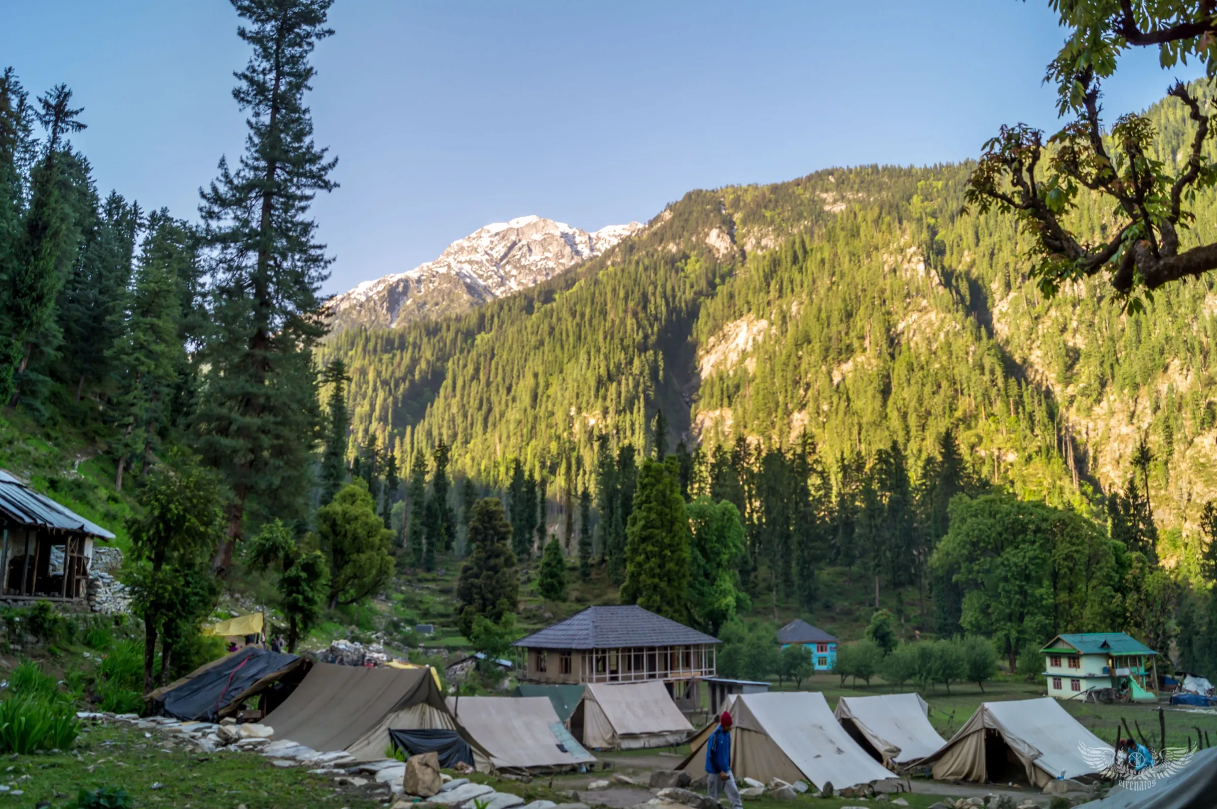
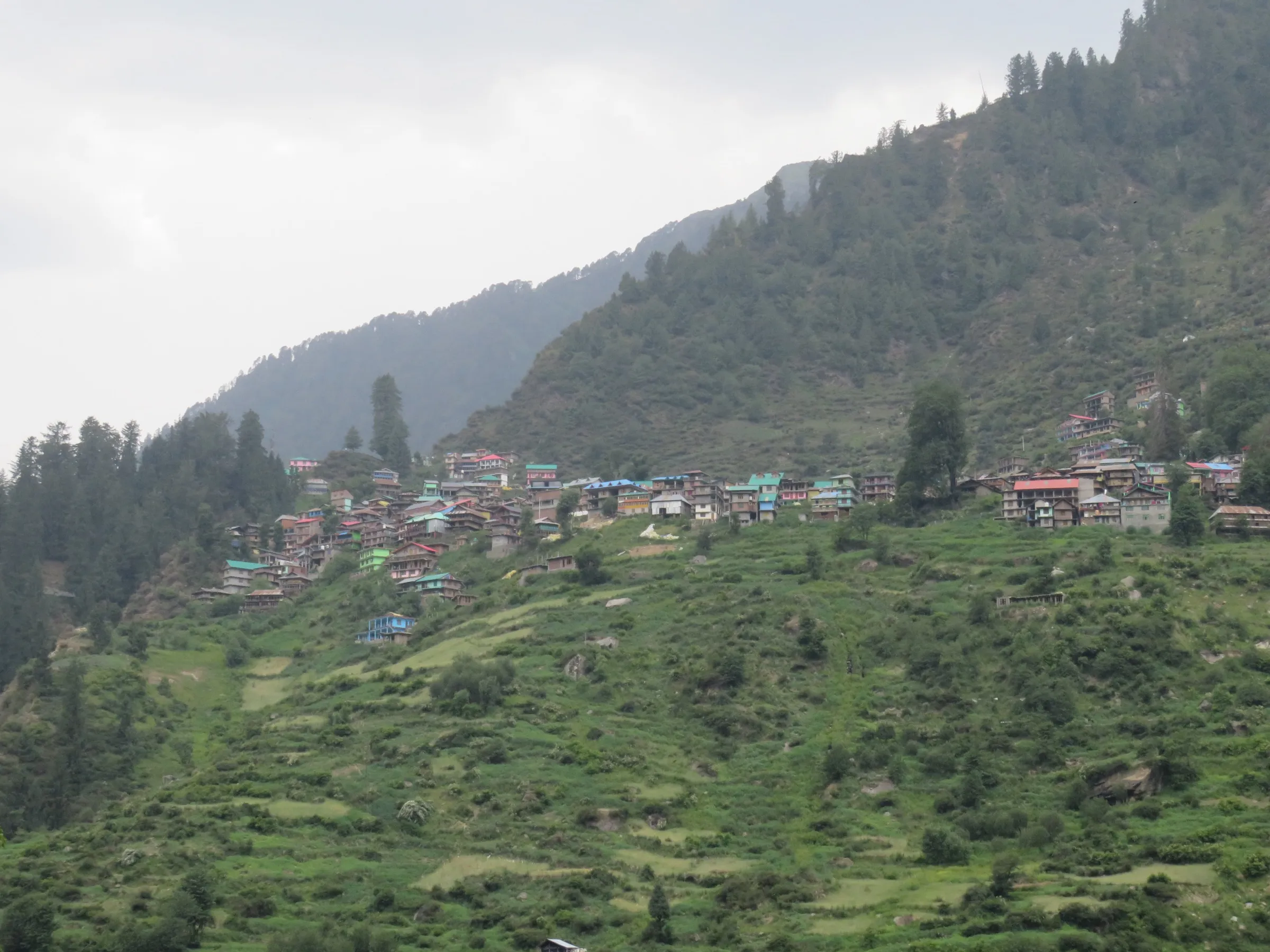
- Grahan, an old village of wooden houses on a slope high above Kasol, with no road to it
- Pine and deodar forest beside the Grahan Nala, with small bridges and stream crossings
- Clear night skies for star-gazing and sunrise over the Parvati valley peaks from the village fields
- A short walk from the village to the Grahan waterfall; Grahan is also the first night stop on the Sar Pass trek
Risks
- July-August monsoon brings landslides, cloudbursts (Kullu valley saw cloudbursts in June 2025) and slippery trail; operators advise checking conditions or avoiding these months.
- The trail has forks, one of which leads towards Thunja rather than Grahan; confirm the route in Kasol and follow the red arrow markers.
- The last 1-1.5 km is a steep zig-zag climb; start early, because the markers are hard to see after dark.
- There is no mobile network for help in an emergency; solo walkers and first-timers should take a local guide.
- In winter (December-February) snow or ice can lie on the upper trail; go only with warm gear, microspikes and preferably a guide.
Know before you go
Questions
Can you drive to Grahan village?
No. Grahan is reached only on foot; no vehicle road goes to the village (The Hosteller and Travel Coffee, 2026). The walk starts near the bridge in Kasol and follows the Grahan Nala uphill.
How long is the Grahan trek from Kasol?
Operators and guides give 8-10 km one way, about 16-20 km up and back. The climb takes 4-6 hours and the descent 3-5 hours. Most people stay one night in a Grahan homestay.
Can the Grahan trek be done in one day?
Fit walkers who start very early can go up and down in a day, Travel Coffee says, but an overnight stay is recommended for the village, the night sky and the sunrise.
When is the best time for the Grahan trek?
March-June and September-November give the most reliable trail and weather. Himtrek runs it April-December. Avoid July-August monsoon unless conditions are checked; winter is possible with care and warm gear.
Is there mobile network and an ATM in Grahan?
No. There is no mobile signal in Grahan and no ATM or card machine, so carry cash from Kasol. The village has electricity.
In an emergency
Save these numbers before you lose signal. Tap to call.
- 112All emergenciesIndia’s single emergency number — works in every state
- 108Ambulance
- 1077District disaster control room
You are in
District: KulluHimachal Pradesh
- Nearest hospital
- Health centre at Manikaran, a short drive up the valley from Kasol, for first care; Regional Hospital Kullu for serious cases
- Last ATM
- Kasol; there is no ATM or card machine in Grahan, so carry cash
- Phone network
- Network in Kasol; no mobile signal (Jio or Airtel) in Grahan or on most of the trail, so tell someone your plan before you leave.
Before you set off
- Tell someone your route and when you will be back.
- Carry a charged phone and a power bank.
- Download an offline map of the route.
- Turn back if the weather turns bad — the mountain will wait.
Questions about Grahan
No questions yet. Ask something and trekkers who have done it can answer.
Share your trek photo with #TreksAndTrails
I trekked this
Did Grahan look different from this page? Tell us what changed and we will check it.
Where this comes from
Sources
Last reviewed:
- Grahan Trek Kasol – Stunning 2-Day Parvati Valley Trek — Himtrek
- Grahan Village Trek from Kasol 2026: Route, Stay, Difficulty & Local Guide — Travel Coffee
- All about the Grahan trek - Parvati Valley's little secret — The Hosteller
- Kasol Grahan Tosh Trek | Treks and Trails India — Treks and Trails India
Photos: Gshashidhar125, CC BY-SA 4.0; Gshashidhar125, CC BY-SA 4.0; Kappiri, CC BY-SA 4.0