Guru Shikhar Trek
Sirohi, Rajasthan
Opens without signal on this phone, with the map file and checklist. Saved for offline →
- Max altitude
- 1,722 m
- Days
- 1 day
- Distance
- 5 km
- Difficulty
- Easy
A short day walk of about 5 km on rocky forest paths with gradual climbs and no steep ascents, at modest altitude; heat and loose rock are the main concerns.
About this trek
Guru Shikhar
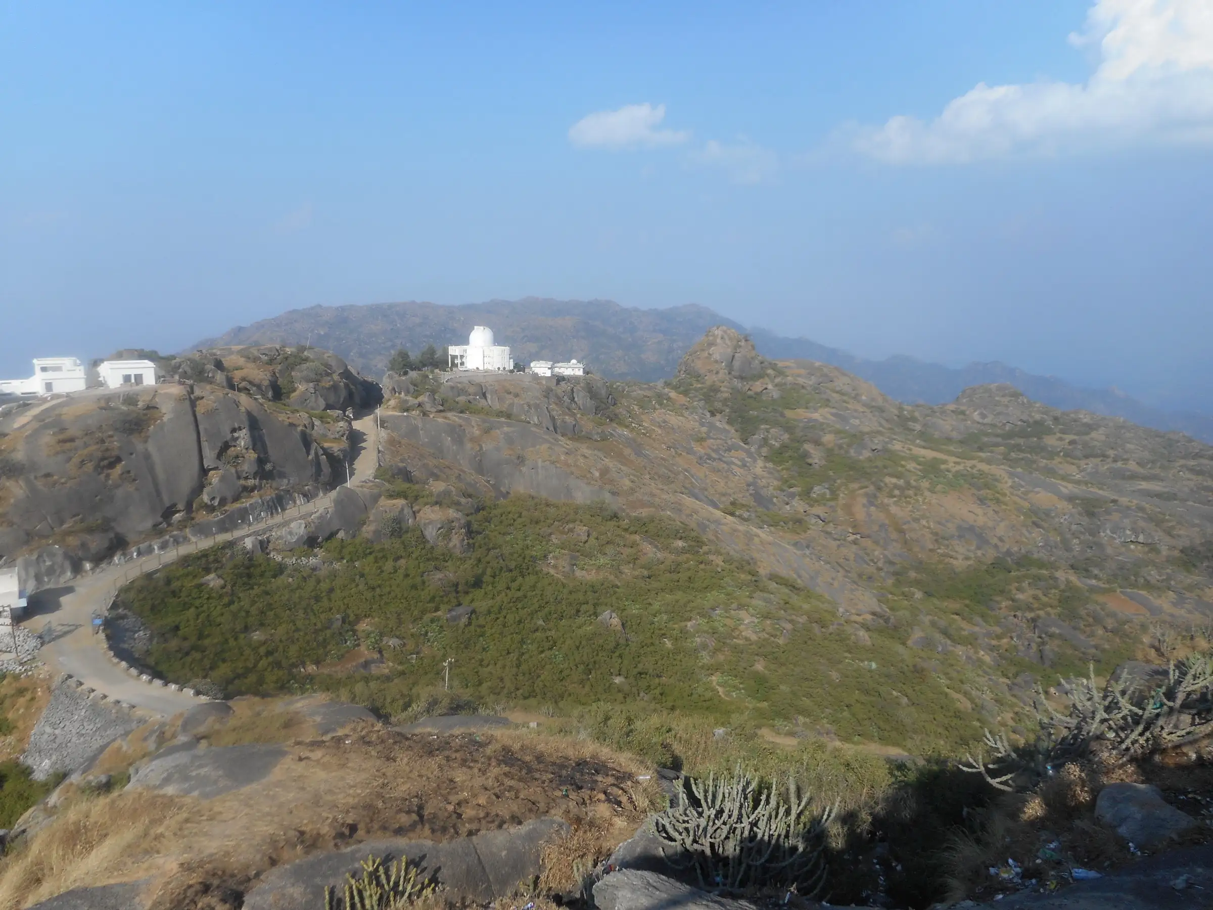
Guru Shikhar, at 1,722 m, is the highest point of the Aravalli Range, on the Mount Abu plateau in Sirohi district, Rajasthan. The walk from Achalgarh climbs about 2 to 3 hours on winding, rocky forest paths to a cave temple of Dattatreya and the Mount Abu infrared observatory beside it. A road also runs from Mount Abu almost to the summit. It suits casual walkers, best in the cooler months.
Photos
On the trail
The route
Day by day
Day 1 · highest point
Achalgarh → Guru Shikhar summit
1,300 m → 1,722 m
- Operators report a moderately challenging trail of 2 to 3 hours through rugged terrain, forest and rocky paths.
- The summit has a cave temple to Dattatreya and, beside it, the Mt Abu Observatory with a 1.2 m infrared telescope.
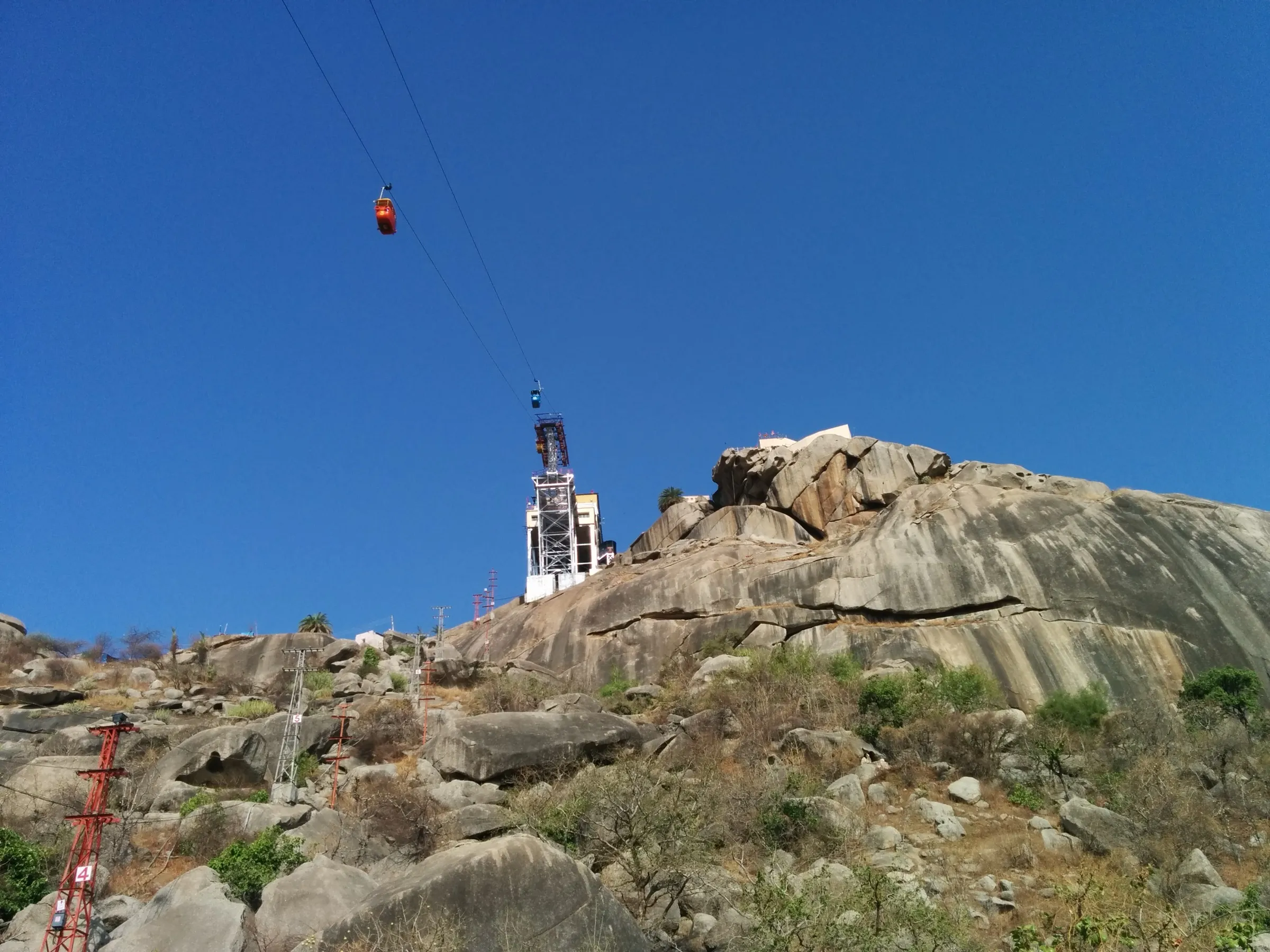
- A road runs from Mount Abu almost to the top, so many visitors drive up instead.
- Views are reported to reach the Thar Desert on clear days.
Ups and downs
Altitude profile
Where it is
Map
Trailhead and high point only — not a recorded track. Use it with a proper map.
Weather
Next 5 days on the trail
Live forecast for the trailhead and the high point. Mountain weather changes fast — check again on the morning you start.
Trailhead · Achalgarh
at 1,300 mLoading forecast…
High point · Guru Shikhar summit
at 1,722 mLoading forecast…
Each day: high / low °C · rain mm and chance · snow cm · wind km/h
Weather data: Open-Meteo.comModel forecast, not an official warning. For alerts follow IMD and the local administration.
Plan the trip
How to reach
- Trailhead
- Achalgarh (nearest town: Mount Abu)
- Nearest railway
- Abu Road
- Nearest airport
- Udaipur (Maharana Pratap Airport)
- By road
- Mount Abu (Achalgarh Fort is about 11 km north of Mount Abu; the Guru Shikhar road base is about 15-16 km from Mount Abu)
- Drive
- About 4 h from Ahmedabad
Plan the trip
Permits and fees
We could not confirm the current permit rules and fees from an official source. Check with the local forest department or tourism office before you go.
Plan the trip
Cost
Self-guided
₹300–1,500
With an operator
₹800–2,500
Per person, ex-Mount Abu. Rough estimate only: no operator price for this walk could be confirmed. Self-guided covers a shared or hired taxi to Achalgarh and back; a local guide is optional. Guides are listed by Mount Abu tourism contacts, so agree the fee beforehand.
Gear
Top picks for this trek
The gear that matters most on this route, chosen from its altitude, season and risks.
 Ad · affiliate link
 Ad · affiliate link
 Ad · affiliate link
 Ad · affiliate link
 Ad · affiliate link
 Ad · affiliate link
 Ad · affiliate link
 Ad · affiliate link
Store buttons open a search on that store, not a product we picked. As an Amazon Associate we earn from qualifying purchases. Photos show the kind of item, not a specific product. Affiliate disclosure
Packing checklist
Matched to this trek: altitude, season, days and the risks on the route.
Packed 0 of 21
Tick each item as it goes in the bag.
Know before you go
Good to know
- Mobile network
- Not confirmed by sources; Mount Abu town has mobile coverage.
- Last ATM
- Mount Abu
- Nearest hospital
- Mount Abu (town); larger hospitals at Abu Road
- Water
- Not confirmed on the trail; carry your own water. Small stalls operate near the summit steps.
Highlights
- Stand on the highest point of the Aravalli Range at 1,722 m, with wide views over the Mount Abu plateau and the plains
- Darshan at the cave temple of Bhagwan Dattatreya on the summit, with a nearby shrine to his mother Mata Anasuya
- Start from Achalgarh Fort and the Achaleshwar Mahadev temple, combining history with a forest walk
Risks
- Many trails pass through the Mount Abu Wildlife Sanctuary; trekking with a registered local guide is advised by one source.
- Trails are rocky and uneven; from July to September mist and slippery steps can reduce visibility.
- April to June is hot; walk early morning if you go then.
Know before you go
Questions
How high is Guru Shikhar?
Guru Shikhar is 1,722 m (5,650 ft) above sea level, the highest point of the Aravalli Range, in Abu Road tehsil, Sirohi district, Rajasthan.
Can I drive to Guru Shikhar or must I trek?
A road goes almost to the top, about 15-16 km from Mount Abu, and from the base about 300 steps lead to the temple. Trekkers instead walk in from Achalgarh (about 5 km, 3-5 hours, per one guide) or other trails.
What is the best time to visit Guru Shikhar?
October to March is the usual advice, with November to February best for views. April to June is hot, and the monsoon months bring mist and slippery steps.
What is at the top?
A cave temple of Bhagwan Dattatreya, a nearby temple of his mother Anasuya, and the Mt Abu infrared observatory run by the Physical Research Laboratory.
Is there an entry fee?
One guide says there is no entry fee, though small parking charges may apply at the base. We could not find an official fee or permit rule for trekkers; check locally.
In an emergency
Save these numbers before you lose signal. Tap to call.
- 112All emergenciesIndia’s single emergency number — works in every state
- 108Ambulance
- 1077District disaster control room
You are in
District: SirohiRajasthan
- Nearest hospital
- Mount Abu (town); larger hospitals at Abu Road
- Last ATM
- Mount Abu
- Phone network
- Not confirmed by sources; Mount Abu town has mobile coverage.
Before you set off
- Tell someone your route and when you will be back.
- Carry a charged phone and a power bank.
- Download an offline map of the route.
- Turn back if the weather turns bad — the mountain will wait.
Questions about Guru Shikhar
No questions yet. Ask something and trekkers who have done it can answer.
Share your trek photo with #TreksAndTrails
I trekked this
Did Guru Shikhar look different from this page? Tell us what changed and we will check it.
Where this comes from
Sources
Last reviewed:
- Guru Shikhar — Wikipedia
- Trekking in Rajasthan: Best Trails, Difficulty & When to Go — Rajasthan Places
- Mount Abu Trekking — TripXL
- Search for thrills in Mount Abu — Outlook Traveller
- Guru Shikhar, Mount Abu — Trawell
- Guru Shikhar Mount Abu — Chalbanjare
- Achalgarh Fort — Wikipedia (Achalgarh Fort)
Photos: ShubhamPaul, CC BY-SA 4.0; Im pyadav, CC BY-SA 4.0; CorrectKnowledge, CC BY-SA 3.0; Tejaspatel1, CC BY-SA 4.0