Gundur Limestone Cave Trek
Salem, Tamil Nadu
Opens without signal on this phone, with the map file and checklist. Saved for offline →
- Max altitude
- 975 m
- Days
- 1 day
- Distance
- 4 km
- Difficulty
- Easy
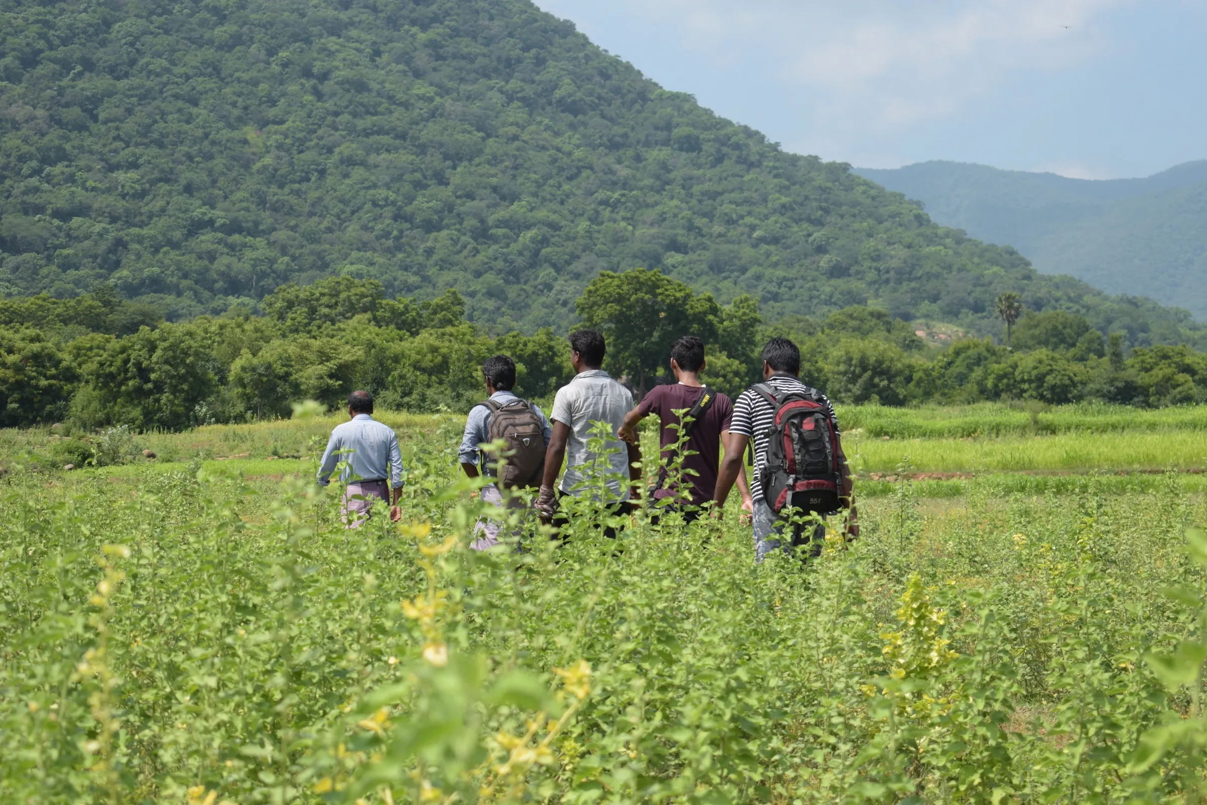
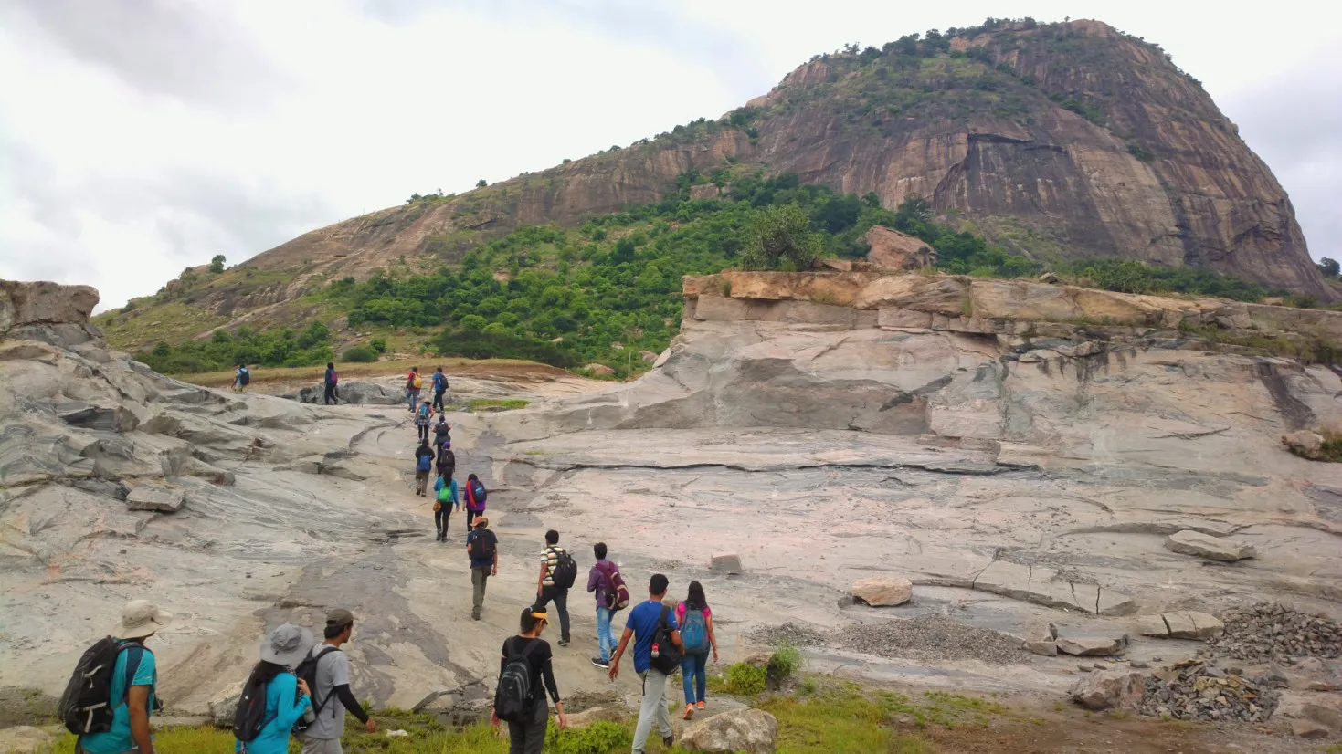
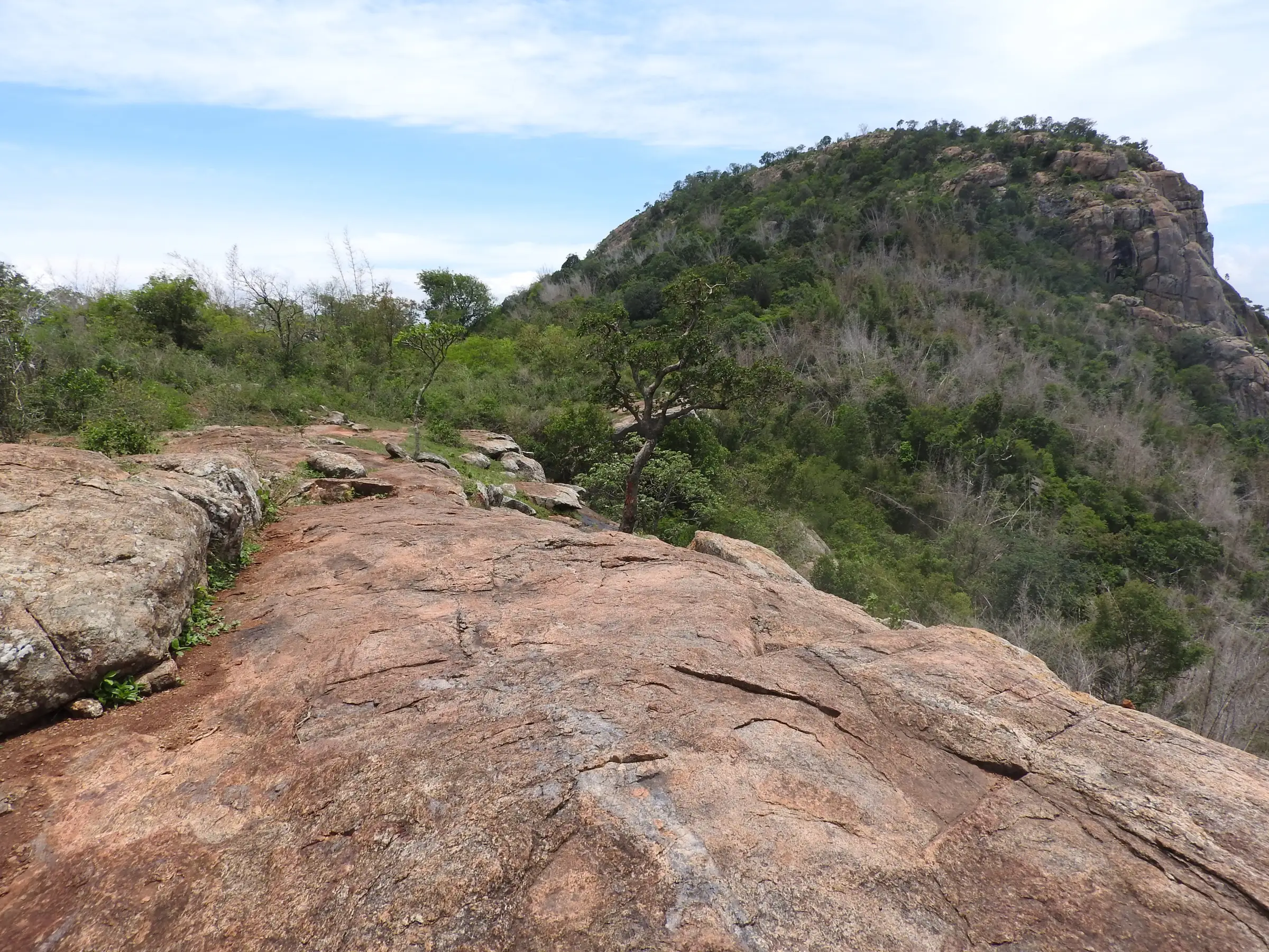
Trek Tamil Nadu rates the Yercaud - Gundur Limestone Cave trail easy: about 4 km in 3 hours on dry deciduous forest paths and village tracks; parts near the cave are steep and rocky, so wear proper shoes.
Photos
On the trail
The route
Day by day
Day 1 · highest point
Gundur trail start (after reporting at Yercaud forest office) → Gundur Limestone Cave
950 m → 975 m → 900 m
Ups and downs
Altitude profile
Where it is
Map
Trailhead and high point only — not a recorded track. Use it with a proper map.
Weather
Next 5 days on the trail
Live forecast for the trailhead and the high point. Mountain weather changes fast — check again on the morning you start.
Trailhead · Gundur village, Shevaroy (Yercaud) foothills (approximate; reception at Yercaud forest office)
at 950 mLoading forecast…
High point · High point of the Gundur trail near Gundur village (approximate)
at 975 mLoading forecast…
Each day: high / low °C · rain mm and chance · snow cm · wind km/h
Weather data: Open-Meteo.comModel forecast, not an official warning. For alerts follow IMD and the local administration.
Plan the trip
How to reach
- Trailhead
- Gundur village, Shevaroy (Yercaud) foothills (approximate; reception at Yercaud forest office)
- Nearest railway
- Salem Junction (about 37 km from the reception point, per Trek Tamil Nadu)
- Nearest airport
- Salem Airport (about 53 km, limited flights); Coimbatore and Tiruchirappalli have more flights
- By road
- Salem (Salem - Yercaud ghat road; Yercaud bus stand is about 7 km from the reception point); Bengaluru (about 210 km via Krishnagiri and Salem)
- Drive
- About 5 h from Bengaluru
Plan the trip
Permits and fees
| Permit | Issued by | Fee (Indian) | Fee (foreign) | How to get it |
|---|---|---|---|---|
| Trek Tamil Nadu trail booking: Yercaud - Gundur Limestone Cave | Tamil Nadu Forest Department / Tamil Nadu Wilderness Experiences Corporation (Trek Tamil Nadu) | ₹649 | — | Book online at trektamilnadu.com (trail 'Yercaud - Gundur Limestone Cave', 8:00 am slot, groups of up to 15). ₹649 per adult (18+) and ₹549 for minors aged 6-17, plus 5% GST (seen 18 Oct 2026). It includes the trek permit, a forest guide, trek insurance on the route, a cap, a bird pamphlet and light snacks. Report at the Yercaud forest office; transport to the trek start is your own. The longer Kondappanaikanpatti - Gundur trail is booked separately (₹1,099 adult, ₹899 minor, plus GST). |
Plan the trip
Cost
Self-guided
₹900–2,800
With an operator
₹681–1,154
Per person, ex-Salem. Every walk here is guided: the official Trek Tamil Nadu booking (seen 18 Oct 2026) costs ₹649 + 5% GST (about ₹681) for the Yercaud - Gundur Limestone Cave trail and ₹1,099 + GST (about ₹1,154) for the longer Kondappanaikanpatti - Gundur trail, both with a forest guide. We found no private operator selling this trek. The 'self-guided' range is our estimate for doing it on your own budget: the portal fee plus a bus or shared taxi from Salem towards Yercaud and food; a private taxi for a small group pushes it to the top of the range.
Gear
Top picks for this trek
The gear that matters most on this route, chosen from its altitude, season and risks.
 Ad · affiliate link
 Ad · affiliate link
 Ad · affiliate link
 Ad · affiliate link
- Ad · affiliate link
 Ad · affiliate link
 Ad · affiliate link
 Ad · affiliate link
Store buttons open a search on that store, not a product we picked. As an Amazon Associate we earn from qualifying purchases. Photos show the kind of item, not a specific product. Affiliate disclosure
Packing checklist
Matched to this trek: altitude, season, days and the risks on the route.
Packed 0 of 20
Monsoon months (Sep): pack everything in plastic or a dry bag and wear shoes with good grip.
Tick each item as it goes in the bag.
Know before you go
Good to know
- Mobile network
- Indiahikes reports mobile signal for most of the neighbouring Kondappanaikanpatti - Gundur route, with a few dead patches.
- Last ATM
- Not confirmed; carry cash from Salem or Yercaud.
- Nearest hospital
- Government Hospital, Yercaud (about 7 km from the reception point)
- Water
- No shops on the forest trail; Indiahikes says local food is available in Gundur village. Carry 2-3 litres of water per person.
Highlights
- A large white limestone formation and cave in the forest, with a water-filled pool at its mouth
- Walking through Gundur village in the Shevaroy (Yercaud) foothills, with coffee and pepper plantations around it
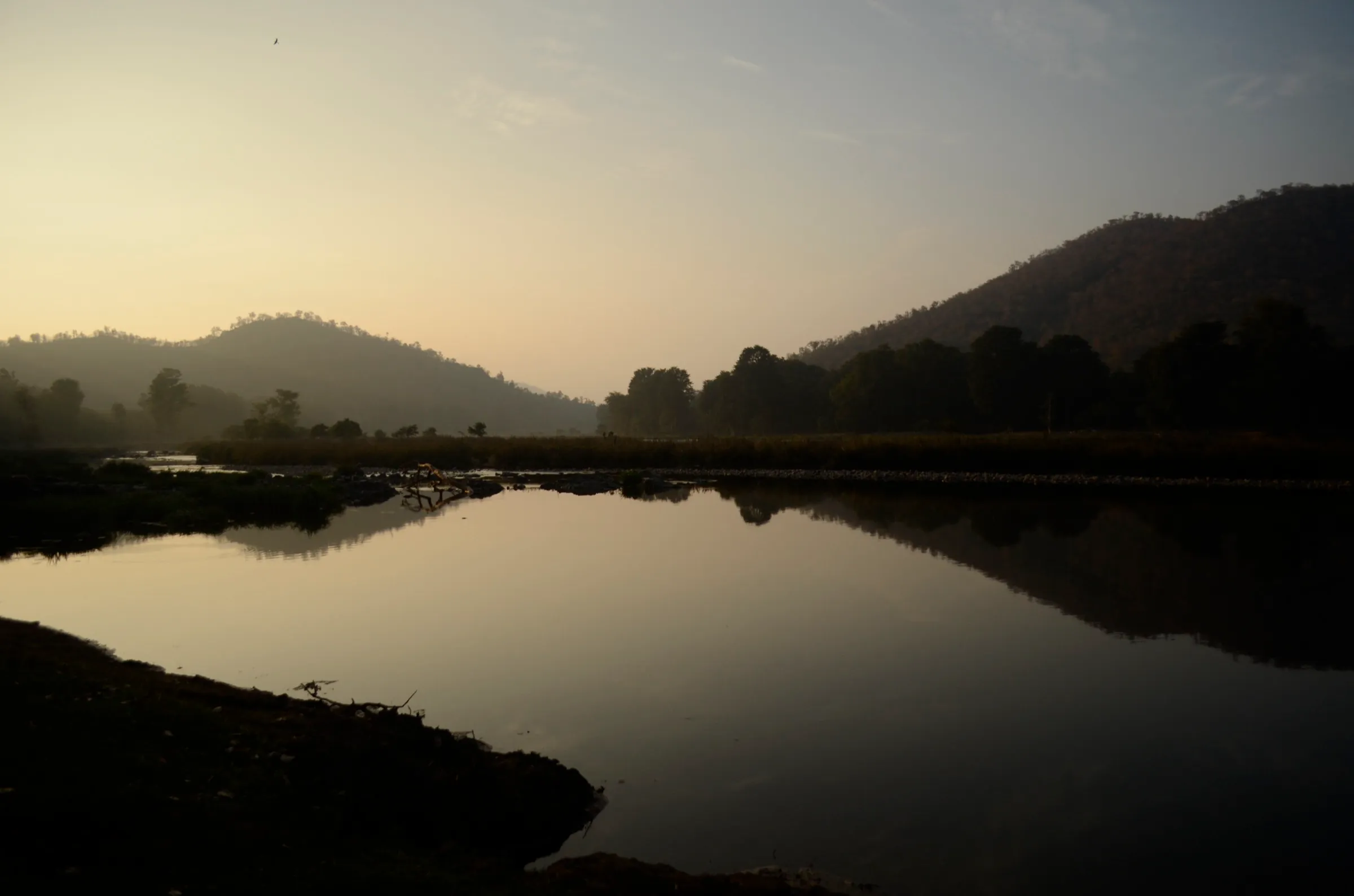
- Dry deciduous Eastern Ghats forest with bamboo, butterflies and many bird species
- Wide views over the Salem plains and the Shevaroy hills from the forest guest house viewpoint
- Official Trek Tamil Nadu trail with a forest guide; the longer 10 km Kondappanaikanpatti - Gundur trail climbs to the same village from the Salem side
Risks
- Trekking in Tamil Nadu forests is allowed only through the official Trek Tamil Nadu booking with a forest guide; walking in on your own is not permitted.
- Indian gaur and wild boar are recorded in this forest (Trek Tamil Nadu Atlas); stay with the guide and keep a distance.
- Sections near the cave are steep and rocky (Indiahikes); watch your footing, especially after rain.
- Indiahikes advises avoiding the summer months because of heat and forest-fire risk and says permits may not be issued then; check the portal for open dates.
- Much of the trail is exposed to the sun; start early and carry enough water.
Know before you go
Questions
How long is the Gundur Limestone Cave trek?
The official Yercaud - Gundur Limestone Cave trail is about 4 km and takes about 3 hours. The other official route, Kondappanaikanpatti - Gundur, is 10 km and about 5 hours on the portal; Indiahikes measured its traverse at about 7.5-8 km in 5-6 hours.
Do I need a permit or a guide for the Gundur trek?
Yes. Both Gundur trails are booked through the Tamil Nadu Forest Department's Trek Tamil Nadu portal, and the booking includes the trek permit, a forest guide and insurance. Indiahikes also notes that a guide arranged by Trek Tamil Nadu accompanies you.
Is the Gundur Limestone Cave trek suitable for beginners and children?
The Yercaud - Gundur trail is rated easy and the portal sells tickets for ages 6-17 as well as adults, so it suits families. The Kondappanaikanpatti route is rated moderate; Indiahikes says beginners can do it with reasonable fitness.
What is the best time to do the Gundur trek?
Indiahikes recommends September to February, after the monsoons, and suggests starting early because much of the trail is in the sun. It advises avoiding summer because of dry conditions and fire risk.
How do I reach the starting point?
For the Yercaud - Gundur Limestone Cave trail, report at the Yercaud forest office (Salem Junction is about 37 km away); transport to the trek start is your own. For Kondappanaikanpatti - Gundur, the reception point is about 9 km from Salem New Bus Stand, near the Adivaram bus stop, and the walk ends at 60 Feet Bridge on the Yercaud ghat road (Indiahikes).
In an emergency
Save these numbers before you lose signal. Tap to call.
- 112All emergenciesIndia’s single emergency number — works in every state
- 108Ambulance
- 1077District disaster control room
You are in
District: SalemTamil Nadu
- Nearest hospital
- Government Hospital, Yercaud (about 7 km from the reception point)
- Last ATM
- Not confirmed; carry cash from Salem or Yercaud.
- Phone network
- Indiahikes reports mobile signal for most of the neighbouring Kondappanaikanpatti - Gundur route, with a few dead patches.
Before you set off
- Tell someone your route and when you will be back.
- Carry a charged phone and a power bank.
- Download an offline map of the route.
- Turn back if the weather turns bad — the mountain will wait.
Questions about Gundur Limestone Cave
No questions yet. Ask something and trekkers who have done it can answer.
Share your trek photo with #TreksAndTrails
I trekked this
Did Gundur Limestone Cave look different from this page? Tell us what changed and we will check it.
Where this comes from
Sources
Last reviewed:
- Yercaud - Gundur Limestone Cave — Trek Tamil Nadu (Tamil Nadu Forest Department / TNWEC) (official)
- Trek Tamil Nadu trail list, July 2026 — Trek Tamil Nadu (Tamil Nadu Forest Department / TNWEC) (official)
- Kondappanaikanpatti - Gundur — Trek Tamil Nadu (Tamil Nadu Forest Department / TNWEC) (official)
- Kurumbapatti Zoo - Gundur — Trek Tamil Nadu (Tamil Nadu Forest Department / TNWEC) (official)
- Kondappanaikanpatti-Gundur Limestone Cave Trek | Salem — Indiahikes
Photos: Yercaud-elango, CC BY-SA 4.0; Yercaud-elango, CC BY-SA 4.0; Yercaud-elango, CC BY-SA 4.0