Forsyth Trail Trek
Narmadapuram, Madhya Pradesh
Opens without signal on this phone, with the map file and checklist. Saved for offline →
- Max altitude
- 1,050 m
- Days
- 3 days
- Distance
- 28 km
- Difficulty
- Moderate
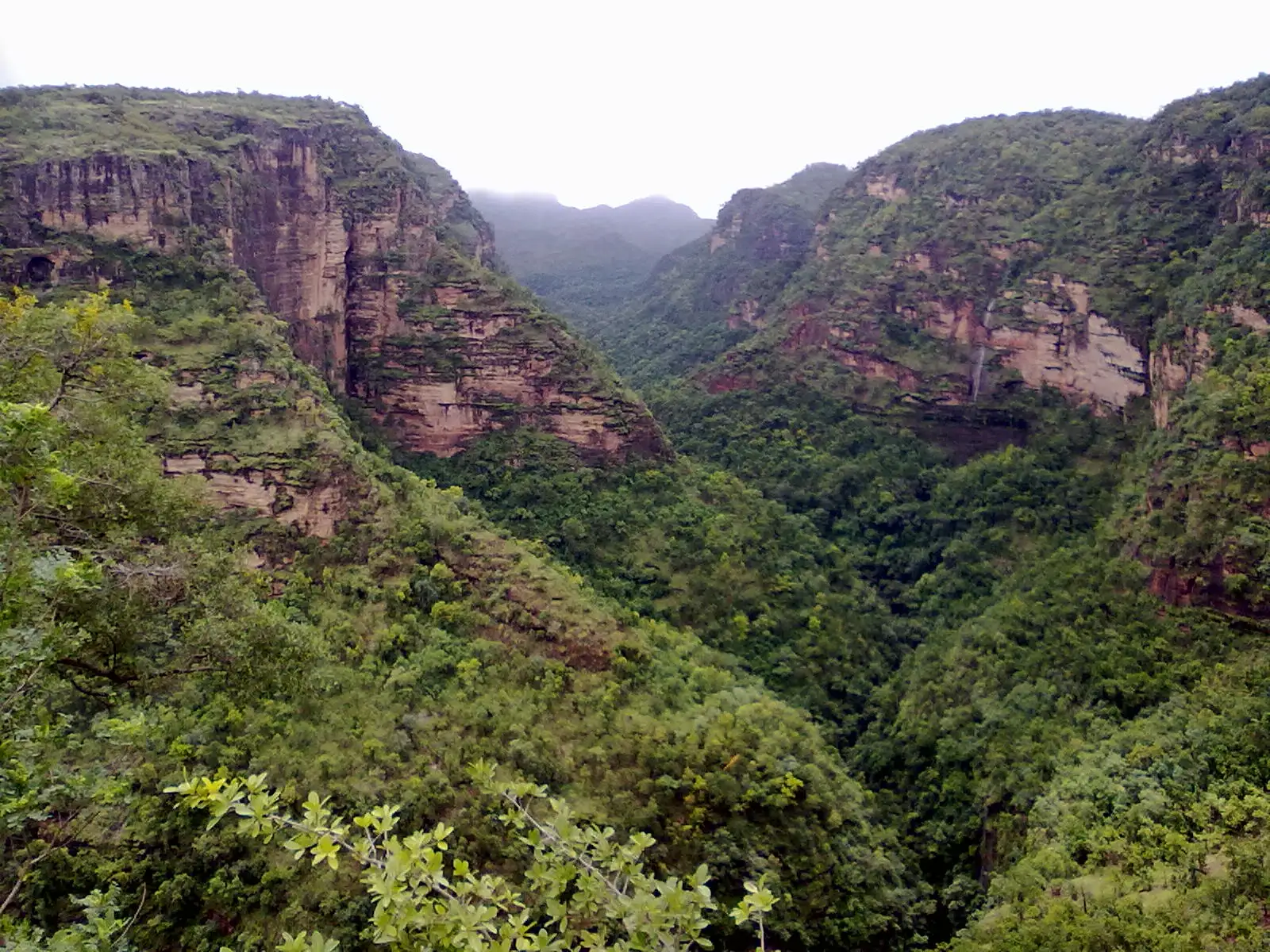
No altitude problems, but the first trek day is a long 13-17 km descent of about 550 m on loose rock steps and stream beds, followed by a day of river walking with wading, sand and boulders in summer heat.
Photos
On the trail
The route
Day by day
Day 1 · highest point
Bhopal → Pachmarhi
495 m → 1,050 m
Day 2
Pachmarhi Naka → Dehaliya camp on the Denwa (via Forsyth's waterfall and Kanjighat)
1,050 m → 495 m
Day 3
Dehaliya → Dehaliya via Jhela beach on the Denwa, then jeep exit towards Matkuli
495 m → 416 m
Ups and downs
Altitude profile
Where it is
Map
Trailhead and high point only — not a recorded track. Use it with a proper map.
Weather
Next 5 days on the trail
Live forecast for the trailhead and the high point. Mountain weather changes fast — check again on the morning you start.
Trailhead · Pachmarhi Naka
at 1,050 mLoading forecast…
High point · Pachmarhi Naka (start of the descent)
at 1,050 mLoading forecast…
Each day: high / low °C · rain mm and chance · snow cm · wind km/h
Weather data: Open-Meteo.comModel forecast, not an official warning. For alerts follow IMD and the local administration.
Plan the trip
How to reach
- Trailhead
- Pachmarhi Naka
- Nearest railway
- Pipariya (about 50 km from Pachmarhi)
- Nearest airport
- Raja Bhoj Airport, Bhopal
- By road
- Bhopal (about 206 km to Pachmarhi, about 6 hours); Pipariya railway station, via Matkuli, by state bus or shared jeep to Pachmarhi
- Drive
- About 6 h from Bhopal
Plan the trip
Permits and fees
We could not confirm the current permit rules and fees from an official source. Check with the local forest department or tourism office before you go.
Plan the trip
Cost
Self-guided
₹4,000–8,000
With an operator
₹10,999–12,499
Per person, ex-Pachmarhi. Only one operator publishes a current price: Treks n Trails (treksandtrails.org, not this site) ₹10,999 triple sharing or ₹12,499 double sharing for 2 nights/3 days, including meals, forest entry and camping permits, naturalists and the jeep exit; transport to Pachmarhi extra. Jehannuma (Reni Pani Jungle Lodge) and Indiahikes run the route but publish no price. The self-guided figure is an estimate only: the core-zone stretch needs Satpura Tiger Reserve permission and a forest guide, so budget for the guide, forest fees, camping gear or hired tents, food and a jeep from Dehaliya. Ask the forest office in Pachmarhi before planning it.
Gear
Top picks for this trek
The gear that matters most on this route, chosen from its altitude, season and risks.
 Ad · affiliate link
 Ad · affiliate link
 Ad · affiliate link
 Ad · affiliate link
 Ad · affiliate link
 Ad · affiliate link
 Ad · affiliate link
 Ad · affiliate link
Store buttons open a search on that store, not a product we picked. As an Amazon Associate we earn from qualifying purchases. Photos show the kind of item, not a specific product. Affiliate disclosure
Packing checklist
Matched to this trek: altitude, season, days and the risks on the route.
Packed 0 of 26
Tick each item as it goes in the bag.
Know before you go
Good to know
- Mobile network
- BSNL works inside the reserve; other networks are patchy, with signal only at a few points on the trail.
- Last ATM
- Pachmarhi; carry cash for the guide and jeep
- Nearest hospital
- Government and Army hospitals in Pachmarhi, up to about 3 hours from the farthest point of the trail
- Water
- Gidhmau Nala and a clear stream just past Kanjighat on day 1, and the Denwa at camp. Do not drink from the Bainganga at Kanjighat, which flows through Pachmarhi town. Treat all water.
Highlights
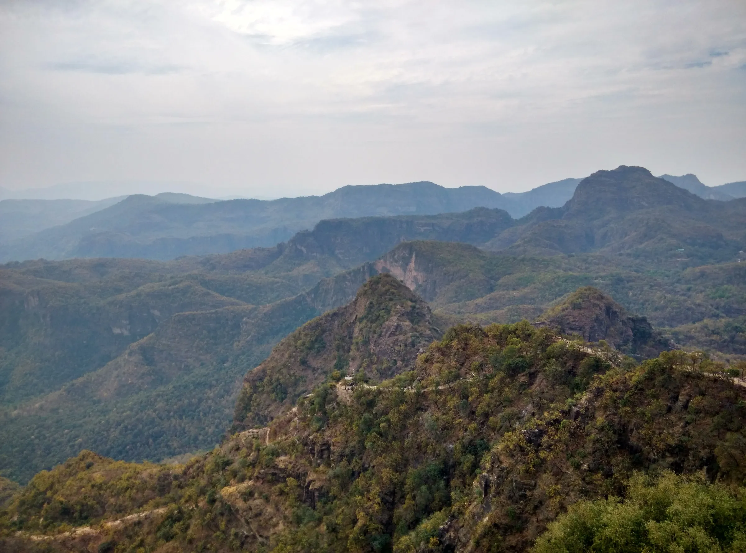
- Walking the route Captain James Forsyth took when he came upon the Pachmarhi plateau, down from Pachmarhi Naka into the Satpura forest
- One of the few treks in India that crosses the core zone of a tiger reserve, with a chance of seeing pugmarks, gaur, sloth bear and leopard
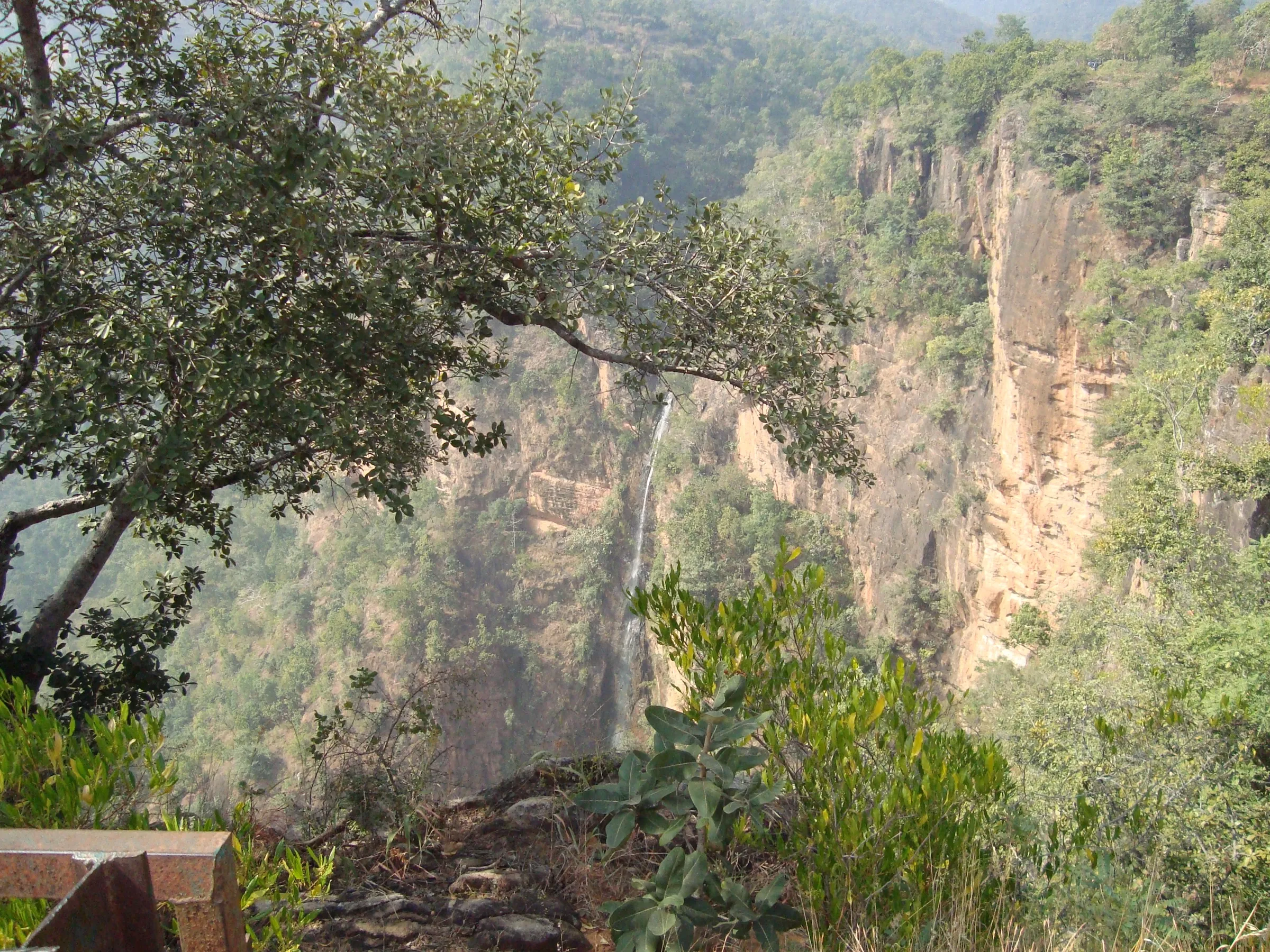
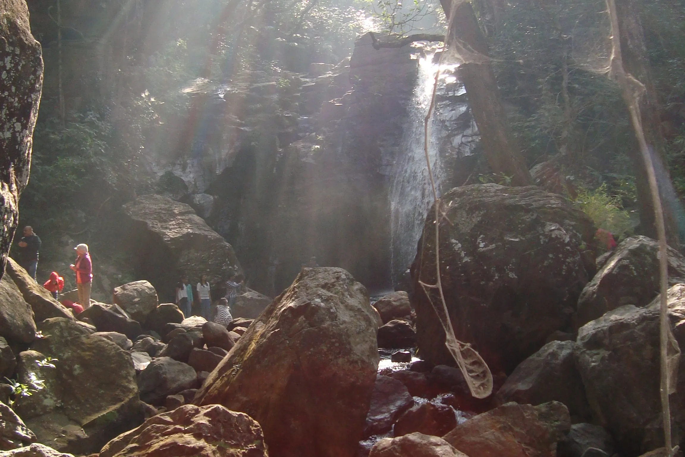
- Forsyth's waterfall and a second fall on Gidhmau Nala, then lunch at Kanjighat on the Bainganga
- Camping on the wide sandy bank of the Denwa at Dehaliya and a barefoot river walk to Jhela beach
Risks
- The core zone is tiger, leopard and sloth bear habitat: walk only with forest guides or naturalists and follow their instructions.
- The descent from the plateau is on loose rock with a drop on one side; take it slowly.
- River crossings on the Bainganga and Denwa become harder after rain; operators do not run the trek in the monsoon.
- Days are hot from March onwards, and the first trek day is long (7-8 hours); carry enough water between the stream refills.
- The core zone reopens around 1 October; some guides say mid-October, so confirm the opening date for an early-October trek.
Know before you go
Questions
How long is the Forsyth Trail?
It depends on the version. The common 2-night, 3-day trek from Pachmarhi Naka to Dehaliya and back out by jeep is about 27-30 km. Outlook Traveller describes a fuller 32 km, 3-night/4-day trail, and Indiahikes runs a 36 km variant that continues down the Denwa to Muar Ghat.
Can I walk through the Satpura Tiger Reserve core zone?
Yes, Satpura is one of the very few tiger reserves where walking in the core zone is allowed, but only with permission and a forest guide or naturalist. Camping is not allowed in the core zone, which is why the first day runs all the way to Dehaliya, on the buffer-zone side of the Denwa.
When is the best time to do the Forsyth Trail?
October to February. December to February is the most comfortable for walking. The core zone is closed to tourists from July to the end of September, and from March the days get hot.
Is the Forsyth Trail suitable for beginners?
Yes, operators grade it easy-moderate to moderate because there is no altitude gain to speak of, but the first trek day is 13-17 km and 7-8 hours, so you need good walking fitness.
How do I reach the start of the Forsyth Trail?
The trek starts at Pachmarhi Naka on the edge of Pachmarhi. Bhopal is about 206 km (6 hours) away by road. The nearest railway station is Pipariya, from where buses and shared jeeps run up to Pachmarhi via Matkuli.
In an emergency
Save these numbers before you lose signal. Tap to call.
- 112All emergenciesIndia’s single emergency number — works in every state
- 108Ambulance
- 1077District disaster control room
You are in
District: NarmadapuramMadhya Pradesh
- Nearest hospital
- Government and Army hospitals in Pachmarhi, up to about 3 hours from the farthest point of the trail
- Last ATM
- Pachmarhi; carry cash for the guide and jeep
- Phone network
- BSNL works inside the reserve; other networks are patchy, with signal only at a few points on the trail.
Before you set off
- Tell someone your route and when you will be back.
- Carry a charged phone and a power bank.
- Download an offline map of the route.
- Turn back if the weather turns bad — the mountain will wait.
Questions about Forsyth Trail
No questions yet. Ask something and trekkers who have done it can answer.
Share your trek photo with #TreksAndTrails
I trekked this
Did Forsyth Trail look different from this page? Tell us what changed and we will check it.
Where this comes from
Sources
Last reviewed:
- Top experiences of treks and trails in Madhya Pradesh — Madhya Pradesh Tourism Board (official)
- Forsyth Trail in Satpura National Park — Madhya Pradesh Tourism Board (official)
- Forsyth Trek "Queens on the trail" — Moustache Escapes (with MP Tourism, on utsav.gov.in)
- Satpura Tiger Reserve Trek — Indiahikes
- Forsyth Trek inside the heart of Satpura Tiger Reserve — Treks n Trails (treksandtrails.org)
- Satpura Under Canvas — Jehannuma (Reni Pani Jungle Lodge)
- Following the Footsteps of Forsyth — Outlook Traveller
- MP To Shut 6 Tiger Reserves Till October For This Reason — Outlook Traveller
- Satpura Tiger Safari Timings — Big Cats India
- Satpura National Park — Incredible India (Ministry of Tourism) (official)
- Pachmarhi — Wikipedia
- Pachmarhi — Wikivoyage
Photos: Abhayashok, CC BY-SA 3.0; Vikalp Kumar, CC BY-SA 3.0