Chandratal to Baralacha La Trek
Lahaul and Spiti, Himachal Pradesh
Opens without signal on this phone, with the map file and checklist. Saved for offline →
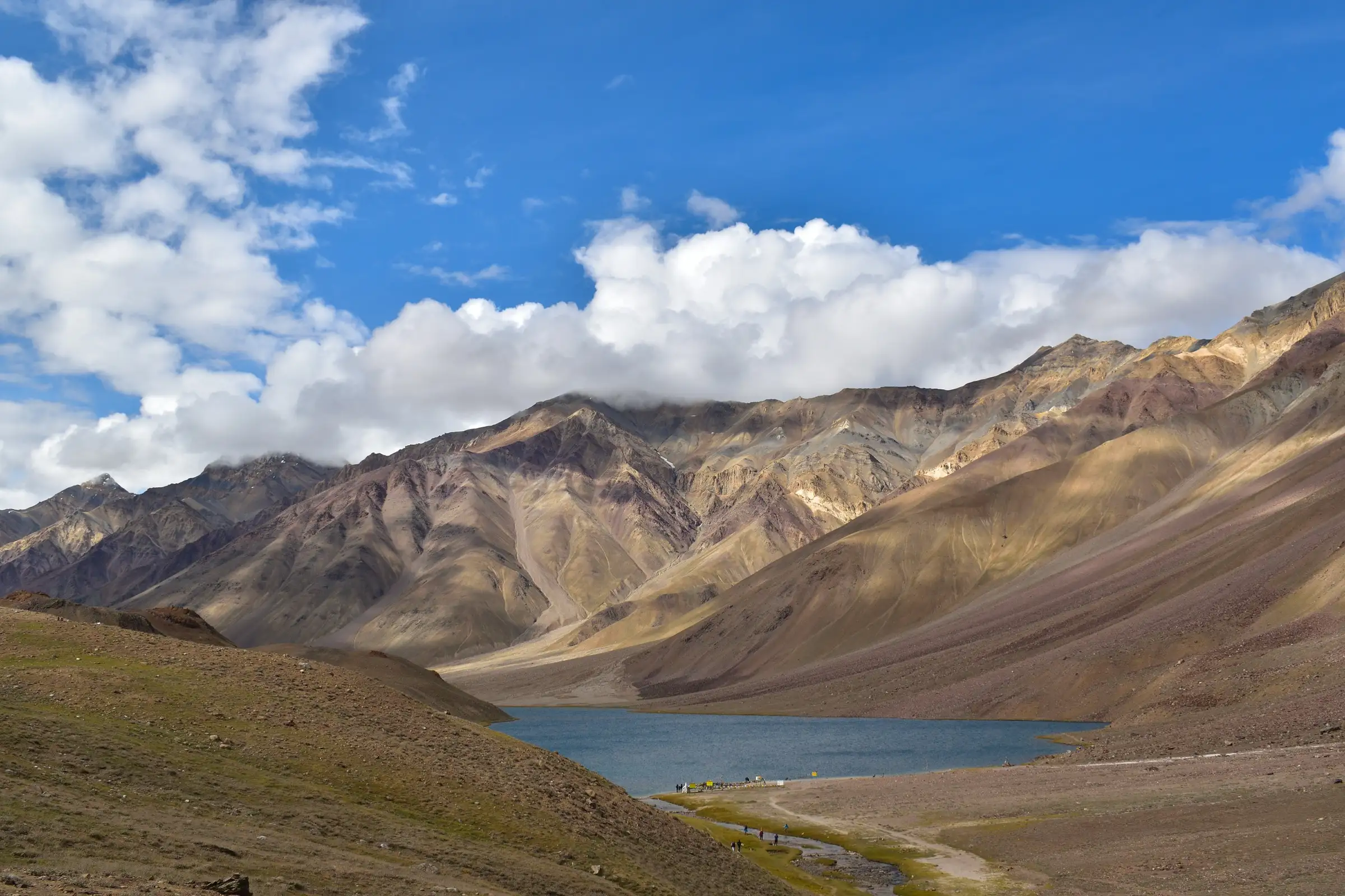
- Max altitude
- 4,920 m
- Days
- 5 days
- Distance
- 40 km
- Difficulty
- Difficult
A remote, unsupported traverse at 4,270-4,920 m with no villages, faint or missing trail across boulder and scree zones, three major glacial river crossings (Tokpo Gongma and Tokpo Yongma) that may need a snow bridge or a wade in icy water, and long 12-14 km days; operators rate it from easy-moderate (Indiahikes) to difficult (Himalaya Shelter).
Photos
On the trail
The route
Day by day
Day 1
Manali → Batal (drive via Atal Tunnel and Gramphu)
2,050 m → 3,950 m
Day 2
Batal → Chandratal (drive, or optional 12 km walk from Kunzum La)
3,950 m → 4,270 m
Day 3
Chandratal → Tokpo Gongma
4,270 m → 4,420 m
Day 4
Tokpo Gongma → Tokpo Yongma
4,420 m → 4,650 m
Day 5 · highest point
Tokpo Yongma → Baralacha La (drive to Manali)
4,650 m → 4,920 m
Ups and downs
Altitude profile
Where it is
Map
Trailhead and high point only — not a recorded track. Use it with a proper map.
Weather
Next 5 days on the trail
Live forecast for the trailhead and the high point. Mountain weather changes fast — check again on the morning you start.
Trailhead · Chandratal (Chandra Tal Lake)
at 4,270 mLoading forecast…
High point · Baralacha La
at 4,920 mLoading forecast…
Each day: high / low °C · rain mm and chance · snow cm · wind km/h
Weather data: Open-Meteo.comModel forecast, not an official warning. For alerts follow IMD and the local administration.
Plan the trip
How to reach
- Trailhead
- Chandratal (Chandra Tal Lake) (nearest town: Batal)
- Nearest railway
- Joginder Nagar (narrow gauge); Chandigarh for broad gauge
- Nearest airport
- Bhuntar Airport, Kullu
- By road
- Manali to Batal (about 95 km via Atal Tunnel, Gramphu and Chhatru); Batal to Chandratal (about 14 km to Kunzum La side road, then the Chandratal diversion road); Baralacha La back to Manali (about 144 km on the Manali-Leh highway, about 5 hours) or on to Sarchu/Pang for Leh
- Drive
- About 7 h from Manali
Plan the trip
Permits and fees
We could not confirm the current permit rules and fees from an official source. Check with the local forest department or tourism office before you go.
Plan the trip
Cost
Self-guided
₹12,000–20,000
With an operator
₹24,999–26,250
Per person, ex-Manali. Guided prices published in 2026: Himalaya Shelter ₹24,999 + 5% GST (transport Manali-Batal-Chandratal and Baralacha La-Manali included); Himtrek ₹25,000 + 5% GST, reporting at Manali. Self-guided is our estimate: hired vehicle Manali-Chandratal and pick-up at Baralacha La, two nights at Batal/Chandratal camps, and a local guide plus horses or porters for three wilderness days, which this river-crossing route needs. Blogs mention a Chandratal entry fee (about ₹150 for Indians); we found no official notice, so check at Batal.
Gear
Top picks for this trek
The gear that matters most on this route, chosen from its altitude, season and risks.
 Ad · affiliate link
 Ad · affiliate link
 Ad · affiliate link
 Ad · affiliate link
 Ad · affiliate link
 Ad · affiliate link
 Ad · affiliate link
 Ad · affiliate link
Store buttons open a search on that store, not a product we picked. As an Amazon Associate we earn from qualifying purchases. Photos show the kind of item, not a specific product. Affiliate disclosure
Packing checklist
Matched to this trek: altitude, season, days and the risks on the route.
Packed 0 of 34
Nights near 4,920 m can drop close to freezing even in summer. Pack one more warm layer than you think.
Tick each item as it goes in the bag.
Know before you go
Good to know
- Mobile network
- No network after Batal and none on the trek; on the way back, signal returns at Jispa (towards Manali) or Sarchu (towards Leh), per Himalaya Shelter.
- Last ATM
- Manali (no ATM at Batal or Chandratal)
- Nearest hospital
- Primary health facilities at Kaza or Keylong; serious cases go to Manali. Army medical posts on the Manali-Leh highway (Sarchu) can help in emergencies after the trek ends.
- Water
- Glacial streams and the Tokpo Gongma and Tokpo Yongma rivers along the whole route; water is silty and cold, so filter and treat it.
Highlights
- Starting at Chandratal, the crescent 'Moon Lake' at about 4,270 m, and camping near it
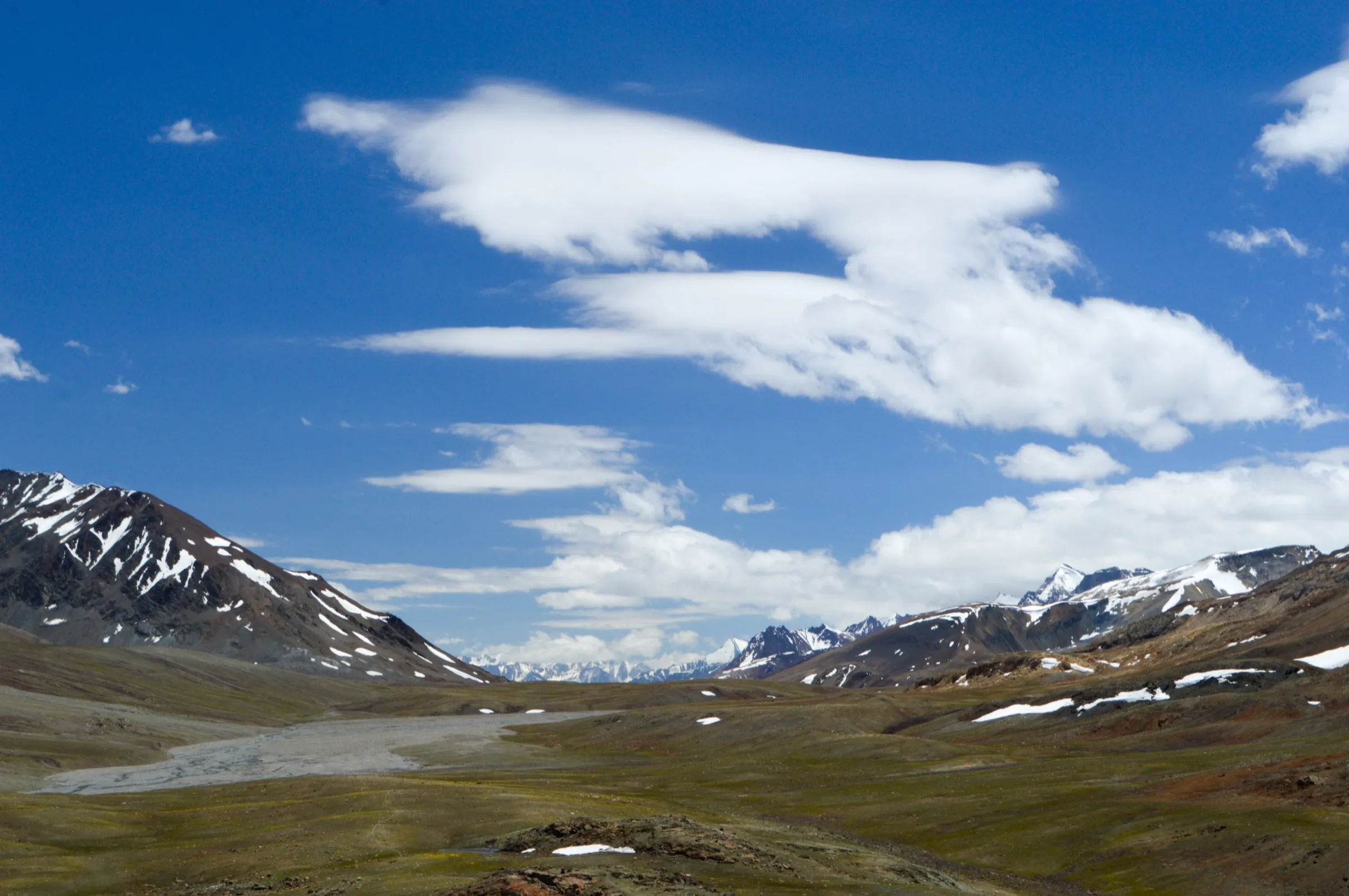
- Walking high above the Chandra river through a wild, roadless cold-desert valley
- Gaddi shepherd camps and grassy meadows at Tokpo Gongma and Tokpo Yongma
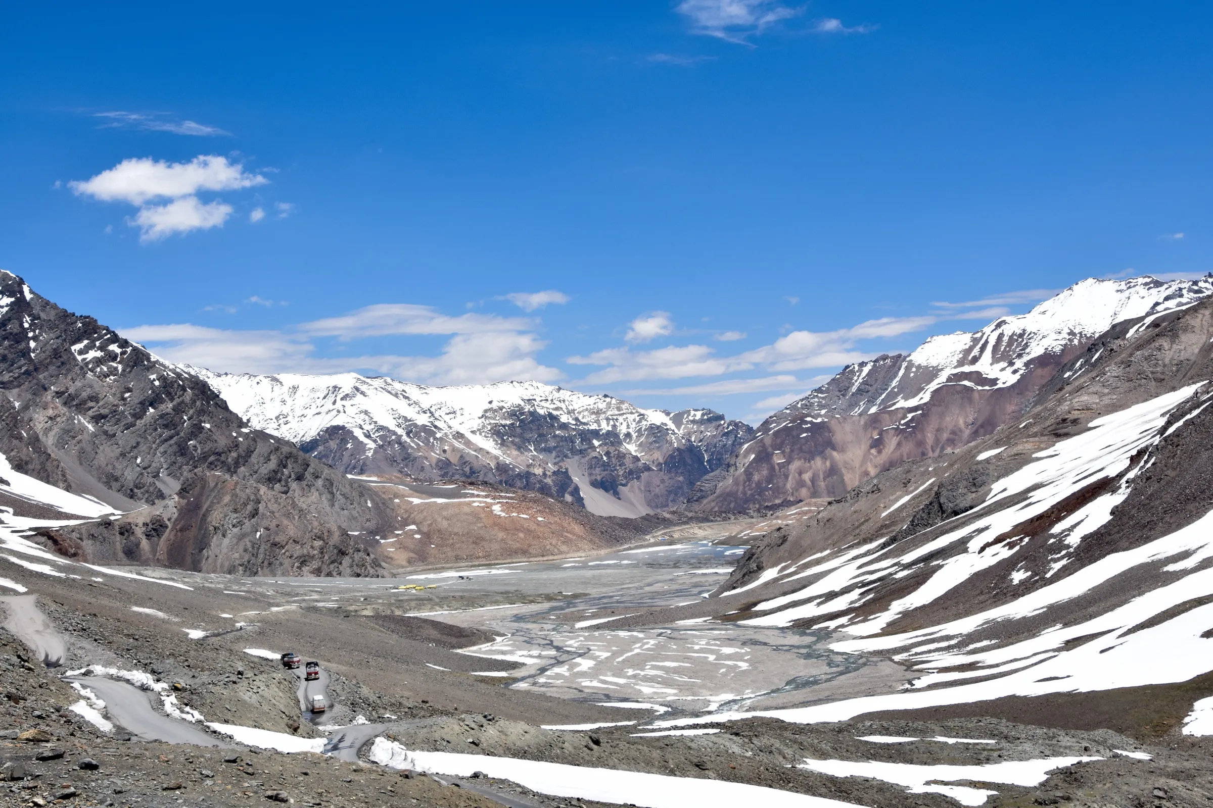
- Finishing at Baralacha La, the ancient crossroads of Lahaul, Spiti, Zanskar and Ladakh trade routes
- A Ladakh-style landscape reached from Manali in a day
Risks
- Three major glacial river crossings (Tokpo Gongma, Tokpo Yongma and a last stream before Baralacha La): the water is knee-deep or more, icy and fast, and rises in the afternoon; early in the season snow bridges are used, which can be icy, cracked or broken. Indiahikes' author nearly could not cross the Tokpo Gongma alone.
- High altitude from day one: you drive to about 4,000-4,270 m and finish at about 4,900 m, so acute mountain sickness is a real risk; spend a night at Batal or Chandratal first.
- No villages, shops, network or electricity for three days; the trail is faint or missing across boulder and scree zones. Indiahikes and Himalaya Shelter advise against doing it without an experienced guide.
- Camping on the banks of Chandratal is reported to be banned by the local panchayat; groups camp at designated sites away from the lake.
- Since June 2026 the Lahaul-Spiti DDMA requires all trekkers to register their route and team with an authorised officer before starting and to check out on return; unauthorised trekking can be fined.
- July-August brings rain and landslide risk on the Manali-Batal-Chandratal road; nights drop below freezing and the region is cut off by snow from about late October.
Know before you go
Questions
How long is the Chandratal to Baralacha La trek?
The walk itself is three days from Chandratal to Baralacha La: about 14 km to Tokpo Gongma, 14 km to Tokpo Yongma and 12 km to the pass, roughly 40 km in all (Himalaya Shelter). With the drive from Manali and an acclimatisation night at Batal or Chandratal, plan about 5 days Manali to Manali.
How high is Baralacha La?
Sources give 4,890-4,950 m (16,040-16,240 ft): Trek The Himalayas says 4,890 m, Himalaya Shelter 4,920 m and Indiahikes 16,240 ft. Chandratal, where the trek starts, is about 4,270 m.
When is the best time to do this trek?
June to September. Operators say the roads to Chandratal open around June once snow is cleared; mid-June to July often has snow bridges over the rivers, while in August and September you wade. TourMyIndia prefers September because July-August brings monsoon landslide risk on the road; after early October the route can close at any time.
Can I do the Chandratal Baralacha trek on my own?
Indiahikes says it is not for beginners: you must be a seasoned trekker able to handle the streams and terrain of Lahaul. Himalaya Shelter does not recommend doing it without professional guidance because of the three river crossings. Lahaul-Spiti also requires trekkers to register before starting.
Is there mobile network on the trek?
No. Network is lost after Batal and returns only at Jispa or Sarchu after you reach the Manali-Leh highway. There is no electricity on the trek, so carry power banks.
In an emergency
Save these numbers before you lose signal. Tap to call.
- 112All emergenciesIndia’s single emergency number — works in every state
- 108Ambulance
- 1077District disaster control room
You are in
District: Lahaul and SpitiHimachal Pradesh
- Nearest hospital
- Primary health facilities at Kaza or Keylong; serious cases go to Manali. Army medical posts on the Manali-Leh highway (Sarchu) can help in emergencies after the trek ends.
- Last ATM
- Manali (no ATM at Batal or Chandratal)
- Phone network
- No network after Batal and none on the trek; on the way back, signal returns at Jispa (towards Manali) or Sarchu (towards Leh), per Himalaya Shelter.
Before you set off
- Tell someone your route and when you will be back.
- Carry a charged phone and a power bank.
- Download an offline map of the route.
- Turn back if the weather turns bad — the mountain will wait.
Questions about Chandratal to Baralacha La
No questions yet. Ask something and trekkers who have done it can answer.
Share your trek photo with #TreksAndTrails
I trekked this
Did Chandratal to Baralacha La look different from this page? Tell us what changed and we will check it.
Where this comes from
Sources
Last reviewed:
- Chandratal Baralachala Trek (documented trek) — Indiahikes
- Chandratal Baralachala Trek - Trek The Himalayas (16 Feb 2026) — Trek The Himalayas
- Chandratal Baralacha Trek - Itinerary and Trek Route Map — Himalaya Shelter
- Baralacha La Trek - Himtrek 2026 — Himtrek
- Chandratal Baralacha Trek - Tour My India — Tour My India
- Bara-lacha la - Wikipedia — Wikipedia
- Chandratal Baralacha La Trek | Himalayan Trek Route & Adventure Guide (5 Mar 2025) — Trekup India
- Trekkers must register before hitting Lahaul-Spiti trails now (June 2026) — Newswav (report on Lahaul-Spiti DDMA directive)
- Winter sets in, trekking, climbing banned in Lahaul-Spiti dist (27 Nov 2024) — The Tribune
Photos: Adarsh Patel, CC BY-SA 4.0; GerthMichael, CC BY-SA 3.0; Vijyay negi, CC0