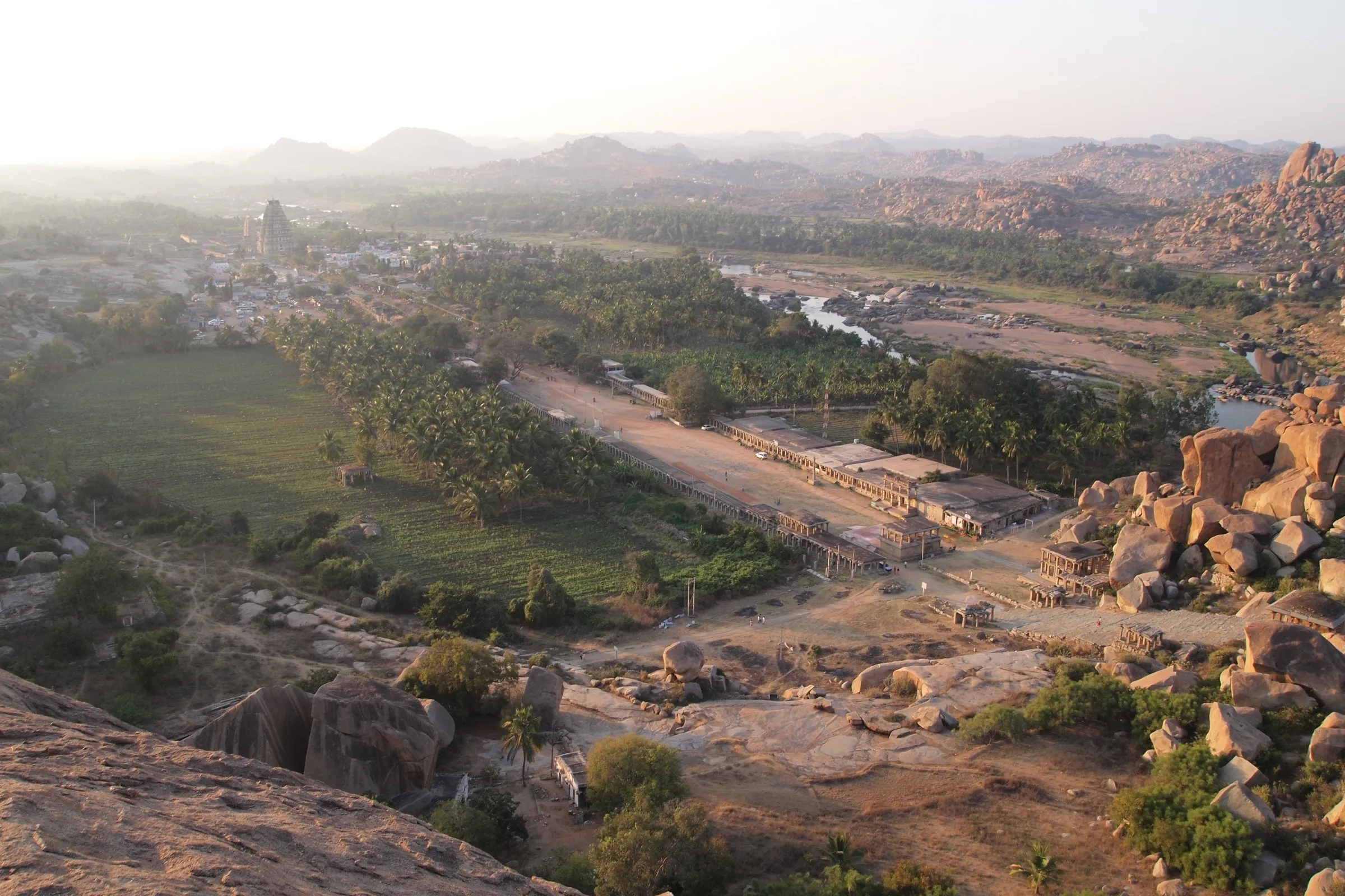
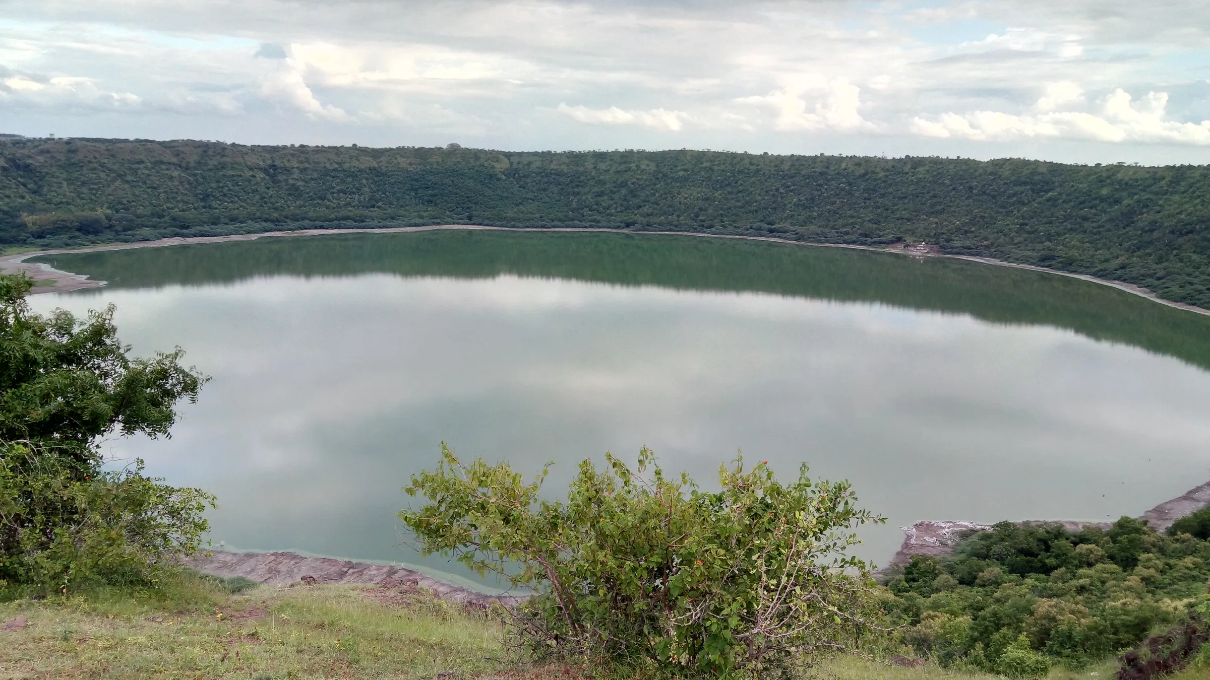
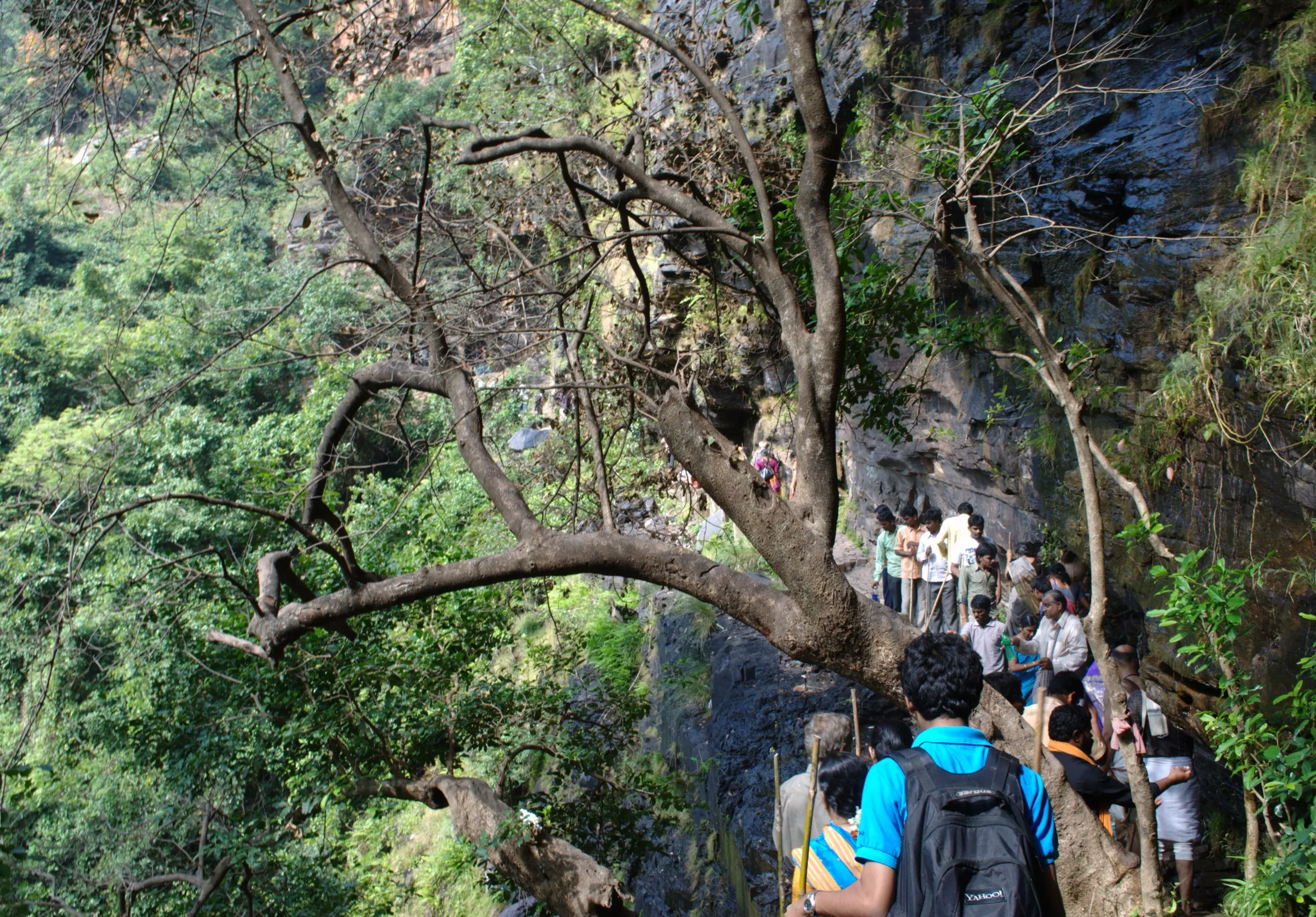
Chandrampalli Nature Trail Trek
Kalaburagi, Karnataka
Opens without signal on this phone, with the map file and checklist. Saved for offline →
- Max altitude
- 853 m
- Satellite terrain suggests about 604 m
- Days
- 1 day
- Distance
- 8 km
- Difficulty
- Moderate
The long trek is about 8 km one way (around 4 hours) on hilly, undulating forest path with rocky and laterite stretches, a short steeper climb to the viewpoint and stream or riverbed crossings that flood in the monsoon. The Forest Department grades it 'adventurous'; the 4 km short trek along the dam is graded easy.
Photos
On the trail
The route
Day by day
Day 1 · highest point
Chandrampalli Nature Camp → Gottamgotta Anti-Poaching Camp
500 m → 853 m → 570 m
Ups and downs
Altitude profile
Where it is
Map
Trailhead and high point only — not a recorded track. Use it with a proper map.
Weather
Next 5 days on the trail
Live forecast for the trailhead and the high point. Mountain weather changes fast — check again on the morning you start.
Trailhead · Chandrampalli Nature Camp, Chandrampalli Dam
at 500 mLoading forecast…
High point · Highest viewpoint on the ridge between Chandrampalli and Gottamgotta, Chincholi Wildlife Sanctuary
at 853 mLoading forecast…
Each day: high / low °C · rain mm and chance · snow cm · wind km/h
Weather data: Open-Meteo.comModel forecast, not an official warning. For alerts follow IMD and the local administration.
Plan the trip
How to reach
- Trailhead
- Chandrampalli Nature Camp, Chandrampalli Dam (nearest town: Chincholi)
- Nearest railway
- Zaheerabad (Telangana), about 35 km from the trek start; then an auto-rickshaw or hired vehicle
- Nearest airport
- Rajiv Gandhi International Airport, Hyderabad; Kalaburagi airport is about 89 km from the sanctuary
- By road
- Hyderabad (about 140 km, about 3.5 hours by car via Zaheerabad and Mogudampalli); Zaheerabad (about 35 km; buses run from MGBS Hyderabad to Zaheerabad); Kalaburagi (about 100 km to Chincholi Wildlife Sanctuary)
- Drive
- About 3.5 h from Hyderabad
Plan the trip
Permits and fees
We could not confirm the current permit rules and fees from an official source. Check with the local forest department or tourism office before you go.
Plan the trip
Cost
Self-guided
₹600–2,000
With an operator
₹1,500–3,000
Per person, ex-Hyderabad, day trip. We found no operator publishing a current price for this trail, so both ranges are estimates: self-guided = bus Hyderabad–Zaheerabad (about ₹100 each way) plus a shared auto or a share of a car for the last 35 km, food and the Aranya Vihaara booking fee (the fee is shown only during booking; check the portal). The guided range assumes a typical Hyderabad weekend-group day trip with transport. The Forest Department sends a forest guard with every group; Indiahikes says the guide cost is separate.
Gear
Top picks for this trek
The gear that matters most on this route, chosen from its altitude, season and risks.
 Ad · affiliate link
 Ad · affiliate link
 Ad · affiliate link
 Ad · affiliate link
- Ad · affiliate link
 Ad · affiliate link
 Ad · affiliate link
 Ad · affiliate link
Store buttons open a search on that store, not a product we picked. As an Amazon Associate we earn from qualifying purchases. Photos show the kind of item, not a specific product. Affiliate disclosure
Packing checklist
Matched to this trek: altitude, season, days and the risks on the route.
Packed 0 of 20
Monsoon months (Jul–Sep): pack everything in plastic or a dry bag and wear shoes with good grip.
Tick each item as it goes in the bag.
Know before you go
Good to know
- Mobile network
- Not confirmed. Expect weak or no signal inside the sanctuary forest; call the range office before you enter.
- Last ATM
- Chincholi town or Zaheerabad (not confirmed); carry cash
- Nearest hospital
- Chincholi taluk town (about 20 km) for first care; Zaheerabad, Kalaburagi or Hyderabad for serious cases
- Water
- Water is available only near the temples at the start of the trek; there is no water and no food on the trail. Carry at least 2 litres.
Highlights
- Chandrampalli Dam on the Mullamari river, a tributary of the Bhima, seen from the very first viewpoint
- Dry and moist deciduous forest of Chincholi Wildlife Sanctuary, the first dry-land wildlife sanctuary in South India, with teak groves and open grassland
- A wide rocky riverbed near Gottamgotta that runs full in the monsoon, and a final viewpoint over the river valley
- Birdlife and wildlife of the sanctuary: over 35 bird species, with blackbuck, four-horned antelope, hyena and Indian wolf recorded
- Two official options: the long trek to Gottamgotta and an easy 4 km walk along the dam bank suited to families and school children
Risks
- Entry only with an Aranya Vihaara booking (Kalaburagi district). The long trek has one morning slot, 6:00–8:00 AM, capped at 100 people; the short trek has 6:00–8:00 AM (60) and 2:00–4:00 PM (40) slots. Bookings open 1–30 days ahead and allow at most 3 visitors per booking.
- A forest guard accompanies every group; walking without one or leaving the marked route is not allowed inside the wildlife sanctuary.
- In the monsoon the riverbed crossing near Gottamgotta can be impossible and the trail floods in places; do not cross a swollen stream.
- March to May is hot and dry with little water; start at the first slot and carry plenty of water. Indiahikes suggests the 4 km short trek in summer.
- The long trek is one way (it ends at Gottamgotta Anti-Poaching Camp). Most groups walk back the same way, which makes the day about 12 km, unless a vehicle meets you at Gottamgotta; plan this with the range office.
Know before you go
Questions
Do I need to book the Chandrampalli Nature Trail?
Yes. Book on the Karnataka Forest Department's Aranya Vihaara portal (aranyavihaara.karnataka.gov.in) under Kalaburagi district: 'Chandrampalli Nature Trail- Long Trek' or '- Short Trek'. Book at least a day ahead (up to 30 days), carry the booking and a photo ID, and report to the start point at least 10 minutes before your slot. The fee is shown on the portal at booking.
How long is the Chandrampalli (Chincholi forest) trek?
The Forest Department lists the long trek as 8 km from Chandrampalli Nature Camp to Gottamgotta Anti-Poaching Camp, about 4 hours, and the short trek as a 4 km, 2-hour walk along the bank of Chandrampalli Dam. A minister's announcement at the opening in November 2024 called the long route 9 km. If you walk back from Gottamgotta, as Indiahikes describes, the day is about 12 km.
Is the Chincholi forest trek good for beginners and children?
The short 4 km trek is easy and the Forest Department recommends it for families and school children. The long trek is graded 'adventurous' by the department; Indiahikes says it suits beginners with basic fitness who are used to walking long distances, with some rocky stretches and stream crossings.
When is the best time to do the Chandrampalli Nature Trail?
July to November, when the forest is green and the dam and river are full; post-monsoon months give firmer paths. The trail is open all year, but summer (March–May) is hot and dry, and in heavy rain the riverbed crossing may not be possible.
How do I reach the Chandrampalli trek from Hyderabad?
It is about 140 km (around 3.5 hours) from Hyderabad by road via Zaheerabad. By public transport, take a bus or train to Zaheerabad, then an auto or hired vehicle for the last 35 km to Chandrampalli Dam. Groups usually leave Hyderabad around 3 AM to make the 6 AM slot.
In an emergency
Save these numbers before you lose signal. Tap to call.
- 112All emergenciesIndia’s single emergency number — works in every state
- 108Ambulance
- 1077District disaster control room
You are in
District: KalaburagiKarnataka
- Nearest hospital
- Chincholi taluk town (about 20 km) for first care; Zaheerabad, Kalaburagi or Hyderabad for serious cases
- Last ATM
- Chincholi town or Zaheerabad (not confirmed); carry cash
- Phone network
- Not confirmed. Expect weak or no signal inside the sanctuary forest; call the range office before you enter.
Before you set off
- Tell someone your route and when you will be back.
- Carry a charged phone and a power bank.
- Download an offline map of the route.
- Turn back if the weather turns bad — the mountain will wait.
Questions about Chandrampalli Nature Trail
No questions yet. Ask something and trekkers who have done it can answer.
Share your trek photo with #TreksAndTrails
I trekked this
Did Chandrampalli Nature Trail look different from this page? Tell us what changed and we will check it.
Where this comes from
Sources
Last reviewed:
- Aranya Vihaara – Chandrampalli Nature Trail- Long Trek (Kalaburagi, trek id 126) and Short Trek (trek id 127) — Karnataka Forest Department (official)
- Chandrampalli Nature Trail (Trek) opened to the public (6 Nov 2024) — Priyank Kharge, Karnataka minister (X post)
- A Complete Guide to the Chincholi Forest Trek — Indiahikes
- Chincholi Wildlife Sanctuary – Gottam Gutta — Telangana360
- Chincholi Forest trek — GoAdventure
- Trekking around Hyderabad — Deccan Chronicle
- Chincholi Wildlife Sanctuary — Karnataka Tourism (official)
Photos: Hari K Patibanda, CC BY 2.0; Hari K Patibanda, CC BY 2.0; Hari K Patibanda, CC BY 2.0