Traill's Pass Trek
Bageshwar and Pithoragarh, Uttarakhand
Opens without signal on this phone, with the map file and checklist. Saved for offline →
- Max altitude
- 5,400 m
- Days
- 18 days
- Distance
- 125 km
- Difficulty
- Challenging
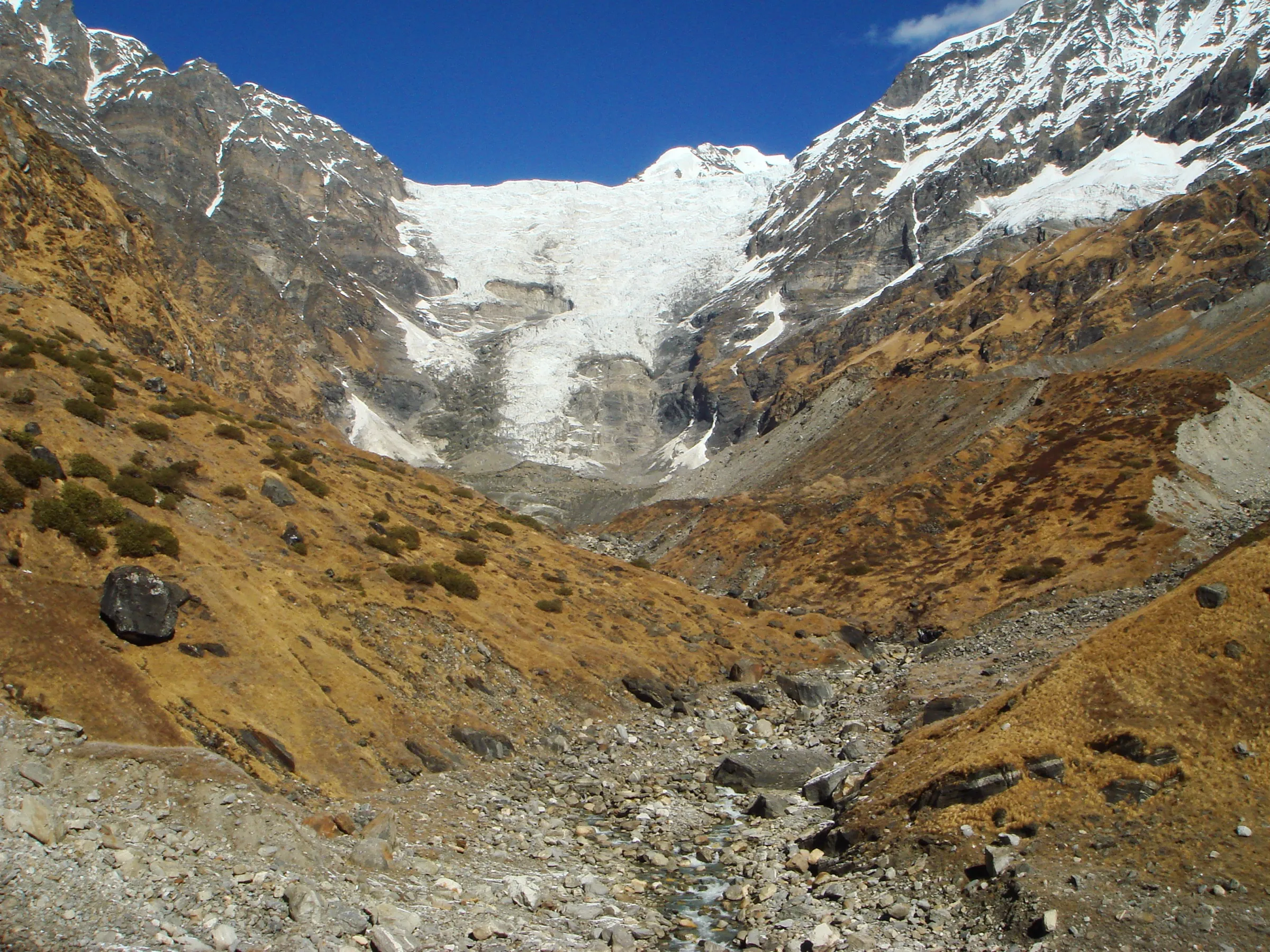
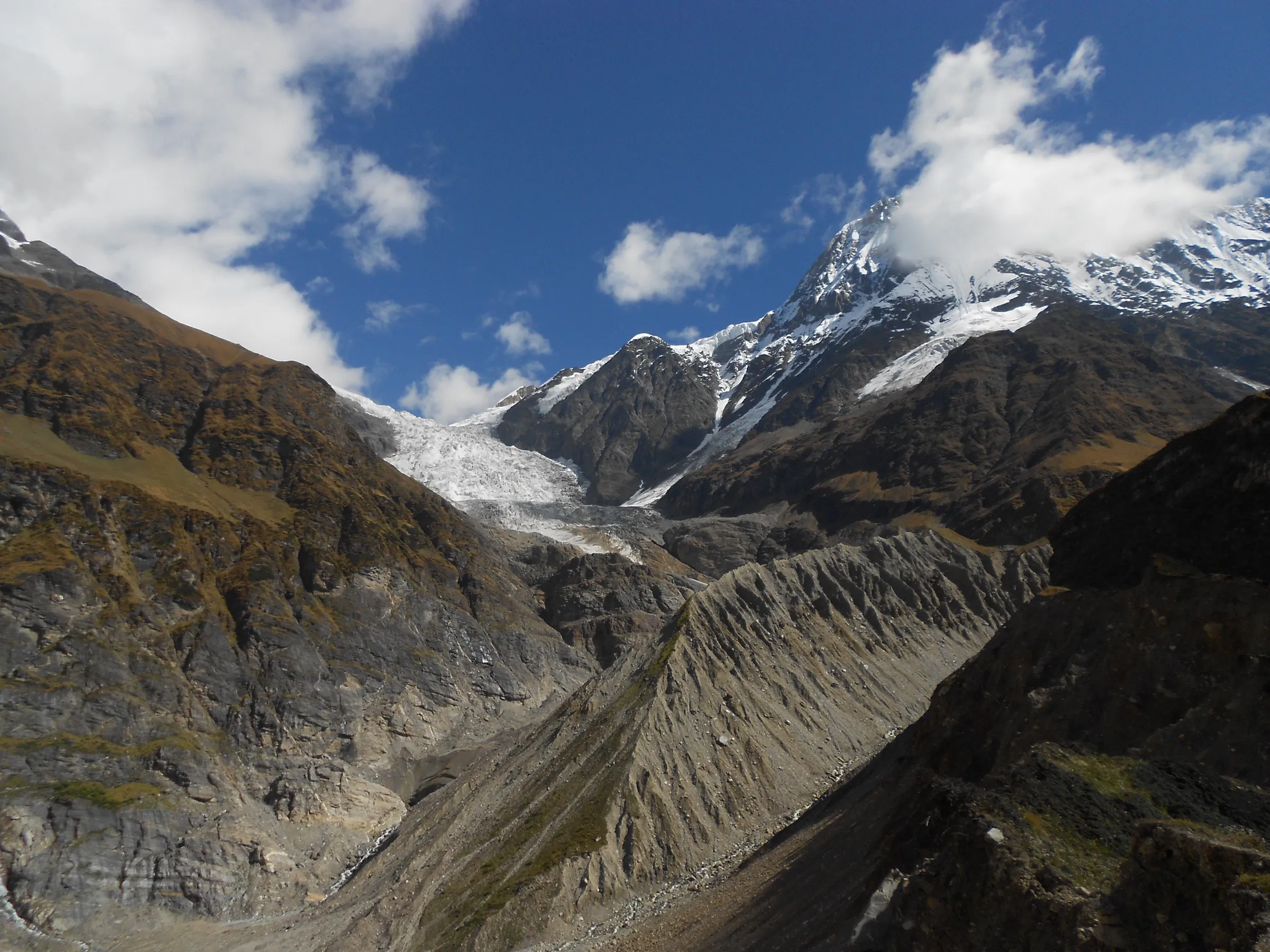
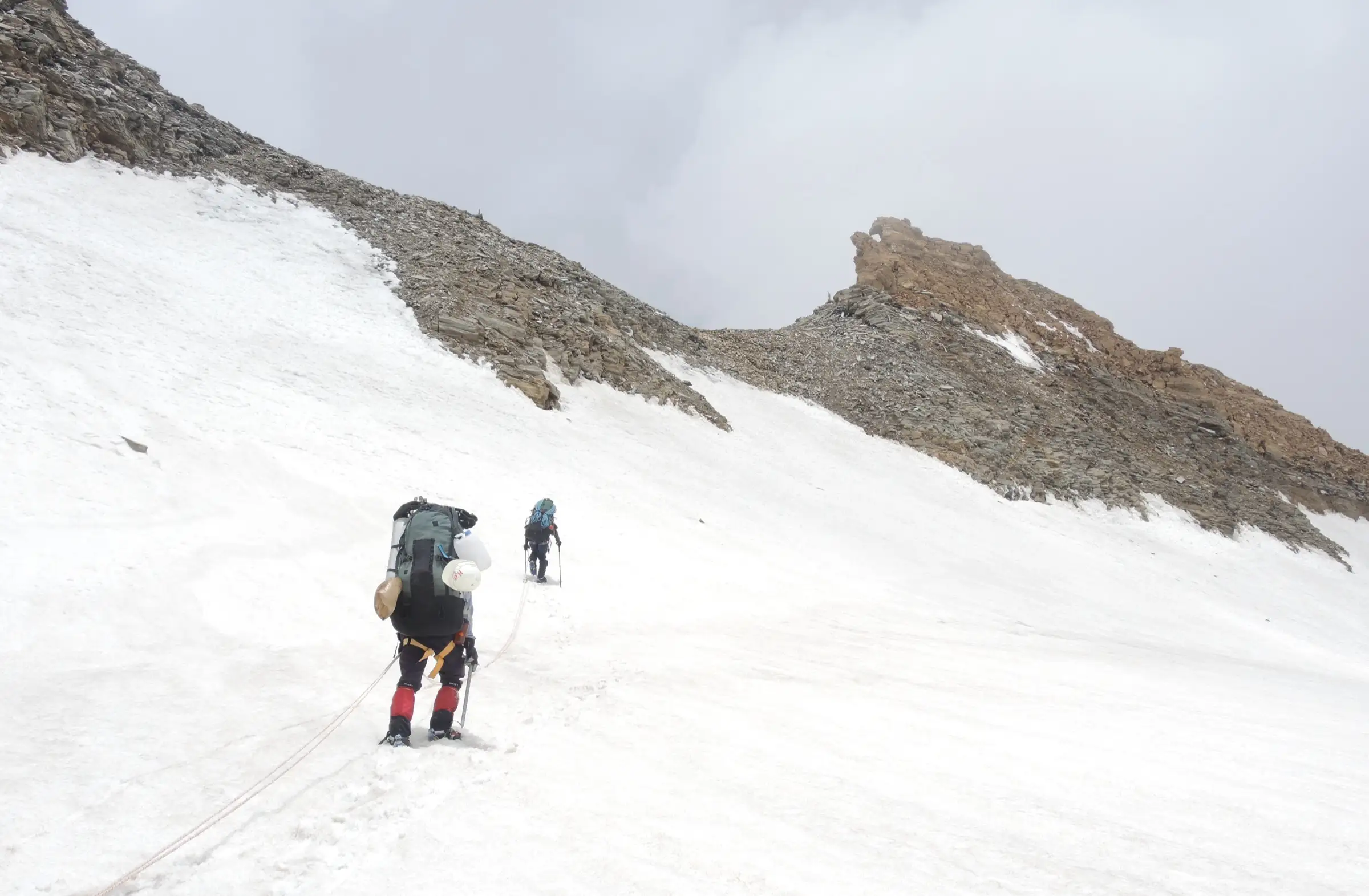
A technical glacier crossing rather than a hiking trail: beyond the Pindari Glacier the route climbs a crevassed icefall and a steep rock, snow and ice wall of roughly 300-800 m on fixed ropes to the 5,400 m pass, then ropes down about 570 m onto the Lwan Glacier. Climbing gear (harness, jumar, crampons, ice axe) and a rope-trained guide team are needed; the Himalayan Club records only a handful of successful crossings.
Photos
On the trail
The route
Day by day
Day 1
Delhi → Kathgodam (overnight train)
215 m → 554 m
Day 2
Kathgodam → Loharkhet (drive via Bageshwar)
554 m → 1,750 m
Day 3
Loharkhet → Dhakuri
1,750 m → 2,680 m
Day 4
Dhakuri → Dwali (via Khati)
2,680 m → 2,575 m
Day 5
Dwali → Pindari Base Camp
2,575 m → 3,565 m
Day 6
Pindari Base Camp → Pindari Base Camp (acclimatisation walk to Zero Point)
3,565 m → 3,750 m → 3,565 m
Day 7
Pindari Base Camp → Pindari Base Camp (load ferry to Advance Base Camp)
3,565 m → 4,475 m → 3,565 m
Day 8
Pindari Base Camp → Advance Base Camp (Thakta Kharak)
3,565 m → 4,475 m
Day 9
Advance Base Camp → Advance Base Camp (route opening to Camp 1)
4,475 m → 4,800 m → 4,475 m
Day 10
Advance Base Camp → Camp 1
4,475 m → 4,800 m
Day 11
Camp 1 → Camp 2 (above the rock and ice wall)
4,800 m → 5,100 m
Day 12 · highest point
Camp 2 → Camp 3, Lwan Glacier (via Traill's Pass)
5,100 m → 5,400 m → 4,830 m
Day 13
Camp 3, Lwan Glacier → Nanda Devi East Base Camp
4,830 m → 4,100 m
Day 14
Nanda Devi East Base Camp → Naspan Patti
4,100 m → 3,700 m
Day 15
Naspan Patti → Martoli
3,700 m → 3,300 m
Day 16
Martoli → Bogudiyar
3,300 m → 2,500 m
Day 17
Bogudiyar → Munsiyari (trek to the road-head, then drive)
2,500 m → 2,200 m
Day 18
Munsiyari → Kathgodam (drive, overnight train to Delhi)
2,200 m → 554 m
Ups and downs
Altitude profile
Where it is
Map
Trailhead and high point only — not a recorded track. Use it with a proper map.
Weather
Next 5 days on the trail
Live forecast for the trailhead and the high point. Mountain weather changes fast — check again on the morning you start.
Trailhead · Loharkhet
at 1,750 mLoading forecast…
High point · Traill's Pass
at 5,400 mLoading forecast…
Each day: high / low °C · rain mm and chance · snow cm · wind km/h
Weather data: Open-Meteo.comModel forecast, not an official warning. For alerts follow IMD and the local administration.
Plan the trip
How to reach
- Trailhead
- Loharkhet (nearest town: Bageshwar at the start (Munsiyari at the finish))
- Nearest railway
- Kathgodam (about 203 km from Loharkhet)
- Nearest airport
- Pantnagar Airport
- By road
- Kathgodam to Loharkhet (about 203 km, 7 hours via Almora and Bageshwar) at the start; Munsiyari to Kathgodam (about 280 km via Thal or Dhaulchina) at the finish
- Drive
- About 7 h from Kathgodam (Haldwani)
Plan the trip
Permits and fees
We could not confirm the current permit rules and fees from an official source. Check with the local forest department or tourism office before you go.
Plan the trip
Cost
Self-guided
₹90,000–1,50,000
With an operator
₹1,55,000–2,35,000
Per person, ex-Delhi (train to Kathgodam, Loharkhet start, Munsiyari finish). Guided prices published October 2026: Aquaterra ₹1,48,000 + 5% GST (about ₹1,55,400) for its 18-day 1-18 May 2027 departure, Delhi to Delhi, with permits and porterage up to 15 kg included; White Magic Adventure ₹2,35,000 Delhi to Delhi twin sharing for 20 days including permit fees. Self-guided is an estimate for a small group hiring a rope-trained guide team with fixed rope and glacier gear, cook and porters for about 15 trekking days, plus food, camping, permits and the two long drives; crossing without an experienced technical guide is not advisable.
Gear
Top picks for this trek
The gear that matters most on this route, chosen from its altitude, season and risks.
 Ad · affiliate link
 Ad · affiliate link
 Ad · affiliate link
 Ad · affiliate link
 Ad · affiliate link
 Ad · affiliate link
 Ad · affiliate link
 Ad · affiliate link
Store buttons open a search on that store, not a product we picked. As an Amazon Associate we earn from qualifying purchases. Photos show the kind of item, not a specific product. Affiliate disclosure
Packing checklist
Matched to this trek: altitude, season, days and the risks on the route.
Packed 0 of 35
Nights near 5,400 m can drop close to freezing even in summer. Pack one more warm layer than you think.
Tick each item as it goes in the bag.
Know before you go
Good to know
- Mobile network
- Patchy BSNL up to Khati, then none until the Milam valley; expect no signal from Dwali to Munsiyari. Operators carry satellite phones.
- Last ATM
- Bageshwar (Kapkot has a branch ATM that often runs dry); Munsiyari at the finish
- Nearest hospital
- Kapkot for first aid and the district hospital in Bageshwar on the Pindari side; Munsiyari and Pithoragarh on the Milam side. From the glacier, evacuation means a carry-down by porters or a helicopter.
- Water
- Streams all along the Pindari valley and glacial meltwater at the high camps; the camps on snow above Thakta Kharak need snow to be melted. Treat all water.
Highlights
- Crossing Traill's Pass (about 5,400 m), the col between Nanda Devi East and Nanda Kot first crossed by Commissioner G.W. Traill in 1830
- Following the whole Pindari valley through Dhakuri, Khati and Dwali to the snout of the Pindari Glacier
- A true traverse from the Pindari (Bageshwar) side to the Lwan and Milam valley (Pithoragarh), past the Nanda Devi East base camp
- Walking out through Martoli and the old Johar trade villages of the Gori Ganga gorge to Munsiyari
Risks
- Steep rock, snow and ice wall below the pass: the Himalayan Club team fixed 240 m of rope on the ridge and 140 m for the descent, with falling stones and verglass.
- Crevasses on the upper Pindari icefield and the Lwan Glacier: rope up behind a guide.
- Weather: the 1994 Himalayan Club party was caught by a blizzard on the pass during the descent; carry reserve days.
- Monsoon (July-August) brings landslides in the Pindari valley between Khati and Dwali and in the Gori Ganga gorge.
- Very low success rate: the Army Ordnance Corps team that crossed in September 2017 was reported as only the sixteenth team to do so.
- No road or network for about two weeks; rescue from the glacier is slow.
Know before you go
Questions
How difficult is the Traill's Pass trek?
It is one of the hardest trekking passes in Uttarakhand and is closer to a mountaineering expedition. Above Thakta Kharak the route climbs a steep rock, snow and ice wall on fixed ropes and crosses crevassed glaciers on both sides. Operators rate it 'Challenging' (Aquaterra) or a grade 6 'Technical Trek' (White Magic).
What is the altitude of Traill's Pass?
The Himalayan Journal (1994 expedition), Aquaterra and the Army Ordnance Corps give 5,400 m. White Magic Adventure and some trek lists give 5,312 m. The pass is the lowest point of the ridge between Nanda Devi East and Nanda Kot.
How many days does the Traill's Pass trek take?
Operators run 18 days (Aquaterra) to 20 days (White Magic Adventure) from Delhi, starting at Loharkhet or Kharkiya in Bageshwar district and finishing at Munsiyari in Pithoragarh district. The Army team took 18 days from Loharkhet to Munsiyari in September 2017.
Who discovered Traill's Pass?
G.W. Traill, the British Commissioner of Kumaon, crossed it in 1830 while looking for a direct route from the Pindari valley to the Milam valley. It was little used afterwards and only a small number of parties have crossed it since.
When can you cross Traill's Pass?
Recorded crossings are in the pre-monsoon window (May-June) and the post-monsoon window (September-October): the 1994 Himalayan Club team crossed on 8 October and the Army team on 19 September 2017. The Pindari valley approach is not run in winter (December to March).
Do I need a permit for Traill's Pass?
Operators include permit and forest fees in their price but do not name them. The route borders the Nanda Devi Biosphere Reserve and ends in the Milam valley near the border; we could not find a current official fee list, so check with the Bageshwar forest office and the SDM office in Munsiyari before you go.
In an emergency
Save these numbers before you lose signal. Tap to call.
- 112All emergenciesIndia’s single emergency number — works in every state
- 108Ambulance
- 1077District disaster control room
You are in
District: Bageshwar and PithoragarhUttarakhand
- Nearest hospital
- Kapkot for first aid and the district hospital in Bageshwar on the Pindari side; Munsiyari and Pithoragarh on the Milam side. From the glacier, evacuation means a carry-down by porters or a helicopter.
- Last ATM
- Bageshwar (Kapkot has a branch ATM that often runs dry); Munsiyari at the finish
- Phone network
- Patchy BSNL up to Khati, then none until the Milam valley; expect no signal from Dwali to Munsiyari. Operators carry satellite phones.
Before you set off
- Tell someone your route and when you will be back.
- Carry a charged phone and a power bank.
- Download an offline map of the route.
- Turn back if the weather turns bad — the mountain will wait.
Questions about Traill's Pass
No questions yet. Ask something and trekkers who have done it can answer.
Share your trek photo with #TreksAndTrails
I trekked this
Did Traill's Pass look different from this page? Tell us what changed and we will check it.
Where this comes from
Sources
Last reviewed:
- Traill's Pass Trek — Aquaterra
- Traill's Pass — White Magic Adventure
- Traill's Pass Expedition, 1994 (Himalayan Journal 54) — The Himalayan Club
- Army Ordnance Corps successfully reaches Traill's Pass — Aviation Defence Universe
- Mightiest Passes/ Treks to Attempt, Himalayas Part 1 — Tripoto
- Pindari Glacier Trek — Himalaya Shelter
- Pindari Glacier Trek — Explurger
Photos: Dhruv Joshi (User:Dhruvjoe), CC BY-SA 3.0; Yann, CC BY-SA 4.0