Pindari Glacier Trek
Bageshwar, Uttarakhand
Opens without signal on this phone, with the map file and checklist. Saved for offline →
- Max altitude
- 3,750 m
- Days
- 6 days
- Distance
- 56 km
- Difficulty
- Moderate
No technical climbing and the high point is only about 3,750 m, but the walking days are long (13-18 km), the Khati-Dwali stretch crosses several landslide zones where the old trail is broken and you detour over river moraine, and early in the season the streams above Phurkia are hard snow.
Photos
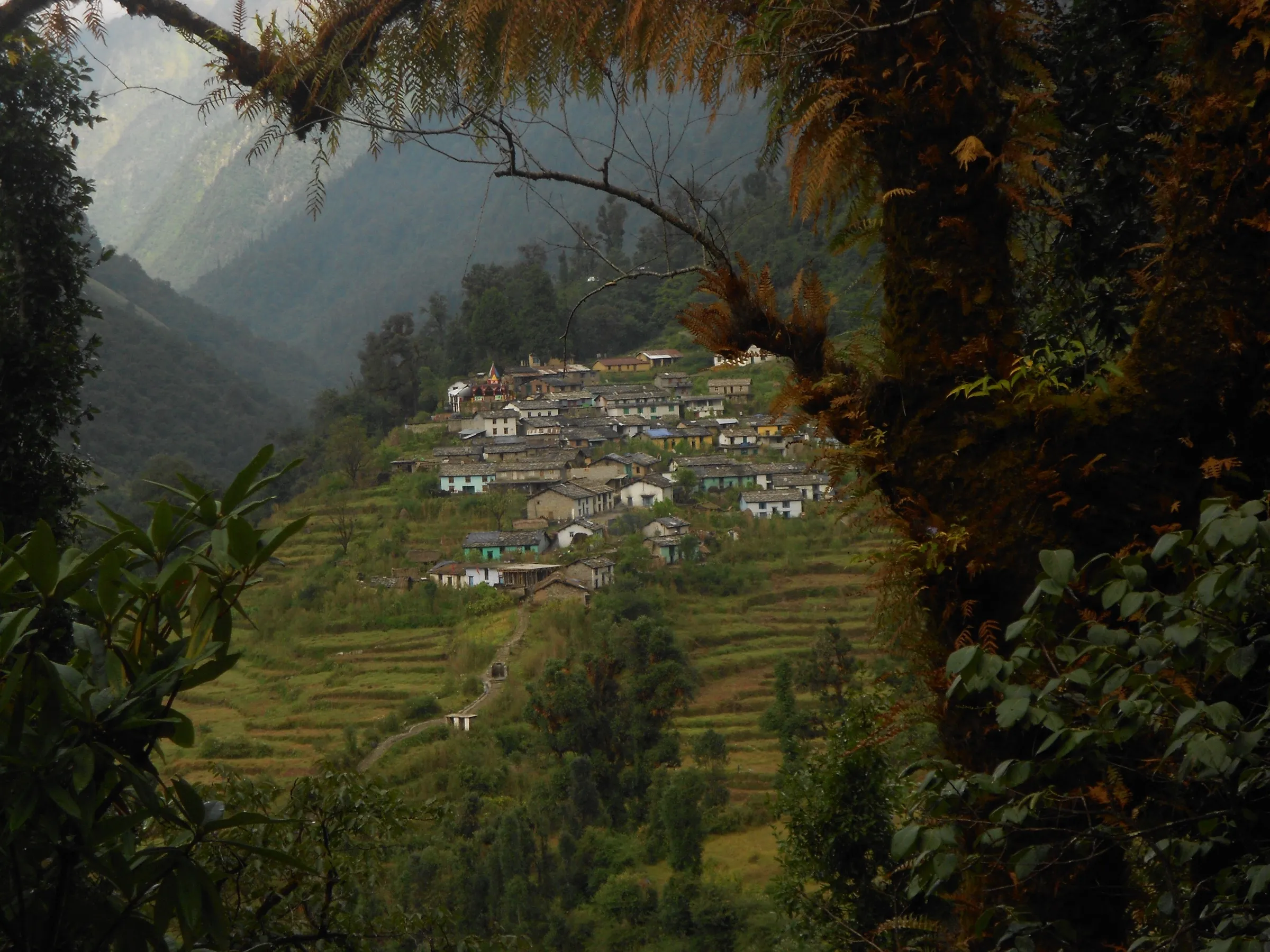
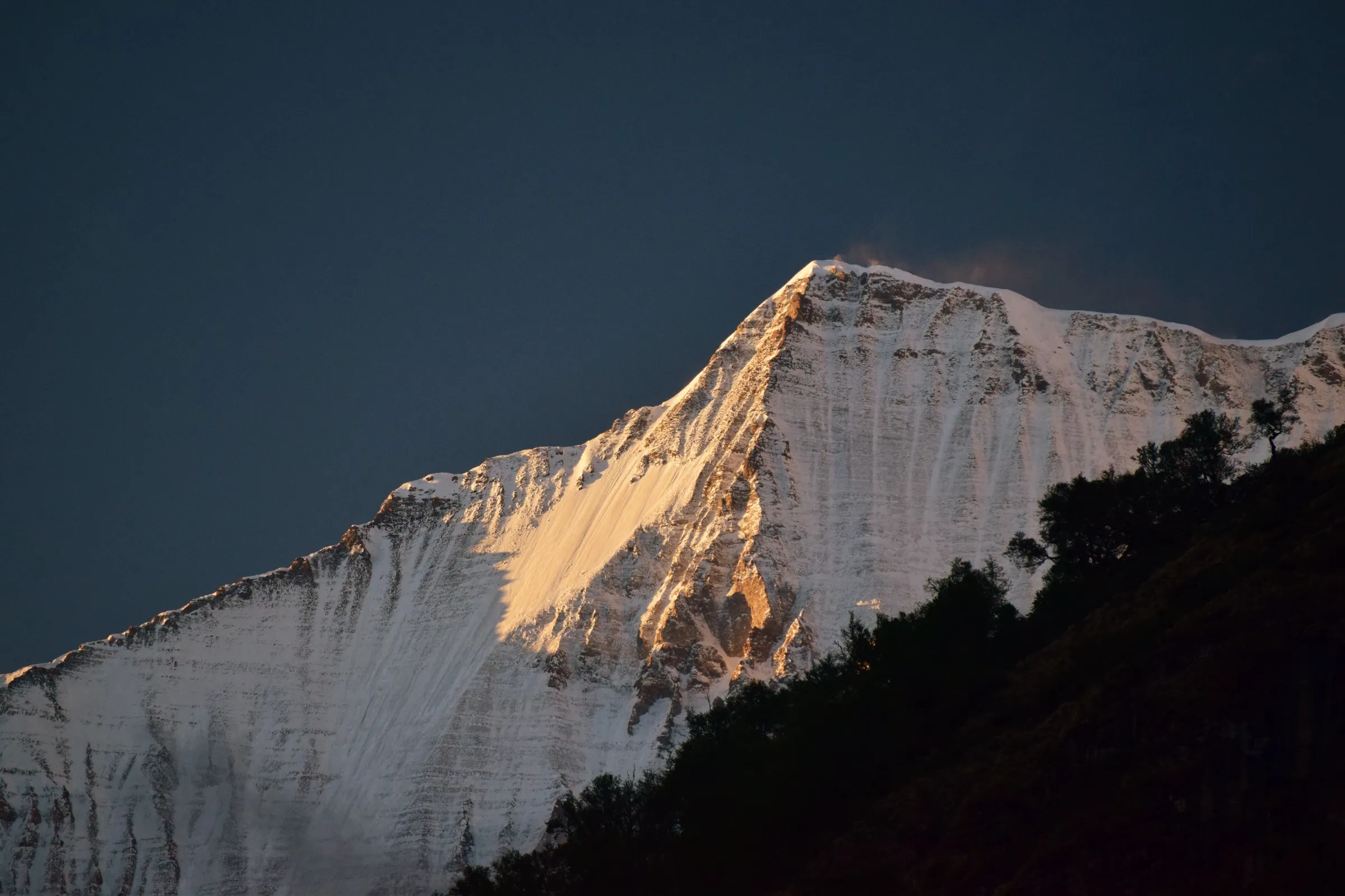
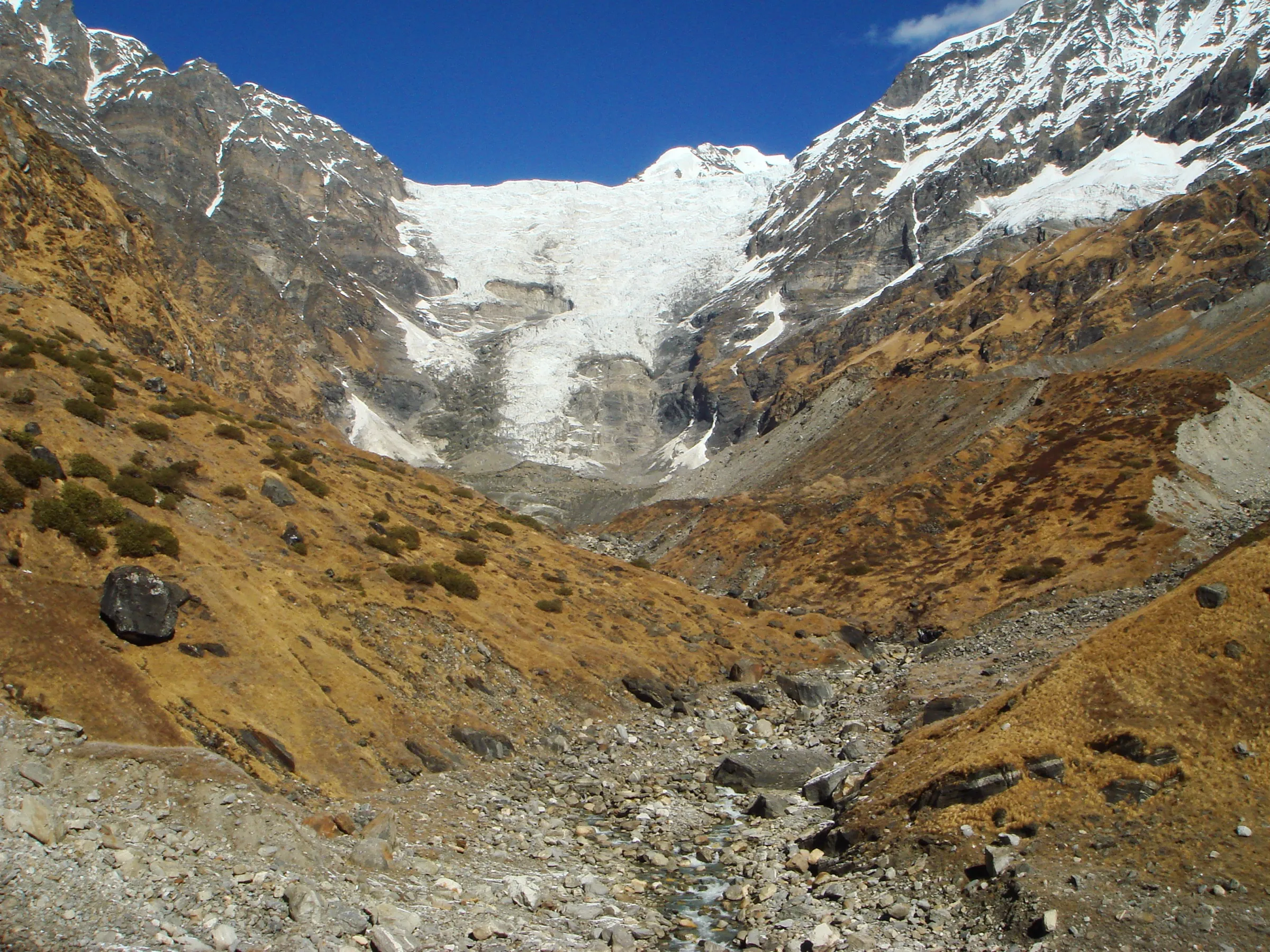
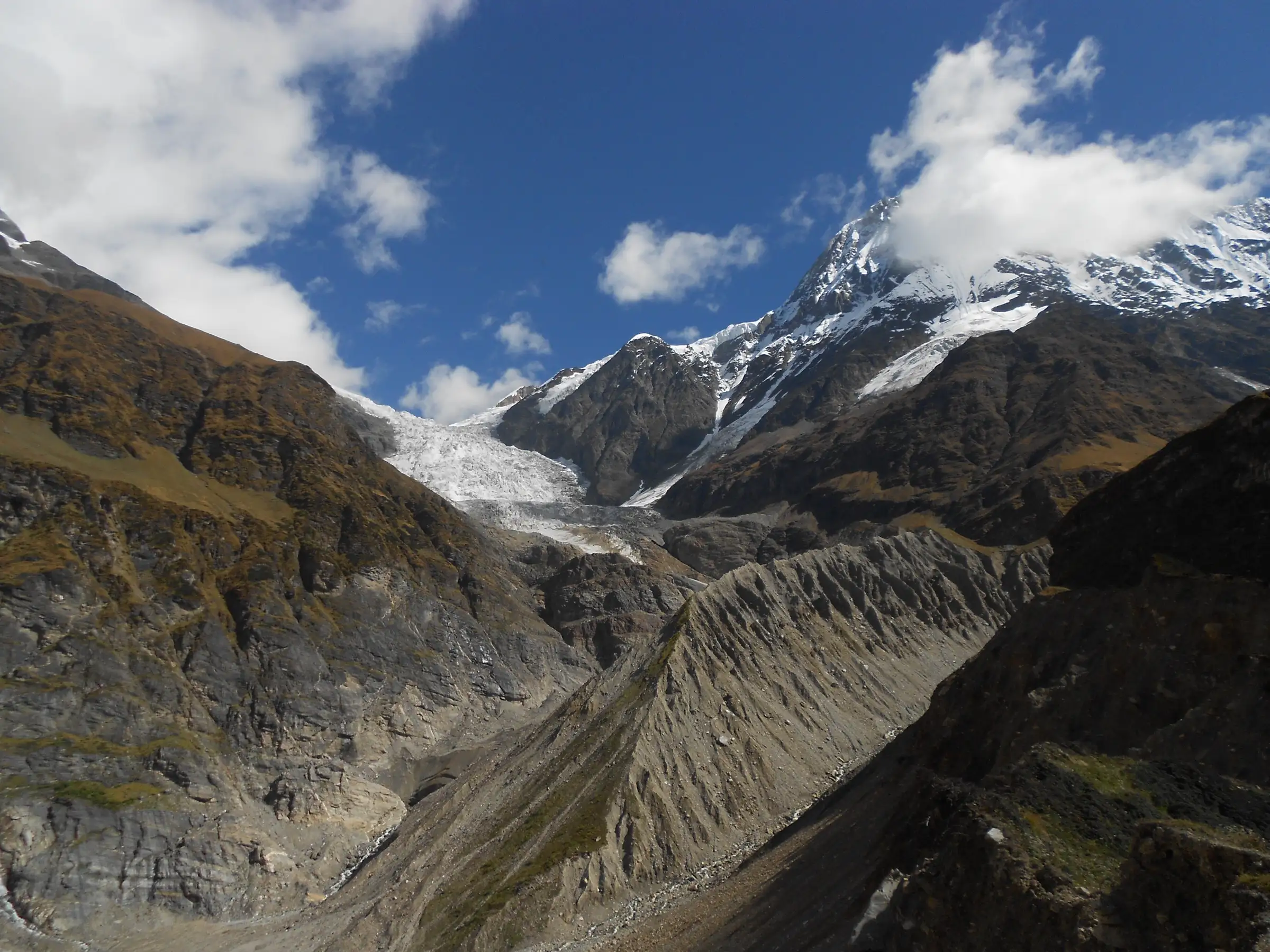
On the trail
The route
Day by day
Day 1
Kathgodam → Khati (drive to Kharkiya, then short trek)
554 m → 2,220 m
Day 2
Khati → Dwali
2,220 m → 2,610 m
Day 3
Dwali → Phurkia
2,610 m → 3,200 m
Day 4 · highest point
Phurkia → Phurkia (via Zero Point, Pindari Glacier)
3,200 m → 3,750 m → 3,200 m
Day 5
Phurkia → Khati (via Dwali)
3,200 m → 2,220 m
Day 6
Khati → Kharkiya (drive to Kathgodam)
2,220 m → 2,250 m
Ups and downs
Altitude profile
Where it is
Map
Trailhead and high point only — not a recorded track. Use it with a proper map.
Weather
Next 5 days on the trail
Live forecast for the trailhead and the high point. Mountain weather changes fast — check again on the morning you start.
Trailhead · Kharkiya (road-head for Khati)
at 554 mLoading forecast…
High point · Zero Point, Pindari Glacier
at 3,750 mLoading forecast…
Each day: high / low °C · rain mm and chance · snow cm · wind km/h
Weather data: Open-Meteo.comModel forecast, not an official warning. For alerts follow IMD and the local administration.
Plan the trip
How to reach
- Trailhead
- Kharkiya (road-head for Khati) (nearest town: Bageshwar (Kapkot is the last town on the road))
- Nearest railway
- Kathgodam (about 200-214 km)
- Nearest airport
- Pantnagar Airport
- By road
- Kathgodam (about 200-214 km via Bhimtal, Almora, Bageshwar, Kapkot and Loharkhet to Kharkiya); Bageshwar (shared jeeps to Kharkiya, about 2 hours)
- Drive
- About 9 h from Kathgodam (Haldwani)
Plan the trip
Permits and fees
We could not confirm the current permit rules and fees from an official source. Check with the local forest department or tourism office before you go.
Plan the trip
Cost
Self-guided
₹8,000–14,000
With an operator
₹12,000–15,300
Per person, ex-Kathgodam. Guided prices published October 2026: Trek The Himalayas ₹14,500 + 5% GST for 6 days Kathgodam to Kathgodam; Himalayan Dream Treks ₹11,500 + 5% GST ex-Khati plus ₹3,000 for Kathgodam transport; Bikat Adventures ₹14,500 + 5% GST for its longer 8-day Pindari-Kafni version. Self-guided is an estimate: bus or shared jeep Kathgodam-Bageshwar-Kharkiya and back, five nights in KMVN, PWD or private guesthouses at Khati, Dwali and Phurkia, food, a local guide or porter, and forest entry fees.
Gear
Top picks for this trek
The gear that matters most on this route, chosen from its altitude, season and risks.
 Ad · affiliate link
 Ad · affiliate link
 Ad · affiliate link
 Ad · affiliate link
 Ad · affiliate link
 Ad · affiliate link
 Ad · affiliate link
 Ad · affiliate link
Store buttons open a search on that store, not a product we picked. As an Amazon Associate we earn from qualifying purchases. Photos show the kind of item, not a specific product. Affiliate disclosure
Packing checklist
Matched to this trek: altitude, season, days and the risks on the route.
Packed 0 of 37
Nights near 3,750 m can drop close to freezing even in summer. Pack one more warm layer than you think.
Tick each item as it goes in the bag.
Know before you go
Good to know
- Mobile network
- Only BSNL, and only in parts: at Khati it works for a few hours a day. Expect no signal beyond Khati.
- Last ATM
- Kapkot, on the road to Kharkiya
- Nearest hospital
- Kapkot for first aid; the district hospital at Bageshwar for anything serious
- Water
- Several streams cross the trail between Khati and Zero Point, and there is drinking water behind the PWD guest house at Dwali; the upper streams can be frozen in April and early May. Boil or treat all water.
Highlights
- Standing at Zero Point facing the snout of the Pindari Glacier, with Changuch (6,322 m) and Nanda Kot (6,861 m) around the head of the valley
- Khati, the last inhabited village of the Pindar Valley, with views of Nandabaner, Nanda Kot and Laspadhura
- Oak and rhododendron forest along the Pindar River, with the Pindar-Kafni confluence at Dwali
- The ashram and temple of Pindari Baba (Swami Dharmanand) about 40 minutes below Zero Point
- Nanda Khat and Nanda Devi East seen on clear mornings above Phurkia
Risks
- Since the 2013 floods the Khati-Dwali trail is broken at about six landslide zones; you climb down to the river moraine and back up on loose gravel and boulders.
- July-August monsoon: heavy rain, leeches, landslides and road blocks; operators advise against the trek then (Himalayan Dream Treks calls the trail inaccessible in peak monsoon).
- In April and early May the stream crossings above Phurkia are hard snow; microspikes and sometimes an ice axe are needed.
- Weather at the glacier changes within minutes; start from Phurkia very early and aim to reach Zero Point by about 9 am.
- Rock-fall section and narrow broken ledges between Phurkia and Zero Point.
Know before you go
Questions
Where does the Pindari Glacier trek start now?
A motor road now runs from Loharkhet to Kharkiya, so most groups drive from Kathgodam via Bageshwar and Kapkot to Kharkiya and walk 3-4 km to Khati on the first day. The older route walked from Loharkhet over the Dhakuri Pass to Khati, adding a day or two.
What is the best time for the Pindari Glacier trek?
April to June and September to October. In April and early May there is still snow on the upper trail; autumn gives the clearest views. Avoid July and August for monsoon landslides, and winter (December to February) when heavy snow closes the upper trail.
Is the Pindari Glacier trek suitable for beginners?
Operators grade it moderate and describe it as one of the easier glacier treks, suitable for fit beginners and families. The challenge is the long days of 13-18 km and the broken landslide sections between Khati and Dwali, so build up stamina beforehand.
How high is Zero Point?
Sources give 3,660 m to 3,816 m; most operators quote about 12,300 ft (around 3,750 m). Zero Point is a moraine viewpoint with a sign board facing the glacier snout; going further needs expedition permits.
Is there mobile network and an ATM on the trek?
Only BSNL works, and only in parts (at Khati for a few hours a day). The last ATM is at Kapkot, so carry enough cash for guesthouses and porters.
In an emergency
Save these numbers before you lose signal. Tap to call.
- 112All emergenciesIndia’s single emergency number — works in every state
- 108Ambulance
- 1077District disaster control room
You are in
District: BageshwarUttarakhand
- Nearest hospital
- Kapkot for first aid; the district hospital at Bageshwar for anything serious
- Last ATM
- Kapkot, on the road to Kharkiya
- Phone network
- Only BSNL, and only in parts: at Khati it works for a few hours a day. Expect no signal beyond Khati.
Before you set off
- Tell someone your route and when you will be back.
- Carry a charged phone and a power bank.
- Download an offline map of the route.
- Turn back if the weather turns bad — the mountain will wait.
Questions about Pindari Glacier
No questions yet. Ask something and trekkers who have done it can answer.
Share your trek photo with #TreksAndTrails
I trekked this
Did Pindari Glacier look different from this page? Tell us what changed and we will check it.
Where this comes from
Sources
Last reviewed:
- The Complete Guide To Pindari Glacier Trek — Indiahikes
- Pindari Glacier Trek Guide 2026 - Itinerary, Dates and Cost — Trek The Himalayas
- Pindari Glacier Trek — Himalayan Dream Treks
- Pindari Glacier Trek – Gateway to Kumaon Himalayas — Himalaya Shelter
- Pindari Glacier Trek — Explurger
- Pindari Glacier Trek — Bikat Adventures
- Pindari Glacier — Wikipedia
Photos: Yann, CC BY-SA 4.0; Harshit SR, CC BY-SA 4.0; Yann, CC BY-SA 4.0