- Max altitude
- 4,650 m
- Days
- 7 days
- Distance
- 40 km
- Difficulty
- Difficult
Five trekking days that climb from about 2,300 m to a 4,650 m pass, with snow bridges and river crossings, a steep rock-fall-prone gully below the pass, and a 10-11 hour crossing day followed by a long knee-jarring descent to Sangla.
Photos
On the trail
The route
Day by day
Day 1
Shimla → Jiskun
2,206 m → 2,326 m
Day 2
Jiskun → Jakha
2,326 m → 2,669 m
Day 3
Jakha → Saruwas Thatch
2,669 m → 3,283 m
Day 4
Saruwas Thatch → Dhanderas Thatch
3,283 m → 3,566 m
Day 5
Dhanderas Thatch → Upper Waterfall camp
3,566 m → 4,046 m
Day 6 · highest point
Upper Waterfall camp → Ronti Gad (via Rupin Pass)
4,046 m → 4,650 m → 3,964 m
Day 7
Ronti Gad → Sangla (via Sangla Kanda; drive to Shimla)
3,964 m → 2,650 m
Ups and downs
Altitude profile
Where it is
Map
Trailhead and high point only — not a recorded track. Use it with a proper map.
Weather
Next 5 days on the trail
Live forecast for the trailhead and the high point. Mountain weather changes fast — check again on the morning you start.
Trailhead · Jiskun (Bawta)
at 2,326 mLoading forecast…
High point · Rupin Pass
at 4,650 mLoading forecast…
Each day: high / low °C · rain mm and chance · snow cm · wind km/h
Weather data: Open-Meteo.comModel forecast, not an official warning. For alerts follow IMD and the local administration.
Plan the trip
How to reach
- Trailhead
- Jiskun (Bawta) (nearest town: Rohru)
- Nearest railway
- Shimla (Kalka-Shimla line); Kalka for broad-gauge trains
- Nearest airport
- Shimla (Jubbarhatti) Airport; Chandigarh International Airport for more flights
- By road
- Shimla (about 191 km via Theog, Kotkhai, Rohru, Chirgaon and Chanshal Pass to Jiskun); Sangla to Shimla at the end (about 215 km via Karcham and Rampur)
- Drive
- About 10 h from Shimla
Plan the trip
Permits and fees
We could not confirm the current permit rules and fees from an official source. Check with the local forest department or tourism office before you go.
Plan the trip
Cost
Self-guided
₹10,000–18,000
With an operator
₹17,000–24,000
Per person, ex-Shimla. Guided prices published October 2026, ex-Jiskun: Indiahikes ₹17,750 plus ₹4,850 for Shimla transport both ways; Trek The Himalayas ₹17,500 + 5% GST; Trekup India ₹16,750 + 5% GST; Bikat Adventures ₹16,650 + 5% GST. Self-guided is an estimate for a group of four: bus or shared taxi Shimla-Jiskun and Sangla-Shimla, a local guide and porters or mules for six days, tent and stove hire, food, and forest fees.
Gear
Top picks for this trek
The gear that matters most on this route, chosen from its altitude, season and risks.
 Ad · affiliate link
 Ad · affiliate link
 Ad · affiliate link
 Ad · affiliate link
 Ad · affiliate link
 Ad · affiliate link
 Ad · affiliate link
 Ad · affiliate link
Store buttons open a search on that store, not a product we picked. As an Amazon Associate we earn from qualifying purchases. Photos show the kind of item, not a specific product. Affiliate disclosure
Packing checklist
Matched to this trek: altitude, season, days and the risks on the route.
Packed 0 of 36
Snow on the trail in May–Jun: microspikes, gaiters and a warm layer are not optional.
Tick each item as it goes in the bag.
Know before you go
Good to know
- Mobile network
- Patchy BSNL/Airtel/Vodafone signal up to Jiskun; no mobile network on the trail until you near Sangla.
- Last ATM
- Rohru, on the drive from Shimla; villages such as Jiskun and Jakha take cash only
- Nearest hospital
- Government hospital at Rohru for basic care (exit via Jiskun before the pass); IGMC Shimla for serious cases
- Water
- The Rupin river and side streams along the whole trail, plus streams at Ronti Gad after the pass. Treat or boil all water.
Highlights
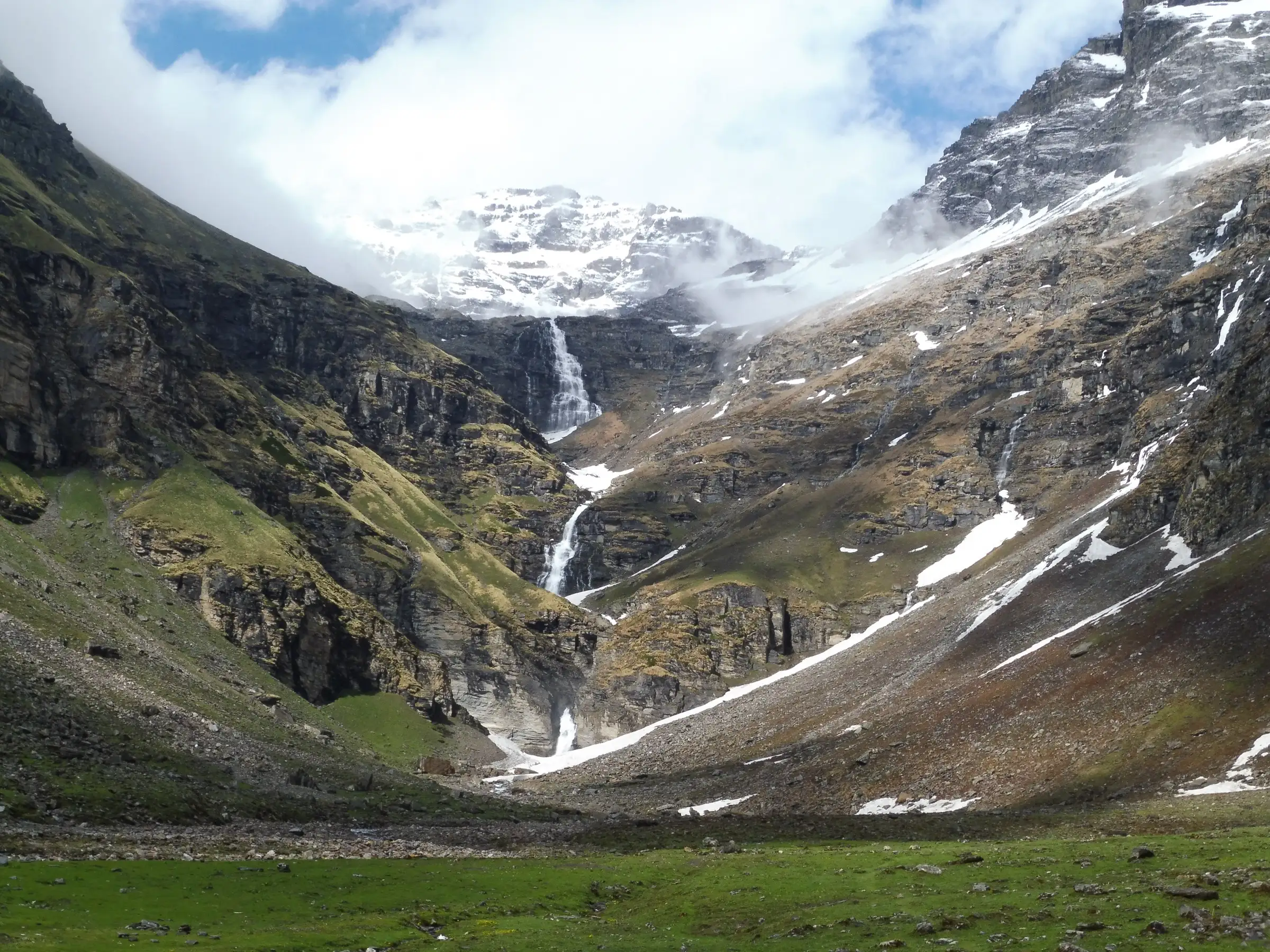
- The three-tier Rupin waterfall, which you camp below at Dhanderas Thatch and then climb beside to the Upper Waterfall camp
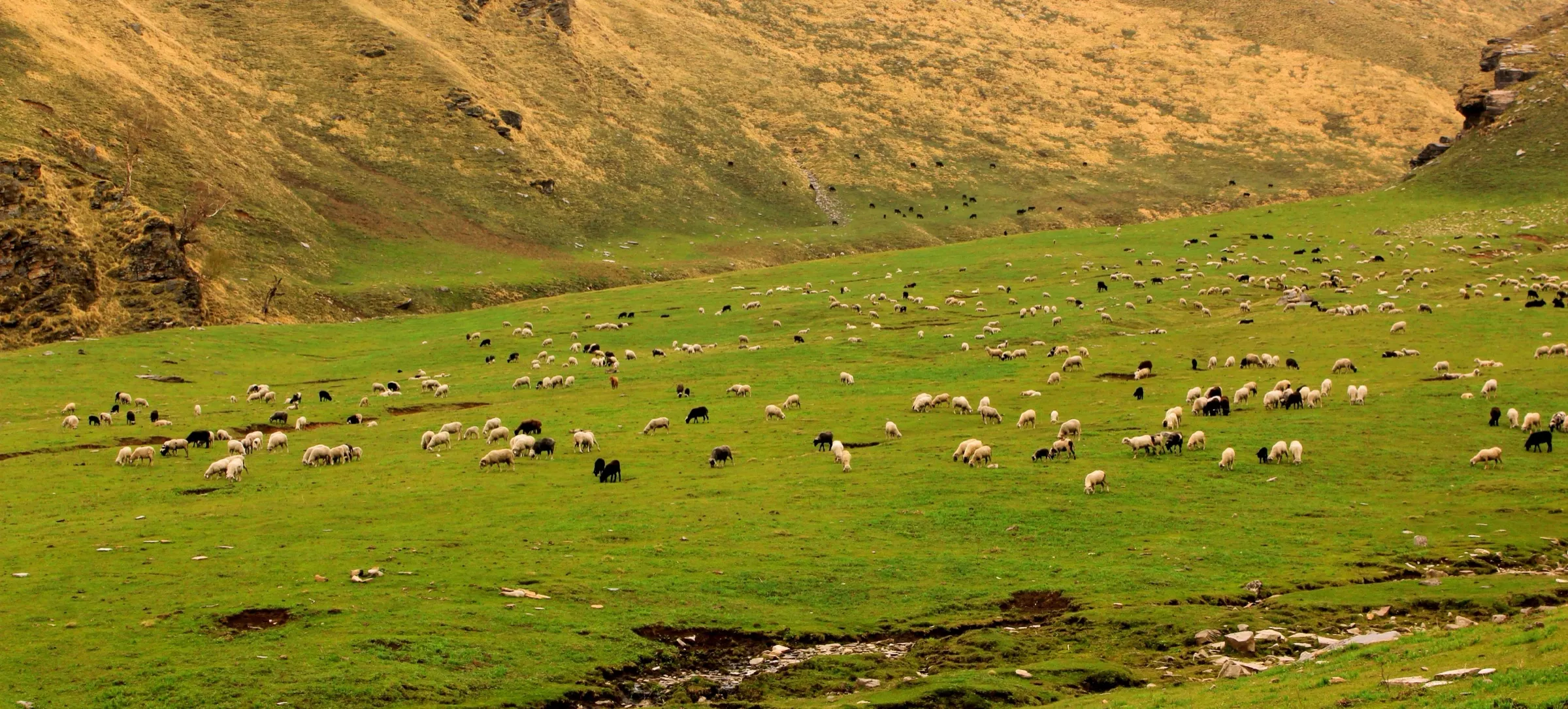
- Jakha, the 'hanging village' clinging to the mountainside above the Rupin river
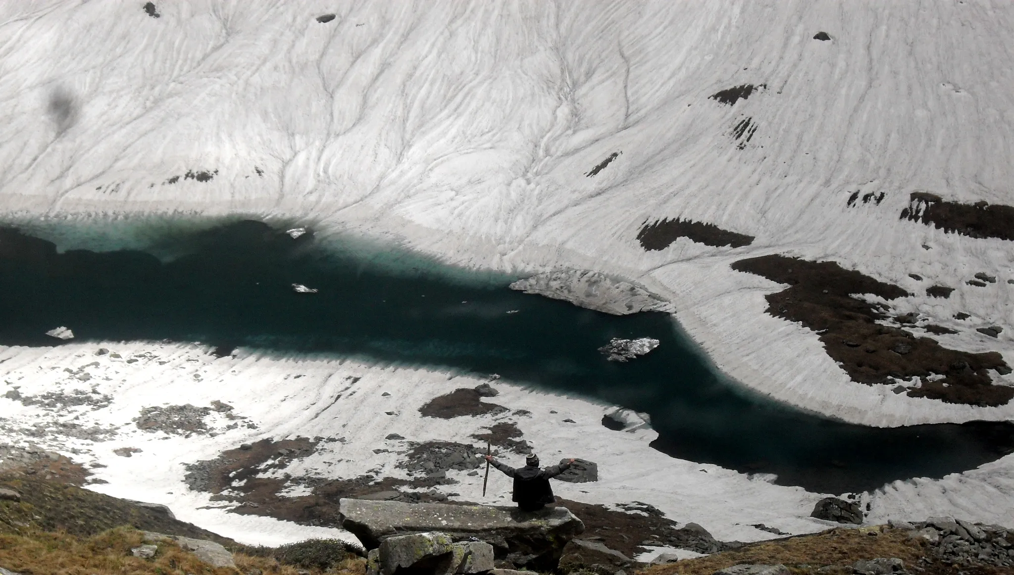
- Snow bridges, the Rata Pheri snowfields and the steep Rupin gully up to the 4,650 m pass
- Snow slides down from the pass and the first view of the Kinner Kailash range over the meadows of Sangla Kanda
- A true crossover: from the Rupin valley (Yamuna side) to the Baspa valley of Kinnaur (Sutlej side)
Risks
- TREKKING BAN: In late October 2021 the Kinnaur Deputy Commissioner banned trekking and mountaineering on all treks in Kinnaur district 'till further orders' under Section 34 of the Disaster Management Act, 2005, warning of legal action against violators (Himachal Watcher, 26 October 2021). The last two days of this route, from Rupin Pass down to Ronti Gad and Sangla, are in Kinnaur, so the order as reported covers them. We found no order lifting it. Do not attempt this trek while the ban is in force, and confirm with the Kinnaur district administration at Reckong Peo before booking.
- The Rupin gully below the pass is steep, bouldery and prone to rock fall; when full of snow it needs crampons or microspikes and a guide
- River crossings: snow bridges in May-June and shepherds' log crossings in September-October can be missing or unsafe
- Not doable in winter: JustWravel and Himalayan Hikers say heavy snow closes the pass from November to April; early snow can also end the autumn season (an Uttarkashi DDMA advisory of 27 September 2026 warned of heavy snow and avalanche risk on high routes, and Trekup India listed Rupin Pass among the affected treks)
- The July-August monsoon brings swollen rivers, washed-out bridges and landslides on the access roads
- Altitude sickness on the 600 m climb from Upper Waterfall to the pass; once past Upper Waterfall the quickest exit is over the pass to Sangla
Know before you go
Questions
Is the Rupin Pass trek allowed right now?
Not as far as we can find. In late October 2021 the Kinnaur Deputy Commissioner banned trekking and mountaineering on all treks in Kinnaur district 'till further orders' under Section 34 of the Disaster Management Act, 2005, warning of legal action against violators (Himachal Watcher, 26 October 2021). The descent from Rupin Pass to Ronti Gad and Sangla is in Kinnaur, and we found no order lifting the ban. Do not attempt this trek while the ban is in force; check with the Kinnaur district administration at Reckong Peo before booking.
Where does the Rupin Pass trek start and end?
Operators now start from Jiskun (lower Jiskun is called Bawta) in Shimla district, Himachal Pradesh, about 191 km and 10-11 hours by road from Shimla via Rohru. The older route began at Dhaula in Uttarakhand. The trek ends at Sangla in Kinnaur, about 8 hours by road from Shimla.
What is the best time for the Rupin Pass trek?
Mid-May to June for snow bridges, snowfields and snow slides, and mid-September to mid-October for clear skies and autumn colours. Winter snow blocks the pass, and the July-August monsoon makes river crossings and roads risky.
How difficult is Rupin Pass and how long is it?
It is rated moderate to difficult. Operators run it in 7 days, with about 37-44 km of walking over five trekking days. The hardest day is the 10-11 hour pass crossing from Upper Waterfall to Ronti Gad, which includes a steep gully climb to about 4,650 m.
Is there mobile network and an ATM on the way?
Network is weak and only up to Jiskun, and there is none on the trail until you near Sangla. There are no ATMs beyond Rohru, and villages like Jiskun and Jakha do not take UPI, so carry cash.
Do I need a permit for the Rupin Pass trek?
Forest Department permits are needed, and guided groups include them in the package. We could not find a current official fee, so self-guided trekkers should check with the forest office before setting out.
In an emergency
Save these numbers before you lose signal. Tap to call.
- 112All emergenciesIndia’s single emergency number — works in every state
- 108Ambulance
- 1077District disaster control room
You are in
District: Shimla (Dodra Kwar) to KinnaurHimachal Pradesh
- Nearest hospital
- Government hospital at Rohru for basic care (exit via Jiskun before the pass); IGMC Shimla for serious cases
- Last ATM
- Rohru, on the drive from Shimla; villages such as Jiskun and Jakha take cash only
- Phone network
- Patchy BSNL/Airtel/Vodafone signal up to Jiskun; no mobile network on the trail until you near Sangla.
Before you set off
- Tell someone your route and when you will be back.
- Carry a charged phone and a power bank.
- Download an offline map of the route.
- Turn back if the weather turns bad — the mountain will wait.
Questions about Rupin Pass
No questions yet. Ask something and trekkers who have done it can answer.
Share your trek photo with #TreksAndTrails
I trekked this
Did Rupin Pass look different from this page? Tell us what changed and we will check it.
Where this comes from
Sources
Last reviewed:
- Rupin Pass Trek — Indiahikes
- Rupin Pass Trek — Trek The Himalayas
- Rupin Pass Trek — Bikat Adventures
- Rupin Pass Trek 2026: Best Time, Distance, Cost & Route Map — Himalaya Shelter
- Rupin Pass Trek Guide: Route, Itinerary, Best Time & Tips — JustWravel
- Rupin Pass Trek | Shimla to Sangla — Himalayan High
- Rupin Pass Trek — Trekup India
- Rupin Pass — Wikipedia
- Rupin Pass Trek 2027 - Complete Itinerary, Date, Cost, Safety tips more — Himalayan Hikers
- Trekking in Kinnaur banned after two tragedies — Himachal Watcher
Photos: Nikitaparwani, CC BY-SA 4.0; Engti, CC BY-SA 3.0; Nikitaparwani, CC BY-SA 4.0; AjitK332, CC BY-SA 4.0