Kondana Caves Trek
Raigad, Maharashtra
Opens without signal on this phone, with the map file and checklist. Saved for offline →
- Max altitude
- 60 m
- Satellite terrain suggests about 230 m
- Days
- 1 day
- Distance
- 5 km
- Difficulty
- Easy
A short forest walk of about 45–60 minutes each way with a gentle climb of roughly 150 m, stream crossings and a final flight of stone steps; operators rate it easy and suitable for beginners and children, though rocks and streams turn slippery in monsoon.
Photos
On the trail
The route
Day by day
Day 1 · highest point
Thakurwadi, Kondane village → Thakurwadi, Kondane village (via Kondana Caves)
60 m → 60 m → 60 m
Ups and downs
Altitude profile
Where it is
Map
Trailhead and high point only — not a recorded track. Use it with a proper map.
Weather
Next 5 days on the trail
Live forecast for the trailhead and the high point. Mountain weather changes fast — check again on the morning you start.
Trailhead · Thakurwadi, Kondane (Kondhane, Kondana) village
at 60 mLoading forecast…
High point · Kondana Caves (chaitya and viharas)
at 60 mLoading forecast…
Each day: high / low °C · rain mm and chance · snow cm · wind km/h
Weather data: Open-Meteo.comModel forecast, not an official warning. For alerts follow IMD and the local administration.
Plan the trip
How to reach
- Trailhead
- Thakurwadi, Kondane (Kondhane, Kondana) village (nearest town: Karjat)
- Nearest railway
- Karjat
- Nearest airport
- Chhatrapati Shivaji Maharaj International Airport, Mumbai
- By road
- Karjat station to Kondane village (about 13.5 km by road; shared or private rickshaw via Kondivade); Mumbai to Kondane via Karjat (about 75–83 km)
- Drive
- About 2.5 h from Mumbai
Plan the trip
Permits and fees
We could not confirm the current permit rules and fees from an official source. Check with the local forest department or tourism office before you go.
Plan the trip
Cost
Self-guided
₹150–700
With an operator
₹600–1,950
Per person. Guided: about Rs 600 ex-Kondane base village (Mischief Treks, own transport) up to about Rs 999–1,950 ex-Mumbai with transport and meals (Treks and Trails India, Kshitij). Self-guided estimate ex-Karjat: shared rickshaw to Kondivade about Rs 20–30 each way or a private auto about Rs 250–350, plus a village meal. Bloggers report no entry ticket for the caves; check locally.
Gear
Top picks for this trek
The gear that matters most on this route, chosen from its altitude, season and risks.
 Ad · affiliate link
 Ad · affiliate link
 Ad · affiliate link
 Ad · affiliate link
- Ad · affiliate link
 Ad · affiliate link
 Ad · affiliate link
 Ad · affiliate link
Store buttons open a search on that store, not a product we picked. As an Amazon Associate we earn from qualifying purchases. Photos show the kind of item, not a specific product. Affiliate disclosure
Packing checklist
Matched to this trek: altitude, season, days and the risks on the route.
Packed 0 of 21
Monsoon months (Jun–Sep): pack everything in plastic or a dry bag and wear shoes with good grip.
Tick each item as it goes in the bag.
Know before you go
Good to know
- Mobile network
- Patchy in the forested valley below the caves; expect weak or no signal on the trail
- Last ATM
- Karjat
- Nearest hospital
- Karjat town (about 13.5 km by road from Kondane village)
- Water
- No drinking water on the trail; streams and waterfalls run only in the monsoon. Carry at least 2 litres per person, more in the dry months
Highlights
- Sixteen Buddhist rock-cut caves from about the 1st century BCE, among the earliest in the Western Ghats and close in age to Bhaja
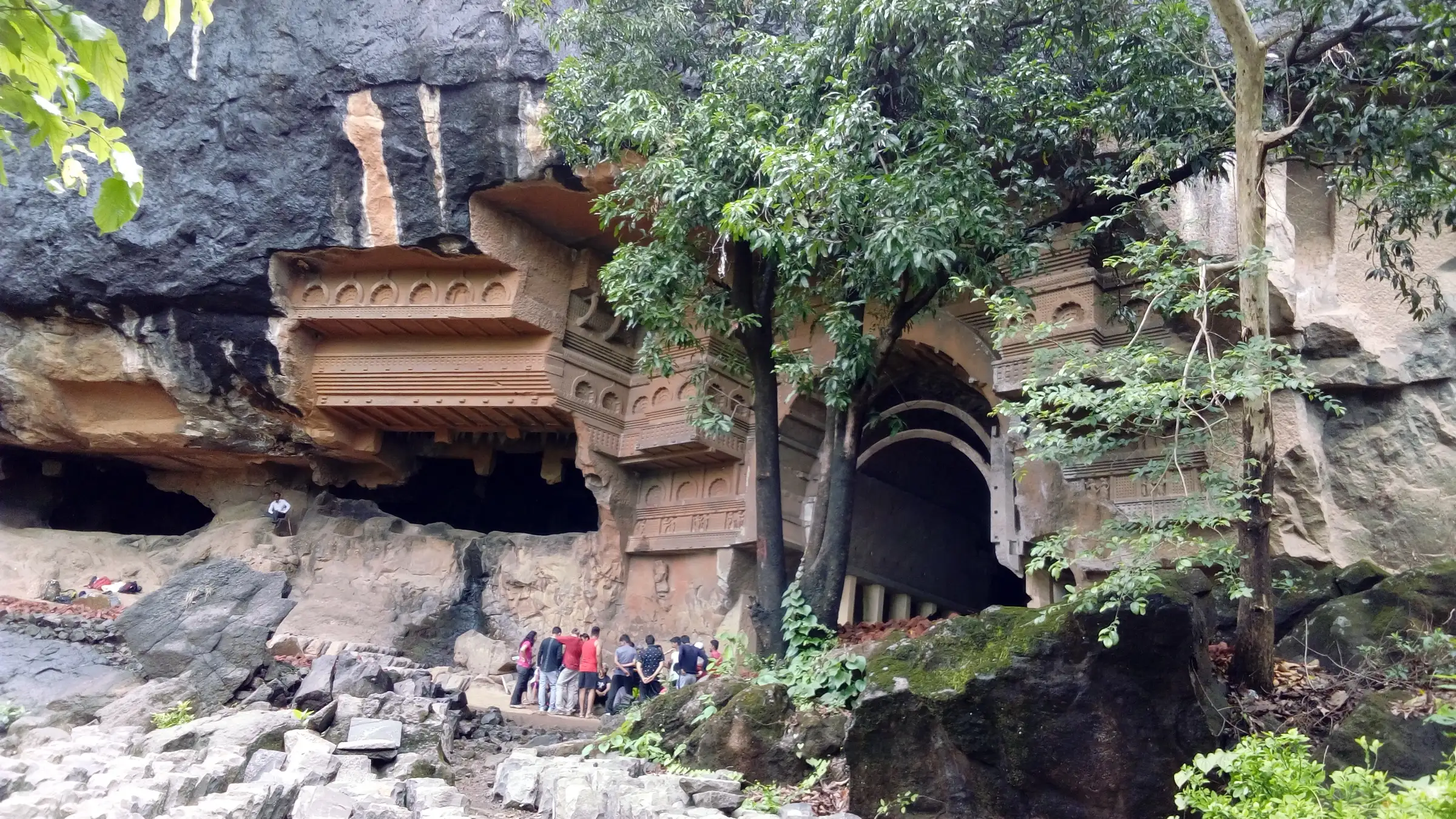
- The chaitya (prayer hall) with its stupa, horseshoe-arch facade and early wooden-style detailing, and a vihara with monks' cells
- A one-line Brahmi inscription beside a carved head on the chaitya facade naming the craftsman Balaka, pupil of Kanha
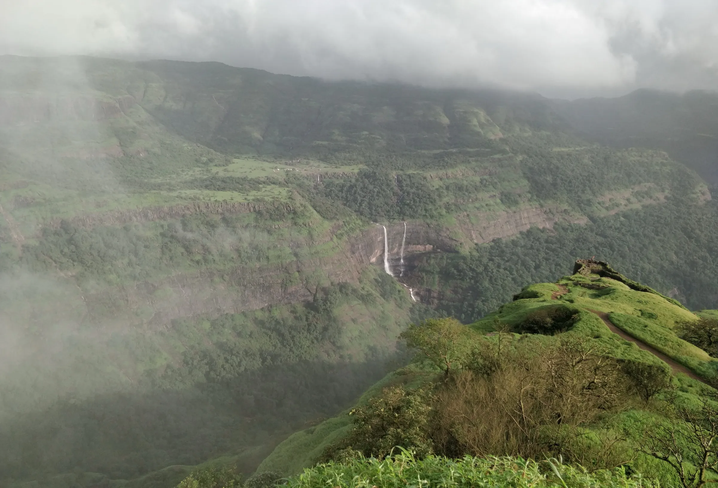
- A monsoon waterfall that pours over the cave front, and forest streams along the approach
- The trail continues uphill to Udhewadi and Rajmachi Fort for those who want a longer day
Risks
- Slippery rock, mud and wet stone steps in monsoon; wear shoes with good grip
- Forest streams can rise quickly in heavy rain; do not cross flowing water or stand under the waterfall in a downpour
- Little shade and no water on the trail in the dry months; operators and karjat.city advise against hot summer afternoons
- Operators note that monsoon trips are cancelled if the government issues a ban for the location; check for any current Raigad district orders on waterfalls and tourist spots before going
- The caves are a protected archaeological monument: do not climb on carvings, touch sculptures or leave litter; return before the site closes in the evening
- The onward trail to Rajmachi has forks and few markings; go with a local guide if continuing
Know before you go
Questions
How long does the Kondana Caves trek take?
Operators and bloggers give about 45–60 minutes each way from the trail start at Thakurwadi beyond Kondane village, so plan 3 hours for the round trip with time at the caves.
Is the Kondana Caves trek suitable for beginners and children?
Yes. Treks and Trails India, Mischief Treks and Kshitij rate it easy and suitable for first-time trekkers and children, with no technical sections. Expect stream crossings and slippery rock in monsoon.
How do I reach Kondana Caves from Karjat?
Take a train to Karjat, then a shared or private rickshaw towards Kondivade and on to Kondane village (about 13.5 km by road). The rough lane continues about 10 minutes on foot to Thakurwadi, where a board marks the start of the cave trail.
Is there an entry fee or permit?
No permit is needed. Bloggers report no ticket for the caves, but fees can change; check locally.
When is the waterfall at Kondana Caves running?
Only in the monsoon, roughly June to September, when a stream falls over the front of the caves. October to January is drier and more comfortable for walking.
Can I continue from Kondana Caves to Rajmachi?
Yes. The same trail climbs on to Udhewadi, the village below Rajmachi Fort; The Free Bird puts it at about 2–3 hours from the caves. The route has forks, so a local guide helps.
In an emergency
Save these numbers before you lose signal. Tap to call.
- 112All emergenciesIndia’s single emergency number — works in every state
- 108Ambulance
- 1077District disaster control room
You are in
District: RaigadMaharashtra
- Nearest hospital
- Karjat town (about 13.5 km by road from Kondane village)
- Last ATM
- Karjat
- Phone network
- Patchy in the forested valley below the caves; expect weak or no signal on the trail
Before you set off
- Tell someone your route and when you will be back.
- Carry a charged phone and a power bank.
- Download an offline map of the route.
- Turn back if the weather turns bad — the mountain will wait.
Questions about Kondana Caves
No questions yet. Ask something and trekkers who have done it can answer.
Share your trek photo with #TreksAndTrails
I trekked this
Did Kondana Caves look different from this page? Tell us what changed and we will check it.
Where this comes from
Sources
Last reviewed:
- Kondana Caves — Wikipedia
- Kondhane Caves Trek (tour listing by the operator Treks and Trails India, treksandtrails.org; not this site) — Treks and Trails India
- Kondhane Caves Trek — Mischief Treks
- A river runs through it: Kondana Caves and Ulhas Valley (Andre Morris) — ixigo
- Discovering Kondana Caves: The Ancient Buddhist Rock-Cut Marvel Near Karjat — Outlook Traveller
- Kondana Caves Karjat: Trek Distance, Timings & How to Reach — karjat.city
- Kondana Caves Trek: Beautiful Karjat caves hidden behind waterfall — The Free Bird
- Trek to Kondana Caves - Karjat — Kshitij
- Monsoon Trek to Kondana Caves — Adventure Geek
Photos: Amit Jha, CC BY-SA 4.0; Photo Dharma from Sadao, Thailand, CC BY 2.0; Photo Dharma from Sadao, Thailand, CC BY 2.0; Shishirdasika, CC BY-SA 4.0