Kheerganga Trek
Kullu, Himachal Pradesh
Opens without signal on this phone, with the map file and checklist. Saved for offline →
- Max altitude
- 2,960 m
- Satellite terrain suggests about 2,845 m
- Days
- 2 days
- Distance
- 24 km
- Difficulty
- Easy
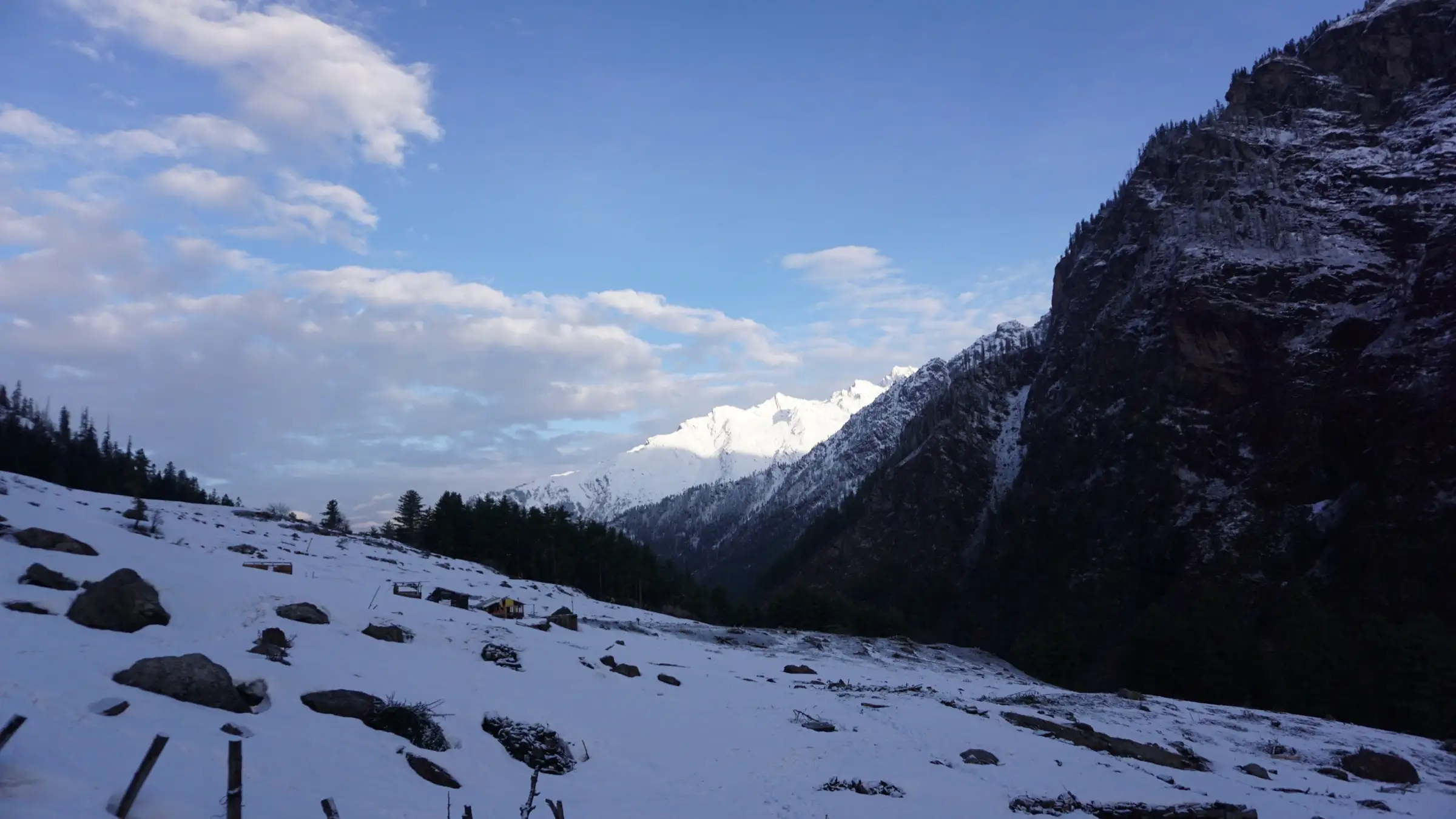
A well-marked forest trail with no technical sections, but about 750 m of climb and, now that overnight camping at the top is reported banned, roughly 24 km up and down in a single day.
Photos
On the trail
The route
Day by day
Day 1
Kasol → Barshaini
1,580 m → 2,210 m
Day 2 · highest point
Barshaini → Barshaini (via Nakthan, Rudra Nag and Kheerganga)
2,210 m → 2,960 m → 2,210 m
Ups and downs
Altitude profile
Where it is
Map
Trailhead and high point only — not a recorded track. Use it with a proper map.
Weather
Next 5 days on the trail
Live forecast for the trailhead and the high point. Mountain weather changes fast — check again on the morning you start.
Trailhead · Barshaini
at 2,210 mLoading forecast…
High point · Kheerganga hot spring (Parvati Kund)
at 2,960 mLoading forecast…
Each day: high / low °C · rain mm and chance · snow cm · wind km/h
Weather data: Open-Meteo.comModel forecast, not an official warning. For alerts follow IMD and the local administration.
Plan the trip
How to reach
- Trailhead
- Barshaini (nearest town: Kasol)
- Nearest railway
- Chandigarh (about 250 km to Kasol); Joginder Nagar narrow-gauge station is closer but has few trains
- Nearest airport
- Kullu-Manali Airport, Bhuntar
- By road
- Delhi (about 500 km to Kasol, around 10 hours by overnight bus to Bhuntar or Kasol); Chandigarh (about 250 km to Kasol, 6-7 hours); Bhuntar to Barshaini by local bus or taxi via Kasol and Manikaran, 2-3 hours; Kasol to Barshaini is about 16-22 km
- Drive
- About 8 h from Chandigarh
Plan the trip
Permits and fees
We could not confirm the current permit rules and fees from an official source. Check with the local forest department or tourism office before you go.
Plan the trip
Cost
Self-guided
₹1,500–3,500
With an operator
₹1,900–9,500
Per person, ex-Kasol. Guided prices published October 2026 (all sold as 2-3 day trips with a night camping at Kheerganga, which travel guides say has been banned since July 2024, so confirm what is actually included): Himalayan Hikers ₹1,800 + 5% GST + ₹80 insurance (Kasol to Kasol, 2 days); Indian Treks ₹4,499 / ₹6,999 / ₹9,999 + 5% GST (Kasol to Kasol, 3 days); Treks and Trails India (treksandtrails.org, not affiliated with this site) from ₹8,999; Himtrek from ₹799 + GST ex-Barshaini. Self-guided is an estimate for the day-trek plan: a Kasol-Barshaini taxi (travel guides quote ₹400-600 each way) or bus, a night in a Barshaini or Kalga guesthouse (about ₹500-1,500) and dhaba food on the trail.
Gear
Top picks for this trek
The gear that matters most on this route, chosen from its altitude, season and risks.
 Ad · affiliate link
 Ad · affiliate link
 Ad · affiliate link
 Ad · affiliate link
 Ad · affiliate link
- Ad · affiliate link
 Ad · affiliate link
 Ad · affiliate link
Store buttons open a search on that store, not a product we picked. As an Amazon Associate we earn from qualifying purchases. Photos show the kind of item, not a specific product. Affiliate disclosure
Packing checklist
Matched to this trek: altitude, season, days and the risks on the route.
Packed 0 of 27
Monsoon months (Jun, Sep): pack everything in plastic or a dry bag and wear shoes with good grip.
Tick each item as it goes in the bag.
Know before you go
Good to know
- Mobile network
- Expect patchy or no signal on the trail above Barshaini; check with your guesthouse before setting out.
- Last ATM
- Kasol and Manikaran; carry cash, travel guides report no UPI at the top
- Nearest hospital
- Health centre at Manikaran for first care; Regional Hospital Kullu for serious cases
- Water
- Streams on the trail (the first reliable refill is about 3.5 km from Barshaini) and dhabas along the route; carry 2 litres and treat stream water.
Highlights
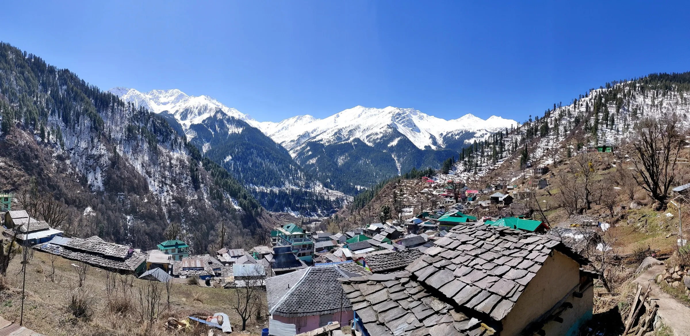
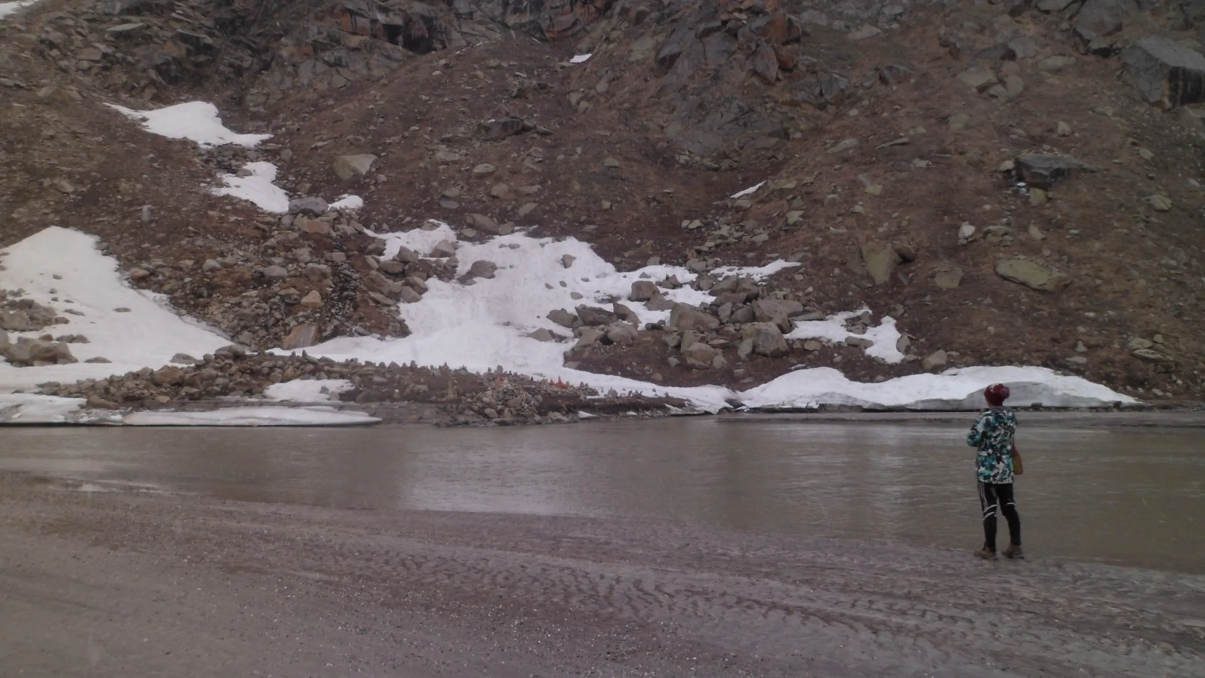
- A soak in Parvati Kund, the natural hot-spring bathing tank beside the Shiv temple at Kheerganga, with snow peaks all around
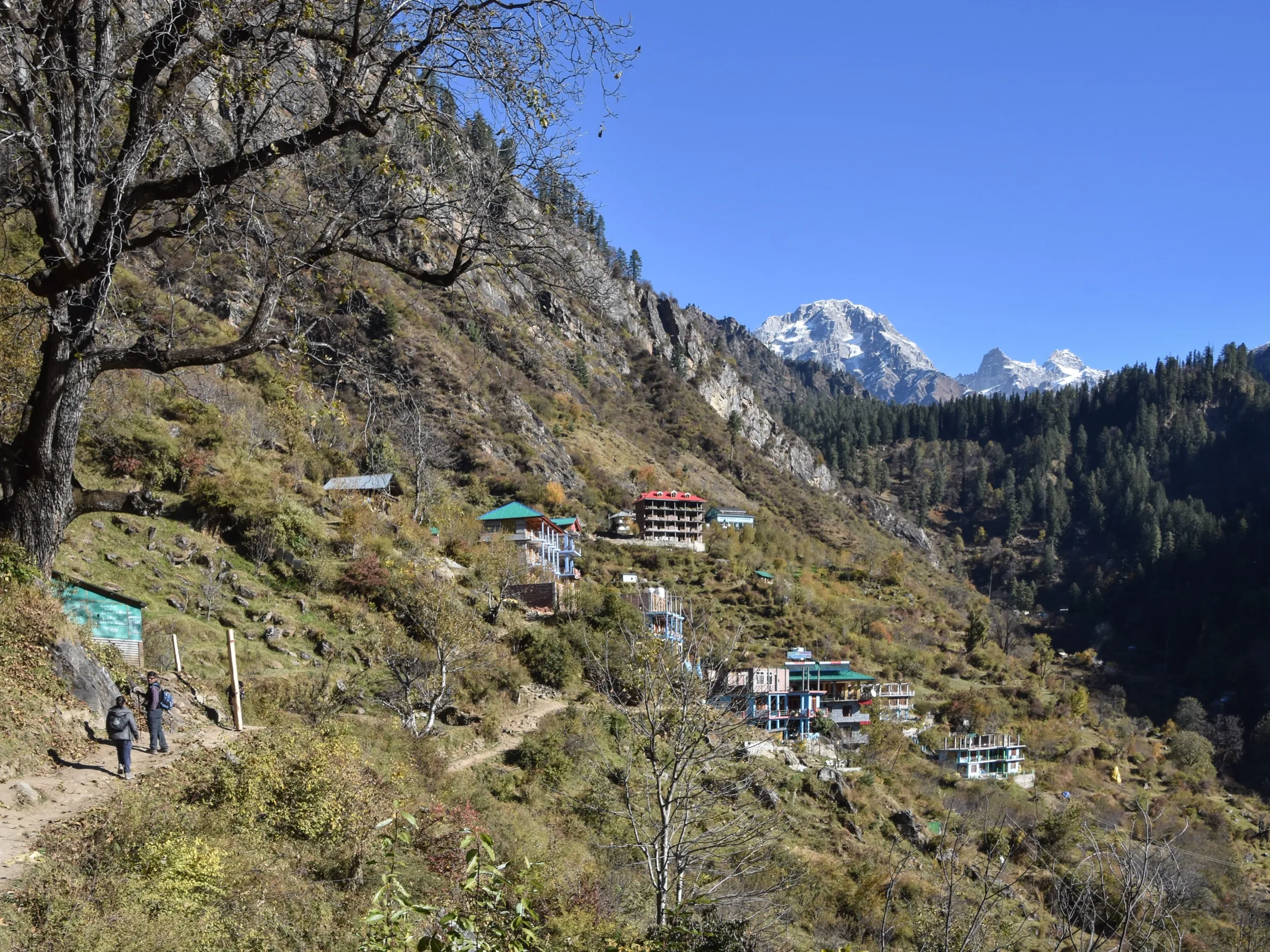
- Forest trail of pine, chestnut and deodar above the Parvati river, past the village of Nakthan
- The Rudra Nag waterfall and shrine of Bhagwan Shiv on the way up
- Option to come down through the apple orchards of Kalga village, or to extend over Buni Buni Pass (3,349 m)
Risks
- Overnight camping at Kheerganga has been reported banned by the Forest Department since July 2024; 2026 travel guides say trekkers must reach the top by about 10 am and start down by 2 pm. We could not find the official order, so confirm at the forest check post or in Barshaini before planning a night up there.
- July-August monsoon makes the trail muddy and slippery, brings leeches in the forest and landslides on the Kasol-Barshaini road; operators advise against it.
- December-February snow covers the trail and the kund can freeze; only go then with a local guide and winter gear.
- A short rocky section and an old landslide patch about 7.5-8 km from Barshaini need care, especially on the descent late in the day.
Know before you go
Questions
Can you camp overnight at Kheerganga?
2026 travel guides report that the Himachal Forest Department has banned overnight camping at Kheerganga since July 2024 and treat it as a day trek: reach the top by about 10 am and start down by 2 pm. Some operators still sell overnight packages. We could not find the official order, so confirm locally and plan to sleep in Barshaini, Kalga, Tosh or Kasol.
How long is the Kheerganga trek?
Operators quote about 12 km each way from Barshaini, 24 km in all (Himalaya Shelter says 9 km each way; Indiahikes measures 9.6 km up). The climb takes 4-6 hours and the descent 3-5 hours.
How high is Kheerganga?
Most operators put Kheerganga at about 2,950-3,000 m (9,700 ft); Indiahikes gives 2,811 m. Barshaini, the start, is at about 2,210 m.
Is Kheerganga suitable for beginners?
Yes. Operators grade it easy to easy-moderate: the trail is well marked and non-technical, with one steep stretch near the waterfall about 5.4 km from Barshaini. As a day trek it is long, so start by 5-6 am.
How do I reach Barshaini?
Take an overnight bus from Delhi or Chandigarh to Bhuntar (Kullu), then a local bus or taxi via Kasol and Manikaran to Barshaini, the road head, 2-3 hours from Bhuntar. Bhuntar also has the nearest airport.
Do I need a permit for Kheerganga?
It is not a restricted-area trek. Indiahikes says trekkers must carry a photo ID for the forest check posts. We could not confirm any current official fee, so check at the forest check post.
In an emergency
Save these numbers before you lose signal. Tap to call.
- 112All emergenciesIndia’s single emergency number — works in every state
- 108Ambulance
- 1077District disaster control room
You are in
District: KulluHimachal Pradesh
- Nearest hospital
- Health centre at Manikaran for first care; Regional Hospital Kullu for serious cases
- Last ATM
- Kasol and Manikaran; carry cash, travel guides report no UPI at the top
- Phone network
- Expect patchy or no signal on the trail above Barshaini; check with your guesthouse before setting out.
Before you set off
- Tell someone your route and when you will be back.
- Carry a charged phone and a power bank.
- Download an offline map of the route.
- Turn back if the weather turns bad — the mountain will wait.
Questions about Kheerganga
No questions yet. Ask something and trekkers who have done it can answer.
Share your trek photo with #TreksAndTrails
I trekked this
Did Kheerganga look different from this page? Tell us what changed and we will check it.
Where this comes from
Sources
Last reviewed:
- Kheerganga Buni Buni Pass — Indiahikes
- Kheerganga Trek — Indian Treks
- Kheerganga Trek Nestled In Parvati Valley in Himachal Kasol 2026 — Himalayan Hikers
- Kheerganga Trek: 2-Day Stunning Hot Springs Camp — Himtrek
- Kheerganga Trek- Himalaya Shelter — Himalaya Shelter
- Kheerganga Trek with Camping — Treks and Trails India (treksandtrails.org)
- Kheerganga Trek 2026 – Complete Beginner's Travel Guide (Camping Ban Update) — Discover with Dheeraj
- Kheerganga Trek 2026: Complete Day Trek Guide, Route, Best Time, Distance and Budget — Zingbus
Photos: Vishrutpanday, CC BY-SA 4.0; Blue Particle Solutions Narender Sharma, CC BY-SA 4.0; Krishnendu Mazumdar, CC BY-SA 4.0; Vishrutpanday, CC BY-SA 4.0