Gupt Khal Trek
Chamoli, Uttarakhand
Opens without signal on this phone, with the map file and checklist. Saved for offline →
- Max altitude
- 5,800 m
- Days
- 13 days
- Distance
- 71 km
- Difficulty
- Challenging
A semi-technical glacier crossing of a pass at about 5,800 m: several nights above 5,000 m, crevassed glacier and icy slopes near the pass that operators say need crampons, ice axe and ropes, and a very remote route with no villages between Ghamsali and Mana.
Photos
On the trail
The route
Day by day
Day 1
Haridwar → Joshimath
300 m → 1,875 m
Day 2
Joshimath → Ghamsali (drive via Niti valley)
1,875 m → 3,320 m
Day 3
Ghamsali → Eri Udiyar
3,320 m → 3,880 m
Day 4
Eri Udiyar → Rataban Glacier camp
3,880 m → 4,200 m
Day 5
Rataban Glacier camp → Bankund Lake
4,200 m → 4,480 m
Day 6
Bankund Lake → Bankund Bend
4,480 m → 4,780 m
Day 7
Bankund Bend → Garh camping ground
4,780 m → 5,450 m
Day 8
Garh camping ground → Gupt Khal base camp
5,450 m → 5,650 m
Day 9
Gupt Khal base camp → Gupt Khal base camp (rest and acclimatisation)
5,650 m → 5,650 m
Day 10 · highest point
Gupt Khal base camp → Nakthani hanging-glacier camp (over Gupt Khal)
5,650 m → 5,800 m → 5,400 m
Day 11
Nakthani hanging-glacier camp → Shepherd camp near Musa Pani
5,400 m → 3,960 m
Day 12
Musa Pani → Mana village (drive on to Badrinath)
3,960 m → 3,100 m
Day 13
Badrinath → Haridwar
3,100 m → 300 m
Ups and downs
Altitude profile
Where it is
Map
Trailhead and high point only — not a recorded track. Use it with a proper map.
Weather
Next 5 days on the trail
Live forecast for the trailhead and the high point. Mountain weather changes fast — check again on the morning you start.
Trailhead · Ghamsali
at 3,320 mLoading forecast…
High point · Gupt Khal pass
at 5,800 mLoading forecast…
Each day: high / low °C · rain mm and chance · snow cm · wind km/h
Weather data: Open-Meteo.comModel forecast, not an official warning. For alerts follow IMD and the local administration.
Plan the trip
How to reach
- Trailhead
- Ghamsali (nearest town: Joshimath)
- Nearest railway
- Haridwar
- Nearest airport
- Jolly Grant Airport, Dehradun
- By road
- Haridwar to Joshimath (about 296 km via Rishikesh, Devprayag and Rudraprayag); Joshimath to Ghamsali (about 84 km up the Niti valley)
- Drive
- About 14 h from Haridwar
Plan the trip
Permits and fees
We could not confirm the current permit rules and fees from an official source. Check with the local forest department or tourism office before you go.
Plan the trip
Cost
Self-guided
₹60,000–1,10,000
With an operator
₹90,000–1,41,750
Per person, ex-Haridwar or ex-Dehradun. Guided prices published October 2026: Himalayan Hikers ₹1,35,000 + 5% GST (₹1,41,750) plus ₹520 insurance, Haridwar to Haridwar; Himalaya Shelter ₹90,000 per person ex-Dehradun (+5% GST). Self-guided is an estimate only and not advised: a local guide with glacier experience, porters, rope and crampons, tents, and about 11 days of food for a remote route with no villages, plus transport to Ghamsali and back from Badrinath.
Gear
Top picks for this trek
The gear that matters most on this route, chosen from its altitude, season and risks.
 Ad · affiliate link
 Ad · affiliate link
 Ad · affiliate link
 Ad · affiliate link
 Ad · affiliate link
 Ad · affiliate link
 Ad · affiliate link
 Ad · affiliate link
Store buttons open a search on that store, not a product we picked. As an Amazon Associate we earn from qualifying purchases. Photos show the kind of item, not a specific product. Affiliate disclosure
Packing checklist
Matched to this trek: altitude, season, days and the risks on the route.
Packed 0 of 35
Nights near 5,800 m can drop close to freezing even in summer. Pack one more warm layer than you think.
Tick each item as it goes in the bag.
Know before you go
Good to know
- Mobile network
- Not confirmed. Expect no mobile signal on the trail between Ghamsali and Mana; check BSNL/Jio coverage in Joshimath and Badrinath before setting out.
- Last ATM
- Joshimath (about 84 km before the trailhead); carry enough cash.
- Nearest hospital
- Joshimath for first care; serious cases go down to Srinagar (Garhwal) or AIIMS Rishikesh.
- Water
- Glacier streams and Bankund Lake on the way up; above Garh camp water often has to be melted from snow. Boil or treat all water.
Highlights
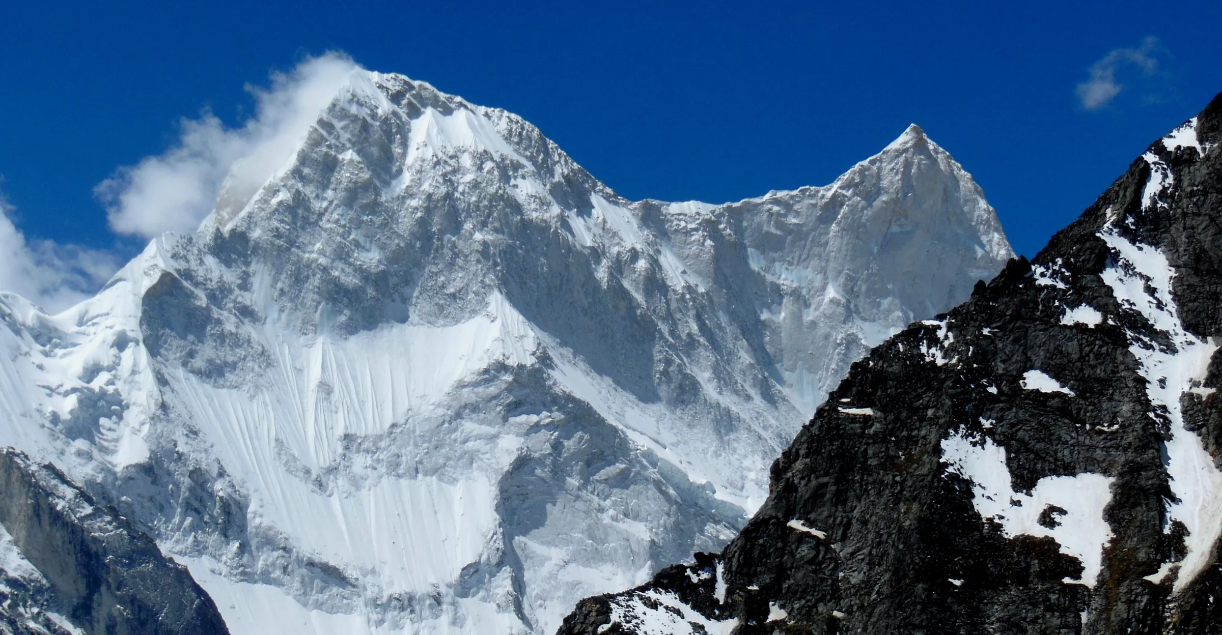
- Crossing a pass of about 5,800 m between the Niti (Dhauliganga) valley and the Mana valley above Badrinath
- Close views of Nilkantha, Hathi Parbat, Nilgiri, Rataban and the Kamet massif
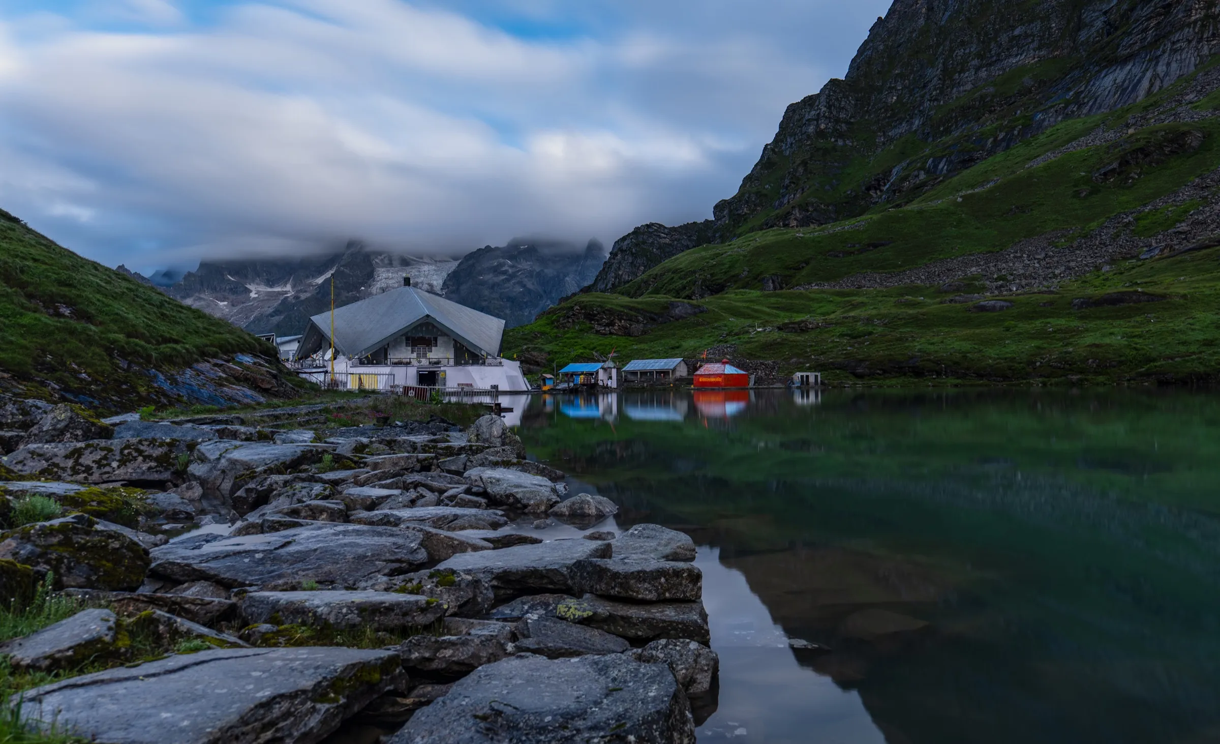
- Camping by the glacial Bankund Lake and on the Rataban and Bankund glaciers
- Ending at Mana village and the evening aarti at Shri Badrinath Dham
Risks
- Border area: the route begins in the Niti valley and ends at Mana, both on the Indo-Tibet border. Chamoli district issues Inner Line Permits for its border areas through pass.chamoli.org (police and health certificates needed; Niti Pass and Mana Pass are named), with ITBP and Army checks. Gupt Khal itself is not named in the published list, so confirm with SDM Joshimath or the portal that civilian trekkers may cross it on your dates. Entry is at the discretion of the administration and army even with a permit. We found no ban on the route, but could not confirm whether IMF permission is also required.
- Very high altitude: several nights above 5,000 m and a pass at about 5,800 m bring a high risk of acute mountain sickness, HAPE and HACE; the itinerary includes one rest day at base camp.
- Semi-technical glacier travel with crevasses and icy slopes near the pass; operators say ice axe, crampons and ropes may be needed, and prior high-altitude trekking experience is expected.
- July-August monsoon brings rain, landslides on the Joshimath-Niti road and dangerous glacier conditions; operators say to avoid it.
- Very remote: no villages, shelter or quick evacuation between Ghamsali and Mana. Weather can turn to snowstorms and whiteouts quickly.
Know before you go
Questions
Do I need a permit for the Gupt Khal trek?
Yes, expect to need an Inner Line Permit. The route starts in the Niti valley and ends at Mana, both border areas of Chamoli district. The district issues these permits online at pass.chamoli.org after police and health certificates, and permission also passes through ITBP and the Army. Gupt Khal is not named on the published list, so check with SDM Joshimath or your operator before booking. We could not confirm an official fee.
How difficult is the Gupt Khal trek?
It is one of the hardest crossings in Uttarakhand, and operators sell it as an expedition. You cross a pass of about 5,800 m after several nights above 5,000 m, on glacier and icy slopes that may need crampons, ice axe and ropes. It is only for trekkers with earlier high-altitude experience.
What is the best time for Gupt Khal?
May to June and September to October. Operators advise against the July-August monsoon because of rain, landslides and risky glacier conditions. From November to March heavy snow covers the route, and one operator says the pass cannot be done in winter.
How many days does the Gupt Khal trek take and how far is it?
Operators run it in 13 days from Haridwar or Dehradun, with about 70-71 km on foot from Ghamsali village to Mana. A longer variant starts from Govindghat and the Valley of Flowers, crosses Bhyundar Khal first, and covers close to 100 km.
Where does the Gupt Khal trek start and end?
The usual route starts at Ghamsali village in the Niti valley, about 84 km from Joshimath, and ends at Mana village near Badrinath.
In an emergency
Save these numbers before you lose signal. Tap to call.
- 112All emergenciesIndia’s single emergency number — works in every state
- 108Ambulance
- 1077District disaster control room
You are in
District: ChamoliUttarakhand
- Nearest hospital
- Joshimath for first care; serious cases go down to Srinagar (Garhwal) or AIIMS Rishikesh.
- Last ATM
- Joshimath (about 84 km before the trailhead); carry enough cash.
- Phone network
- Not confirmed. Expect no mobile signal on the trail between Ghamsali and Mana; check BSNL/Jio coverage in Joshimath and Badrinath before setting out.
Before you set off
- Tell someone your route and when you will be back.
- Carry a charged phone and a power bank.
- Download an offline map of the route.
- Turn back if the weather turns bad — the mountain will wait.
Questions about Gupt Khal
No questions yet. Ask something and trekkers who have done it can answer.
Share your trek photo with #TreksAndTrails
I trekked this
Did Gupt Khal look different from this page? Tell us what changed and we will check it.
Where this comes from
Sources
Last reviewed:
- Gupt Khal Trek | Best Trek in Uttarakhand Himalayas — Himalayan Hikers
- Gupt Khal Expedition - Difficulty, Trek Itinerary, Package — Himalaya Shelter
- Gupt Khal Trekking Expedition — eUttaranchal
- Two is Company: Explorations and Climbs in the Mana Gad (Himalayan Journal 47) — The Himalayan Club
- Chamoli ILP Portal - Inner Line Permit — Chamoli District Administration (official)
- Inner Line Permit Process Goes Digital — ETV Bharat
- How to Get Mana Pass Permit in 2026: Complete Guide — Himalayan Dream Treks
Photos: Harshit SR, CC BY-SA 4.0; Harshit SR, CC BY-SA 4.0; Harshit SR, CC BY-SA 4.0