Binsar Trek
Almora, Uttarakhand
Opens without signal on this phone, with the map file and checklist. Saved for offline →
- Max altitude
- 2,400 m
- Days
- 3 days
- Distance
- 23 km
- Difficulty
- Easy
Short forest walks on clear paths with no camp above 2,300 m; the only effort is the 12 km last day, a gradual climb to Vriddh Jageshwar followed by a long descent to Jageshwar, with some muddy and rocky patches.
Photos
On the trail
The route
Day by day
Day 1 · highest point
Kathgodam (drive) / Binsar KMVN Tourist Rest House → Binsar KMVN Tourist Rest House (via Zero Point and back)
2,285 m → 2,400 m → 2,285 m
Day 2
Binsar KMVN Tourist Rest House → Dhaulchina
2,285 m → 1,860 m
Day 3
Dhaulchina → Jageshwar Dham (via Vriddh Jageshwar), drive to Kathgodam
1,860 m → 2,250 m → 1,830 m
Ups and downs
Altitude profile
Where it is
Map
Trailhead and high point only — not a recorded track. Use it with a proper map.
Weather
Next 5 days on the trail
Live forecast for the trailhead and the high point. Mountain weather changes fast — check again on the morning you start.
Trailhead · Binsar Wildlife Sanctuary (KMVN Tourist Rest House)
at 2,285 mLoading forecast…
High point · Binsar Zero Point (Jhandi Dhar)
at 2,400 mLoading forecast…
Each day: high / low °C · rain mm and chance · snow cm · wind km/h
Weather data: Open-Meteo.comModel forecast, not an official warning. For alerts follow IMD and the local administration.
Plan the trip
How to reach
- Trailhead
- Binsar Wildlife Sanctuary (KMVN Tourist Rest House) (nearest town: Almora)
- Nearest railway
- Kathgodam
- Nearest airport
- Pantnagar Airport
- By road
- Kathgodam (about 120-130 km via Bhowali and Almora, about 5 hours); Almora (about 30 km)
- Drive
- About 8 h from Delhi
Plan the trip
Permits and fees
We could not confirm the current permit rules and fees from an official source. Check with the local forest department or tourism office before you go.
Plan the trip
Cost
Self-guided
₹3,000–8,000
With an operator
₹4,200–6,300
Per person. Guided prices published October 2026: Trek The Himalayas ₹4,000 + 5% GST for the 2-day Binsar-Dhaulchina-Jageshwar trek, ex-Kathgodam (Kathgodam transport offered separately); Himalaya Shelter ₹6,000 + 5% GST for a 4-day version ex-Dehradun. Self-guided is an estimate, ex-Kathgodam: bus or shared taxi to Almora and a taxi to Binsar, a night at the KMVN rest house, a local guide, a homestay or camp at Dhaulchina, and the sanctuary entry fee.
Gear
Top picks for this trek
The gear that matters most on this route, chosen from its altitude, season and risks.
 Ad · affiliate link
 Ad · affiliate link
 Ad · affiliate link
 Ad · affiliate link
 Ad · affiliate link
 Ad · affiliate link
 Ad · affiliate link
 Ad · affiliate link
Store buttons open a search on that store, not a product we picked. As an Amazon Associate we earn from qualifying purchases. Photos show the kind of item, not a specific product. Affiliate disclosure
Packing checklist
Matched to this trek: altitude, season, days and the risks on the route.
Packed 0 of 28
Tick each item as it goes in the bag.
Know before you go
Good to know
- Mobile network
- Patchy inside the sanctuary (the KMVN area has weak signal at best); better at Dhaulchina and Jageshwar.
- Last ATM
- Almora (about 30 km before Binsar)
- Nearest hospital
- Community Health Centre at Dhaulchina for first care; Almora district hospital for serious cases
- Water
- Few springs on the ridge; carry 2 litres from Binsar and refill at Dhaulchina and the villages before Jageshwar. Treat all water.
Highlights
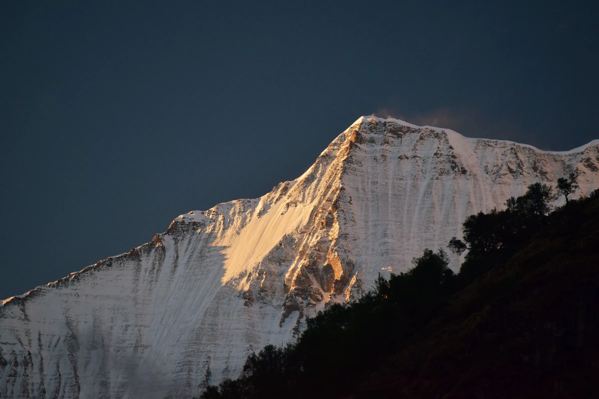
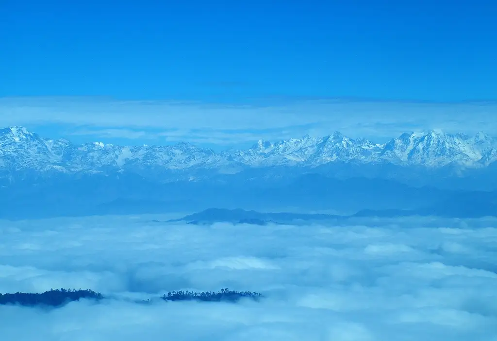
- Sunrise from Zero Point (Jhandi Dhar), the highest point of the sanctuary, with a 300 km sweep of Kedarnath, Chaukhamba, Trishul, Nanda Devi, Nanda Kot and Panchachuli
- Oak and rhododendron forest that turns red with blossom in March and April, home to over 200 bird species
- Darshan at Vriddh Jageshwar on the ridge, then at Jageshwar Dham, a cluster of more than 100 stone temples of Bhagwan Shiva among deodars
- A gentle, short trek that suits first-timers and families
Risks
- Leopards live in the sanctuary; do not walk the forest at dusk or after dark, and keep to the trail with a guide.
- July-August monsoon rain makes the mud paths slippery and brings leeches; Himalaya Shelter advises avoiding the monsoon.
- December-January nights fall to about 0 °C and snow can lie on the ridge; the road into the sanctuary can be blocked after snowfall.
- Distances for the Dhaulchina-Jageshwar day differ between operators (8-9 km vs 12-13 km); plan for the longer figure.
Know before you go
Questions
Is the Binsar trek suitable for beginners?
Yes. Trek The Himalayas, Himalaya Shelter and Thrillophilia all grade it easy: a 7 km descent through forest to Dhaulchina and a gradual climb to Vriddh Jageshwar before the descent to Jageshwar. You should be able to walk 5 km in about 50 minutes.
How far is Binsar Zero Point from the gate?
Uttarakhand Tourism describes a 2 km walk to Zero Point. Most visitors walk it from the KMVN Tourist Rest House, about 30-60 minutes each way, ideally for sunrise.
What is the best time for the Binsar trek?
March to June and September to November give the clearest views and dry trails; rhododendrons bloom in March-April. December-January can bring snow. Avoid July-August, when the monsoon makes trails slippery.
How do I reach Binsar?
Kathgodam is the nearest railway station, about 120-130 km and roughly 5 hours by road via Almora; Pantnagar is the nearest airport. Binsar is about 30 km from Almora.
Do I need a permit or entry fee for Binsar?
Binsar is a wildlife sanctuary, so an entry fee is collected at the gate and is included in guided packages. We could not confirm the current official fee, so check at the sanctuary gate or the forest office in Almora.
In an emergency
Save these numbers before you lose signal. Tap to call.
- 112All emergenciesIndia’s single emergency number — works in every state
- 108Ambulance
- 1077District disaster control room
You are in
District: AlmoraUttarakhand
- Nearest hospital
- Community Health Centre at Dhaulchina for first care; Almora district hospital for serious cases
- Last ATM
- Almora (about 30 km before Binsar)
- Phone network
- Patchy inside the sanctuary (the KMVN area has weak signal at best); better at Dhaulchina and Jageshwar.
Before you set off
- Tell someone your route and when you will be back.
- Carry a charged phone and a power bank.
- Download an offline map of the route.
- Turn back if the weather turns bad — the mountain will wait.
Questions about Binsar
No questions yet. Ask something and trekkers who have done it can answer.
Share your trek photo with #TreksAndTrails
I trekked this
Did Binsar look different from this page? Tell us what changed and we will check it.
Where this comes from
Sources
Last reviewed:
- Binsar | Uttarakhand Tourism — Uttarakhand Tourism Development Board (official)
- Binsar Trek — Trek The Himalayas
- Binsar Trek — Himalaya Shelter
- Binsar Trek, Uttarakhand — Thrillophilia
- Binsar Wildlife Sanctuary — Wikipedia
Photos: solarshakti, CC BY 2.0; SudiptoDutta, CC BY-SA 3.0; Itsmalay~commonswiki, CC BY-SA 4.0