Phawngpui Trek
Lawngtlai, Mizoram
Opens without signal on this phone, with the map file and checklist. Saved for offline →
- Max altitude
- 2,157 m
- Days
- 2 days
- Distance
- 10 km
- Difficulty
- Moderate
A steep forested climb of about an hour and a half from the Farpak meadow to a broad summit plateau; distances are short but the area is remote, with rough jeep tracks and no facilities.
Photos
On the trail
The route
Day by day
Day 1
Sangau → Farpak forest lodge
1,330 m → 1,900 m
Day 2 · highest point
Farpak forest lodge → Farpak forest lodge
1,900 m → 2,157 m → 1,900 m
Ups and downs
Altitude profile
Where it is
Map
Trailhead and high point only — not a recorded track. Use it with a proper map.
Weather
Next 5 days on the trail
Live forecast for the trailhead and the high point. Mountain weather changes fast — check again on the morning you start.
Trailhead · Sangau
at 1,900 mLoading forecast…
High point · Phawngpui summit
at 2,157 mLoading forecast…
Each day: high / low °C · rain mm and chance · snow cm · wind km/h
Weather data: Open-Meteo.comModel forecast, not an official warning. For alerts follow IMD and the local administration.
Plan the trip
How to reach
- Trailhead
- Sangau
- Nearest railway
- Sairang (Aizawl); Silchar is the older option
- Nearest airport
- Lengpui Airport, Aizawl
- By road
- Aizawl via Lunglei and Lawngtlai to Sangau (about 226–229 km); Saiha to Sangau (about 3 hours); Sangau to Farpak by authorised jeep through the national park
- Drive
- About 10 h from Aizawl
Plan the trip
Permits and fees
We could not confirm the current permit rules and fees from an official source. Check with the local forest department or tourism office before you go.
Plan the trip
Cost
Self-guided
₹3,000–6,000
With an operator
₹6,000–12,000
Per person, ex-Sangau, estimate only. No trek operator publishes a current Phawngpui price, so the guided range is a reasoned estimate (park ranger or guide, authorised jeep, Farpak lodge and food for 2 days), not two operators' prices. Self-guided covers a shared jeep from Sangau to Farpak, a ranger or local guide, the forest lodge and food carried from Sangau (one trekker blog puts guide, gear and food at ₹2,000–4,000 for 2 days). Park entry, camping and guide fees are extra; check them at the forest office.
Gear
Top picks for this trek
The gear that matters most on this route, chosen from its altitude, season and risks.
 Ad · affiliate link
 Ad · affiliate link
 Ad · affiliate link
 Ad · affiliate link
 Ad · affiliate link
 Ad · affiliate link
 Ad · affiliate link
 Ad · affiliate link
Store buttons open a search on that store, not a product we picked. As an Amazon Associate we earn from qualifying purchases. Photos show the kind of item, not a specific product. Affiliate disclosure
Packing checklist
Matched to this trek: altitude, season, days and the risks on the route.
Packed 0 of 22
Tick each item as it goes in the bag.
Know before you go
Good to know
- Mobile network
- Patchy Jio and Airtel around Sangau; no signal or electricity at the Farpak lodge
- Last ATM
- Lawngtlai or Saiha town; smaller villages have no ATM, so carry cash
- Nearest hospital
- District hospitals at Lawngtlai and Saiha
- Water
- Streams and rock pools on the plateau; carry 2 litres and treat or filter any water you refill
Highlights
- Highest point in Mizoram, inside Phawngpui (Blue Mountain) National Park on the Myanmar border
- Farpak, an open grassland of pine and tall grass at the park's main entrance
- Broad summit plateau with a 360-degree view and the Thlazuang Khàm cliff on its western side
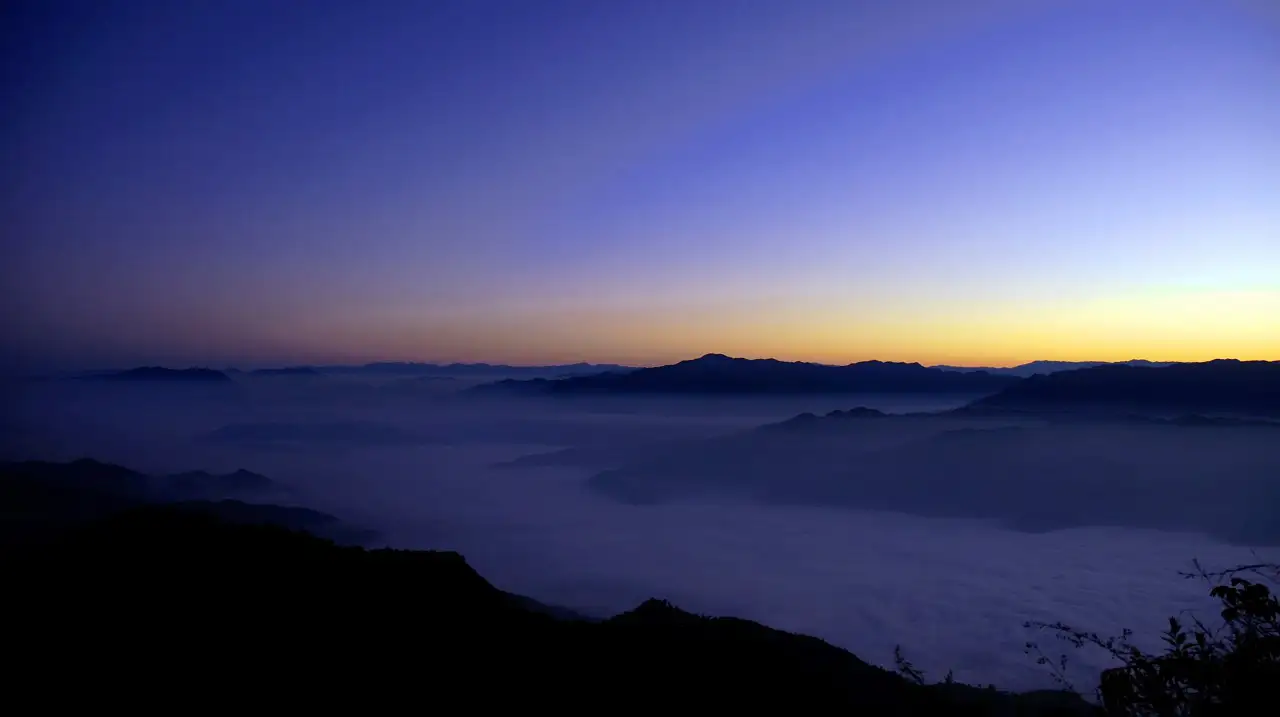
- Sea of clouds over the Chhimtuipui (Kaladan) valley at dawn
- Birds such as Blyth's tragopan and sunbirds; the park also holds serow, goral and Asiatic black bear
Risks
- Season: Wikipedia says the Mizoram government allows tourism on the mountain only from November to April, and trekkers' blogs say to avoid May–September (monsoon). Confirm the park is open before you travel
- Park access is regulated: only authorised vehicles go beyond a certain point, and a permit from the forest department is needed
- Muddy, steep jeep tracks inside the park become hard to drive in rain
- Very remote: no electricity or signal at Farpak, and medical help is hours away
- The Thlazuang Khàm cliff on the western side of the summit is a sheer drop; keep back from the edge
Know before you go
Questions
How high is Phawngpui?
Phawngpui stands at about 2,157 m, the highest peak in Mizoram. One article gives 2,210 m, but Wikipedia, Incredible India and most trek reports use 2,157 m.
What is the best time to trek Phawngpui?
November to April, according to Incredible India and Wikipedia; trek blogs extend this to October. The monsoon months (May–September) bring slippery, muddy tracks and are generally avoided.
Do I need a permit for Phawngpui?
Yes. Incredible India says a permit is needed from the forest department office in Saiha district, and trekkers report a pass booth at Thaltlang and a check post near Sangau. Visitors from outside Mizoram also need a Mizoram Inner Line Permit. Fees change, so check current amounts locally.
Where does the trek start?
From Sangau, the village at the base of the mountain, about 226–229 km from Aizawl. Jeeps take trekkers into the park to Farpak, the main entrance, from where the summit is about an hour and a half's climb.
Where can I stay?
Sangau has a tourist lodge and a forest rest house. Inside the park there is a basic forest lodge at Farpak with no electricity, so carry sleeping bags and food from Sangau; one trekker also describes a forest lodge at Vonbuk on the south-eastern side.
In an emergency
Save these numbers before you lose signal. Tap to call.
- 112All emergenciesIndia’s single emergency number — works in every state
- 108Ambulance
- 1077District disaster control room
You are in
District: LawngtlaiMizoram
- Nearest hospital
- District hospitals at Lawngtlai and Saiha
- Last ATM
- Lawngtlai or Saiha town; smaller villages have no ATM, so carry cash
- Phone network
- Patchy Jio and Airtel around Sangau; no signal or electricity at the Farpak lodge
Before you set off
- Tell someone your route and when you will be back.
- Carry a charged phone and a power bank.
- Download an offline map of the route.
- Turn back if the weather turns bad — the mountain will wait.
Questions about Phawngpui
No questions yet. Ask something and trekkers who have done it can answer.
Share your trek photo with #TreksAndTrails
I trekked this
Did Phawngpui look different from this page? Tell us what changed and we will check it.
Where this comes from
Sources
Last reviewed:
- Phawngpui — Wikipedia
- Phawngpui National Park — Incredible India (Ministry of Tourism, Government of India) (official)
- A trekking guide to Mizoram's highest peak: Phawngpui trek — OYO Travel Guide
- Phawngpui National Park — RoundGlass Sustain
- Phawngpui Blue Mountain Trek: Mizoram's Highest Peak — AllBlogs
- #1432. The Blue Mountains of Mizoram — Dear Susan
- Mizoram's Blue Mountain: Abode of the gods and Israel's lost tribe — 30 Stades
Photos: Yathin S Krishnappa, CC BY-SA 3.0; Garima Singh, CC BY-SA 4.0; Yathin S Krishnappa, CC BY-SA 3.0