Nalgan Pass Trek
Uttarkashi (Uttarakhand), with the pass on the Shimla-Kinnaur side and the descent into Kinnaur (Himachal Pradesh), Uttarakhand & Himachal Pradesh
Opens without signal on this phone, with the map file and checklist. Saved for offline →
 4,978 mhighest point
- Max altitude
- 4,978 m
- Days
- 10 days
- Distance
- 61 km
- Difficulty
- Difficult
A rarely walked high pass linking Garhwal and Kinnaur: several nights above 4,300 m, snow patches and glaciated ground near Baraadsar Lake, steep climbs over loose rock to the pass and a long, steep descent into the Baspa valley. Himalaya Shelter recommends it only for seasoned trekkers.
The route
Day by day
Day 1
Dehradun → Sankri
640 m → 1,920 m
Day 2
Sankri (drive to Kasla) → Rala Thach via Fitari village
1,920 m → 2,300 m
Day 3
Rala Thach → Devbasa
2,300 m → 3,650 m
Day 4
Devbasa → Baraadsar Lake
3,650 m → 4,300 m
Day 5
Baraadsar Lake → Gulgaar / Manjivan
4,300 m → 4,500 m
Day 6
Manjivan → Panch Odari
4,500 m → 4,678 m
Day 7
Panch Odari → Ghatadi Gad
4,678 m → 4,770 m
Day 8
Ghatadi Gad → Ghatadi Gad (rest and acclimatisation)
4,770 m → 4,770 m
Day 9 · highest point
Ghatadi Gad → Sangla Kanda (via Nalgan Pass)
4,770 m → 4,978 m → 3,390 m
Day 10
Sangla Kanda → Sangla
3,390 m → 2,650 m
Ups and downs
Altitude profile
Where it is
Map
Trailhead and high point only — not a recorded track. Use it with a proper map.
Weather
Next 5 days on the trail
Live forecast for the trailhead and the high point. Mountain weather changes fast — check again on the morning you start.
Trailhead · Sankri (walk starts at Kasla)
at 1,920 mLoading forecast…
High point · Nalgan Pass
at 4,978 mLoading forecast…
Each day: high / low °C · rain mm and chance · snow cm · wind km/h
Weather data: Open-Meteo.comModel forecast, not an official warning. For alerts follow IMD and the local administration.
Plan the trip
How to reach
- Trailhead
- Sankri (walk starts at Kasla)
- Nearest railway
- Dehradun (start); Shimla or Kalka (end)
- Nearest airport
- Jolly Grant Airport, Dehradun
- By road
- Dehradun to Sankri (about 210 km, 8-9 hours via Mussoorie, Damta, Naugaon, Purola and Naitwar); Sankri to Kasla by jeep (about 38 km, about 2 hours); Sangla back to Shimla by road via Karcham and Rampur (a full day's drive)
- Drive
- About 9 h from Dehradun
Plan the trip
Permits and fees
We could not confirm the current permit rules and fees from an official source. Check with the local forest department or tourism office before you go.
Plan the trip
Cost
Self-guided
₹22,000–35,000
With an operator
₹75,000–79,000
Per person, ex-Dehradun. Only one operator price was found: Himalayan Hikers quotes ₹75,000 + 5% GST + ₹400 insurance, Dehradun to Dehradun (October 2026); the taxi from the Sangla road-head is paid directly. Himalayan Daredevils sells a copy of the same itinerary. Self-guided is an estimate only: jeep to Sankri and Kasla, a local guide who knows the pass and porters for 9 trekking days, tents, food, forest fees and the drive out from Sangla. Do not attempt this route without a local guide.
Gear
Top picks for this trek
The gear that matters most on this route, chosen from its altitude, season and risks.
 Ad · affiliate link
 Ad · affiliate link
 Ad · affiliate link
 Ad · affiliate link
 Ad · affiliate link
 Ad · affiliate link
 Ad · affiliate link
 Ad · affiliate link
Store buttons open a search on that store, not a product we picked. As an Amazon Associate we earn from qualifying purchases. Photos show the kind of item, not a specific product. Affiliate disclosure
Packing checklist
Matched to this trek: altitude, season, days and the risks on the route.
Packed 0 of 34
Nights near 4,978 m can drop close to freezing even in summer. Pack one more warm layer than you think.
Tick each item as it goes in the bag.
Know before you go
Good to know
- Mobile network
- Not confirmed for this route. On neighbouring routes from Sankri only BSNL and Jio work in Sankri and there is no signal on the trail until the Baspa valley; expect none from Kasla to Sangla.
- Last ATM
- Purola or Sankri (Sankri's is unreliable); carry enough cash from Dehradun
- Nearest hospital
- Mori and Purola for first care on the Uttarakhand side; after the pass, Sangla and the Baspa valley road towards Rampur and Shimla. Serious cases need evacuation.
- Water
- Streams in the lower valleys; higher camps around Baraadsar Lake and the pass may depend on snowmelt or a long walk to water, so carry 2 litres. Boil or treat all water.
Highlights
- One of the little-used passes linking Garhwal with Kinnaur, close to the better-known Rupin Pass
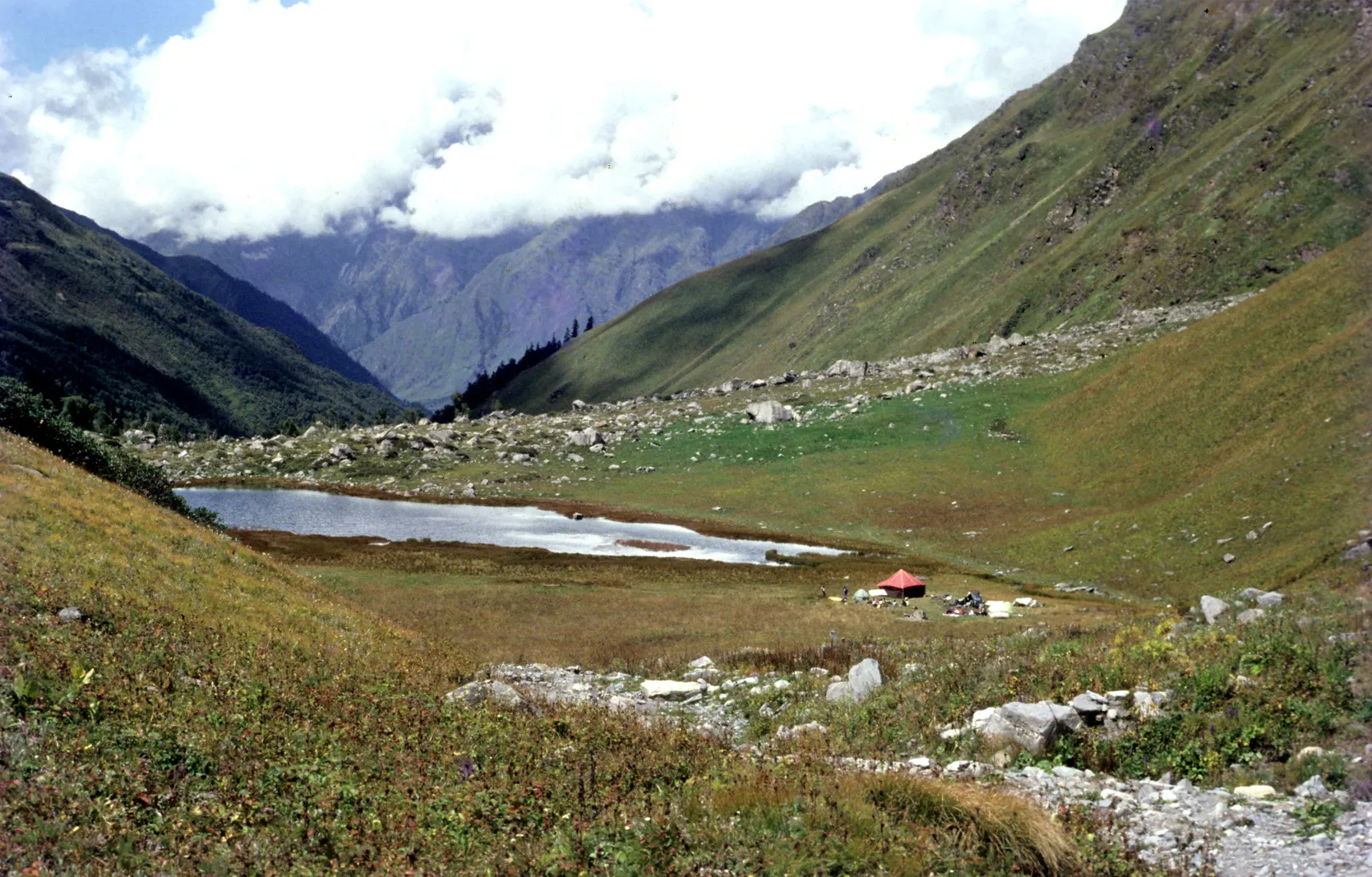
- A night beside Baraadsar Lake (about 4,300 m), a high lake on the ridge between the Rupin and Supin valleys
- High meadows of Manjivan and the Panch Odari rock shelters, with views of Bandarpoonch and Swargarohini
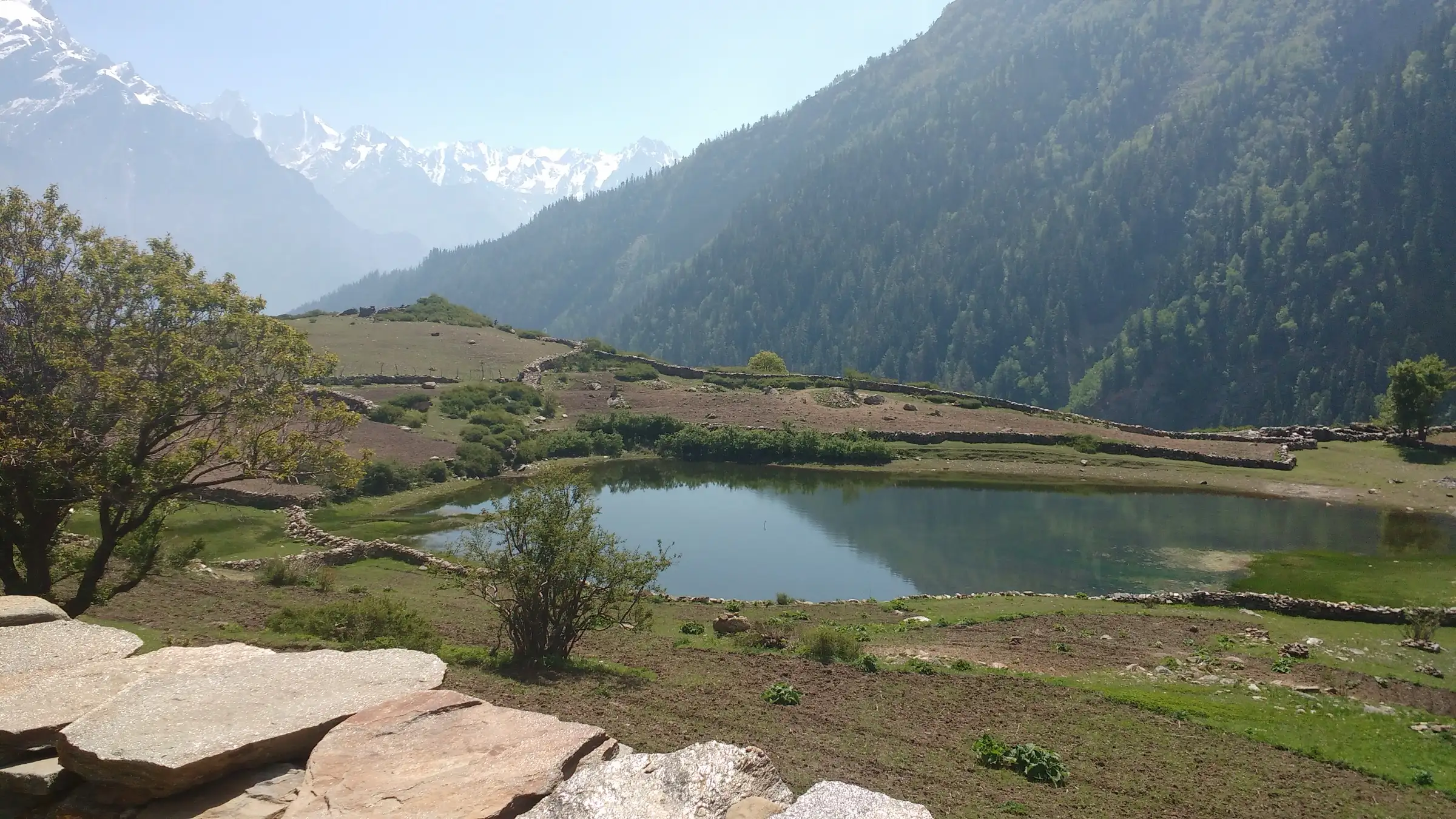
- Descending to Sangla Kanda and its small lake below the Kinner Kailash range in the Baspa valley
Risks
- TREKKING BAN: on 7 September 2022 the Kinnaur Deputy Commissioner banned treks linking Uttarkashi and Kinnaur after deaths on these routes, and warned of strict legal action for violations (Amar Ujala). Nalgan Pass is one of the Garhwal-Kinnaur passes and ends at Sangla in Kinnaur. We found no later order lifting the ban, although an operator lists the trek. Get written permission from the Kinnaur district administration before you go.
- Himachal Pradesh has advised high-altitude treks above 15,000 ft only from 1 May to 15 September and asked districts to restrict such passes after that date, so October crossings may be refused.
- Altitude sickness: five nights are planned above 4,300 m before the crossing; keep the rest day and turn back at the first signs of AMS.
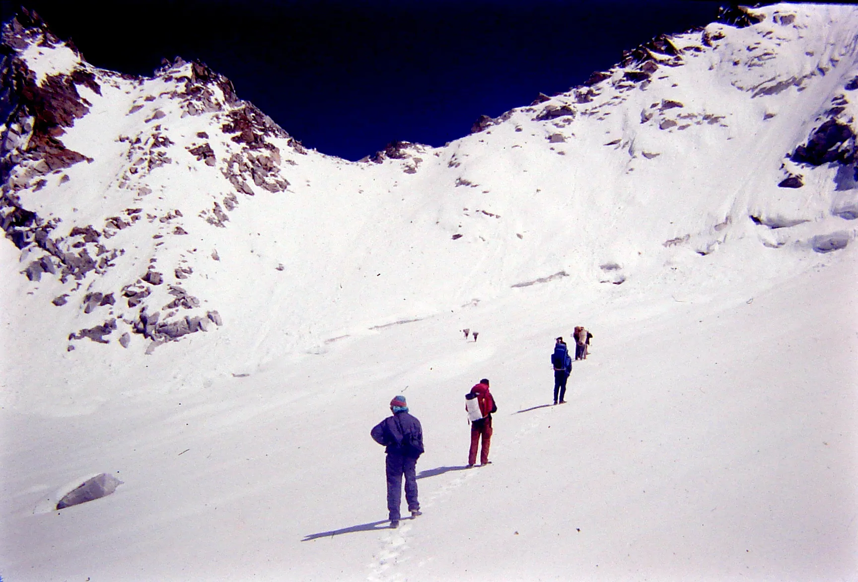
- Snow patches and glaciated ground near Baraadsar Lake and deep snow near the pass in early summer (Outlook Traveller's June party walked through progressively deeper snow).
- Steep climbs over loose rock and a long, steep descent; the Nalgan valley is narrow, boulder-strewn and prone to landslides, with a faint trail.
- Very few groups use this route, so trail-finding, rescue and help are far away; go only with a guide who has crossed it.
- No source confirms winter conditions, but the pass is a high snow-bound crossing; operators run it only in May-June and September-October.
Know before you go
Questions
Is the Nalgan Pass trek allowed right now?
Check before you plan. On 7 September 2022 the Kinnaur district administration banned treks linking Uttarkashi and Kinnaur after fatal accidents. Nalgan Pass crosses from Uttarkashi into Kinnaur, and we found no later order lifting the ban, although Himalayan Hikers lists the trek. Ask the Kinnaur Deputy Commissioner's office for written permission first.
How high is Nalgan Pass?
Figures differ. Himalayan Hikers' itinerary gives 4,978 m; Himalaya Shelter gives 4,450 m (14,600 ft) on one page and 4,500 m on another; an Outlook Traveller trip report from 2014 gives 4,200 m. OpenStreetMap tags the saddle at 4,600 m. Plan for a crossing close to 5,000 m.
How long is the Nalgan Pass trek?
Himalayan Hikers runs it as 10 days from Dehradun, with about 61 km on foot from Kasla near Sankri to Sangla, including a rest and acclimatisation day before the pass. Himalaya Shelter says 8 to 10 days.
What is the best time for the Nalgan Pass trek?
May-June and September-October, according to both Himalayan Hikers and Himalaya Shelter. Early-summer parties meet deep snow near the pass, and Himachal advises crossings above 15,000 ft only until 15 September.
Is Nalgan Pass suitable for beginners?
No. Himalaya Shelter recommends it only for seasoned trekkers, and Himalayan Hikers says it is not for beginners because of the altitude, steep loose-rock climbs and sub-zero nights.
Do I need a permit?
The route starts near Govind National Park, so forest entry and camping fees apply, and it ends in Kinnaur, where you need district permission because of the 2022 ban. We could not confirm current official fees; check at the forest office in Sankri and with the Kinnaur district administration.
In an emergency
Save these numbers before you lose signal. Tap to call.
- 112All emergenciesIndia’s single emergency number — works in every state
- 108Ambulance
- 1077District disaster control room
You are in
District: Uttarkashi (Uttarakhand), with the pass on the Shimla-Kinnaur side and the descent into Kinnaur (Himachal Pradesh)Uttarakhand · Himachal Pradesh
- Nearest hospital
- Mori and Purola for first care on the Uttarakhand side; after the pass, Sangla and the Baspa valley road towards Rampur and Shimla. Serious cases need evacuation.
- Last ATM
- Purola or Sankri (Sankri's is unreliable); carry enough cash from Dehradun
- Phone network
- Not confirmed for this route. On neighbouring routes from Sankri only BSNL and Jio work in Sankri and there is no signal on the trail until the Baspa valley; expect none from Kasla to Sangla.
Before you set off
- Tell someone your route and when you will be back.
- Carry a charged phone and a power bank.
- Download an offline map of the route.
- Turn back if the weather turns bad — the mountain will wait.
Questions about Nalgan Pass
No questions yet. Ask something and trekkers who have done it can answer.
Share your trek photo with #TreksAndTrails
I trekked this
Did Nalgan Pass look different from this page? Tell us what changed and we will check it.
Where this comes from
Sources
Last reviewed:
- Nalgan Pass Trek | A Journey to The Himalayas — Himalayan Hikers
- Treks from Sankri: Gateway to multiple Himalayan treks — Himalaya Shelter
- Passes of Uttarakhand — Himalaya Shelter
- Top spot (Kanasar Lake via Nalgan Pass, June 2014) — Outlook Traveller
- Kinnaur administration bans trekking on Uttarkashi-Kinnaur route (7 Sep 2022) — Amar Ujala
- Himachal government restricts trekking in high-altitude tracks from September 15 — The Tribune
Photos: Nikitaparwani, CC BY-SA 4.0