- Max altitude
- 5,947 m
- Days
- 15 days
- Distance
- 99 km
- Difficulty
- Challenging
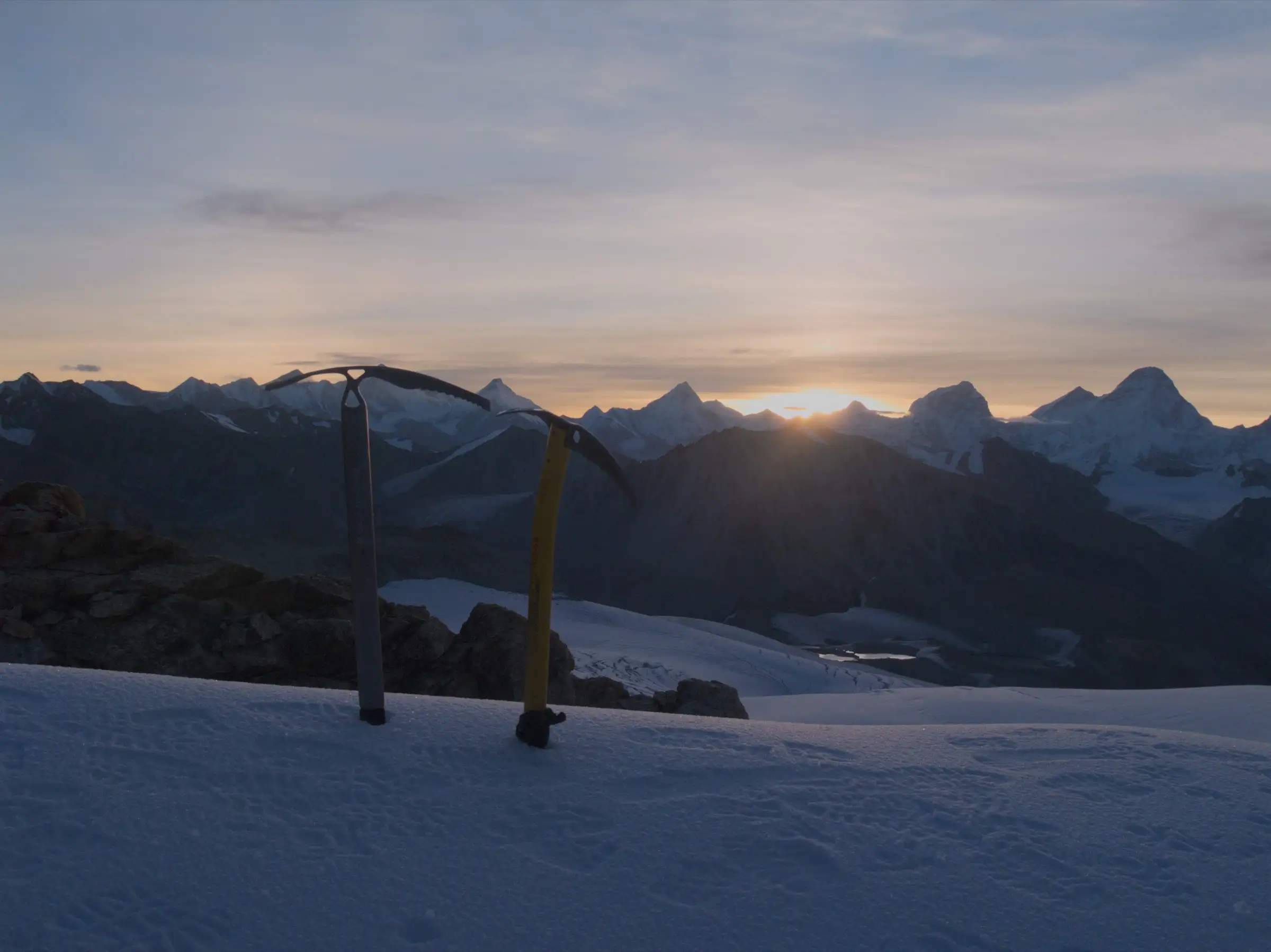
A glaciated 5,947 m pass crossed after several nights above 5,000 m: days over moraine and the Chaturangi and Sweta glaciers, hidden crevasses, rope-up sections and a 13 km pass day of 8-10 hours. Operators ask for prior high-altitude trek experience; not for beginners.
Photos
On the trail
The route
Day by day
Day 1
Dehradun → Uttarkashi
640 m → 1,160 m
Day 2
Uttarkashi → Gangotri
1,160 m → 3,048 m
Day 3
Gangotri → Gangotri (acclimatisation walk)
3,048 m → 3,048 m
Day 4
Gangotri → Bhojbasa
3,048 m → 3,800 m
Day 5
Bhojbasa → Tapovan (via Gaumukh)
3,800 m → 4,460 m
Day 6
Tapovan → Nandanvan (across Gangotri Glacier)
4,460 m → 4,350 m
Day 7
Nandanvan → Vasuki Tal
4,350 m → 4,880 m
Day 8
Vasuki Tal → Vasuki Tal (rest and acclimatisation)
4,880 m → 4,880 m
Day 9
Vasuki Tal → Khara Patthar
4,880 m → 5,200 m
Day 10
Khara Patthar → Sweta Glacier camp
5,200 m → 5,450 m
Day 11
Sweta Glacier camp → Kalindi Base Camp
5,450 m → 5,660 m
Day 12 · highest point
Kalindi Base Camp → Rajparav (via Kalindi Khal)
5,660 m → 5,947 m → 4,900 m
Day 13
Rajparav → Arwa Tal
4,900 m → 4,500 m
Day 14
Arwa Tal → Badrinath (via Ghastoli and Mana)
4,500 m → 3,100 m
Day 15
Badrinath → Dehradun
3,100 m → 640 m
Ups and downs
Altitude profile
Where it is
Map
Trailhead and high point only — not a recorded track. Use it with a proper map.
Weather
Next 5 days on the trail
Live forecast for the trailhead and the high point. Mountain weather changes fast — check again on the morning you start.
Trailhead · Gangotri
at 3,048 mLoading forecast…
High point · Kalindi Khal pass
at 5,947 mLoading forecast…
Each day: high / low °C · rain mm and chance · snow cm · wind km/h
Weather data: Open-Meteo.comModel forecast, not an official warning. For alerts follow IMD and the local administration.
Plan the trip
How to reach
- Trailhead
- Gangotri
- Nearest railway
- Dehradun (Rishikesh also works)
- Nearest airport
- Jolly Grant Airport, Dehradun
- By road
- Dehradun to Gangotri, about 241 km via Uttarkashi and Harsil (start); Badrinath to Dehradun, about 295-330 km via Joshimath and Rudraprayag (finish)
- Drive
- About 10 h from Dehradun
Plan the trip
Permits and fees
We could not confirm the current permit rules and fees from an official source. Check with the local forest department or tourism office before you go.
Plan the trip
Cost
Self-guided
₹60,000–1,00,000
With an operator
₹1,04,500–2,10,000
Per person. Guided prices published for 2026-27: Great Adventure ₹1,04,499 ex-Uttarkashi; Bikat Adventures ₹1,40,000 + 5% GST ex-Gangotri (Dehradun-Gangotri and Badrinath-Dehradun vehicles extra, ₹9,000-16,000 per vehicle); Aquaterra ₹1,40,000 + 5% GST; White Magic ₹2,10,000 ex-Dehradun. Self-guided is a rough estimate ex-Dehradun: the pass is not crossed without a local guide and porters, so it assumes hiring a guide, cook and porters in Gangotri, glacier gear (rope, harness, crampons), 10 days of rations, park fees and the long road transfers at both ends.
Gear
Top picks for this trek
The gear that matters most on this route, chosen from its altitude, season and risks.
 Ad · affiliate link
 Ad · affiliate link
 Ad · affiliate link
 Ad · affiliate link
 Ad · affiliate link
 Ad · affiliate link
 Ad · affiliate link
 Ad · affiliate link
Store buttons open a search on that store, not a product we picked. As an Amazon Associate we earn from qualifying purchases. Photos show the kind of item, not a specific product. Affiliate disclosure
Packing checklist
Matched to this trek: altitude, season, days and the risks on the route.
Packed 0 of 35
Snow on the trail in May–Jun, Oct: microspikes, gaiters and a warm layer are not optional.
Tick each item as it goes in the bag.
Know before you go
Good to know
- Mobile network
- Little or no mobile signal after Gangotri; none on the glaciers or at the pass. Signal returns near Mana and Badrinath.
- Last ATM
- Uttarkashi, about 97 km before Gangotri; draw cash in Dehradun or Uttarkashi.
- Nearest hospital
- District hospital Uttarkashi on the Gangotri side, Joshimath on the Badrinath side; AIIMS Rishikesh for serious cases. Evacuation from the glaciers is by helicopter only.
- Water
- Glacial streams and melt pools along the moraine, Vasuki Tal and Arwa Tal; on the upper glacier camps water is often melted from snow. Glacial water is silty: filter and treat it.
Highlights
- Crossing a 5,947 m glaciated pass from the Gangotri (Bhagirathi) valley to the Alaknanda valley and Badrinath
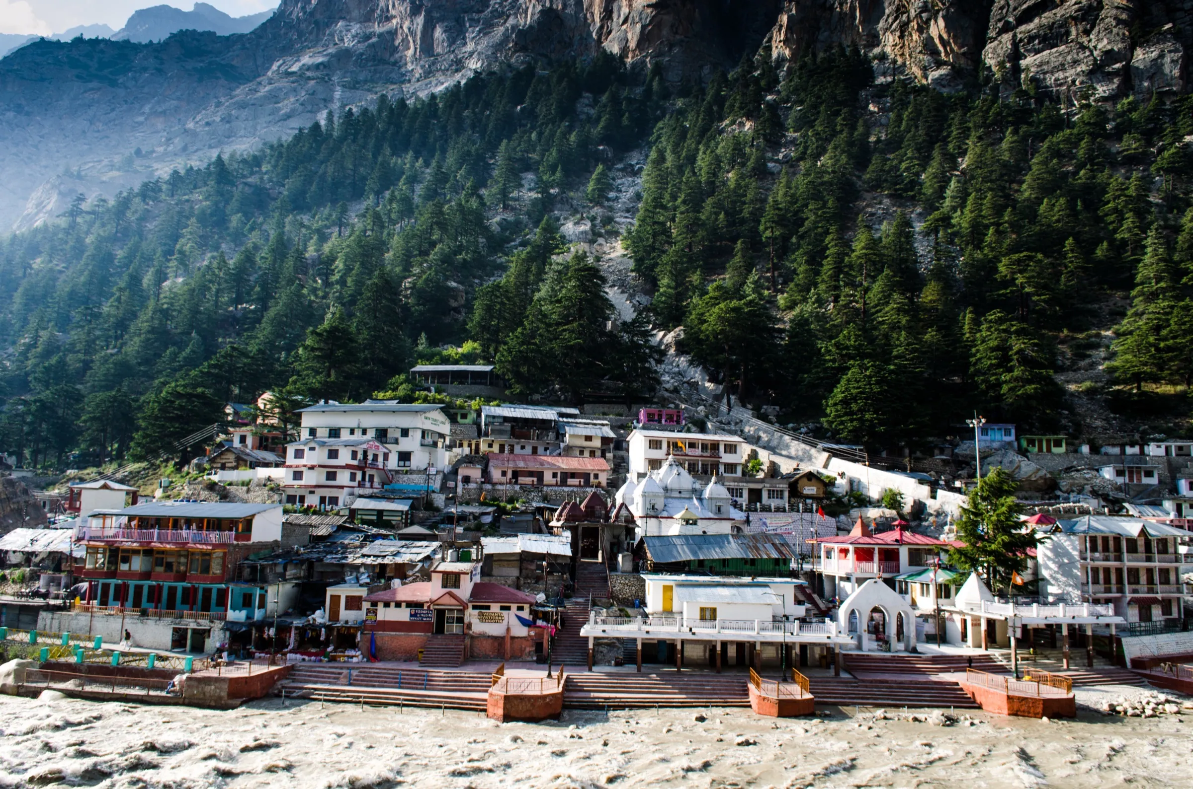
- Gaumukh, the snout of the Gangotri Glacier and source of the Bhagirathi, and the Tapovan meadow below Shivling
- Close views of Shivling, Meru, the Bhagirathi peaks, Chandra Parbat and Satopanth along the Chaturangi Glacier
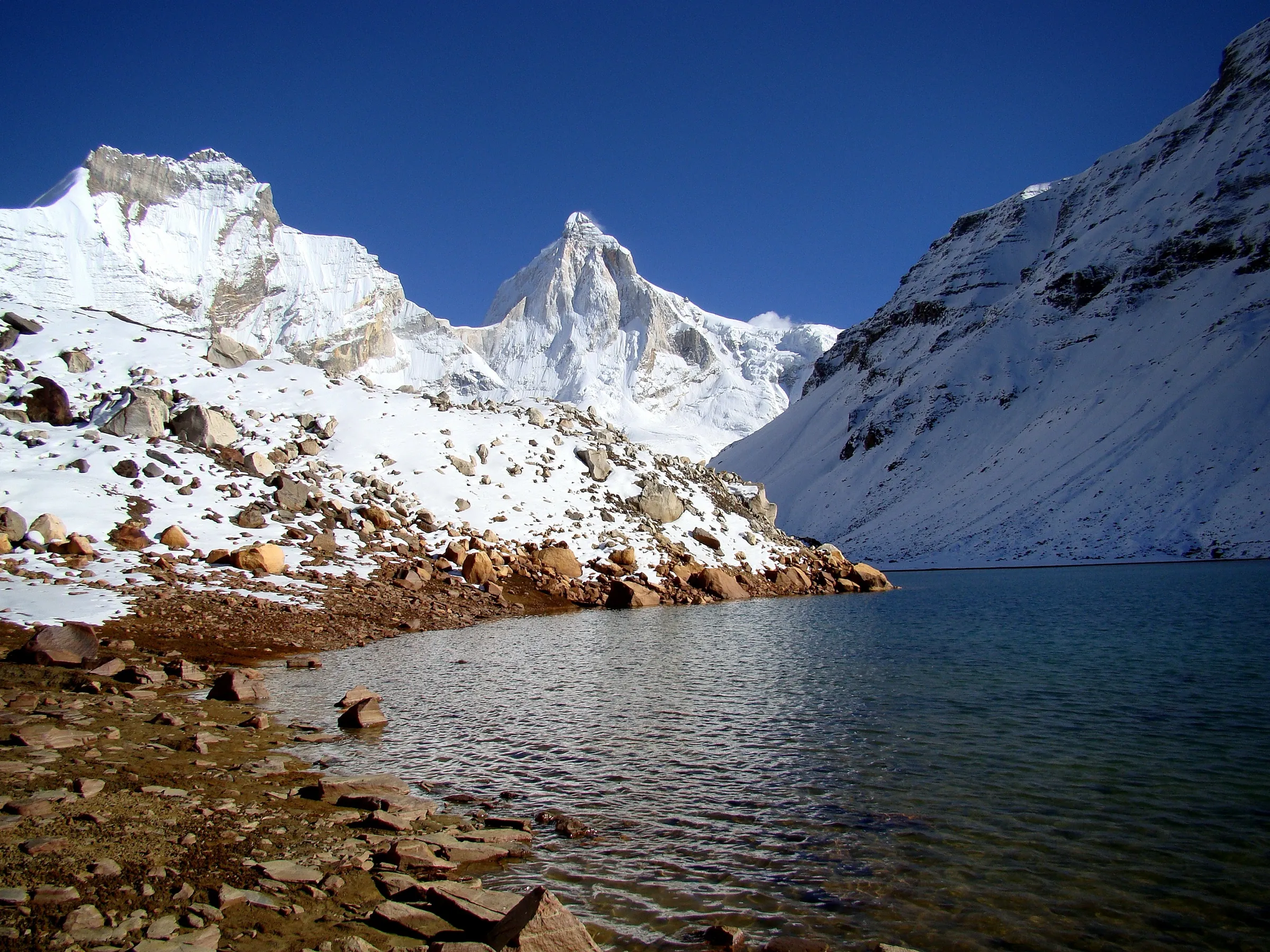
- Camping at Vasuki Tal, a high glacial lake at about 4,880 m
- Finishing through Arwa Tal, Ghastoli and Mana, the last village before Tibet
Risks
- Sudden snowstorms: in late September 2026 heavy snowfall stranded 19 trekkers near the Kalindi base camp and the SDRF had to airlift them to Harsil over two days. Carry spare days and turn back early if the weather breaks.
- Crevasses, avalanche-prone slopes and loose moraine on the Chaturangi and Sweta glaciers; ropes, harnesses, crampons and a guide who knows the route are essential. One trekker report describes a wrong turn onto a ridge off the real pass, which cost a day.
- The route ends in the border zone near Mana: army/ITBP posts at Gangotri and Ghastoli check papers, and trekkers without an Indian crew have been stopped and taken to Joshimath. One operator (Himalayan Dream Treks) says an Inner Line Permit is required; we could not confirm this from an official source, so check current rules with the Uttarkashi and Chamoli district offices.
- Himalaya Shelter advises against July-August (monsoon rain, swollen streams, landslides on the roads); late October brings a high chance of snowfall on the pass.
- Long stretches above 5,000 m: build in acclimatisation days and descend at the first signs of altitude sickness.
Know before you go
Questions
Can beginners do the Kalindi Khal trek?
No. Operators grade it as a difficult or technical trek and ask for prior high-altitude experience. It crosses several glaciers, spends nights above 5,000 m and the pass day is about 13 km and 8-10 hours.
What is the best time for Kalindi Khal?
May-June and September to early October. Gangotri National Park is closed from 30 November to 31 March, July-August brings monsoon rain, and late October often brings snowfall on the pass.
Which permits are needed for Kalindi Khal?
A Gangotri National Park entry permit, issued online through the Pathik portal or at the Uttarkashi forest office, and one operator says an Inner Line Permit is also needed because the route ends in the border zone near Mana (we could not confirm this officially). Army/ITBP posts check papers at Gangotri and Ghastoli. We could not confirm the current official fees, so check with the forest office or your operator.
How long is the Kalindi Khal trek?
About 97-100 km on foot from Gangotri to Badrinath, usually over 14-15 days including the drive from Dehradun, acclimatisation days and the drive back.
Is there mobile network or an ATM on the route?
There is little or no signal after Gangotri. The nearest ATM is in Uttarkashi, about 97 km before Gangotri, so carry cash from Dehradun or Uttarkashi.
In an emergency
Save these numbers before you lose signal. Tap to call.
- 112All emergenciesIndia’s single emergency number — works in every state
- 108Ambulance
- 1077District disaster control room
You are in
District: Uttarkashi and ChamoliUttarakhand
- Nearest hospital
- District hospital Uttarkashi on the Gangotri side, Joshimath on the Badrinath side; AIIMS Rishikesh for serious cases. Evacuation from the glaciers is by helicopter only.
- Last ATM
- Uttarkashi, about 97 km before Gangotri; draw cash in Dehradun or Uttarkashi.
- Phone network
- Little or no mobile signal after Gangotri; none on the glaciers or at the pass. Signal returns near Mana and Badrinath.
Before you set off
- Tell someone your route and when you will be back.
- Carry a charged phone and a power bank.
- Download an offline map of the route.
- Turn back if the weather turns bad — the mountain will wait.
Questions about Kalindi Khal
No questions yet. Ask something and trekkers who have done it can answer.
Share your trek photo with #TreksAndTrails
I trekked this
Did Kalindi Khal look different from this page? Tell us what changed and we will check it.
Where this comes from
Sources
Last reviewed:
- Kalindi Khal Expedition (Gangotri to Badrinath) — Bikat Adventures
- Kalindi Khal Trek — Himalayan Dream Treks
- Kalindi Khal Pass Trek — Himalaya Shelter
- Kalindi Khal Trekking Expedition — Himalayan High
- Kalindi Khal pass (5,950 M) — Great Adventure
- Kalindi Khal Trek — White Magic Adventure Travel
- Kalindi Pass Trek — Aquaterra Adventures
- Garwhal himal: Kalindi khal (trip report, August 2016) — Last Frontiers on Foot
- Gangotri National Park Reopens For Trek: Date, Permits, And What Travellers Need To Know (updated 4 Apr 2026) — Outlook Traveller
- Uttarkashi: All 19 trekkers stranded on Kalindi Khal trek rescued (29 Sep 2026) — NewKerala (IANS)
Photos: Danielvandermaas, CC BY-SA 4.0; Asish Das75, CC BY-SA 4.0; DipankarSen68, CC BY-SA 4.0